|
Williamson County, Texas
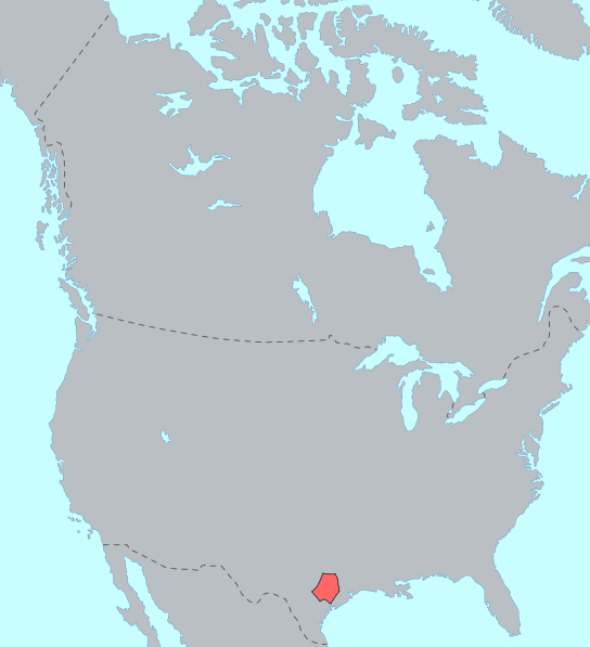
Williamson County (sometimes abbreviated as "Wilco") is a County (United States), county in the U.S. state of Texas. As of the 2020 United States census, 2020 census, its population was 609,017. The 2024 population estimate was 727,480. Its county seat is Georgetown, Texas, Georgetown. The county is named for Robert McAlpin Williamson (–1859), a community leader and a veteran of the Battle of San Jacinto. Williamson County is part of the Greater Austin, Austin-Round Rock-San Marcos metropolitan statistical area. It was included with Austin in the Best Cities to Live in for 2009 by the Milken Institute. Located in Central Texas, it is on both the Edwards Plateau to the west, rocky terrain and hills, and Texas Blackland Prairies in the east, rich, fertile farming land. The two areas are roughly bisected by Interstate 35 in Texas, Interstate 35. History Prehistoric Much of Williamson County has been the site of human habitation for at least 11,200 years. The earliest known i ... [...More Info...] [...Related Items...] OR: [Wikipedia] [Google] [Baidu] |
Robert McAlpin Williamson
Robert McAlpin Williamson (1804? – December 22, 1859) was a Republic of Texas Supreme Court Justice, state lawmaker and Texas Ranger. Williamson County, Texas is named for him. He was the first white person documented to have played the banjo. Early life Williamson was born in Wilkes County, Georgia to a prestigious family. His mother died shortly after and he was raised by his paternal grandmother, Sarah Gilliam, in Milledgeville, Georgia. At the age of fifteen, he contracted tuberculous arthritis that caused his right leg to permanently stiffen at a 90-degree angle. In order to walk, a wooden leg had to be fastened to his knee. Because of this, he later acquired the nickname "Three-Legged-Willie". He passed the bar at the approximate age of nineteen before practicing one year of law in Georgia. Life in Texas Williamson came to Stephen F. Austin's colony ( San Felipe de Austin) in June 1827. He became acquainted with both Stephen F. Austin and William B. Travis duri ... [...More Info...] [...Related Items...] OR: [Wikipedia] [Google] [Baidu] |
Pleistocene
The Pleistocene ( ; referred to colloquially as the ''ice age, Ice Age'') is the geological epoch (geology), epoch that lasted from to 11,700 years ago, spanning the Earth's most recent period of repeated glaciations. Before a change was finally confirmed in 2009 by the International Union of Geological Sciences, the cutoff of the Pleistocene and the preceding Pliocene was regarded as being 1.806 million years Before Present (BP). Publications from earlier years may use either definition of the period. The end of the Pleistocene corresponds with the end of the last glacial period and also with the end of the Paleolithic age used in archaeology. The name is a combination of Ancient Greek () 'most' and (; Latinized as ) 'new'. The aridification and cooling trends of the preceding Neogene were continued in the Pleistocene. The climate was strongly variable depending on the glacial cycle, oscillating between cold Glacial period, glacial periods and warmer Interglacial, int ... [...More Info...] [...Related Items...] OR: [Wikipedia] [Google] [Baidu] |
National Weather Service
The National Weather Service (NWS) is an Government agency, agency of the Federal government of the United States, United States federal government that is tasked with providing weather forecasts, warnings of hazardous weather, and other weather-related products to organizations and the public for the purposes of protection, safety, and general information. It is a part of the National Oceanic and Atmospheric Administration (NOAA) branch of the United States Department of Commerce, Department of Commerce, and is headquartered in Silver Spring, Maryland, within the Washington metropolitan area. The agency was known as the United States Weather Bureau from 1891 until it adopted its current name in 1970. The NWS performs its primary task through a collection of national and regional centers, and 122 local List of National Weather Service Weather Forecast Offices, Weather Forecast Offices (WFOs). As the NWS is an agency of the U.S. federal government, most of its products are in the ... [...More Info...] [...Related Items...] OR: [Wikipedia] [Google] [Baidu] |
Thrall, Texas
Thrall is a city in Williamson County, Texas, United States. Its population was 816 at the 2020 census. The name Thrall was chosen by the community to honor the Rev. Homer S. Thrall, a Methodist minister and historian much admired by local settlers and residents. Thrall was founded in 1876. Geography Thrall is located at (30.588640, –97.298707), approximately 35 miles northeast of Austin. According to the United States Census Bureau, the city has a total area of 0.4 square mile (1.1 km2), all land. It is located in Williamson County. Demographics As of the 2020 United States census, 816 people, 205 households, and 144 families were residing in the city. As of the census of 2000, 710 people, 255 households, and 189 families resided in the city. The population density was . The 264 housing units had an average density of . The racial makeup of the city was 70.00% White, 8.59% African American, 1.41% Native American, 0.14% Pacific Islander, 18.03% from other r ... [...More Info...] [...Related Items...] OR: [Wikipedia] [Google] [Baidu] |
Tawakoni
The Tawakoni (also Tahuacano and Tehuacana) are a Southern Plains Native American tribe, closely related to the Wichitas. They historically spoke a Wichita language of the Caddoan language family. Currently, they are enrolled in the Wichita and Affiliated Tribes, a federally recognized tribe."Wichita Memories: In the Beginning: 1540-1750." ''Wichita and Affiliated Tribes'' (retrieved 1 May 2010). History At the beginning of the 18th century, the Tawakoni lived in villages in what is now and . In his 1719 expedition, French explorer[...More Info...] [...Related Items...] OR: [Wikipedia] [Google] [Baidu] |
Kiowa
Kiowa ( ) or Cáuigú () people are a Native Americans in the United States, Native American tribe and an Indigenous people of the Great Plains of the United States. They migrated southward from western Montana into the Rocky Mountains in Colorado in the 17th and 18th centuriesPritzker 326 and eventually into the Southern Plains by the early 19th century. In 1867, the Kiowa were moved to a Indian reservation, reservation in Southwestern Oklahoma. Today, they are Federally recognized tribe, federally recognized as Kiowa Indian Tribe of Oklahoma with headquarters in Carnegie, Oklahoma. , there were 12,000 citizens. The Kiowa language, Kiowa language (Cáuijògà), part of the Tanoan languages, Tanoan language family, is in danger of extinction, with only 20 speakers as of 2012."Kiowa Tanoan" ''Ethnologue.'' Retrieved 21 June 2012. ... [...More Info...] [...Related Items...] OR: [Wikipedia] [Google] [Baidu] |
Comanches
The Comanche (), or Nʉmʉnʉʉ (, 'the people'), are a Native American tribe from the Southern Plains of the present-day United States. Comanche people today belong to the federally recognized Comanche Nation, headquartered in Lawton, Oklahoma. The Comanche language is a Numic language of the Uto-Aztecan family. Originally, it was a Shoshoni dialect, but diverged and became a separate language. The Comanche were once part of the Shoshone people of the Great Basin. In the 18th and 19th centuries, Comanche lived in most of present-day northwestern Texas and adjacent areas in eastern New Mexico, southeastern Colorado, southwestern Kansas, and western Oklahoma. Spanish colonists and later Mexicans called their historical territory '' Comanchería''. During the 18th and 19th centuries, Comanche practiced a nomadic horse culture and hunted, particularly bison. They traded with neighboring Native American peoples, and Spanish, French, and American colonists and settlers. As Eu ... [...More Info...] [...Related Items...] OR: [Wikipedia] [Google] [Baidu] |
American Bison
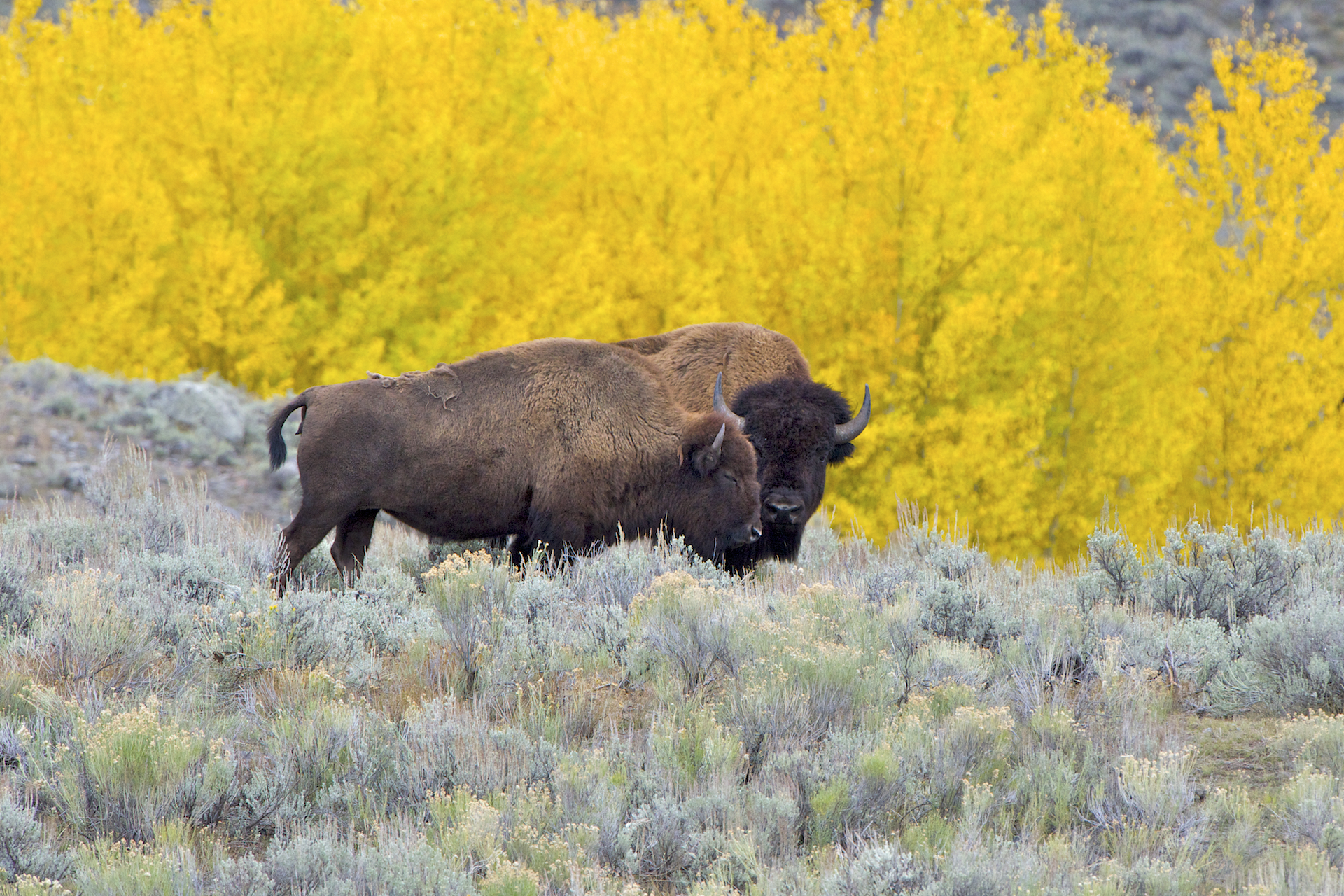
The American bison (''Bison bison''; : ''bison''), commonly known as the American buffalo, or simply buffalo (not to be confused with Bubalina, true buffalo), is a species of bison that is endemic species, endemic (or native) to North America. It is one of two extant species of bison, along with the European bison. Its habitat, historical range ''circa'' 9000 BC is referred to as the great bison belt, a tract of rich grassland spanning from Alaska south to the Gulf of Mexico, and east to the Atlantic Seaboard (nearly to the Atlantic tidewater (geographic term), tidewater in some areas), as far north as New York (state), New York, south to Georgia (U.S. state), Georgia, and according to some sources, further south to northern Florida, with sightings in North Carolina near Buffalo Ford on the Catawba River as late as 1750. Two subspecies or ecotypes have been described: the plains bison (''B. b. bison''), smaller and with a more rounded hump; and the wood bison (''B. b. athabascae ... [...More Info...] [...Related Items...] OR: [Wikipedia] [Google] [Baidu] |
Tonkawa
The Tonkawa are a Native American tribe from Oklahoma and Texas. Their Tonkawa language, now extinct language, extinct, is a linguistic isolate. Today, Tonkawa people are enrolled in the Federally recognized tribes, federally recognized Tonkawa Tribe of Indians of Oklahoma, headquartered in Tonkawa, Oklahoma. They have more than 700 tribal citizens. Name The Tonkawa's autonym is (meaning "real people"). The name Tonkawa is derived from the Waco people, Waco word, ', meaning "they all stay together". History In 1601, the Tonkawa people lived in what is now northwestern Oklahoma. They were made up of related bands. Historically, they were nomadic people, who practiced some horticulture. The Tonkawa, long thought to have been prehistoric residents of Texas, are now thought to have migrated into the state in the late 17th century. Their arrival in Central Texas is believed to have been just before or during the early European contact period. 18th century By 1700, Apache and Wi ... [...More Info...] [...Related Items...] OR: [Wikipedia] [Google] [Baidu] |
San Gabriel River (Texas)
The San Gabriel River is a river that flows through central Texas, USA. The San Gabriel River is formed in Georgetown by the confluence of the North Fork San Gabriel and the South Fork San Gabriel, both of which originate in Burnet County. There are two major impoundments of the river: Lake Georgetown along the North Fork, and Granger Lake, about 25 miles (40 km) below the confluence. Both are U.S. Army Corps of Engineers impoundments. The San Gabriel River joins the Little River five miles south of Cameron which then meets the Brazos River northwest of College Station. There is a city park in Georgetown at the confluence of the North and South Forks, with a well-known local swimming spot (the "Blue Hole") located just upriver from the confluence on the South Fork. Like most Texas Hill Country rivers, the San Gabriel west of the Balcones Fault is characterized by limestone river bottoms, some moderate rapids, small canyons, and muddy bottoms along slower-moving stretch ... [...More Info...] [...Related Items...] OR: [Wikipedia] [Google] [Baidu] |
Brushy Creek (San Gabriel River Tributary)
Brushy Creek is a tributary of the San Gabriel River in Texas that flows east for 69 miles. Route North Fork Brushy Creek and South Fork Brushy Creek merge north of Leander, Texas to form Brushy Creek. South Brushy Creek feeds Brushy Creek from south of Cedar Park, Texas. Brushy Creek ultimately merges into the San Gabriel River 5 miles north of Rockdale, Texas. Parks The namesake "Round Rock" of Round Rock, Texas sits in Brushy Creek west of Interstate 35. Long-term plans envision a trail that will go from Leander to Hutto, Texas, via Cedar Park and Round Rock, generally following the route of Brushy Creek. The following segments have been created: Sarita Valley Greenbelt Ground broke on the Sarita Valley neighborhood in early 2011. This greenbelt was created as a requirement of Leander's Parkland Dedication Ordinance and is owned and maintained by the City of Leander. The trail itself begins at the convergence of the North and South Forks of Brushy Creek. Brushy Creek Regio ... [...More Info...] [...Related Items...] OR: [Wikipedia] [Google] [Baidu] |
Archaic Period In The Americas
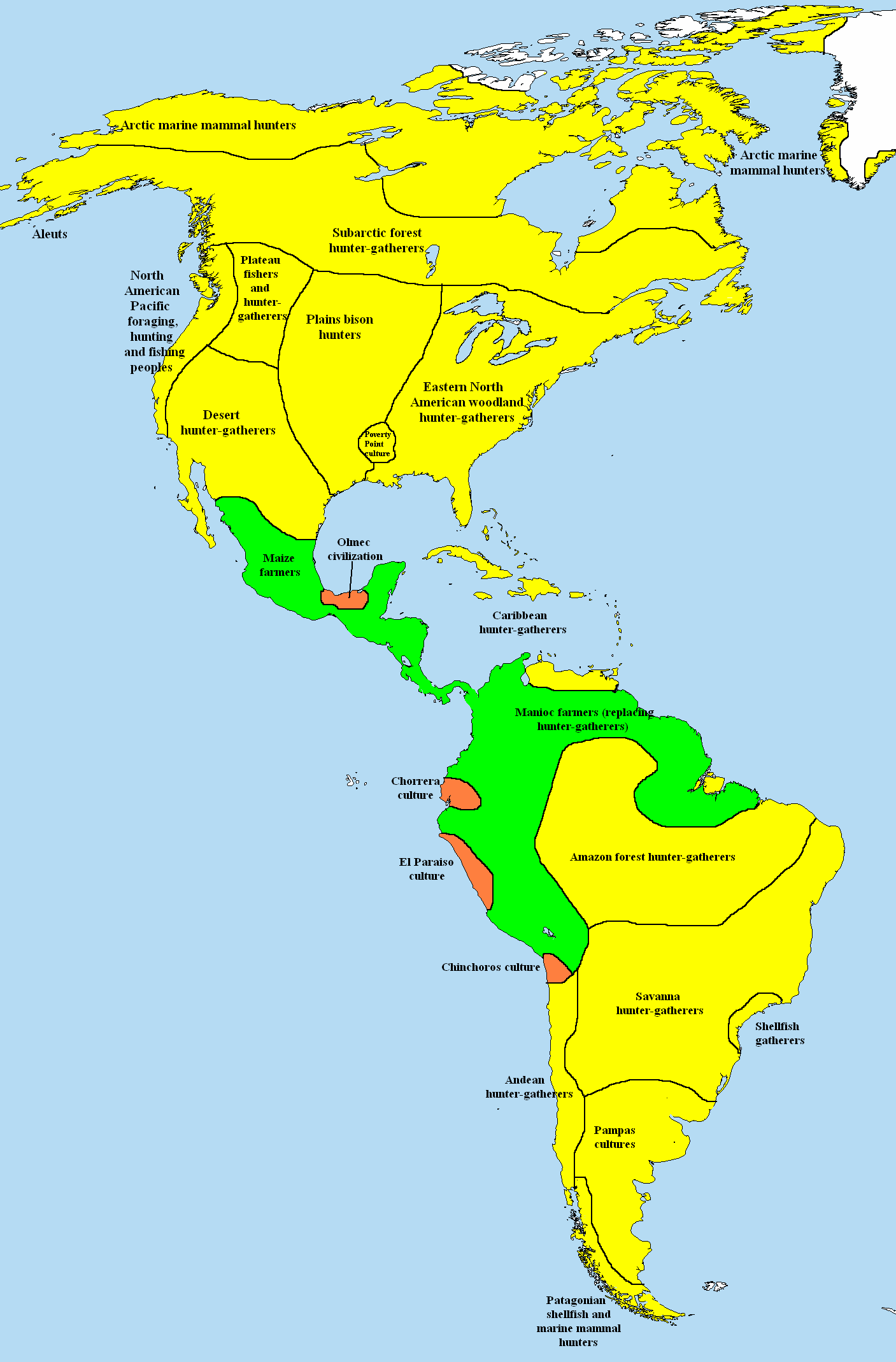
In the classification of the archaeological cultures of North America, the Archaic period in North America, taken to last from around 8000 to 1000 BC in the sequence of North American pre-Columbian cultural stages, is a period defined by the ''archaic stage'' of cultural development. The Archaic stage is characterized by subsistence economies supported through the exploitation of nuts, seeds, and shellfish. As its ending is defined by the adoption of sedentary farming, this date can vary significantly across the Americas. The rest of the Americas also have an Archaic Period. Classifications This classification system was first proposed by Gordon Willey and Philip Phillips in the widely accepted 1958 book ''Method and Theory in American Archaeology''. In the organization of the system, the Archaic period followed the Lithic stage and is superseded by the Formative stage. # The Lithic stage # The Archaic stage # The Formative stage # The Classic stage # The Post-Cl ... [...More Info...] [...Related Items...] OR: [Wikipedia] [Google] [Baidu] |


