|
Whepstead, Wellington Point
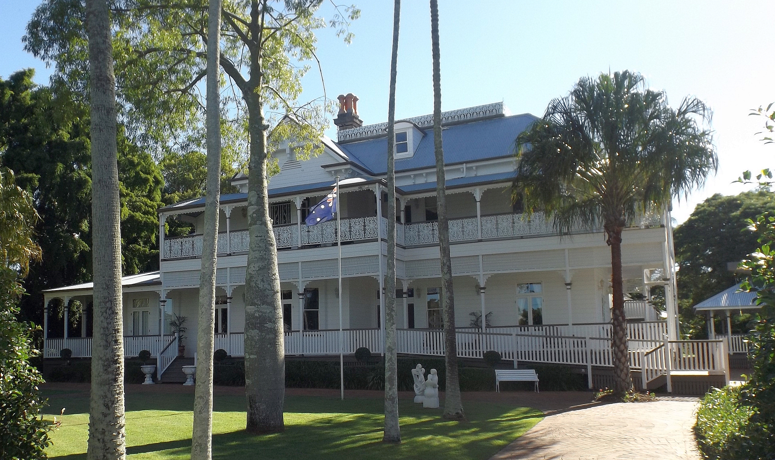
Whepstead is a heritage-listed villa at Main Road, Wellington Point, City of Redland, Queensland, Australia. It was designed by architect Claude William Chambers and built in 1889 by Patrick Horisk. It is also known as Bay View Private Hospital and Fernbourne. It was added to the Queensland Heritage Register on 21 October 1992. History Whepstead, a large two-storeyed timber residence with a substantial attic, was constructed in 1889 for Gilbert Burnett JP, a Wellington Point landowner, sawmill proprietor, and member of the Cleveland Divisional Board. Originally called Fernbourne, the house was designed by Brisbane architect Claude William Chambers and constructed by Cleveland builder Patrick Horisk. When first erected, it was considered one of the finest houses in the district, with unrivalled views of sea, shore, headland and islands. Set in a very fine, well-established garden, Fernbourne replaced an earlier Burnett family home on the same site. Burnett had emigrated ... [...More Info...] [...Related Items...] OR: [Wikipedia] [Google] [Baidu] |
Wellington Point, Queensland
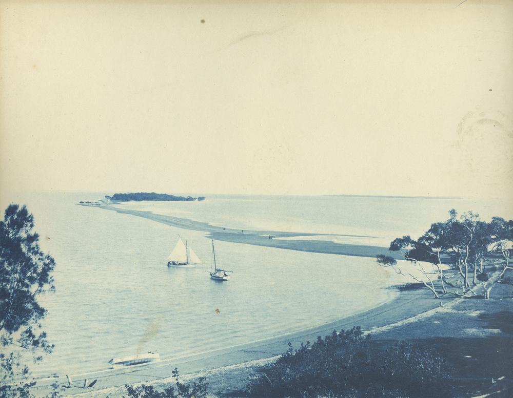
Wellington Point is a residential Suburbs and localities (Australia), locality in the City of Redland, Queensland, Australia. In the , Wellington Point had a population of 12,350 people. The suburb is a popular seaside destination within the Brisbane metropolitan area and is notable for a popular walk along a shoal, sandbar to King Island which emerges at low tide. Geography Wellington Point is about 22 km south-east of Brisbane, the capital of Queensland. Wellington Point is largely residential and adjoins Birkdale, Queensland, Birkdale in the west and Ormiston, Queensland, Ormiston to the south east. The locality derives its name from the headland called Wellington Point which extends prominently into Moreton Bay. The headland and its adjoining waters are used extensively for aquatic sports. The area is also a popular day-trip destination. While it is predominantly Urban area, urban, Wellington Point retains a seaside and village atmosphere. History The people of the Quandam ... [...More Info...] [...Related Items...] OR: [Wikipedia] [Google] [Baidu] |
Coochiemudlo Island
Coochiemudlo Island is a small island in the southern part of Moreton Bay, near Brisbane, in South East Queensland, Australia. It is also the name of the locality upon the island, which is within the local government area of Redland City. In the , Coochiemudlo Island had a population of 753 people. Geography The island is approximately from Victoria Point, also in Redland City. A natural cliff composed of iron-rich rock is exposed on the south western side of the island. Sandy beaches wrap around the island's southern, eastern and northern sides. Mangroves cover the western foreshore of the island. History The name ''Coochiemudlo'' is the English language version of the Yuggera words ''kutchi'' (meaning ''red'') and ''mudlo'' (meaning ''stone''). The British explorer Matthew Flinders landed on Coochiemudlo Island on 19 July 1799, while he was mapping the southern part of Moreton Bay. The original European name was Innis Island from 1825 to 1850. The island celebrates Fl ... [...More Info...] [...Related Items...] OR: [Wikipedia] [Google] [Baidu] |
William O'Connell (politician)
William Bligh Henry O'Connell (26 January 1852 – 4 March 1903) was an Australian politician. He was a member of the Queensland Legislative Assembly from 1888 to 1903, representing the electorate of Musgrave. He was Secretary of Lands in the Philp government from 1899 until his death. O'Connell was born in Brisbane, and was educated in England, returning to Australia at the age of eighteen. He worked for a time at Baramba Station, near Kilkivan, went to work as an aide to his uncle, Administrator of the Government Maurice Charles O'Connell, and worked for the Bank of New South Wales in Bundaberg. He was then inspector of Pacific Islanders and assistant immigration agent for five years, before forming his own grocery, wine and spirit merchant firm at Bundaberg, O'Connell & Co. He was one of the first Bundaberg borough councillors in 1881. He was elected to the Legislative Assembly at the 1888 election as a supporter of Thomas McIlwraith Sir Thomas McIlwraith (17 May 183 ... [...More Info...] [...Related Items...] OR: [Wikipedia] [Google] [Baidu] |
James Chataway
James Vincent Chataway (6 September 1852 – 12 April 1901) was a member of the Queensland Legislative Assembly. Biography Chataway was born in Warwickshire, England, the son of James Chataway and his wife Elizabeth (née Drinkwater) and was educated at Winchester College. He was at first destined for the Indian civil service but after a period of ill-health this was abandoned and he instead headed to Australia, arriving in 1873. After his arrival he was in Victoria and New South Wales getting pastoral experience before arriving in Queensland where he worked as an auctioneer and owned a livery stable. He then took up an interest in ''Eton Plantation'' in the Mackay region before taking up the role as editor of the Mackay Mercury in 1883 and three years later owner of the newspaper. In 1892 he established the ''Mackay Sugar Journal'' and ''Tropical Cultivator''. On 8 December 1882 Chataway married Jessie Carlyle Little and together had two sons and two daughters. He died in Ap ... [...More Info...] [...Related Items...] OR: [Wikipedia] [Google] [Baidu] |
Ipswich, Queensland
Ipswich () is a city in South East Queensland, Australia. Situated on the Bremer River, it is approximately west of the Brisbane central business district. The city is renowned for its architectural, natural and cultural heritage. Ipswich preserves and operates from many of its historical buildings, with more than 6000 heritage-listed sites and over 500 parks. Ipswich began in 1827 as a mining settlement. History Early history Ipswich according to The Queenslander (Brisbane, Qld,: 1866-1939), Thursday 18 January 1934, Page 13 was tribally known as Coodjirar meaning place of the Red Stemmed Gum Tree in the Yugararpul language. Jagara (also known as Jagera, Yagara, and Yuggara) and Yugarabul (also known as Ugarapul and Yuggerabul) are Australian Aboriginal languages of South-East Queensland. There is some uncertainty over the status of Jagara as a language, dialect or perhaps a group or clan within the local government boundaries of Ipswich City Council, Lockyer Region ... [...More Info...] [...Related Items...] OR: [Wikipedia] [Google] [Baidu] |
Queensland National Bank
The Queensland National Bank is a former bank in Queensland, Australia. History In 1872, the bank was established in Brisbane. In December 1914, the bank had its head office in Brisbane with branches throughout Queensland at Allora, Aramac, Ayr, Barcaldine, Beaudesert, Biggenden, Blackall, Boonah, Bundaberg, Burketown, Cairns (with a receiving office at Gordonvale), Charleville, Charters Towers, Childers (with a receiving office at Cordalba), Clifton, Cloncurry, Cooktown, Crows Nest, Cunnamulla, Dalby (with receiving offices at Bell and Tara), Esk, Forest Hill, Fortitude Valley, Gatton (with receiving office at Grantham), Gladstone, Goombungee, Goondiwindi, Greenmount, Gympie, Halifax, Herberton, Hughenden, Ingham, Innsifail, Ipswich, Invinebank, Jandowae, Kandanga, Killarney, Kingaroy, Laidley, Longreach, Mackay, Marburg, Mareeba, Maryborough, Millmerran, Mitchell (with receiving office at Mungallala), Mount Morgan, Murgon, Muttaburra, ... [...More Info...] [...Related Items...] OR: [Wikipedia] [Google] [Baidu] |
Edward Robert Drury
Edward Robert Drury (1832–1896) was a banker in Queensland, Australia. He was the first general manager of the Queensland National Bank which played a major role in Queensland finance in the late 19th century. Early life Edward Robert Drury was born in 1832 in Brussels, Belgium, the son of the Rev. William James Joseph Drury (chaplain to the British Embassy in Brussels and tutor of Leopold II of Belgium) and his wife Anne (née Nicholas). Drury immigrated to Australia in 1852. Business career Drury was employed by the Bank of Australasia in 1853. In 1860 he was promoted to manager of their Brisbane branch. In 1872, he was appointed the general manager of the new Queensland National Bank, a role he held until his death in 1896. He was the President of the Australian Association of Bankers from June 1894 to June 1895. Drury was professionally and personally committed to promoting development of the colony of Queensland. In both his banking role at the Queensland National Bank ... [...More Info...] [...Related Items...] OR: [Wikipedia] [Google] [Baidu] |
Waterloo Bay
Waterloo Bay is an area of foreshore in Larne on the east coast of County Antrim, Northern Ireland. It is of particular interest to geologists because it provides a clear, complete and accessible example of the sequences from Upper Triassic to Lower Jurassic, when the rock types changed from land to marine. Geology Early investigation Joseph Ellison Portlock studied the Triassic and Jurassic rocks of Ireland in 1843 as part of his engagement by Ordnance Survey Ireland. In 1864 Ralph Tate made an investigation of the Triassic rocks of County Antrim County Antrim (named after the town of Antrim, ) is one of six counties of Northern Ireland and one of the thirty-two counties of Ireland. Adjoined to the north-east shore of Lough Neagh, the county covers an area of and has a population o ..., which he reported to the Geological Society of London. Status and significance Because the location provides an unusually clear, complete and accessible example of the sequences ... [...More Info...] [...Related Items...] OR: [Wikipedia] [Google] [Baidu] |
Tingalpa Divisional Board
The Shire of Tingalpa was a local government area in the south-eastern suburbs of Brisbane, Queensland, Australia. The shire, administered from Mount Cotton, covered an area of , and existed as a local government entity from 1879 until 1949. History On 11 November 1879, the Tingalpa Division was created as one of 74 divisions within Queensland under the ''Divisional Boards Act 1879'' with a population of 1,490. However, the residents of Cleveland sought to be independent of the division and on 29 May 1885, Cleveland Division was separated from Tingalpa Division. With the passage of the ''Local Authorities Act 1902'', the Tingalpa Division became the Shire of Tingalpa on 31 March 1903. On 1 October 1925, the shire lost areas west of the Tingalpa Creek to the new City of Brisbane. Amalgamations in 1948 On 9 December 1948, as part of a major reorganisation of local government in South East Queensland, an Order in Council replacing ten former local government areas between th ... [...More Info...] [...Related Items...] OR: [Wikipedia] [Google] [Baidu] |
Cleveland Railway Line
The Cleveland railway line is a suburban railway line extending east-southeast from Brisbane, the state capital of Queensland, Australia. It is part of the Queensland Rail City network. History Following the opening of the Wooloongabba Branch railway line from Corinda to Stanley Street in South Brisbane in 1884, calls were made for extending the line to Cleveland to serve the developing farming area. A line was surveyed, and took an indirect route to avoid hilly country and to serve Fort Lytton, a gun emplacement at the south entrance to the Brisbane River, then the major defence installation for the city. The line was opened to Manly in 1888 and extended to the first Cleveland station in 1889. An extension to the second Cleveland station opened in 1897, at which time the first Cleveland station was renamed West Cleveland (later Cleveland Central). The initial constricted terminus at Stanley St was replaced by a dual track line to South Brisbane in 1891, and the Cl ... [...More Info...] [...Related Items...] OR: [Wikipedia] [Google] [Baidu] |
Logan River
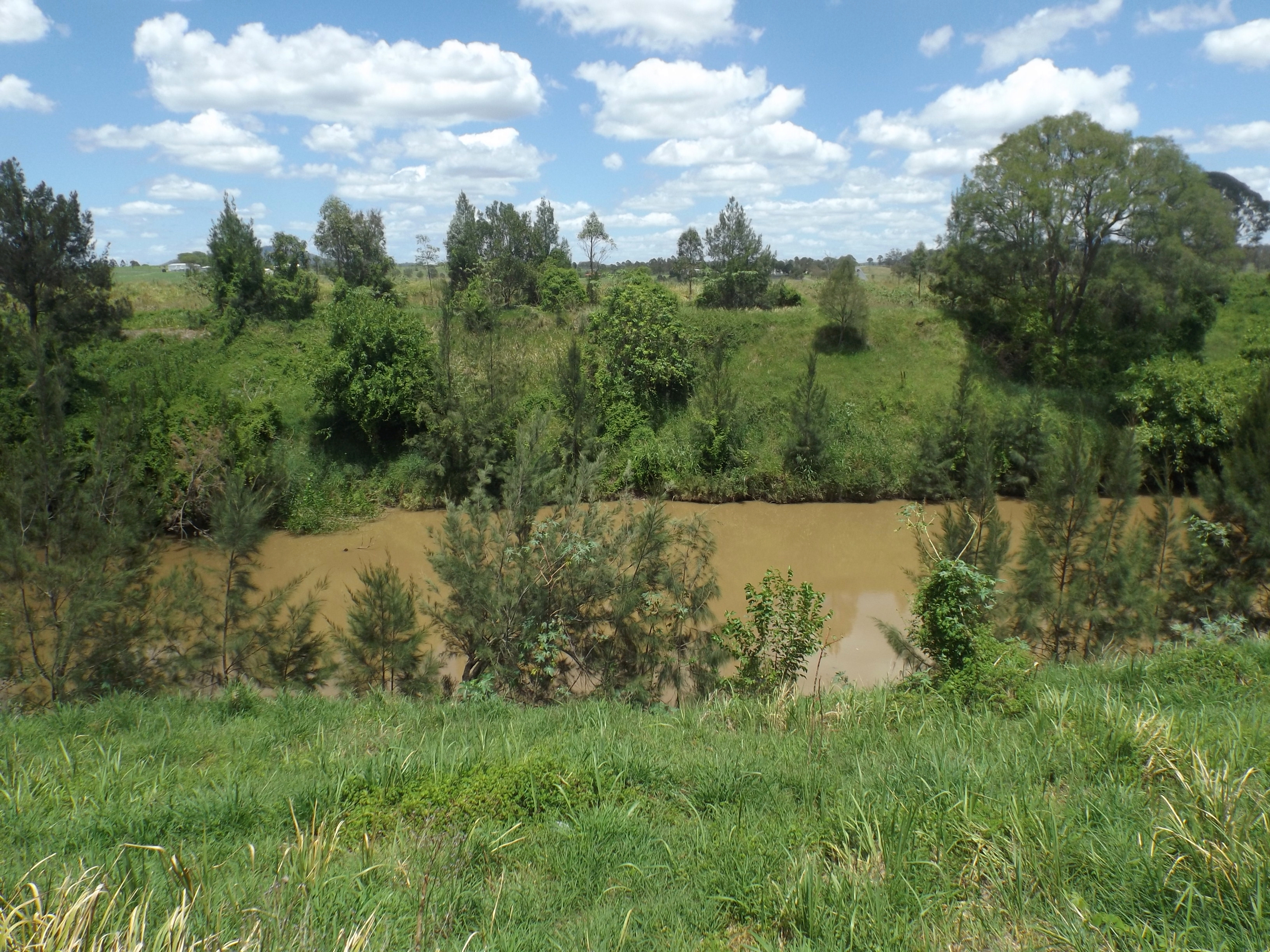
The Logan River ( Yugambeh: ''Dugulumba'') is a perennial river located in the Scenic Rim, Logan and Gold Coast local government areas of the South East region of Queensland, Australia. The -long river is one of the dominant waterways in South East Queensland that drains the southern ranges of the Scenic Rim and empties into Moreton Bay after navigating the City of Logan, a major suburban centre located south of Brisbane. The catchment is dominated by urban and agricultural land use. Near the river mouth are mangrove forests and a number of aquaculture farms. Course and features The river rises below Mount Ernest on the southern slopes of the Scenic Rim, part of the Great Dividing Range and forms in the Mount Barney National Park, near the Queensland New South Wales border, below Mount Lindesay. The river flows generally north by northeast, joined by eleven minor tributaries, before heading east and eventually emptying into Moreton Bay. Its principal tributaries a ... [...More Info...] [...Related Items...] OR: [Wikipedia] [Google] [Baidu] |
Coomera, Queensland
Coomera is a town and suburb in the City of Gold Coast, Queensland, Australia. In the , Coomera had a population of 13,305 people. Geography Located next to the Pacific Motorway, Coomera is close to Pimpama, Hope Island, Willow Vale, Wongawallan, Oxenford, and east of Upper Coomera. The southern boundary of Coomera is aligned with the Coomera River. History Yugembah (also known as Yugumbir, Jugambel, Jugambeir, Jugumbir, Jukam, Jukamba) is one of the Australian Aboriginal languages in areas that include the Beenleigh, Beaudesert, Gold Coast, Logan, Scenic Rim, Albert River, Coolangatta, Coomera, Logan River, Pimpama, Tamborine and Tweed River Valley, within the local government boundaries of the City of Gold Coast, City of Logan, Scenic Rim Regional Council and the Tweed River Valley. The town takes its name from the Coomera River, which in turn takes its name comes from the Yugambeh word ''kumera'', a species of wattle. The bark of this tree was used by Aborigi ... [...More Info...] [...Related Items...] OR: [Wikipedia] [Google] [Baidu] |


