|
Whangārei Harbour
Whangārei Harbour is a large harbour on the east coast of the North Island of New Zealand. The harbour stretches from Whangārei City, and the termination of the Hātea River, south east around the Onerahi peninsula and out to the Pacific Ocean at Whangārei Heads. Its Māori-language name (given by the ''Ngāti Wai'' ''iwi'' (tribe)) is ''Whangārei-te-rerenga-parāoa'', meaning "the place where whales gather". Another traditional name for this area is ''Whangarei-o-te-tohorā'' – "waiting for the breastbone of whales". History left, The Marsden Point Oil Refinery at the entrance of Whangārei Harbour Many early settlers and Maori used the harbour as a form of transport, and this played a large role in the establishment of Whangārei, and many of the industries in the area. These include Portland Cement Works, Marsden Point Oil Refinery and for the extraction of coal from Kamo. From 1911 to 1933 the Onerahi Branch Railway crossed the upper reaches of the harbour t ... [...More Info...] [...Related Items...] OR: [Wikipedia] [Google] [Baidu] |
New Zealand
New Zealand () is an island country in the southwestern Pacific Ocean. It consists of two main landmasses—the North Island () and the South Island ()—and List of islands of New Zealand, over 600 smaller islands. It is the List of island countries, sixth-largest island country by area and lies east of Australia across the Tasman Sea and south of the islands of New Caledonia, Fiji, and Tonga. The Geography of New Zealand, country's varied topography and sharp mountain peaks, including the Southern Alps (), owe much to tectonic uplift and volcanic eruptions. Capital of New Zealand, New Zealand's capital city is Wellington, and its most populous city is Auckland. The islands of New Zealand were the last large habitable land to be settled by humans. Between about 1280 and 1350, Polynesians began to settle in the islands and subsequently developed a distinctive Māori culture. In 1642, the Dutch explorer Abel Tasman became the first European to sight and record New Zealand. ... [...More Info...] [...Related Items...] OR: [Wikipedia] [Google] [Baidu] |
Onerahi Branch
The Onerahi Branch, sometimes known as the Grahamtown Railway, was a branch line railway in the Northland Region of New Zealand. It operated from 1911 until 1933 and linked the city of Whangārei to the nearby harbour in Onerahi. History In the early 1880s, a wharf was established at Whangārei in the tidal part of the Hātea River, in the upper reaches of Whangārei Harbour. Roughly 20 years later the maintenance bill was rising and the wharf's inadequacies were being revealed as it was too shallow for some vessels to access. The deep-water wharves in nearby Onerahi were considerably more desirable, and in 1899 approval was granted to extend the railway from Whangārei to Onerahi. It took until July 1901 for construction to get underway, and in May 1902 a contract was let to build a bridge across the Hātea River. It was 323 metres long with a central lifting span, and completed in 1904. It was not long before the bridge was nicknamed the Gull Roost, for obvious reaso ... [...More Info...] [...Related Items...] OR: [Wikipedia] [Google] [Baidu] |
Bryde's Whale
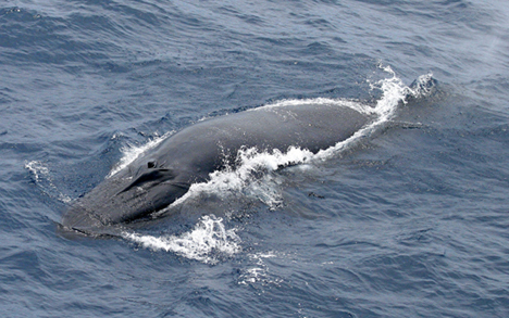
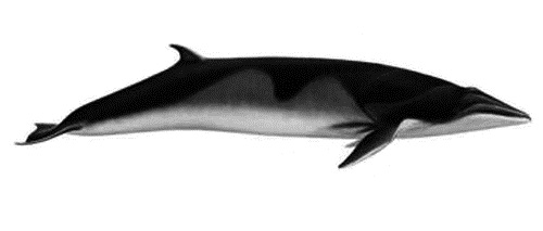
Bryde's whale ( ), or the Bryde's whale complex, putatively comprises three species of rorqual and possibly four. The "complex" means the number and classification remain unclear because of a lack of definitive information and research. The common Bryde's whale (''Balaenoptera brydei'', Olsen, 1913) is a larger form that occurs worldwide in warm temperate and tropical waters, and the Sittang or Eden's whale (''Balaenoptera edeni'', Anderson, 1879) is a smaller form that may be restricted to the Indo-Pacific. Also, a smaller, coastal form of ''B. brydei'' is found off southern Africa, and perhaps another form in the Indo-Pacific differs in skull morphology, tentatively referred to as the Indo-Pacific Bryde's whale. The recently described Omura's whale (''B. omurai'', Wada et al. 2003), was formerly thought to be a pygmy form of Bryde's, but is now recognized as a distinct species. Rice's whale (''B. ricei''), which makes its home solely in the Gulf of Mexico, was once consider ... [...More Info...] [...Related Items...] OR: [Wikipedia] [Google] [Baidu] |
The New Zealand Herald
''The New Zealand Herald'' is a daily newspaper published in Auckland, New Zealand, owned by New Zealand Media and Entertainment, and considered a newspaper of record for New Zealand. It has the largest newspaper circulation in New Zealand, peaking at over 200,000 copies in 2006, although circulation of the daily ''Herald'' had declined to 100,073 copies on average by September 2019. The ''Herald''s publications include a daily paper; the ''Weekend Herald'', a weekly Saturday paper; and the ''Herald on Sunday'', which has 365,000 readers nationwide. The ''Herald on Sunday'' is the most widely read Sunday paper in New Zealand. The paper's website, nzherald.co.nz, is viewed 2.2 million times a week and was named Voyager Media Awards' News Website of the Year in 2020, 2021, 2022, and 2023. In 2023, the ''Weekend Herald'' was awarded Weekly Newspaper of the Year and the publication's mobile application was the News App of the Year. Its main circulation area is the Auckland R ... [...More Info...] [...Related Items...] OR: [Wikipedia] [Google] [Baidu] |
Humpback Whale
The humpback whale (''Megaptera novaeangliae'') is a species of baleen whale. It is a rorqual (a member of the family Balaenopteridae) and is the monotypic taxon, only species in the genus ''Megaptera''. Adults range in length from and weigh up to . The humpback has a distinctive body shape, with long pectoral fins and tubercles on its head. It is known for Cetacean surfacing behaviour, breaching and other distinctive surface behaviors, making it popular with whale watching, whale watchers. Males produce a complex Whale sound, song that typically lasts from 4 to 33 minutes. Found in oceans and list of seas, seas around the world, humpback whales typically animal migration, migrate between feeding areas towards the poles and breeding areas near the equator. They feed in Polar region, polar waters and migrate to tropics, tropical or subtropical waters to breed and give birth. Their diet consists mostly of krill and small fish, and they usually Bubble-net feeding, use bubbles to c ... [...More Info...] [...Related Items...] OR: [Wikipedia] [Google] [Baidu] |
Southern Right Whale
The southern right whale (''Eubalaena australis'') is a baleen whale, one of three species classified as right whales belonging to the genus ''Eubalaena''. Southern right whales inhabit oceans south of the Equator, between the latitudes of 20° and 60° south. In 2009 the global population was estimated to be approximately 13,600. Taxonomy Right whales were first classified in the genus '' Balaena'' in 1758 by Carl Linnaeus, who at the time considered all right whales (including the bowhead) to be a single species. In the 19th and 20th centuries the family Balaenidae was the subject of great taxonometric debate. Authorities have repeatedly recategorised the three populations of right whale plus the bowhead whale, as one, two, three or four species, either in a single genus or in two separate genera. In the early whaling days, they were all thought to be a single species, ''Balaena mysticetus''. The southern right whale was initially described as ''Balaena australis'' by Des ... [...More Info...] [...Related Items...] OR: [Wikipedia] [Google] [Baidu] |
Mangapai River
The Mangapai River is a river of the Northland Region of New Zealand's North Island. It is perhaps better described as a silty arm of Whangārei Harbour, located due south of Whangārei. Its average width is some , but the silty nature of its course means that the stream itself is far narrower. The New Zealand Ministry for Culture and Heritage gives a translation of "good stream" for ''Mangapai''. See also *List of rivers of New Zealand This is a list of all waterways named as rivers in New Zealand. A * Aan River * Acheron River (Canterbury) * Acheron River (Marlborough) * Ada River (New Zealand), Ada River * Adams River (New Zealand), Adams River * Ahaura River * Ahuriri R ... References Whangarei District Rivers of the Northland Region Rivers of New Zealand {{Northland-river-stub ... [...More Info...] [...Related Items...] OR: [Wikipedia] [Google] [Baidu] |
Northland Port
Northport is a commercial sea port at Marsden Point, at the entrance to the Whangārei Harbour in Northland, New Zealand, located next to the Marsden Point Oil Refinery. It is a naturally deep-water port, with a maximum depth of 14.5 metres. It is the northernmost multi-purpose port in New Zealand, and the closest port to the majority of New Zealand's international markets. It is about 100 km north of the Auckland Northern Motorway, and around 75 nautical miles north of the Port of Auckland. History The Northland Harbour Board first proposed a container port at Marsden Point in the 1960s, at which time Whangārei was served by Port Whangārei, in the upper harbour near the city. The Northland Port Corporation was formed in 1988 to take over the commercial port assets of the Northland Harbour Board, and it entered a joint venture with Port of Tauranga Ltd in 2000 to establish Northport Limited. Construction of the port at Marsden Point started in October 2000 and the fi ... [...More Info...] [...Related Items...] OR: [Wikipedia] [Google] [Baidu] |
Matakohe Island
Motu Matakohe, also known as Matakohe or Limestone Island, is a island in the upper reaches of Whangārei Harbour, just off Onerahi, a seaside suburb of the city of Whangārei, Northland, New Zealand. Used for farming and industry for many years, the island is an example of ecological island restoration by a volunteer community group. History The earliest known inhabitants of the island were Ngaitahuhu Māori who occupied it in the early 18th century. They were dispossessed and driven out of the Whangārei area in the mid 18th century by Ngāpuhi Māori led by Te Ponaharakeke.Matakohe / Limestone Island The first European house on the island was built in 1832, though later destroyed. In 1848 the island was leased from the Parawhau hapū by Robert Carruth and Mathew Whitelaw who established a limeworks there, using the local limestone. In 1865 the island was purchased by Henry Walton from Te Tirarau and the Parawahau chiefs. The limeworks were extended and sheep were farmed ... [...More Info...] [...Related Items...] OR: [Wikipedia] [Google] [Baidu] |
Sand Bar
In oceanography, geomorphology, and geoscience, a shoal is a natural submerged ridge, bank, or bar that consists of, or is covered by, sand or other unconsolidated material, and rises from the bed of a body of water close to the surface or above it, which poses a danger to navigation. Shoals are also known as sandbanks, sandbars, or gravelbars. Two or more shoals that are either separated by shared troughs or interconnected by past or present sedimentary and hydrographic processes are referred to as a shoal complex.Neuendorf, K.K.E., J.P. Mehl Jr., and J.A. Jackson, eds. (2005) ''Glossary of Geology'' (5th ed.). Alexandria, Virginia, American Geological Institute. 779 pp. The term ''shoal'' is also used in a number of ways that can be either similar to, or quite different from, how it is used in geologic, geomorphic, and oceanographic literature. Sometimes, the term refers to either any relatively shallow place in a stream, lake, sea, or other body of water; a rocky area ... [...More Info...] [...Related Items...] OR: [Wikipedia] [Google] [Baidu] |
Mud Flats
Mudflats or mud flats, also known as tidal flats or, in Ireland, slob or slobs, are coastal wetlands that form in intertidal areas where sediments have been deposited by tides or rivers. A global analysis published in 2019 suggested that tidal flat ecosystems are as extensive globally as mangroves, covering at least of the Earth's surface. / They are found in sheltered areas such as bays, bayous, lagoons, and estuaries; they are also seen in freshwater lakes and salty lakes (or inland seas) alike, wherein many rivers and creeks end. Mudflats may be viewed geologically as exposed layers of bay mud, resulting from deposition of estuarine silts, clays and aquatic animal detritus. Most of the sediment within a mudflat is within the intertidal zone, and thus the flat is submerged and exposed approximately twice daily. A recent global remote sensing analysis estimated that approximately 50% of the global extent of tidal flats occurs within eight countries (Indonesia, China, Australi ... [...More Info...] [...Related Items...] OR: [Wikipedia] [Google] [Baidu] |
Marsden Bay, New Zealand
Marsden Bay is a locality and bay at the south head of Whangārei Harbour in Northland Region, Northland, New Zealand. The western side of Marsden Bay is a coastal community called One Tree Point, New Zealand, One Tree Point, and the eastern side is the industrial development of Marsden Point. Ruakākā lies about 9 km to the south. The Māori language, Māori name for the area is Te Poupouwhenua. History The town of Marsden, situated where Marsden Point is now, was originally intended to be the commercial centre for the district, due to the access to deep water, and because it was closer to Auckland than the area which is now Whangārei. The government purchased on the point in the mid-1850s and laid it out in quarter-acre sections. The development of the gum-digger, kauri gum industry changed the focus of settlement to Whangarei. The Marsden Point oil refinery was built in the 1960s and expanded in the 1980s. Demographics Demographics for the former statistical area o ... [...More Info...] [...Related Items...] OR: [Wikipedia] [Google] [Baidu] |


