|
Western Air Command
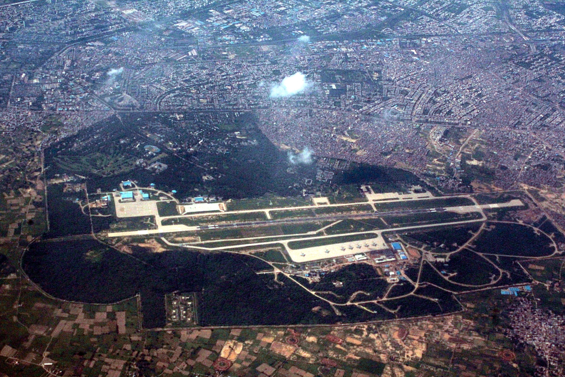
, colors= , colors_label= , battles= 1962 Sino-Indian War, 1971 India-Pakistan War, Operation Meghdoot , anniversaries= , commander1= Air Marshal Sreekumar Prabhakaran, AVSM, VM , commander1_label= Air Officer Commanding-in-Chief(AOC-in-C) , notable_commanders=Air Marshal MSD Wollen Air Chief Marshal Anil Yashwant Tipnis Air Chief Marshal Arup Raha Air Chief Marshal Norman Anil Kumar Browne Air Chief Marshal Srinivasapuram Krishnaswamy , identification_symbol= , identification_symbol_label= , start_date= July 22, 1949 The Western Air Command (WAC) is the regional command of Indian Air Force headquartered in New Delhi. It is the largest and most important Air Command of the IAF, comprising sixteen Air Force Bases (AFBs), and is responsible for aerial defence of North India. WAC's Area of Responsibility extends from Jammu and Kashmir to Rajasthan, also covering the states of Himachal Pradesh, Punjab, Haryana, New Delhi and Western Uttar Pradesh. History WAC was raised in ... [...More Info...] [...Related Items...] OR: [Wikipedia] [Google] [Baidu] |
India
India, officially the Republic of India (Hindi: ), is a country in South Asia. It is the seventh-largest country by area, the second-most populous country, and the most populous democracy in the world. Bounded by the Indian Ocean on the south, the Arabian Sea on the southwest, and the Bay of Bengal on the southeast, it shares land borders with Pakistan to the west; China, Nepal, and Bhutan to the north; and Bangladesh and Myanmar to the east. In the Indian Ocean, India is in the vicinity of Sri Lanka and the Maldives; its Andaman and Nicobar Islands share a maritime border with Thailand, Myanmar, and Indonesia. Modern humans arrived on the Indian subcontinent from Africa no later than 55,000 years ago., "Y-Chromosome and Mt-DNA data support the colonization of South Asia by modern humans originating in Africa. ... Coalescence dates for most non-European populations average to between 73–55 ka.", "Modern human beings—''Homo sapiens''—originated in Africa. Then, int ... [...More Info...] [...Related Items...] OR: [Wikipedia] [Google] [Baidu] |
North India
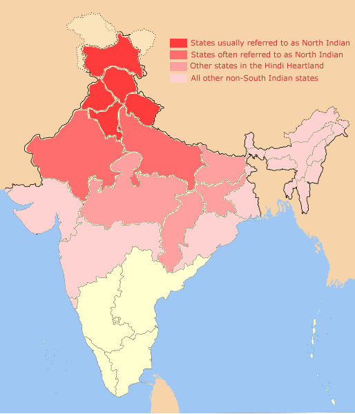
North India is a loosely defined region consisting of the northern part of India. The dominant geographical features of North India are the Indo-Gangetic Plain and the Himalayas, which demarcate the region from the Tibetan Plateau and Central Asia. The term North India has varying definitions. The Ministry of Home Affairs in its Northern Zonal Council Administrative division included the states of Haryana, Himachal Pradesh, Punjab and Rajasthan and Union Territories of Chandigarh, Delhi, Jammu and Kashmir and Ladakh. The Ministry of Culture in its ''North Culture Zone'' includes the state of Uttarakhand but excludes Delhi whereas the Geological Survey of India includes Uttar Pradesh and Delhi but excludes Rajasthan and Chandigarh. Other states sometimes included are Bihar, Gujarat, Jharkhand, Madhya Pradesh and West Bengal. North India has been the historical centre of the Mughal Empire, the Delhi Sultanate and the British Indian Empire. It has a diverse culture, and includ ... [...More Info...] [...Related Items...] OR: [Wikipedia] [Google] [Baidu] |
HAL Cheetah
HAL may refer to: Aviation * Halali Airport (IATA airport code: HAL) Halali, Oshikoto, Namibia * Hawaiian Airlines (ICAO airline code: HAL) * HAL Airport, Bangalore, India * Hindustan Aeronautics Limited an Indian aerospace manufacturer of fighter aircraft and helicopters Businesses * HAL Allergy, a Dutch pharmaceutical company * HAL Computer Systems, a defunct computer manufacturer * HAL Laboratory, a Japanese video game developer * Halliburton's New York Stock Exchange ticker symbol * Hamburg America Line, a shipping company * Hindustan Aeronautics Limited, an Indian aerospace manufacturer of fighter aircraft and helicopters * Hindustan Antibiotics Limited, an Indian public sector pharmaceutical manufacturer * Holland America Line, a cruise ship operator * HAL FM, or CHNS-FM, a classic rock station in Halifax, Nova Scotia Computing * Hardware abstraction layer, a layer of software that hides hardware differences from higher level programs * HAL (software), an implementation o ... [...More Info...] [...Related Items...] OR: [Wikipedia] [Google] [Baidu] |
HAL Dhruv
The HAL Dhruv is a utility helicopter designed and developed by Hindustan Aeronautics Limited (HAL) in November 1984. The helicopter first flew in 1992; however, its development was prolonged due to multiple factors including the Indian Army's requirement for design changes, budget restrictions, and sanctions placed on India following the 1998 Pokhran-II nuclear tests. The name comes from a Sanskrit origin word '' dhruv'' which means unshakeable or firm. Dhruv entered service in 2002. It is designed to meet the requirement of both military and civil operators, with military variants of the helicopter being developed for the Indian Armed Forces, while a variant for civilian/commercial use has also been developed. Military versions in production include transport, utility, reconnaissance and medical evacuation variants. As of January 2022, 335 HAL Dhruv have been produced for domestic and export markets logging more than 340,000 flying hours. Development Origins The ''Adv ... [...More Info...] [...Related Items...] OR: [Wikipedia] [Google] [Baidu] |
Mil Mi-17
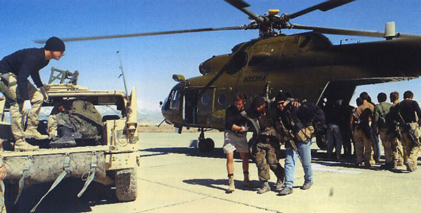
The Mil Mi-17 ( NATO reporting name: Hip) is a Soviet-designed Russian military helicopter family introduced in 1975 (Mi-8M), continuing in production at two factories, in Kazan and Ulan-Ude. It is known as the Mi-8M series in Russian service. The helicopter is mostly used as a medium twin-turbine transport helicopter, as well as an armed gunship version. Development Developed from the basic Mi-8 airframe, the Mi-17 was fitted with the larger Klimov TV3-117MT engines, rotors, and transmission developed for the Mi-14, along with fuselage improvements for heavier loads. Optional engines for "hot and high" conditions are the 1545 kW (2070 shp) Isotov TV3-117VM. Recent exports to China and Venezuela for use in high mountains have the new Klimov VK-2500 version of the Klimov TV3-117 engine with FADEC control. The designation Mi-17 is for export; Russian armed forces call it Mi-8MT. The Mi-17 can be recognized because it has the tail rotor on the port side instead of the s ... [...More Info...] [...Related Items...] OR: [Wikipedia] [Google] [Baidu] |
Siachen
The Siachen Glacier is a glacier located in the eastern Karakoram range in the Himalayas at about , just northeast of the point NJ9842 where the Line of Control between India and Pakistan ends. At long, it is the longest glacier in the Karakoram and second-longest in the world's non-polar areas. It falls from an altitude of 5,753 m (18,875 ft) above sea level at its head at Indira Col on the India–China border down to 3,620 m (11,875 ft) at its terminus. The entire Siachen Glacier, with all major passes, has been under the administration of India (currently as part of the union territory of Ladakh, located in the Kashmir region) since 1984. Pakistan maintains a territorial claim over the Siachen Glacier and controls the region west of Saltoro Ridge, lying west of the glacier, with Pakistani posts located 3,000 ft below more than 100 Indian posts on the ridge. The Siachen Glacier lies immediately south of the great drainage divide that separa ... [...More Info...] [...Related Items...] OR: [Wikipedia] [Google] [Baidu] |
Siachen Glacier
The Siachen Glacier is a glacier located in the eastern Karakoram range in the Himalayas at about , just northeast of the point NJ9842 where the Line of Control between India and Pakistan ends. At long, it is the longest glacier in the Karakoram and second-longest in the world's non-polar areas. It falls from an altitude of 5,753 m (18,875 ft) above sea level at its head at Indira Col on the India–China border down to 3,620 m (11,875 ft) at its terminus. The entire Siachen Glacier, with all major passes, has been under the administration of India (currently as part of the union territory of Ladakh, located in the Kashmir region) since 1984. Pakistan maintains a territorial claim over the Siachen Glacier and controls the region west of Saltoro Ridge, lying west of the glacier, with Pakistani posts located 3,000 ft below more than 100 Indian posts on the ridge. The Siachen Glacier lies immediately south of the great drainage divide that separat ... [...More Info...] [...Related Items...] OR: [Wikipedia] [Google] [Baidu] |
India-China War
The Sino-Indian War took place between China and India from October to November 1962, as a major flare-up of the Sino-Indian border dispute. There had been a series of violent border skirmishes between the two countries after the 1959 Tibetan uprising, when India granted asylum to the Dalai Lama. Chinese military action grew increasingly aggressive after India rejected proposed Chinese diplomatic settlements throughout 1960–1962, with China re-commencing previously-banned "forward patrols" in Ladakh after 30 April 1962. Amidst the Cuban Missile Crisis, China abandoned all attempts towards a peaceful resolution on 20 October 1962, invading disputed territory along the border in Ladakh and across the McMahon Line in the northeastern frontier. Chinese troops pushed back Indian forces in both theatres, capturing all of their claimed territory in the western theatre and the Tawang Tract in the eastern theatre. The conflict ended when China unilaterally declared a ceasefire on ... [...More Info...] [...Related Items...] OR: [Wikipedia] [Google] [Baidu] |
Western Uttar Pradesh
Western Uttar Pradesh is a region in India that comprises the western districts of Uttar Pradesh state, including the areas of Rohilkhand and those where Khariboli, Braj and Kannauji are spoken. The region has some demographic, economic and cultural patterns that are distinct from other parts of Uttar Pradesh, and more closely resemble those of Haryana and Rajasthan states. Western Uttar Pradesh has experienced rapid economic growth, in a fashion similar to Haryana and Punjab, due to the successes of the Green Revolution. Mohamad Riad El-Ghonemy, "The Dynamics of Rural Poverty", Food and Agriculture Organization of the United Nations, 1986. ''... Haryana and West Uttar Pradesh recorded spectacular production increases ...''V. G. Rastyannikov, "Agrarian Evolution in a Multiform Structure Society: Experience of Independent India", Routledge & Kegan Paul, 1981, .B. M. Bhatia, "Food Security in South Asia", Oxford & IHB Pub. Co., 1985. A significant part of western Uttar Pradesh is a ... [...More Info...] [...Related Items...] OR: [Wikipedia] [Google] [Baidu] |
Haryana
Haryana (; ) is an Indian state located in the northern part of the country. It was carved out of the former state of East Punjab on 1 Nov 1966 on a linguistic basis. It is ranked 21st in terms of area, with less than 1.4% () of India's land area. The state capital is Chandigarh, which it shares with the neighboring state of Punjab, and the most populous city is Faridabad, which is a part of the National Capital Region (India), National Capital Region. The city of Gurugram is among India's largest financial and technology hubs. Haryana has 6 Divisions of Haryana, administrative divisions, 22 List of districts of Haryana, districts, 72 sub-divisions, 93 tehsil, revenue tehsils, 50 sub-tehsils, 140 Community development block in India, community development blocks, 154 List of cities in Haryana by population, cities and towns, 7,356 villages, and 6,222 Gram panchayat, villages panchayats. Haryana contains 32 special economic zones (SEZs), mainly located within the industrial corri ... [...More Info...] [...Related Items...] OR: [Wikipedia] [Google] [Baidu] |
Punjab (India)
Punjab (; ) is a States and union territories of India, state in northern India. Forming part of the larger Punjab region of the Indian subcontinent, the state is bordered by the States and union territories of India, Indian states of Himachal Pradesh to the north and northeast, Haryana to the south and southeast, and Rajasthan to the southwest; by the Indian union territory, union territories of Chandigarh to the east and Jammu and Kashmir (union territory), Jammu and Kashmir to the north. It shares an international border with Punjab, Pakistan, Punjab, a Pakistani province, province of Pakistan to the west. The state covers an area of 50,362 square kilometres (19,445 square miles), which is 1.53% of India's total geographical area, making it List of states and union territories of India by area, the 19th-largest Indian state by area out of 28 Indian states (20th largest, if UTs are considered). With over 27 million inhabitants, Punjab is List of states and union territories of ... [...More Info...] [...Related Items...] OR: [Wikipedia] [Google] [Baidu] |


.jpg)


