|
Vriezenveen
Vriezenveen ( Lower Saxon: '''t Vjenne, Venne, Vjenne, Vreeznven or Vreeinvenne'') is a town in the municipality of Twenterand in the Dutch province of Overijssel. The population was 13,800 on January 1, 2020. Until July 1, 2002, Vriezenveen formed an independent municipality together with the villages of De Pollen, Westerhaar-Vriezenveensewijk, Aadorp and the hamlets Bruinehaar, Weitemanslanden and Westerhoeven. In 2001, the municipality of Vriezenveen was merged with the municipality of Den Ham, which included the villages of Den Ham, Vroomshoop, and Geerdijk. The new municipality was called Vriezenveen and renamed Twenterand in 2003. The town hall of Twenterand is located in Vriezenveen. The dependance of the town hall in Den Ham was closed on May 30, 2008. History The oldest mention of Vriezenveen dates from 1364, when Evert van Hekeren, lord of Almelo, wrote a charter for the free Frisians, their heirs and all the people who lived on the moor, from the ''Wierdense Weus ... [...More Info...] [...Related Items...] OR: [Wikipedia] [Google] [Baidu] |
Twenterand
Twenterand (; Twents: ) is a municipality in the province of Overijssel in the eastern Netherlands. The name means "edge of Twente" as it is situated on the northwestern fringe of the historical region of Twente. The municipality of Twenterand also had two city halls, because of the merger between the former municipalities of Vriezenveen and Den Ham in 2001. The city hall in Vriezenveen remained. The extended municipality of Vriezenveen is called Twenterand since 2003. The former municipal area of Vriezenveen belongs to the region of Twente and the former municipal area of Den Ham partly to the region of Salland and partly to the region of Twente. Population centres ''Dutch topographic map of the municipality of Twenterand, June 2015'' Transportation *Geerdijk railway station * Vriezenveen railway station * Vroomshoop railway station Notable people * Louis Reijtenbagh (born 1946 in Den Ham) a Dutch businessman, investor, a retired general practitioner and art collector * ... [...More Info...] [...Related Items...] OR: [Wikipedia] [Google] [Baidu] |
List Of Cities, Towns And Villages In Overijssel
This is a list of settlements in the province of Overijssel, Netherlands. References GEOnet Names Server (GNS) * ''ANWB Topografische Atlas Nederland'', 2005 * ''VUGA's Alfabetische Plaatsnamengids van Nederland'', 1997. {{DEFAULTSORT:List Of Cities, Towns And Villages In Overijssel Populated places in Overijssel, Lists of populated places in the Netherlands, *Overijssel ... [...More Info...] [...Related Items...] OR: [Wikipedia] [Google] [Baidu] |
Aadorp
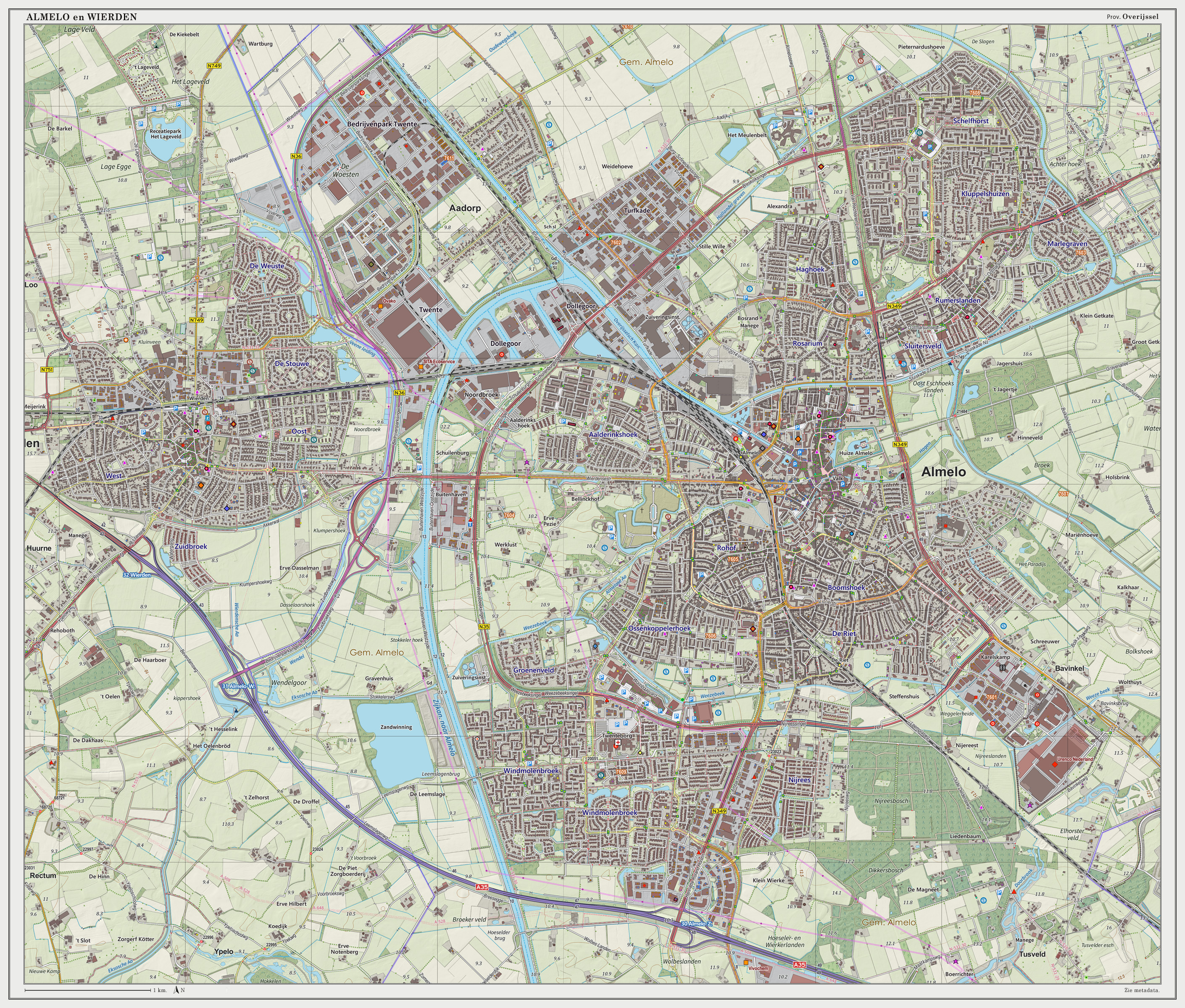
Aadorp is a village on the northern side of Almelo, Netherlands with a population of about 1500; it has been part of the Almelo municipality since 2001. The villagers of Aadorp are very close, since there are so few of them. The central meeting point in Aadorp is the Aahoes, which consists of a meeting hall, and a small barbershop. Also, Aadorp has recreation areas including soccer fields and more. For anything else Aadorp villagers must go to one of the neighbouring towns. History The village was first mentioned in 1867 as Aabrug, and means "settlement on the river Aa". The river Aa is nowadays part of the Twentekanaal. It formally exists since 3 November 1930 when the hamlets of Woesten and Buitenwonen were merged into the village of Aadorp. In the early 20th century, it was a peat excavation settlement. There was a railway station of the Mariënberg to Almelo railway line between 1920 and 1938. In 1925, a Dutch Reformed church was built in the village. It was replaced in 1992 ... [...More Info...] [...Related Items...] OR: [Wikipedia] [Google] [Baidu] |
Twente
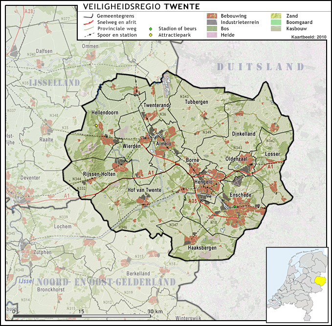
Twente ( nl, Twente , Tweants dialect: ''Tweante'') is a region in the eastern Netherlands. It encompasses the most urbanised and easternmost part of the province of Overijssel. Twente is most likely named after the Tuihanti or Tvihanti, a Germanic tribe that settled in the area and was mentioned by the Roman historian Tacitus. The region's borders are defined by the Overijssel region of Salland in the northwest and west (the river Regge roughly defines the western border), the German County of Bentheim in the northeast and east (the river Dinkel roughly defines the eastern border) and the Gelderland region of the Achterhoek in the south. Twente has approximately 620,000 inhabitants, most of whom live in its three largest cities: Almelo, Hengelo and Enschede, the latter being the main city of the region. It comprises fourteen municipalities: Almelo, Borne, Dinkelland, Enschede, Haaksbergen, Hellendoorn, Hengelo, Hof van Twente, Losser, Oldenzaal, Rijssen-Holten, Tubbergen, Twe ... [...More Info...] [...Related Items...] OR: [Wikipedia] [Google] [Baidu] |
Den Ham
Den Ham ɛn ɦɑmis a village in the Dutch province of Overijssel. It is located in the municipality of Twenterand, about 15 km northwest of Almelo. Den Ham was a separate municipality until 2001, when it became a part of Vriezenveen. It was subsequently renamed ''Twenterand'' in 2002. History Den Ham is an ''esdorp'' which was first mentioned in 1333. During the Dutch Revolt it was under frequent attack. In 1840, it was home to 748 people. It the mid-19th century, it was surpassed by Vroomshoop Vroomshoop is a town located at the center of the municipality Twenterand in the Dutch province of Overijssel and was founded around 1859. The earliest inhabitants lived from the peat that was found in the nearby area. Farmers from the Groninge ... which had better connections to the outside world. In 1914, the dairy factory De Eensgezindheid opened in Den Ham. Gallery File:Den Ham, de Nederlands Hervormde kerk RM19999 foto2 2014-10-04 15.37.jpg, Den Ham, reformed church ... [...More Info...] [...Related Items...] OR: [Wikipedia] [Google] [Baidu] |
Netherlands
) , anthem = ( en, "William of Nassau") , image_map = , map_caption = , subdivision_type = Sovereign state , subdivision_name = Kingdom of the Netherlands , established_title = Before independence , established_date = Spanish Netherlands , established_title2 = Act of Abjuration , established_date2 = 26 July 1581 , established_title3 = Peace of Münster , established_date3 = 30 January 1648 , established_title4 = Kingdom established , established_date4 = 16 March 1815 , established_title5 = Liberation Day (Netherlands), Liberation Day , established_date5 = 5 May 1945 , established_title6 = Charter for the Kingdom of the Netherlands, Kingdom Charter , established_date6 = 15 December 1954 , established_title7 = Dissolution of the Netherlands Antilles, Caribbean reorganisation , established_date7 = 10 October 2010 , official_languages = Dutch language, Dutch , languages_type = Regional languages , languages_sub = yes , languages = , languages2_type = Reco ... [...More Info...] [...Related Items...] OR: [Wikipedia] [Google] [Baidu] |
Geerdijk
Geerdijk is a village in the Netherlands, Dutch province of Overijssel. It is located in the municipality of Twenterand. It became a village in 2009. History Geerdijk was founded in the mid-19th century along the canal Almelo–De Haandrik as a peat excavation village. It was a Catholic enclave which was settled by colonists from neighbouring Germany and the area around Slagharen and Dedemsvaart. In 1868, an independent parish was established. In 1906, the Geerdijk railway station opened on the Mariënberg–Almelo railway, and closed on 29 April 2016. It was closed, because there were not enough passengers and Arriva wanted to increase the speed to allow an extension of the line to Hardenberg. Geerdijk used to be part of the municipality of Den Ham. In 2001, it was merged into Twenterand. It was considered a hamlet of Vroomshoop. In 2009, Geerdijk separated from Vroomshoop, and became a village. Gallery File:Geerdijk nooorderweg oudste nog bestaande woning.jpg, Oldest exta ... [...More Info...] [...Related Items...] OR: [Wikipedia] [Google] [Baidu] |
Vroomshoop
Vroomshoop is a town located at the center of the municipality Twenterand in the Dutch province of Overijssel and was founded around 1859. The earliest inhabitants lived from the peat that was found in the nearby area. Farmers from the Groningen area played an important role by the excavated peat into farmland here. They settled mainly on the Tonnendijk Road. The Groninger-farms are still on the Tonnendijk. History In 1859, the canal Almelo-De Haandrik was dug, and a peat colony developed along the canal. Around 1875, the economy became based on potatoes and colonists from Groningen and Drenthe settled in the area. The Saint Willibrord Church was finished in 1868. In 1906, the village still contained 109 sod houses. In 2009, the village of Geerdijk separated from Vroomshoop. Transportation In 1906 a train station was built in Vroomshoop, because of the NOLS track from Mariënberg to Almelo. The Original name for this station was "Den Ham - Vroomshoop", it was changed to "Vr ... [...More Info...] [...Related Items...] OR: [Wikipedia] [Google] [Baidu] |
15th Century
The 15th century was the century which spans the Julian dates from 1 January 1401 ( MCDI) to 31 December 1500 ( MD). In Europe, the 15th century includes parts of the Late Middle Ages, the Early Renaissance, and the early modern period. Many technological, social and cultural developments of the 15th century can in retrospect be seen as heralding the "European miracle" of the following centuries. The architectural perspective, and the modern fields which are known today as banking and accounting were founded in Italy. The Hundred Years' War ended with a decisive French victory over the English in the Battle of Castillon. Financial troubles in England following the conflict resulted in the Wars of the Roses, a series of dynastic wars for the throne of England. The conflicts ended with the defeat of Richard III by Henry VII at the Battle of Bosworth Field, establishing the Tudor dynasty in the later part of the century. Constantinople, known as the capital of the wo ... [...More Info...] [...Related Items...] OR: [Wikipedia] [Google] [Baidu] |
Almelo
Almelo () is a municipality and a city in the eastern Netherlands. The main population centres in the town are Aadorp, Almelo, Mariaparochie, and Bornerbroek. Almelo has about 72,000 inhabitants in the middle of the rolling countryside of Twente, with the industrial centres of Enschede and Hengelo as close neighbours but also with tourist towns like Ootmarsum, Delden and Markelo only a bicycle ride away. Almelo received city rights in 1394. Within the city limits lies the castle of the Counts of Almelo. Located in the city centre is Huize Almelo, a castle that in its current form dates back to 1662 (This castle is not open to the public). There are mosaics which decorate the walls of the tunnel close to the railway station. The city is also known for its local association football club Heracles Almelo, which plays in the Eredivisie, the highest football league in the Netherlands. The club uses the Erve Asito. History At the end of the 19th century textile emerged as a major emp ... [...More Info...] [...Related Items...] OR: [Wikipedia] [Google] [Baidu] |


