|
Vasili Chichagov
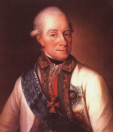
Vasili Yakovlevich Chichagov (russian: Василий Яковлевич Чичагов; 28 February 1726 – 4 April 1809) was an admiral in the Russian Navy and an explorer. He was the father of Pavel Chichagov, a Russian admiral during the Napoleonic Wars. Background Joining the Navy at the age of 16, Chichagov was educated in Great Britain. Throughout his life, he would become enthusiastic for all things British, eventually marry an English woman, and spend his last years in the United Kingdom (after he had settled into retirement in 1797). Expeditions In 1764, the scientist Lomonosov organized an expedition to find the Northeast Passage between the Atlantic and Pacific oceans by sailing along the northern coast of Siberia. Chichagov, then serving as the deputy commandant of Arkhangelsk Port, was put in charge of the expedition with three ships, the ''Chichagov'', the ''Panov'' and the ''Babayev''. Although he sailed past Svalbard and reached 80°26'N in 1765 and 80°30 ... [...More Info...] [...Related Items...] OR: [Wikipedia] [Google] [Baidu] |
Chichagov
Chichagov or Chichagof(f) (masculine) or Chichagova (feminine) is a Russian surname. Notable people with the surname include: *Pavel Chichagov (1767–1849), a Russian military and naval commander in the Napoleonic Wars *Seraphim Chichagov (b.? - 1937), martyr and Father Superior of the Monastery of Saint Euthymius *Vasily Chichagov (1726–1809), an admiral in the Russian Navy * Nikolai Chichagov (1803-1858), Russian architect * Dmitrii Chichagov (1835-1894), Russian architect * Olga and Galina Chichagova (1886-1958 and 1891-1966), Russian artists and children's book illustrators See also *Chichagof Harbor, an inlet on Attu Island in the Aleutian Islands in Alaska *Chichagof Island Chichagof Island (russian: Остров Чичагова), or Shee Kaax, is an island in the Alexander Archipelago of the Alaska Panhandle. At long and wide, it has a land area of , making it the fifth largest island in the United States and ... in the Alexander Archipelago of the Alaskan Panhand ... [...More Info...] [...Related Items...] OR: [Wikipedia] [Google] [Baidu] |
Chichagof Island
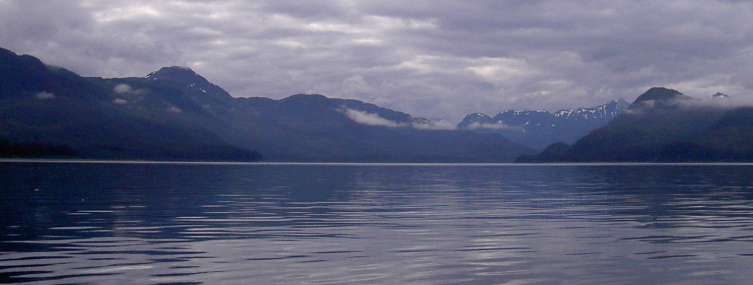
Chichagof Island (russian: Остров Чичагова), or Shee Kaax, is an island in the Alexander Archipelago of the Alaska Panhandle. At long and wide, it has a land area of , making it the fifth largest island in the United States and the 109th largest island in the world. Its coastline measures 742 miles. There was a 2000 census population of 1,342 persons. It is one of the ABC islands of Alaska. Chichagof Island has the highest population of bears per square mile of any place on Earth.Carol HealyBrown Bear Management Report Alaska Department of Fish & Game, Dec. 2003 Chichagof Island is directly north of Baranof Island, with Peril Strait separating the two islands. It is bounded by Chatham Strait to the east, Icy Strait to the northeast, Cross Sound to the northwest, and the Gulf of Alaska to the west. The communities of Hoonah, Pelican, Tenakee Springs, and Elfin Cove are all located on the northern half of Chichagof Island, in the Hoonah-Angoon Census Are ... [...More Info...] [...Related Items...] OR: [Wikipedia] [Google] [Baidu] |
Tallinn
Tallinn () is the most populous and capital city of Estonia. Situated on a bay in north Estonia, on the shore of the Gulf of Finland of the Baltic Sea, Tallinn has a population of 437,811 (as of 2022) and administratively lies in the Harju ''maakond'' (county). Tallinn is the main financial, industrial, and cultural centre of Estonia. It is located northwest of the country's second largest city Tartu, however only south of Helsinki, Finland, also west of Saint Petersburg, Russia, north of Riga, Latvia, and east of Stockholm, Sweden. From the 13th century until the first half of the 20th century, Tallinn was known in most of the world by variants of its other historical name Reval. Tallinn received Lübeck city rights in 1248,, however the earliest evidence of human population in the area dates back nearly 5,000 years. The medieval indigenous population of what is now Tallinn and northern Estonia was one of the last " pagan" civilisations in Europe to adopt Christianit ... [...More Info...] [...Related Items...] OR: [Wikipedia] [Google] [Baidu] |
Sea Of Azov
The Sea of Azov ( Crimean Tatar: ''Azaq deñizi''; russian: Азовское море, Azovskoye more; uk, Азовське море, Azovs'ke more) is a sea in Eastern Europe connected to the Black Sea by the narrow (about ) Strait of Kerch, and is sometimes regarded as a northern extension of the Black Sea. The sea is bounded by Russia on the east, by Ukraine on the northwest and southwest. The sea is largely affected by the inflow of the Don, Kuban, and other rivers, which bring sand, silt, and shells, which in turn form numerous bays, limans, and narrow spits. Because of these deposits, the sea bottom is relatively smooth and flat with the depth gradually increasing toward the middle. Also, due to the river inflow, water in the sea has low salinity and a high amount of biomass (such as green algae) that affects the water colour. Abundant plankton result in unusually high fish productivity. The sea shores and spits are low; they are rich in vegetation and bird colonie ... [...More Info...] [...Related Items...] OR: [Wikipedia] [Google] [Baidu] |
Kerch Strait
The Kerch Strait, uk, Керченська протока, crh, Keriç boğazı, ady, Хы ТӀуалэ is a strait in Eastern Europe. It connects the Black Sea and the Sea of Azov, separating the Kerch Peninsula of Crimea in the west from the Taman Peninsula of Russia's Krasnodar Krai in the east. The strait is to wide and up to deep. The most important harbor, the Crimean city of Kerch, gives its name to the strait, formerly known as the Cimmerian Bosporus. It has also been called the Straits of Yenikale after the Yeni-Kale fortress in Kerch. Taman, the most important settlement on the Taman Peninsula side of the strait, sits on Taman Bay, which is separated from the main Kerch Strait by the Chushka Spit to the north and the former Tuzla Spit to the south; the Tuzla Spit is now Tuzla Island, connected to the Taman Peninsula by a 2003 Russian-built dam, and to mainland Crimea by the Crimean Bridge opened in 2018. A major cargo port is under construction near Taman. ... [...More Info...] [...Related Items...] OR: [Wikipedia] [Google] [Baidu] |
Spitzbergen
Svalbard ( , ), also known as Spitsbergen, or Spitzbergen, is a Norwegian archipelago in the Arctic Ocean. North of mainland Europe, it is about midway between the northern coast of Norway and the North Pole. The islands of the group range from 74° to 81° north latitude, and from 10° to 35° east longitude. The largest island is Spitsbergen, followed by Nordaustlandet and . The largest settlement is Longyearbyen. The islands were first used as a base by the whalers who sailed far north in the 17th and 18th centuries, after which they were abandoned. Coal mining started at the beginning of the 20th century, and several permanent communities were established. The Svalbard Treaty of 1920 recognizes Norwegian sovereignty, and the 1925 Svalbard Act made Svalbard a full part of the Kingdom of Norway. They also established Svalbard as a free economic zone and a demilitarized zone. The Norwegian Store Norske and the Russian remain the only mining companies in place. Res ... [...More Info...] [...Related Items...] OR: [Wikipedia] [Google] [Baidu] |
Aleutian Islands
The Aleutian Islands (; ; ale, Unangam Tanangin,”Land of the Aleuts", possibly from Chukchi language, Chukchi ''aliat'', "island"), also called the Aleut Islands or Aleutic Islands and known before 1867 as the Catherine Archipelago, are a chain of 14 large volcanic islands and 55 smaller islands. Most of the Aleutian Islands belong to the U.S. state of Alaska, but some belong to the Russian Federal subjects of Russia, federal subject of Kamchatka Krai. They form part of the Aleutian Arc in the Northern Pacific Ocean, occupying a land area of 6,821 sq mi (17,666 km2) and extending about westward from the Alaska Peninsula toward the Kamchatka Peninsula in Russia, and act as a border between the Bering Sea to the north and the Pacific Ocean to the south. Crossing 180th meridian, longitude 180°, at which point east and west longitude end, the archipelago contains both the westernmost part of the United States by longitude (Amatignak Island) and the easternmost by longitude ( ... [...More Info...] [...Related Items...] OR: [Wikipedia] [Google] [Baidu] |
Attu Island
Attu ( ale, Atan, russian: Атту, link=no) is an island in the Near Islands (part of the Aleutian Islands chain). It is the westernmost point of the U.S. state of Alaska. The island became uninhabited in 2010, making it the largest uninhabited island to be politically part of the United States. (archived June 25, 2017) The Battle of Attu was the site of the only World War II land battle fought in the United States. The battlefield area is a U.S. National Historic Landmark. Attu Station, a former Coast Guard LORAN station, is located at , making it one of the westernmost points of the United States relative to the rest of the country. However, since it is in the Eastern Hemisphere, being on the opposite side of the 180° longitude line of the contiguous 48 states, it can also be considered one of the easternmost points of the country (a second Aleutian Island, Semisopochnoi Island at 179°46′E, is the easternmost location in the United States by this definition). For purpo ... [...More Info...] [...Related Items...] OR: [Wikipedia] [Google] [Baidu] |
Chichagof Harbor
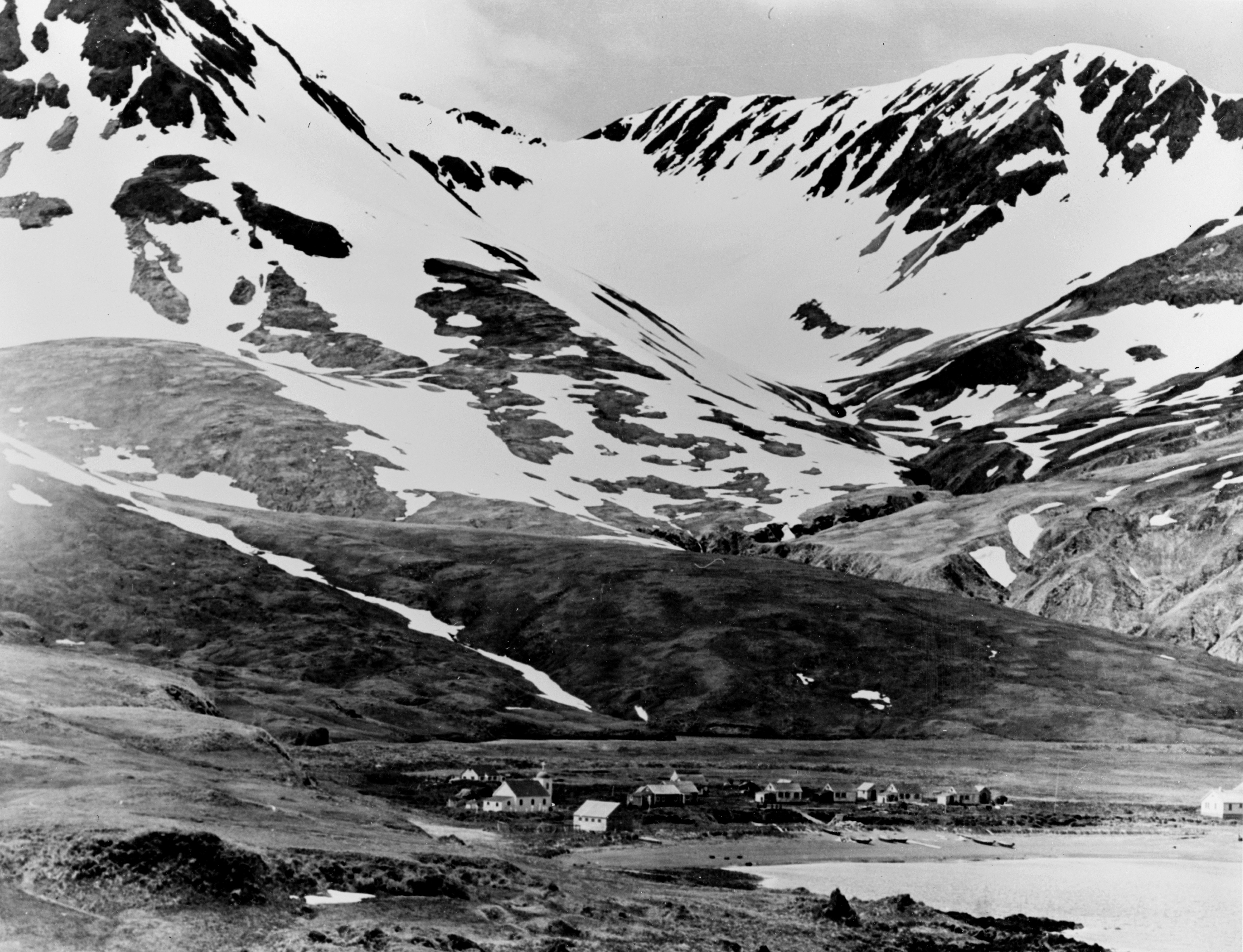
Chichagof Harbor is an inlet on the northeast coast of the island of Attu in the Aleutian Islands in Alaska.''Merriam-Webster's Geographical Dictionary, Third Edition'', p. 243. It is named after Russian Admiral and polar explorer Vasily Chichagov. It is the location of the Aleut village served by an American pastor and his wife. It was also where some heavy fighting took place during the recapture of the island from the Japanese during the Battle of Attu The Battle of Attu (codenamed Operation Landcrab), which took place on 11–30 May 1943, was a battle fought between forces of the United States, aided by Canadian reconnaissance and fighter-bomber support, and Japan on Attu Island off the coas ... in World War II and afterwards was the site of Battery B 42nd Coast Artillery Battalion. Notes References *''Merriam-Webster's Geographical Dictionary, Third Edition''. Springfield, Massachusetts: Merriam-Webster, Incorporated, 1997. . External links * Attu Island Bodies o ... [...More Info...] [...Related Items...] OR: [Wikipedia] [Google] [Baidu] |
French Polynesia
)Territorial motto: ( en, "Great Tahiti of the Golden Haze") , anthem = , song_type = Regional anthem , song = " Ia Ora 'O Tahiti Nui" , image_map = French Polynesia on the globe (French Polynesia centered).svg , map_alt = Location of French Polynesia , map_caption = Location of French Polynesia (circled in red) , mapsize = 290px , subdivision_type = Sovereign state , subdivision_name = , established_title = Protectorate proclaimed , established_date = 9 September 1842 , established_title2 = Territorial status , established_date2 = 27 October 1946 , established_title3 = Collectivity status , established_date3 = 28 March 2003 , established_title4 = Country status (nominal title) , established_date4 = 27 February 2004 , official_languages = French , regional_languages = , capital = Papeete , coordinates = , largest_city = Fa'a'ā , demonym = French Polynesian , ethnic_groups = 66.5% unmixed Polynesians7.1% mixed Polynesians9.3% Demis1 ... [...More Info...] [...Related Items...] OR: [Wikipedia] [Google] [Baidu] |
Marquesas Islands
The Marquesas Islands (; french: Îles Marquises or ' or '; Marquesan: ' ( North Marquesan) and ' ( South Marquesan), both meaning "the land of men") are a group of volcanic islands in French Polynesia, an overseas collectivity of France in the southern Pacific Ocean. Their highest point is the peak of Mount Oave (french: Mont Oave, links=no) on Ua Pou island, at 1,230 m (4,035 ft) above sea level. Archaeological research suggests the islands were colonized in the 10th century AD by voyagers from West Polynesia. Over the centuries that followed, the islands have maintained a "remarkably uniform culture, biology and language". The Marquesas were named after the 16th century Spanish Viceroy of Peru, the Marquis of Cañete ( es, Marqués de Cañete, italic=unset) by navigator , who visited them in 1595. The Marquesas Islands constitute one of the five administrative divisions (') of French Polynesia. The capital of the Marquesas Islands' administrative subdivision is t ... [...More Info...] [...Related Items...] OR: [Wikipedia] [Google] [Baidu] |


