|
Volcán San Pedro
{{NorthAm-protected-area-stub ...
Volcán San Pedro (or ''Las Yeguas'') is a stratovolcano on the shores of Lago de Atitlán, in the Sololá Department of southern Guatemala. At its base is the village of San Pedro La Laguna. __NOTOC__ Notes References External links San Pedro, Lake Atitlan videoshowing the view from the top. Sololá Department Sierra Madre de Chiapas Stratovolcanoes of Guatemala Subduction volcanoes Volcano A volcano is a rupture in the crust of a planetary-mass object, such as Earth, that allows hot lava, volcanic ash, and gases to escape from a magma chamber below the surface. On Earth, volcanoes are most often found where tectonic plates ... [...More Info...] [...Related Items...] OR: [Wikipedia] [Google] [Baidu] |
Panajachel
Panajachel (, Pana) is a town in the southwestern Guatemalan Highlands, less than from Guatemala City, in the department of Sololá. It serves as the administrative centre for the surrounding municipality of the same name. The elevation is . Population was 11 thousand in the 2000 census, projected as 15,830 by June 30, 2020 and has approximately doubled each of the last few decades. The town of Panajachel is located on the Northeast shore of Lake Atitlán, and has become a centre for the tourist trade of the area as it provides a base for visitors crossing the lake to visit other towns and villages. "Panajachel" derives from the Kaqchikel language and roughly translates to "place of the Matasanos," the white sapote fruit tree. History Spanish colony In the 16th century, during the period of the Spanish conquest of Guatemala, the shore of the lake was the scene of a battle in which the Spanish and their Kaqchikel allies defeated the Tz'utujils. After the Spanish conquest ... [...More Info...] [...Related Items...] OR: [Wikipedia] [Google] [Baidu] |
Sierra Madre De Chiapas
The Sierra Madre de Chiapas is a major mountain range in Central America. It crosses El Salvador, Guatemala, Mexico and Honduras. The Sierra Madre de Chiapas is part of the American Cordillera, a chain of mountain ranges that consists of an almost continuous sequence of mountain ranges that form the western "backbone" of North America, Central America, and South America. Geography The range runs northwest–southeast from the state of Chiapas in Mexico, across western Guatemala, into El Salvador and Honduras. Most of the volcanoes of Guatemala, part of the Central America Volcanic Arc, are within the range. A narrow coastal plain lies south of the range, between the Sierra Madre and the Pacific Ocean. To the north lie a series of highlands and depressions, including the Chiapas Depression, which separates the Sierra Madre from the Chiapas Plateau, the Guatemalan Highlands, and Honduras' interior highlands. The range forms the main drainage divide between the Pacific and ... [...More Info...] [...Related Items...] OR: [Wikipedia] [Google] [Baidu] |
List Of Volcanoes In Guatemala
This is a list of active, dormant, and extinct volcanoes in Guatemala. Volcanoes See also * Central America Volcanic Arc * List of volcanoes in El Salvador * List of volcanoes in Honduras * List of volcanoes in Mexico Footnotes References {{Central American volcanoes Guatemala Guatemala ( ; ), officially the Republic of Guatemala ( es, República de Guatemala, links=no), is a country in Central America. It is bordered to the north and west by Mexico; to the northeast by Belize and the Caribbean; to the east by H ... *List Volcanoes ... [...More Info...] [...Related Items...] OR: [Wikipedia] [Google] [Baidu] |
Sololá (department)
__NOTOC__ Sololá is a city in Guatemala. It is the capital of the department of Sololá and the administrative seat of Sololá municipality. It is located close to Lake Atitlan. The name is a Hispanicized form of its pre-Columbian name, one spelling variant of which is Tz'olojya. The urban center has about 14,000 people, but the municipality also includes four village communities — Los Encuentros, El Tablón, San Jorge la Laguna, and Argueta — as well as 59 smaller rural communities. Sololá is situated at 2,114 m altitude on a mountainside overlooking Lake Atitlán, some 600 meters below. It is a highland market center and is the headquarters for the Catholic Bishopric encompassing the Sololá and Chimaltenango Departments. Almost all residents of Sololá are Kaqchikel Maya, except in Argueta, where most are K'iche' Maya. A large percentage of both men and women continue to wear traditional Mayan clothing. Sololá is home to many international organizations includin ... [...More Info...] [...Related Items...] OR: [Wikipedia] [Google] [Baidu] |
Guatemala
Guatemala ( ; ), officially the Republic of Guatemala ( es, República de Guatemala, links=no), is a country in Central America. It is bordered to the north and west by Mexico; to the northeast by Belize and the Caribbean; to the east by Honduras; to the southeast by El Salvador and to the south by the Pacific Ocean. With an estimated population of around million, Guatemala is the most populous country in Central America and the 11th most populous country in the Americas. It is a representative democracy with its capital and largest city being Nueva Guatemala de la Asunción, also known as Guatemala City, the most populous city in Central America. The territory of modern Guatemala hosted the core of the Maya civilization, which extended across Mesoamerica. In the 16th century, most of this area was conquered by the Spanish and claimed as part of the viceroyalty of New Spain. Guatemala attained independence in 1821 from Spain and Mexico. In 1823, it became part of t ... [...More Info...] [...Related Items...] OR: [Wikipedia] [Google] [Baidu] |
Stratovolcano
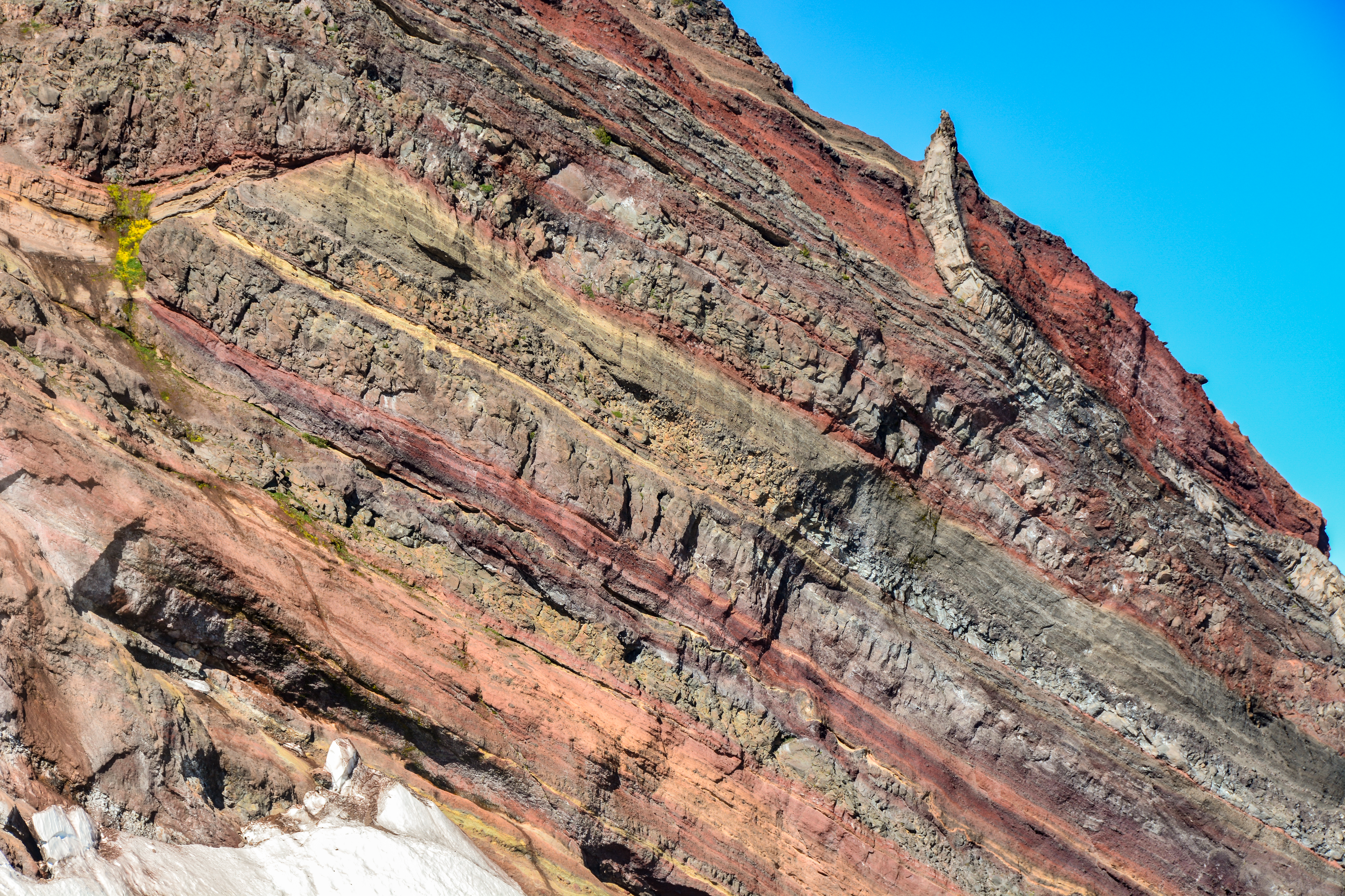
A stratovolcano, also known as a composite volcano, is a conical volcano built up by many layers (strata) of hardened lava and tephra. Unlike shield volcanoes, stratovolcanoes are characterized by a steep profile with a summit crater and periodic intervals of explosive eruptions and effusive eruptions, although some have collapsed summit craters called calderas. The lava flowing from stratovolcanoes typically cools and hardens before spreading far, due to high viscosity. The magma forming this lava is often felsic, having high-to-intermediate levels of silica (as in rhyolite, dacite, or andesite), with lesser amounts of less-viscous mafic magma. Extensive felsic lava flows are uncommon, but have travelled as far as . Stratovolcanoes are sometimes called composite volcanoes because of their composite stratified structure, built up from sequential outpourings of erupted materials. They are among the most common types of volcanoes, in contrast to the less common shield ... [...More Info...] [...Related Items...] OR: [Wikipedia] [Google] [Baidu] |
Lago De Atitlán
__NOTOC__ Lago, which means "lake" in Italian, Portuguese, Spanish and Galician, may refer to: Places *Lago, Calabria, a ''comune'' in the Province of Cosenza, Italy *Lago, Mexico, a municipality zone in the State of Mexico * Lago District, a ''distrito'' in Niassa Province, Mozambique *Lago, Portugal, a ''freguesia'' in the District of Braga *Lago, Asturias, a ''parroquia'' in the ''municipio'' of Allande, Spain * Lago, Texas, a census-designated place *Lagos, Nigeria, the largest city in Nigeria People *Anders Lago, Swedish politician *Ângela Lago (1945–2017), Brazilian children's writer and illustrator *Antonio Lago, Venice-born French motor vehicle manufacturer *Fábio Lago, Brazilian actor *Nais Lago, Italian actress *Virginia Lago (born 1946), Argentine actress Other uses *Lago (Madrid Metro), a station on Line 5 *Talbot-Lago, a type of car *''Lago'', a fictional western town depicted in the film, ''High Plains Drifter ''High Plains Drifter'' is a 1973 American W ... [...More Info...] [...Related Items...] OR: [Wikipedia] [Google] [Baidu] |
Sololá Department
Sololá is a department in the west of Guatemala. The capital is the city of Sololá. Lake Atitlan is a key feature surrounded by a number of the municipalities. Municipalities # Concepción # Nahualá # Panajachel # San Andrés Semetabaj # San Antonio Palopó # San José Chacayá # San Juan La Laguna # San Lucas Tolimán # San Marcos La Laguna # San Pablo La Laguna # San Pedro La Laguna # Santa Catarina Ixtahuacan # Santa Catarina Palopó # Santa Clara La Laguna # Santa Cruz La Laguna # Santa Lucía Utatlán # Santa María Visitación # Santiago Atitlán # Sololá Population As of 2018, the department had a population of 421,583. The area is populated almost entirely by different Mayan ethnic groups, of which the two largest groups are the Kaqchikel people and K'iche'. Kaqchikel people accounted for 50.1% of the department's population, and K'iche' accounted for 35.3%. Indigenous people in total account for 96.5% of the department's population. Economy With ... [...More Info...] [...Related Items...] OR: [Wikipedia] [Google] [Baidu] |
San Pedro La Laguna
San Pedro La Laguna () is a Guatemalan town on the southwest shore of Lake Atitlán. For centuries, San Pedro La Laguna has been inhabited by the Tz'utujil people, and in recent years it has also become a tourist destination for its Spanish language schools, nightlife, and proximity to the lake and volcanoes. Local crops include corn, beans, coffee, and avocado. Some women make belts, shawls, and skirts with a back strap loom. San Pedro graduates large numbers of teachers who work the Atitlán area. Activities for tourists include hikes to the top of the San Pedro volcano or the Mayan Face, studying Spanish, partying in the restaurant sector down by the lakeshore, volunteering, and learning local crafts. Geography San Pedro La Laguna is located on the southwestern shore of Lago de Atitlán. The town is located beneath Volcan San Pedro. This volcano towers over the lake at 9,905 feet and is an attraction for climbers and hikers. The town of San Pedro La Laguna sits on a plate ... [...More Info...] [...Related Items...] OR: [Wikipedia] [Google] [Baidu] |
Stratovolcanoes Of Guatemala
A stratovolcano, also known as a composite volcano, is a conical volcano built up by many layers (strata) of hardened lava and tephra. Unlike shield volcanoes, stratovolcanoes are characterized by a steep profile with a summit crater and periodic intervals of explosive eruptions and effusive eruptions, although some have collapsed summit craters called calderas. The lava flowing from stratovolcanoes typically cools and hardens before spreading far, due to high viscosity. The magma forming this lava is often felsic, having high-to-intermediate levels of silica (as in rhyolite, dacite, or andesite), with lesser amounts of less-viscous mafic magma. Extensive felsic lava flows are uncommon, but have travelled as far as . Stratovolcanoes are sometimes called composite volcanoes because of their composite stratified structure, built up from sequential outpourings of erupted materials. They are among the most common types of volcanoes, in contrast to the less common shield volcanoes. ... [...More Info...] [...Related Items...] OR: [Wikipedia] [Google] [Baidu] |
Subduction Volcanoes
Subduction is a geological process in which the oceanic lithosphere is recycled into the Earth's mantle at convergent boundaries. Where the oceanic lithosphere of a tectonic plate converges with the less dense lithosphere of a second plate, the heavier plate dives beneath the second plate and sinks into the mantle. A region where this process occurs is known as a subduction zone, and its surface expression is known as an arc-trench complex. The process of subduction has created most of the Earth's continental crust. Rates of subduction are typically measured in centimeters per year, with the average rate of convergence being approximately two to eight centimeters per year along most plate boundaries. Subduction is possible because the cold oceanic lithosphere is slightly denser than the underlying asthenosphere, the hot, ductile layer in the upper mantle underlying the cold, rigid lithosphere. Once initiated, stable subduction is driven mostly by the negative buoyancy of th ... [...More Info...] [...Related Items...] OR: [Wikipedia] [Google] [Baidu] |


