|
Ventura Intercity Service Transit Authority
VCTC Intercity (formerly known as Ventura Intercity Service Transit Authority or VISTA) is a public transit agency providing bus service in Ventura County, California. It provides an intercity bus service between the cities of Ventura, Oxnard, Camarillo, Thousand Oaks, Moorpark, Santa Paula, and Fillmore in Ventura County, and to communities in neighboring Los Angeles and Santa Barbara counties. The agency is part of the Ventura County Transportation Commission, a governmental body that oversees transportation planning and funding in Ventura County. In , the system had a ridership of , or about per weekday as of . History Before VISTA was formed in 1994, the County of Ventura provided rudimentary intercity bus service. One line ran along US 101 with stops in Ventura, Oxnard, Camarillo, Thousand Oaks, and Westlake Village. Another service linked Thousand Oaks and Moorpark via SR 23. The city of Fillmore sponsored a route consisting of a few trips between Fillm ... [...More Info...] [...Related Items...] OR: [Wikipedia] [Google] [Baidu] |
Oxnard Transit Center
The Oxnard Transit Center (formerly Oxnard Transportation Center) is an intermodal transit center in downtown Oxnard, California. It is served by Amtrak ''Coast Starlight'' and ''Pacific Surfliner'' intercity service plus Metrolink Ventura County Line commuter service. Service History The Southern Pacific Railroad constructed a wye at Montalvo in late 1897 on the original route connecting Ventura to Los Angeles through the Santa Clara River Valley. This spur was needed for shipping construction equipment to the site of a new beet sugar refinery. A wooden railroad trestle and rail line were constructed over the Santa Clara River as the spur headed south, reaching the new settlement here on the relatively isolated coastal plain in April 1898. The rail line turned here from the north–south alignment to east–west towards Camarillo as they continued building the towards Santa Susana in the Simi Valley. With the completion of the Santa Susana Tunnel connecting th ... [...More Info...] [...Related Items...] OR: [Wikipedia] [Google] [Baidu] |
Santa Barbara County, California
Santa Barbara County, officially the County of Santa Barbara (), is a County (United States), county located in Southern California. As of the 2020 United States census, the population was 448,229. The county seat is Santa Barbara, California, Santa Barbara, and the largest city is Santa Maria, California, Santa Maria. Santa Barbara County comprises the Santa Maria-Santa Barbara, CA Metropolitan Statistical Area. Most of the county is part of the California Central Coast. Mainstays of the county's economy include engineering, resource extraction (particularly petroleum extraction and diatomaceous earth mining), winemaking, agriculture, and education. The software development and tourism industries are important employers in the southern part of the county. Having a blend of both Southern California, Southern and Northern California influences, Santa Barbara County often considered the cultural and geographical boundary between Southern California and Northern California. His ... [...More Info...] [...Related Items...] OR: [Wikipedia] [Google] [Baidu] |
Warner Center, Los Angeles, California
Warner Center is a master-planned neighborhood and business district development in the Canoga Park and Woodland Hills neighborhoods of the San Fernando Valley in Los Angeles, California.Station 84(Woodland Hills) an(Canoga Park) serve Warner Center. Police service Security officers employed by Allied Universal Security Services continuously monitor and patrol all buildings, parking structures, and loading docks. Los Angeles Police Department operates the nearby Topanga Community Police Station. ''lapdonline.org'' Hospital Kaiser Permanente Woodland Hills Medical Center is a general medical and surgical hospital in |
Warner Center Transit Hub
Warner can refer to: People * Warner (writer) * Warner (given name) * Warner (surname) Fictional characters * Yakko, Wakko, and Dot Warner, stars of the animated television series ''Animaniacs'' * Aaron Warner, a character in '' Shatter Me series'' Education * Warner Pacific University, Portland, Oregon * Warner University, Lake Wales, Florida Places * Warner (crater), a lunar impact crater in the southern part of the Mare Smythii * Warner Theatre (other), several theatres Australia * Warner, Queensland Canada * County of Warner No. 5, a municipal district in Alberta * Warner, Alberta, a village * Warner elevator row, Warner, Alberta United States * Warner, New Hampshire, a New England town ** Warner (CDP), New Hampshire, the main village in the town * Warner, Ohio, an unincorporated community * Warner, Oklahoma * Warner, South Dakota * Warner, Wisconsin, a town Organisations * Warner Aerocraft, an American aircraft manufacturer based in Semino ... [...More Info...] [...Related Items...] OR: [Wikipedia] [Google] [Baidu] |
Pacific View Mall
Pacific View Mall (formerly known as Buenaventura Center and Buenaventura Plaza) is a regional, enclosed mall located on the West Coast in Ventura, California. It covers a leasable area of almost . Its current anchors include Macy's, JCPenney, and Target, with one anchor store under construction that was last occupied by Sears and is now being transformed into a Round1. History The open-air Buenaventura Center was built between 1962 and 1965, with its first store, The Broadway, opening in September 1963. Inline stores, such as Barker Brothers Furniture, Kimo's Polynesian Shop, F.W. Woolworth and a Vons-Shopping Bag Supermarket, opened during 1964. J.C. Penney began business in November 1965. A Teflon-coated, fiberglass enclosure was installed in 1983. During the 1990s, after 30 years in operation, the mall began to show its age as tenants began to move out, and the vacancy rate rose. MCA Buenaventura Associates LP, the owners at the time, tried to revitalize the mall by ... [...More Info...] [...Related Items...] OR: [Wikipedia] [Google] [Baidu] |
Santa Barbara, California
Santa Barbara (, meaning ) is a coastal city in Santa Barbara County, California, of which it is also the county seat. Situated on a south-facing section of coastline, the longest such section on the West Coast of the United States excepting Alaska, the city lies between the steeply rising Santa Ynez Mountains and the Pacific Ocean. Santa Barbara's climate is often described as Mediterranean climate, Mediterranean, and the city has been dubbed "The American Riviera". According to the 2020 United States census, 2020 U.S. census, the city's population was 88,665. In addition to being a popular tourist and resort destination, the city has a diverse economy that includes a large service sector, education, technology, health care, finance, agriculture, manufacturing, and local government. In 2004, the service sector accounted for 35% of local employment. Area institutions of higher learning include the University of California, Santa Barbara, Santa Barbara City College, Westmont Co ... [...More Info...] [...Related Items...] OR: [Wikipedia] [Google] [Baidu] |
Warner Center
Warner Center is a master-planned neighborhood and business district development in the Canoga Park and Woodland Hills neighborhoods of the San Fernando Valley in Los Angeles, California.Station 84(Woodland Hills) an(Canoga Park) serve Warner Center. Police service Security officers employed by Allied Universal Security Services continuously monitor and patrol all buildings, parking structures, and loading docks. Los Angeles Police Department operates the nearby Topanga Community Police Station. ''lapdonline.org'' Hospital Kaiser Permanente Woodland Hills Medical Center is a general medical and surgical hospital in Warner Center. ...[...More Info...] [...Related Items...] OR: [Wikipedia] [Google] [Baidu] |
California State University, Channel Islands
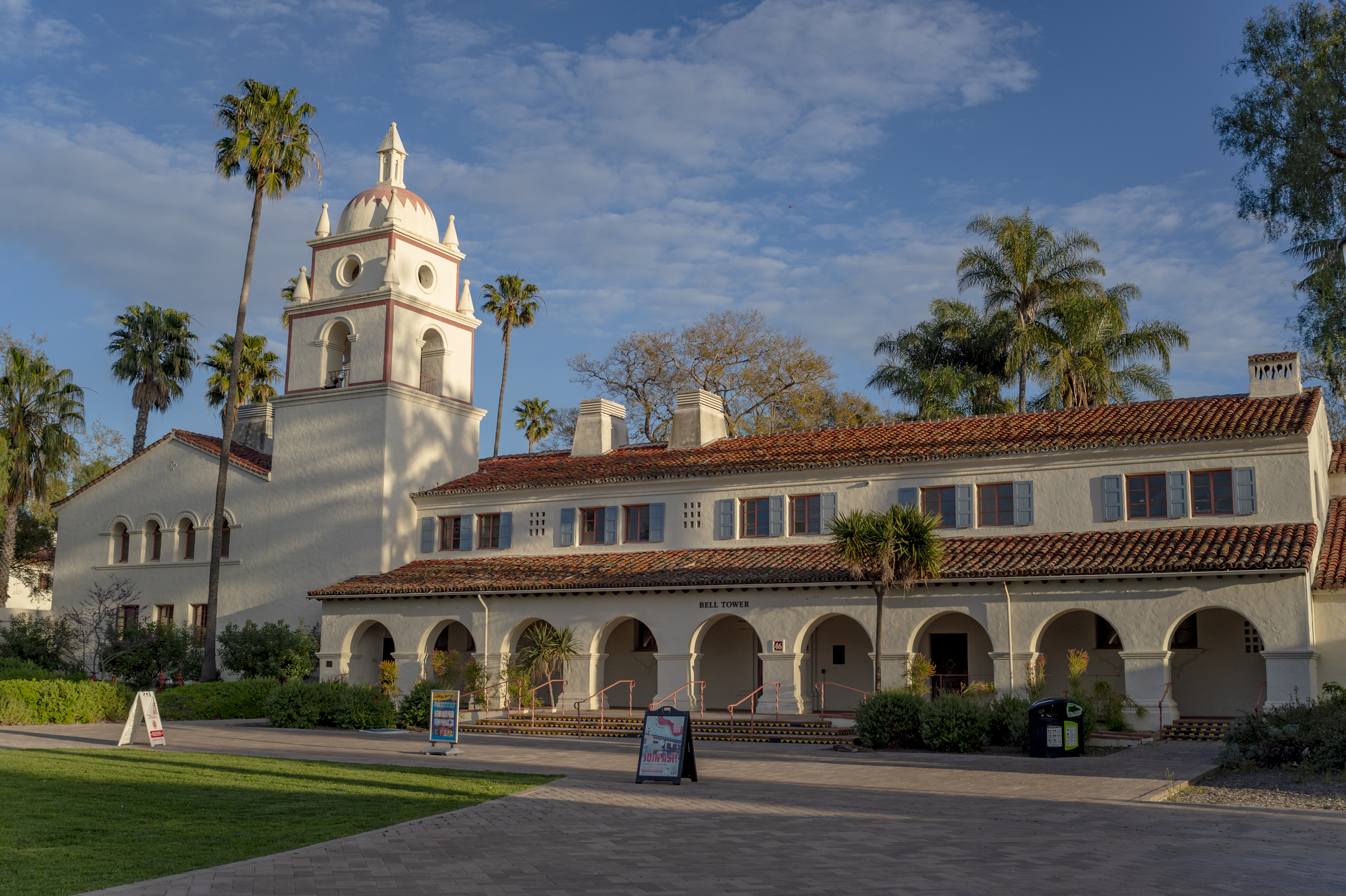
California State University Channel Islands (CSUCI, CSU Channel Islands) is a public university in Ventura County, California. Located near the city of Camarillo, it opened in 2002 as the 23rd campus in the California State University system. CSUCI is located on the Central Coast of California, at the intersection of the Oxnard Plain and northernmost edge of the Santa Monica Mountains range. The Channel Islands are nearby where the university operates a scientific research station on Santa Rosa Island. The university is a Hispanic-serving institution. Channel Islands offers 63 bachelor's degree programs, 12 master's degree programs, and 4 teaching credentials. In the fall of 2020, the university enrolled 6,943 undergraduate and postgraduate students. In the fall of 2020, the university had 425 faculty, of whom 153 (or 36%) were on the tenure track. History The first buildings of the campus were built in 1934 as part of President Franklin D. Roosevelt's New Deal durin ... [...More Info...] [...Related Items...] OR: [Wikipedia] [Google] [Baidu] |
Point Mugu, California
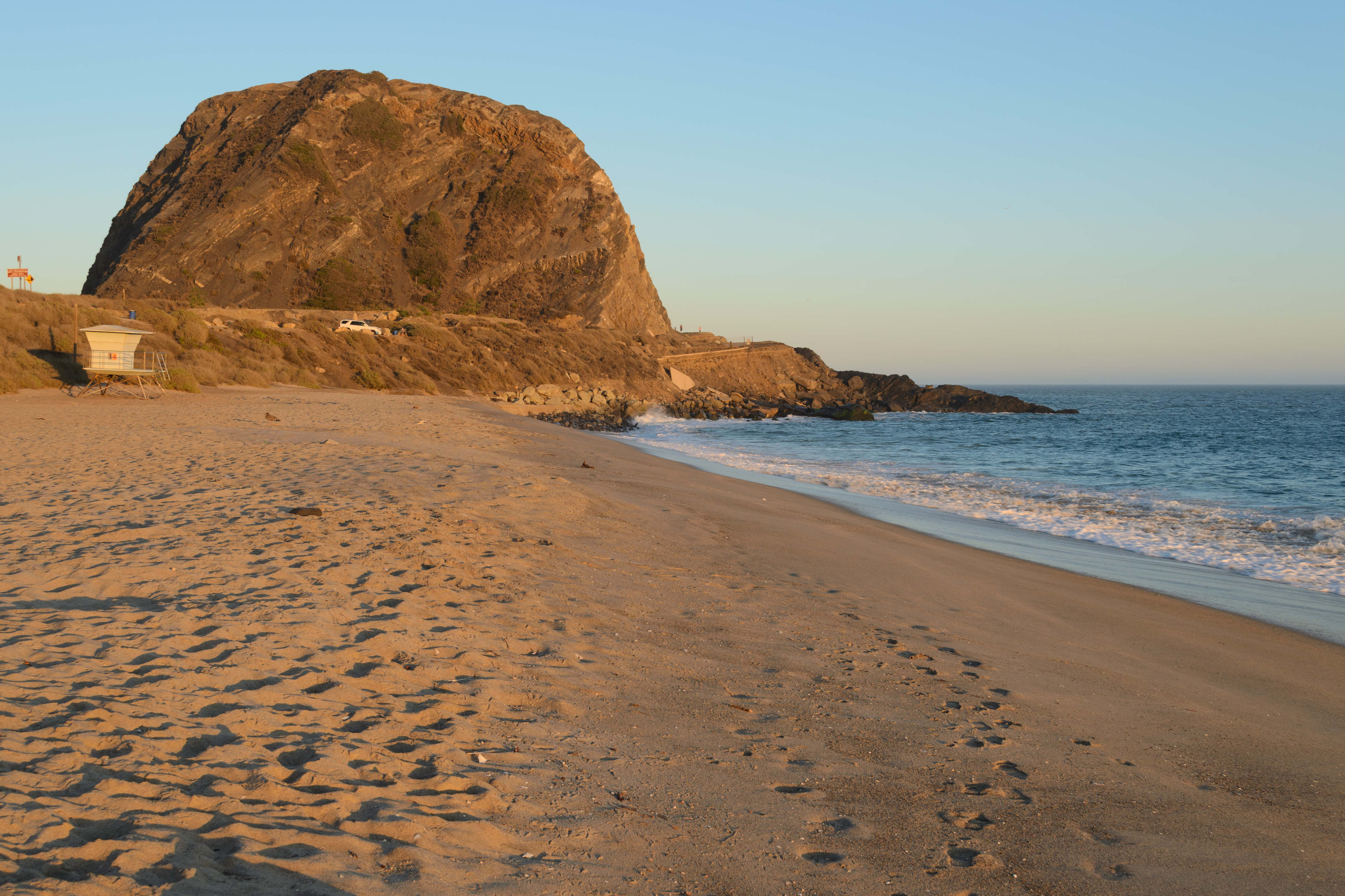
Point Mugu (, Chumash: ''Muwu'') is a cape or promontory within Point Mugu State Park on the Pacific Coast in Ventura County, near the city of Port Hueneme and the city of Oxnard. The name is believed to be derived from the Chumash Indian term "Muwu", meaning "beach", which was first mentioned by Cabrillo in his journals in 1542. Mugu Lagoon is a salt marsh just upcoast from the promontory within the Naval Base Ventura County formerly called the Naval Air Station Point Mugu. History The name derives from Muwu ( Ventureño: "Beach"), which was the name of a Chumash village at Point Mugu during pre-colonial times. The village of Muwu (CA-VEN-11) had the highest population of any coastal Chumash settlements along the Santa Monica Mountains. Muwu was a ceremonial center and the ancient capital of Lulapin, a major political unit of Chumash territory which stretched from modern day Los Angeles County to Santa Barbara in the north. The territory stretched for along the coast, and ... [...More Info...] [...Related Items...] OR: [Wikipedia] [Google] [Baidu] |
Camarillo State Mental Hospital
Camarillo State Mental Hospital, also known as Camarillo State Hospital, was a public psychiatric hospital for patients with both developmental disabilities and mental illness in Camarillo, California. The hospital was in operation from 1936 to 1997. The former hospital campus has been redeveloped and opened in 2002 as the California State University Channel Islands. The university has retained the distinctive Mission Revival Style architecture, and the bell tower in the South quad has been adopted as the symbol of the university. Pre-history When the United States took possession of California and other Mexican lands in 1848, it was bound by the Treaty of Guadalupe Hidalgo to honor the legitimate land claims of Mexican citizens residing in those captured territories. The land upon which the former Camarillo State Hospital sat, once belonged to Isabel Yorba as part of an 1836 land grant, known as "Rancho Guadalasca." In 1929, the California legislature initially appropriated $1 ... [...More Info...] [...Related Items...] OR: [Wikipedia] [Google] [Baidu] |
California State Route 126
State Route 126 (SR 126) is a state highway in the U.S. state of California that serves Ventura and Los Angeles counties. The route runs from U.S. Route 101 in Ventura to Interstate 5 at the Castaic Junction- Santa Clarita border through the Santa Clara River Valley. The highway is an important connector highway in Ventura County, and serves as an alternate route into the Santa Clarita Valley, and (via Interstate 5) the San Fernando Valley area of Los Angeles and the High Desert of Antelope Valley. Route description SR 126 generally follows the Santa Clara River through the valley, passing through the towns of Fillmore and Santa Paula. The freeway portion of the highway, known as the Santa Paula Freeway, begins in Ventura at U.S. Route 101. It proceeds northeast through the city, interchanging with the western end of SR 118 at a grade-separated interchange. SR 126 then passes through areas of agriculture, orchards, and the Saticoy Oil Field to its northeast, continuing ... [...More Info...] [...Related Items...] OR: [Wikipedia] [Google] [Baidu] |


