|
Ventry
Ventry (), officially ''Ceann Trá'', is a Gaeltacht village in County Kerry, Ireland, on the Dingle Peninsula, 7 kilometres west of Dingle. Due to its long sandy beach, Ventry is a tourist destination. History Six kilometres west of Ventry are the ruins of Dunbeg (''An Dún Beag''), an Iron Age promontory fort on the edge of a steep cliff. Near Dunbeg is Kilvickadownig, home to other archeological ruins, including examples of the beehive house and the grave of Caol or Cháil Mic Crimthainn, the last to die in the Battle of Ventry from the Fenian Cycle of Irish mythology. Also within Ventry parish is Rahinnane Castle, which was the residence of the Knight of Kerry. The Knight of Kerry lived there until Cromwellian conquest of Ireland. The castle was built on the site of an old ringfort. The ringfort was built up and a second added with walls of six metres (20 feet), giving the appearance that there may have been a moat, although there never was one. Rahinnane Castle ret ... [...More Info...] [...Related Items...] OR: [Wikipedia] [Google] [Baidu] |
Rahinnane Castle
Rahinnane Castle is a tower house and National Monument located in County Kerry, Ireland. Location Rahinnane Castle is located northwest of Ventry, in the west of the Dingle Peninsula. History The ringfort on the site was built in the 7th or 8th century AD. The Irish name was originally ''Rath Fhionnáin'' — Finan's ringfort. Local tradition once claimed that this piece of land was the last in Ireland held by the Vikings, as it was so easily defended. The stone tower house was built in the 15th or 16th century by the FitzGeralds, hereditary Knights of Kerry. In 1602, towards the end of the Nine Years' War, the castle was taken by Sir Charles Wilmot. It was ruined during the Cromwellian conquest (1649–53). Building The ancient earthwork featured a deep ditch, an entrance in the southwest and a souterrain in the southeast. The castle was rectangular and three storeys tall. Most of the outer walls remain; on the inside there is some mural stairway, traces of vault ... [...More Info...] [...Related Items...] OR: [Wikipedia] [Google] [Baidu] |
James Goodman (musicologist)
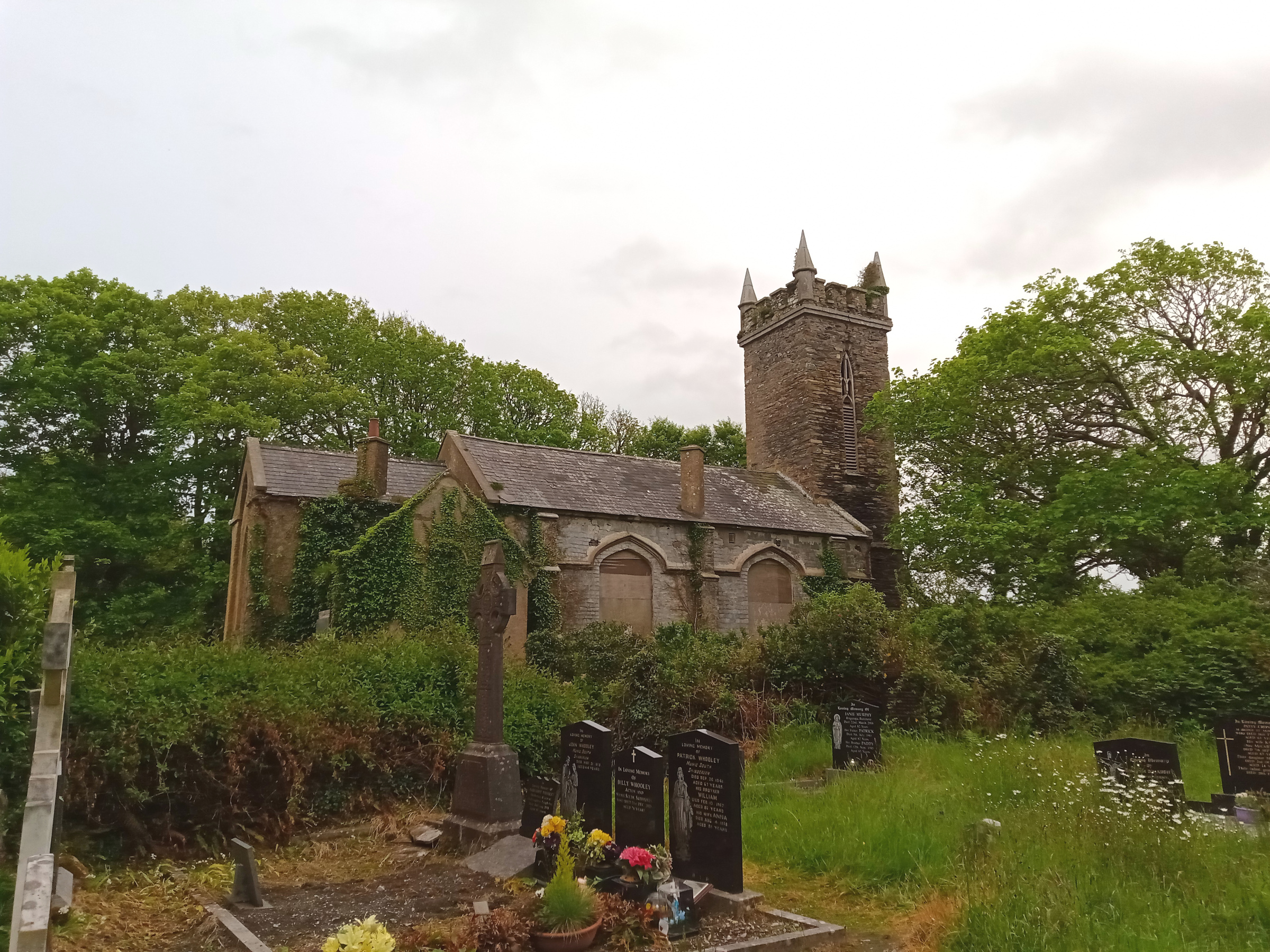
Canon James Goodman (22 September 1828 – 18 January 1896) was a Church of Ireland clergyman, a piper and a collector of Irish music and songs. Life As a cleric Goodman was born in Ballyameen, Dingle, County Kerry and was raised in Ventry, County Kerry, a Gaeltacht area, and studied at Trinity College, Dublin, having gained a scholarship in 1847. He was ordained in the Church of Ireland in 1851 (his father the Reverend Thomas Chute Goodman had been rector of Dingle). He married Charlotte King in 1852. They had three sons, one of whom later drowned while a student, the other two set up a medical practice in Brigg, Lincolnshire. Goodman's first clerical appointment was to Creagh parish in West Cork in 1852. In 1859, he moved to Killaconagh, on the Beara peninsula, where he preached in Irish. He was posted to the parish of Abbeystrewry in Skibbereen in 1866 as a Canon of Ross, remaining there until his death in 1896. In 1867 he self-financed the rebuilding of the local ch ... [...More Info...] [...Related Items...] OR: [Wikipedia] [Google] [Baidu] |
Fenian Cycle
The Fenian Cycle (), Fianna Cycle or Finn Cycle () is a body of early Irish literature focusing on the exploits of the mythical hero Fionn mac Cumhaill, Finn or Fionn mac Cumhaill and his Kóryos, warrior band the Fianna. Sometimes called the Ossianic Cycle after its narrator Oisín, it is one of the four groupings of Irish mythology along with the Mythological Cycle, the Ulster Cycle, and the Cycles of the Kings, Kings' Cycles. Timewise, the Fenian cycle is the third, between the Ulster and Kings' cycles. The cycle also contains stories about other famous Fianna members, including Diarmuid Ua Duibhne, Diarmuid, Caílte mac Rónáin, Caílte, Oisín's son Oscar (Irish mythology), Oscar, and Fionn's rival Goll mac Morna. List of works In the introduction to his ''Fianaigecht'', Kuno Meyer listed the relevant poems and prose texts between the seventh and fourteenth centuriesKuno Meyer. ''Fianaigecht''. xi–xxxi and further examples can be adduced for later ages: ;Seventh centu ... [...More Info...] [...Related Items...] OR: [Wikipedia] [Google] [Baidu] |
Dennis Fenton
Dennis Fenton (November 20, 1888 – March 29, 1954) was an American sport shooter and Olympic champion. He was born in Ventry, Ireland, and died in San Diego, California. In 1920 he won three gold and one bronze medal. He also participated in the 300 metre free rifle, three positions but his final placing is unknown. Four years later he won again a bronze medal. In the 1924 Summer Olympics The 1924 Summer Olympics (), officially the Games of the VIII Olympiad () and officially branded as Paris 1924, were an international multi-sport event held in Paris, France. The opening ceremony was held on 5 July, but some competitions had al ... he also participated in the following events: * Team 100 metre running deer, double shots - fifth place * 100 metre running deer, single shots - twelfth place * 600 metre free rifle - 24th place * 100 metre running deer, double shots - 24th place References External linksProfile: "Dennis Fenton"''databaseOlympics.com'' (Retrieved o ... [...More Info...] [...Related Items...] OR: [Wikipedia] [Google] [Baidu] |
R559 Road (Ireland)
The R559 road is a regional road in Ireland which links various villages on Slea Head on the Dingle Peninsula with the town of Dingle and the N86 road. The road passes through a number of villages including Ventry, Coumeenoole, Dunquin and Dingle itself. The road is long. See also * Roads in Ireland * National primary road * National secondary road A national secondary road () is a category of road in Republic of Ireland, Ireland. These roads form an important part of the national route network but are secondary to the main arterial routes which are classified as national primary roads. Nat ... References Regional roads in the Republic of Ireland Roads in County Kerry {{Ireland-road-stub ... [...More Info...] [...Related Items...] OR: [Wikipedia] [Google] [Baidu] |
List Of Towns And Villages In The Republic Of Ireland
This is a link page for cities, towns and villages in the Republic of Ireland, including townships or urban centres in Dublin, Cork, Limerick, Galway, Waterford and other major urban areas. Cities are shown in bold; see City status in Ireland for an independent list. __NOTOC__ A B C D E F G H I J K L M N O P Q R S T U V W Y See also * List of places in Ireland ** List of places in the Republic of Ireland **List of urban areas in the Republic of Ireland as defined by the Central Statistics Office. Includes non-municipal towns and suburbs outside municipal boundaries *** List of urban areas in the Republic of Ireland/2011 census *** List of urban areas in the Republic of Ireland/2006 census *** List of urban areas in the Republic of Ireland/2002 census ** List of cities, boroughs and towns in the Republic of Ireland, with municipal councils and legally defined boundaries up to 2014 ... [...More Info...] [...Related Items...] OR: [Wikipedia] [Google] [Baidu] |
County Kerry
County Kerry () is a Counties of Ireland, county on the southwest coast of Republic of Ireland, Ireland, within the Provinces of Ireland, province of Munster and the Southern Region, Ireland, Southern Region. It is bordered by two other counties; County Limerick, Limerick to the east, and County Cork, Cork to the south and east. It is separated from County Clare, Clare to the north by the Shannon Estuary. With an area of and a population of 156,458 as of 2022, it is the List of Irish counties by area, 5th largest of Ireland's 32 counties by land area, and the List of Irish counties by population, 15th most populous. The governing Local government in the Republic of Ireland, local authority is Kerry County Council. Bounded by the Atlantic Ocean, Kerry is Ireland's most westerly county. Its List of Irish counties by coastline, rugged coastline stretches for and is characterised by bays, sea cliffs, beaches and many small offshore islands, of which the Blaskets and the Skelligs a ... [...More Info...] [...Related Items...] OR: [Wikipedia] [Google] [Baidu] |
Mount Eagle (Ireland)
Mount Eagle () is a mountain in County Kerry, Ireland. Geography The mountain is part of Mountains of the Central Dingle Peninsula and is the 419th highest in Ireland. Mount Eagle is located not faraway from Slea Head (Ceann Sléibhe), the most south-westerly point of the peninsula, and is connected with Mount Brandon by a ridge of lower hills. On the mountain's top stands a trig point. History The mountain summit was the first European bit of land seen by Charles Lindbergh after his 1927 plane voyage across the Atlantic Ocean. Access to the summit Mount Eagle summit can be reached with a medium walk from Ventry Harbour. From the top of the mountain there is a good view of the neighbouring coast and the Blasket Islands. See also *List of mountains in Ireland * List of Marilyns in Ireland References External links Map of a looped walk to Mount Eagle {{Mountains and hills of County Kerry Mountains and hills of County Kerry Marilyns of Ireland ... [...More Info...] [...Related Items...] OR: [Wikipedia] [Google] [Baidu] |
Dingle
Dingle ( or ''Daingean Uí Chúis'', meaning "fort of Ó Cúis") is a town in County Kerry in the south-west of Ireland. The only town on the Dingle Peninsula (known in Irish as ''Corca Dhuibhne''), it sits on the Atlantic Ocean, Atlantic coast, about southwest of Tralee and northwest of Killarney. Principal industries in the town are tourism, fishing and agriculture: Dingle Mart (livestock market) serves the surrounding countryside. The town is located in the Barony (Ireland), Barony of Corkaguiny (the name 'Corkaguiny' being the anglicised version of ''Dingle Peninsula, Corca Dhuibhne''). In 2022, Dingle had a population of 1,671, a decrease from the 2016 census, and the oldest average age for a town in Ireland (44.4 years). Situated in a ''Gaeltacht'' region, 13.7% of the population spoke Irish on a daily basis in 2016. An adult Bottlenose dolphin named Fungie had been courting human contact in Dingle Bay since 1983 but disappeared in 2020. History A large number of Ogha ... [...More Info...] [...Related Items...] OR: [Wikipedia] [Google] [Baidu] |
Dunbeg Fort
Dunbeg Fort () is a promontory fort built in the Iron Age near the modern village of Ventry in County Kerry, Ireland. Location Dunbeg Fort is located on a rocky promontory just south of Slea Head on the Dingle Peninsula, looking over Dingle Bay to the south and the Atlantic Ocean to the west. The cliffs have eroded since it was built, and much of the fort has been lost to the sea. The fort's wall cut off access to the triangular promontory, which was later occupied by a single large "beehive" hut. Near to the fort there is a group of ''clocháns'', small stone structures also known as beehive huts that seem to have been built around 1000 BC. A visitor center at the site includes audiovisual displays, an information and craft room and a restaurant and café. In January 2014 the fort was closed when much of the western wall of the fort fell into the sea due to storm damage. The Office of Public Works and National Monuments Service sent personnel to investigate damage to the ... [...More Info...] [...Related Items...] OR: [Wikipedia] [Google] [Baidu] |
Slea Head
Slea Head (Irish language, Irish: ''Ceann Sléibhe'') is a headland, promontory on the westernmost part of the Dingle Peninsula, in southwest County Kerry, Ireland. It can be reached by the R559 road (Ireland), R559 road, with the nearest villages being Ballyickeen and Coumeenoole. The headland itself, together with the larger part of Mount Eagle (Ireland), Mount Eagle's southern slopes, is formed from steeply dipping beds of the pebbly sandstones and conglomerate (geology), conglomerates of the Slea Head Formation, dating from the Devonian period and traditionally referred to as old red sandstone. To Slea Head's northwest is Dunmore Head, the Extreme points of Ireland, westernmost point of Ireland. Slea Head is a well-known landmark and viewpoint, with a full view of the Blasket Islands. On 11 March 1982, the Spanish container ship, Ranga (ship), Ranga, was wrecked at Dunmore Head, close to Slea Head after losing power in a storm. Slea Head Drive The Slea Head Drive is on ... [...More Info...] [...Related Items...] OR: [Wikipedia] [Google] [Baidu] |
Placenames Database Of Ireland
The Placenames Database of Ireland (), also known as , is a database and archive of place names in Ireland. It was created by Fiontar, Dublin City University in collaboration with the Placenames Branch of the Department of Tourism, Culture, Arts, Gaeltacht, Sport and Media. The website is a public resource primarily aimed at journalists and translators, students and teachers, historians and researchers in genealogy. Placenames Commission and Placenames Branch The Placenames Commission () was established by the Department of Finance in 1946 to advise Ordnance Survey Ireland and the government of what the Irish name of places should be. Although both the 1922 Constitution of the Irish Free State and the current constitution adopted in 1937 recognised Irish as the national language, the law in regard to placenames was carried over from the 19th-century UK statutes which established the Ordnance Survey and Griffith's Valuation, under which only an English-language name had offi ... [...More Info...] [...Related Items...] OR: [Wikipedia] [Google] [Baidu] |


