|
Urup
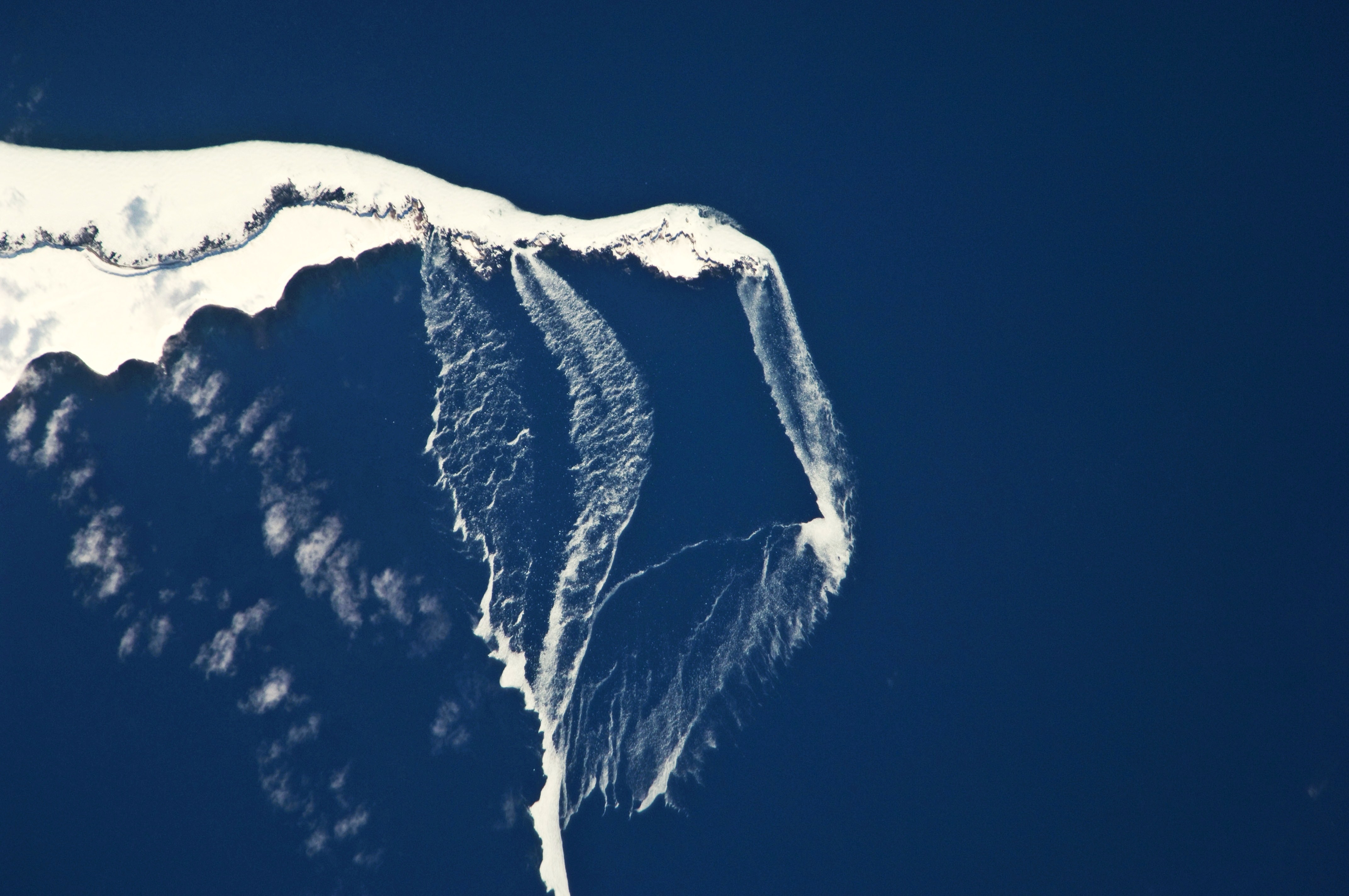
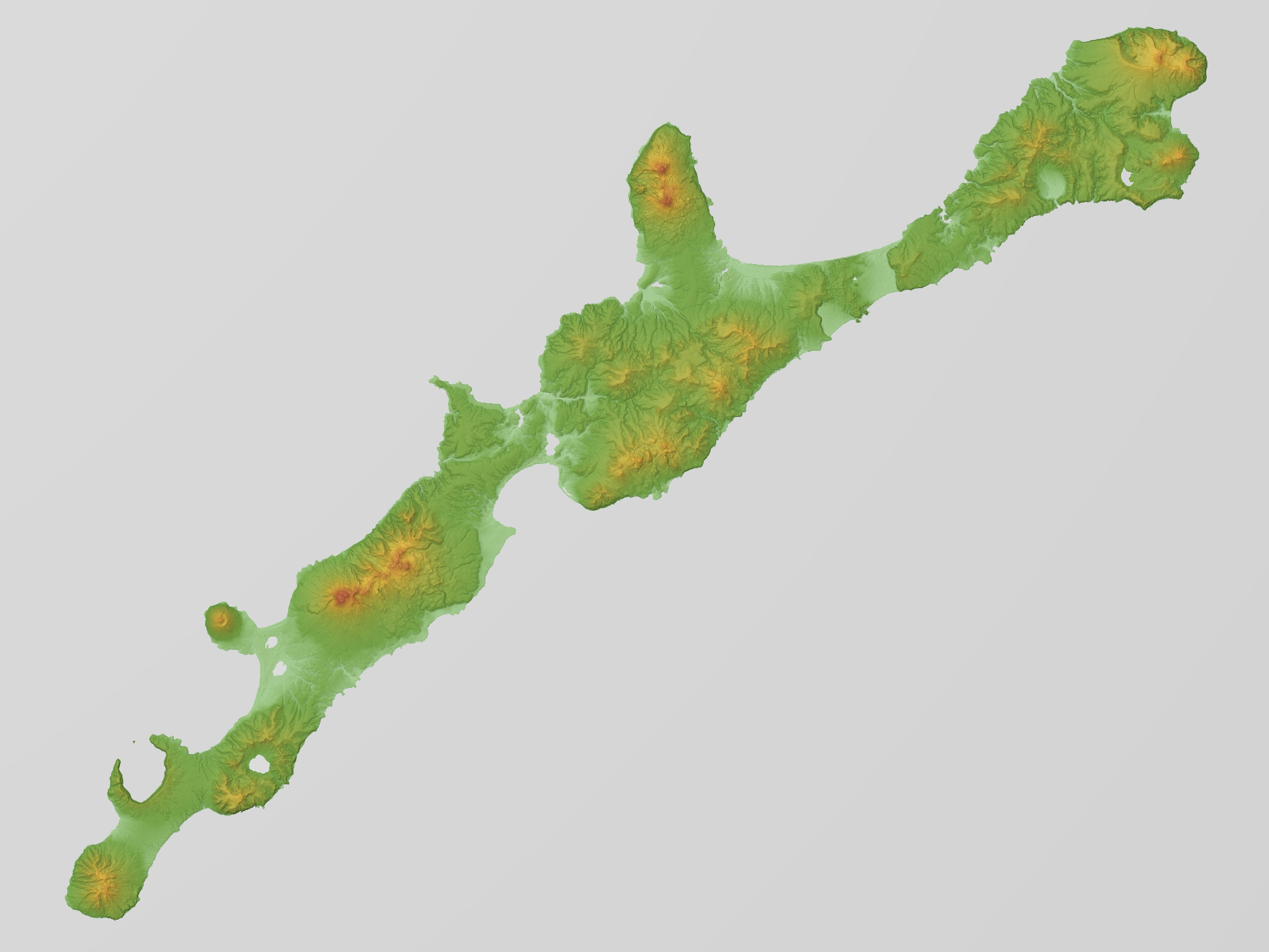
Urup ( ja, 得撫島, Uruppu-to; russian: Уру́п, Urúp, ain, ウルㇷ゚, Urup) is an uninhabited volcanic island in the Kuril Islands chain in the south of the Sea of Okhotsk, northwest Pacific Ocean. Its name is derived from the Ainu language word for salmon trout. It was formerly known as Company's Land. Geography and climate Urup has a roughly rectangular shape, measuring along its long axis and approximately along its narrow axis. It is the fourth largest of the Kuril Islands, with an area of . The highest point is Gora Ivao at . The strait between Urup and Iturup is known as the Vries Strait, after Dutch explorer Maarten Gerritsz Vries, the first recorded European to explore the area. The strait between Urup and Simushir is known as Bussol Strait, after the French word for "compass", which was the name of one of La Pérouse's vessels. This French mariner explored the area of the Kuril Islands in 1787. Urup consists of four major groups of active or dormant ... [...More Info...] [...Related Items...] OR: [Wikipedia] [Google] [Baidu] |
Kuril Islands
The Kuril Islands or Kurile Islands (; rus, Кури́льские острова́, r=Kuril'skiye ostrova, p=kʊˈrʲilʲskʲɪjə ɐstrɐˈva; Japanese: or ) are a volcanic archipelago currently administered as part of Sakhalin Oblast in the Russian Far East. It stretches approximately northeast from Hokkaido in Japan to Kamchatka Peninsula in Russia separating the Sea of Okhotsk from the north Pacific Ocean. There are 56 islands and many minor rocks. The Kuril Islands consist of the Greater Kuril Chain and the Lesser Kuril Chain. They cover an area of around , with a population of roughly 20,000. The islands have been under Russian administration since their 1945 invasion as the Soviet Union towards the end of World War II. Japan claims the four southernmost islands, including two of the three largest ( Iturup and Kunashir), as part of its territory, as well as Shikotan and the Habomai islets, which has led to the ongoing Kuril Islands dispute. The disputed islands ... [...More Info...] [...Related Items...] OR: [Wikipedia] [Google] [Baidu] |
Bussol Strait
The Bussol Strait (Russian: ''Proliv Bussol''), known in Japan as the , is a wide strait that separates the islands of Broutona and Chirpoy to the west from Simushir to the east. It is nearly 58 km (about 36 mi) wide, making it the largest channel in the Kuril Islands.National Geospatial-Intelligence Agency. (2014). ''Sailing Directions (Enroute): East Coast of Russia''. U.S. Government, Springfield, Virginia. It is named after the frigate '' Boussole''. History The strait was a popular route in the 1840s for American whaleships entering and exiting the Sea of Okhotsk on their way to and from cruises for right whales. It was rarely used from the 1850s to the 1870s when ships primarily cruised to the north for bowhead whales, using the more convenient Fourth Kuril Strait further north instead. Among the few to use it during that period was the ship ''Susan'' (349 tons), of Nantucket, which was stove by ice and sank in the strait on the night of 27-28 April 1853 while attempting t ... [...More Info...] [...Related Items...] OR: [Wikipedia] [Google] [Baidu] |
Tri Sestry
Tri Sestry (russian: Три Сестры, link=no, lit=the three sisters) is a stratovolcano located in the central part of Urup Island, Kuril Islands, Russia. See also * List of volcanoes in Russia References * Urup Mountains of the Kuril Islands Volcanoes of the Kuril Islands Stratovolcanoes of Russia Holocene stratovolcanoes Holocene Asia {{SakhalinOblast-geo-stub ... [...More Info...] [...Related Items...] OR: [Wikipedia] [Google] [Baidu] |
Rudakov
Rudakov (russian: Рудаков) is a stratovolcano located in the central part of Urup Island, Kuril Islands, Russia. The volcano has a wide crater which contains a wide crater lake. See also * List of volcanoes in Russia This is a list of active and extinct volcanoes in Russia. European Russia Kamchatka Volcanoes of the Kamchatka Peninsula of the northwestern Pacific Ocean and the Russian Far East. Kuril Islands Volcanoes of the Kuril Islands The Kuri ... References * Urup Stratovolcanoes of Russia Volcanic crater lakes Holocene stratovolcanoes Holocene Asia Volcanoes of the Kuril Islands {{SakhalinOblast-geo-stub ... [...More Info...] [...Related Items...] OR: [Wikipedia] [Google] [Baidu] |
Kolokol Group
Kolokol Group (russian: Группа Колокола, Gruppa Kolokola) is a group of somma volcanoes located in the central part of Urup Island, Kuril Islands, Russia. The group is named after its highest volcano but also includes volcanoes called Berg, Trezubetz (which erupted in 1924) and Borzov. The most active in the group is Berg, while Borzov is the oldest. See also * List of volcanoes in Russia This is a list of active and extinct volcanoes in Russia. European Russia Kamchatka Volcanoes of the Kamchatka Peninsula of the northwestern Pacific Ocean and the Russian Far East. Kuril Islands Volcanoes of the Kuril Islands The Kuri ... References * Urup Active volcanoes Volcanoes of the Kuril Islands {{SakhalinOblast-geo-stub ... [...More Info...] [...Related Items...] OR: [Wikipedia] [Google] [Baidu] |
Ivao Group
Ivao Group (russian: Группа Ивао, Gruppa Ivao) is a group of cinder cones located in the southern part of Urup Island, Kuril Islands, Russia. See also * List of volcanoes in Russia References * Urup Cinder cones Volcanoes of the Kuril Islands Holocene volcanoes Holocene Asia {{SakhalinOblast-geo-stub ... [...More Info...] [...Related Items...] OR: [Wikipedia] [Google] [Baidu] |
Gora Ivao
Ivao Group (russian: Группа Ивао, Gruppa Ivao) is a group of cinder cones located in the southern part of Urup Island, Kuril Islands, Russia. See also * List of volcanoes in Russia This is a list of active and extinct volcanoes in Russia. European Russia Kamchatka Volcanoes of the Kamchatka Peninsula of the northwestern Pacific Ocean and the Russian Far East. Kuril Islands Volcanoes of the Kuril Islands The Kuri ... References * Urup Cinder cones Volcanoes of the Kuril Islands Holocene volcanoes Holocene Asia {{SakhalinOblast-geo-stub ... [...More Info...] [...Related Items...] OR: [Wikipedia] [Google] [Baidu] |
Iturup
, other_names = russian: Итуру́п; ja, 択捉島 , location = Sea of Okhotsk , coordinates = , archipelago = Kuril Islands , total_islands = , major_islands = , area_km2 = 3139 , length_km = 200 , width_km = 27 , coastline = , highest_mount = Stokap , elevation_m = 1634 , country_claim = , country_claim_divisions_title_1 = Prefecture , country_claim_divisions_1 = Hokkaido , country_claim_divisions_title_2 = Subprefecture , country_claim_divisions_2 = Nemuro , country = , country_admin_divisions_title_1 = Federal subject , country_admin_divisions_1 = Sakhalin Oblast , country_admin_divisions_title_2 = District , country_admin_divisions_2 = Kurilsky , population = 7,500 , population_as_of = 2003 , density = , ethnic_groups = , additional_info = Iturup (russian: Остров Итуру́п, Ostrov Iturúp; ain, エツ゚ヲロㇷ ... [...More Info...] [...Related Items...] OR: [Wikipedia] [Google] [Baidu] |
Maarten Gerritsz Vries
Maarten Gerritszoon Vries, or Fries, also referred to as de Vries, (18 February 1589, Harlingen, Netherlands – late 1647, at sea near Manila) was a 17th-century Dutch cartographer and explorer, the first Western European to leave an account of his visit to Ezo, Sakhalin, Kuril Islands and the Sea of Okhotsk. Not much is known about the life of de Vries. He was probably born in Harlingen, Netherlands, in 1589 and spent many years in Taiwan. He is best remembered for his 1643 expedition to the north-western Pacific Ocean to discover the coast of Tartaria, on account of Anthony van Diemen, the governor in Batavia. This was the second expedition to look for legendary gold and silver islands in the Pacific, which nobody had discovered, after a failed expedition in 1639 under command of Matthijs Quast. De Vries expedition The two ships, the ''Castricum'' under De Vries and the ''Breskens'' under Hendrick Cornelisz Schaep left Batavia, the capital of Dutch Java, in February 1643. ... [...More Info...] [...Related Items...] OR: [Wikipedia] [Google] [Baidu] |
Vries Strait
Vries Strait or Miyabe Line is a strait between two main islands of the Kurils. It is located between the northeastern end of the island of Iturup and the southwestern headland of Urup Island, connecting the Sea of Okhotsk on the west with the Pacific Ocean on the east. It has a width of 42 km. The strait is named after Dutch explorer Maarten Gerritsz Vries Maarten Gerritszoon Vries, or Fries, also referred to as de Vries, (18 February 1589, Harlingen, Netherlands – late 1647, at sea near Manila) was a 17th-century Dutch cartographer and explorer, the first Western European to leave an account of ..., the first recorded European to explore the area in 1643. References Straits of the Kuril Islands Maritime history of the Dutch East India Company {{SakhalinOblast-geo-stub ... [...More Info...] [...Related Items...] OR: [Wikipedia] [Google] [Baidu] |
Aleutian Islands
The Aleutian Islands (; ; ale, Unangam Tanangin,”Land of the Aleuts", possibly from Chukchi ''aliat'', "island"), also called the Aleut Islands or Aleutic Islands and known before 1867 as the Catherine Archipelago, are a chain of 14 large volcanic islands and 55 smaller islands. Most of the Aleutian Islands belong to the U.S. state of Alaska, but some belong to the Russian federal subject of Kamchatka Krai. They form part of the Aleutian Arc in the Northern Pacific Ocean, occupying a land area of 6,821 sq mi (17,666 km2) and extending about westward from the Alaska Peninsula toward the Kamchatka Peninsula in Russia, and act as a border between the Bering Sea to the north and the Pacific Ocean to the south. Crossing longitude 180°, at which point east and west longitude end, the archipelago contains both the westernmost part of the United States by longitude ( Amatignak Island) and the easternmost by longitude ( Semisopochnoi Island). The westernmost U.S. islan ... [...More Info...] [...Related Items...] OR: [Wikipedia] [Google] [Baidu] |
Subpolar Oceanic Climate
An oceanic climate, also known as a marine climate, is the humid temperate climate sub-type in Köppen classification ''Cfb'', typical of west coasts in higher middle latitudes of continents, generally featuring cool summers and mild winters (for their latitude), with a relatively narrow annual temperature range and few extremes of temperature. Oceanic climates can be found in both hemispheres generally between 45 and 63 latitude, most notably in northwestern Europe, northwestern America, as well as New Zealand. Precipitation Locations with oceanic climates tend to feature frequent cloudy conditions with precipitation, low hanging clouds, and frequent fronts and storms. Thunderstorms are normally few, since strong daytime heating and hot and cold air masses meet infrequently in the region. In most areas with an oceanic climate, precipitation comes in the form of rain for the majority of the year. However, some areas with this climate see some snowfall annually during winter. ... [...More Info...] [...Related Items...] OR: [Wikipedia] [Google] [Baidu] |


