|
United States General Surveillance Radar Stations
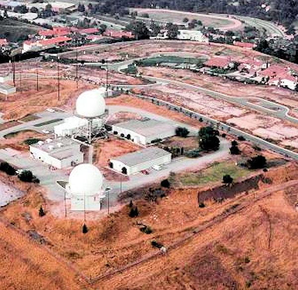
United States general surveillance radar stations include Army and USAF stations of various US air defense networks (in reverse chronological order): *Joint Surveillance System (JSS), with radar stations controlled by joint FAA/USAF ROCCs beginning in 1980 *SAGE radar stations, for the Semi-Automatic Ground Environment network prior to the JSS (the 1st SAGE squadrons were designated in 1958) *Alaska Ring radar net, the radar stations of Alaskan Air Command *Permanent System radar stations, the Air Defense Command manual network of radar stations prior to deployment of SAGE *Lashup Radar Network radar stations, the radar stations deployed 1950-2 when the "Radar Fence" Plan was not approved * Temporary radar net, the "five-station radar net" established in 1948 *Army Radar Stations, World War II installations of the Aircraft Warning Service with radars (cf. filter centers, Ground Observer Corps stations, etc.) By usage: *RBS Express sites, temporary stations for Radar Bomb Scoring t ... [...More Info...] [...Related Items...] OR: [Wikipedia] [Google] [Baidu] |
Air Traffic Control
Air traffic control (ATC) is a service provided by ground-based air traffic controllers who direct aircraft on the ground and through a given section of controlled airspace, and can provide advisory services to aircraft in non-controlled airspace. The primary purpose of ATC worldwide is to prevent collisions, organize and expedite the flow of air traffic, and provide information and other support for pilots. Air traffic controllers monitor the location of aircraft in their assigned airspace by radar and communicate with the pilots by radio. To prevent collisions, ATC enforces traffic separation rules, which ensure each aircraft maintains a minimum amount of empty space around it at all times. In many countries, ATC provides services to all private, military, and commercial aircraft operating within its airspace. Depending on the type of flight and the class of airspace, ATC may issue ''instructions'' that pilots are required to obey, or ''advisories'' (known as ''flight infor ... [...More Info...] [...Related Items...] OR: [Wikipedia] [Google] [Baidu] |
Joint Surveillance System
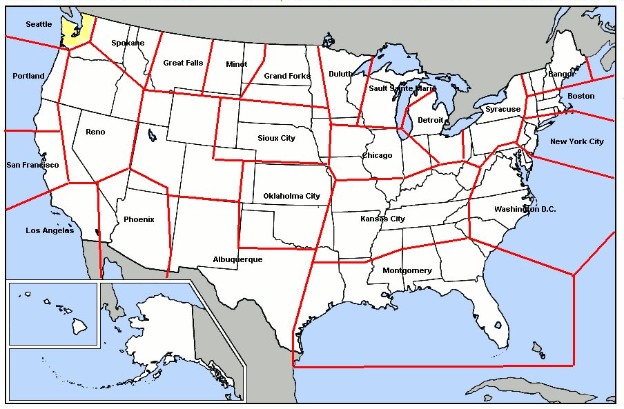
The Joint Surveillance System (JSS) is a joint United States Air Force and Federal Aviation Administration system for the atmospheric air defense of North America. It replaced the Semi Automatic Ground Environment (SAGE) system in 1983. Overview The JSS consists of long range surveillance radars, primarily operated and maintained by the Federal Aviation Administration (FAA), but providing communication and radar data to both FAA and United States Air Force control centers. Air Route Surveillance Radar FAA equipment is primarily a mixture of Long Range Air Route Surveillance Radars (ARSR) of various types, although some use legacy AN/FPS radars. They are co-located with UHF ground-air-ground (G/A/G) transmitter/receiver (GATR) facilities at many locations. Fourteen sites have VHF radios as well. The GATR facility provides radio access to fighters and Airborne early warning and control (AEW&C) aircraft from the Sector Operations Control Centers. The JSS has been enhanced under ... [...More Info...] [...Related Items...] OR: [Wikipedia] [Google] [Baidu] |
SAGE Radar Stations
The SAGE radar stations of Air Defense Command (Aerospace Defense Command after 1968) were the military installations operated by USAF squadrons using the 1st automated air defense environment (Semi-Automatic Ground Environment) and networked by the SAGE System, a computer network. Most of the radar stations used the Burroughs AN/FST-2 Coordinate Data Transmitting Set (CDTS) to automate the operator environment and provide radar tracks to sector command posts at SAGE Direction Centers (DCs), e.g., the Malmstrom Z-124 radar station was co-located with DC-20. The sector/division radar stations were networked by DCs and Manual Control Centers to provide command, control, and coordination (e.g., at Topsham AFS for the " Bangor North American Air Defense Sector" (image of entrance sign with arrow: "Bangor North American Air Defense Sector")) for ground-controlled interception of enemy aircraft by interceptors such as the F-106 developed to work with the SAGE System. Background Post- ... [...More Info...] [...Related Items...] OR: [Wikipedia] [Google] [Baidu] |
Alaska Ring Radar Net
Alaska ( ; russian: Аляска, Alyaska; ale, Alax̂sxax̂; ; ems, Alas'kaaq; Yup'ik: ''Alaskaq''; tli, Anáaski) is a state located in the Western United States on the northwest extremity of North America. A semi-exclave of the U.S., it borders the Canadian province of British Columbia and the Yukon territory to the east; it also shares a maritime border with the Russian Federation's Chukotka Autonomous Okrug to the west, just across the Bering Strait. To the north are the Chukchi and Beaufort Seas of the Arctic Ocean, while the Pacific Ocean lies to the south and southwest. Alaska is by far the largest U.S. state by area, comprising more total area than the next three largest states (Texas, California, and Montana) combined. It represents the seventh-largest subnational division in the world. It is the third-least populous and the most sparsely populated state, but by far the continent's most populous territory located mostly north of the 60th parallel, with a ... [...More Info...] [...Related Items...] OR: [Wikipedia] [Google] [Baidu] |
Permanent System Radar Stations
The Permanent System ("P system") was a 1950s radar network ("P radar net") used for the CONUS "manual air defense system" and which had a USAF aircraft control and warning (AC&W) organization of personnel and military installations with radars to allow Air Defense Command ground-controlled interception of Cold War bombers attacking the United States. Planning As with the World War II CONUS radar network of "Army Radar Stations", Aircraft Warning Corps information centers, Ground Observer Corps filter centers, and Fighter Control Centers ("inactivated...in April 1944"), a post-war system was planned to assess bomber attacks and for dispatching interceptors. The Distant Early Warning Line was "first conceived—and rejected—in 1946", General Stratemeyer forwarded an air defense plan to General Spaatz in November 1946, and in the spring and summer of 1947, 3 Air Defense Command (ADC) Aircraft Control and Warning (AC&W) plans had gone unfunded: e.g., the April 8, 1947, "air de ... [...More Info...] [...Related Items...] OR: [Wikipedia] [Google] [Baidu] |
Lashup Radar Network
The Lashup Radar Network was a United States Cold War radar netting system for air defense surveillance which followed the post-World War II "five-station radar net" and preceded the "high Priority Permanent System". ROTOR was a similar expedient system in the United Kingdom. Background United States electronic attack warning began with a 1939 networking demonstration at Twin Lights station NJ, and 2 SCR-270 radar stations during the August 1940 " Watertown maneuvers" (NY). When "Pearl Harbor was attacked, here were 8 CONUSearly-warning stations" (ME, NJ, & 6 in CA), and Oahu's Opana Mobile Radar Station had 1 of 6 SCR-270s. CONUS "Army Radar Station" deployments for World War II were primarily for coastal anti-aircraft defense, e.g., L-1 at Oceanside CA, J-23 at Seaside OR (Tillamook Head), and B-30 at Lompoc CA; and "the AAF...inactivated the aircraft warning network in April 1944." In 1946 the Distant Early Warning Line was "first conceived—and rejected". By 1948 there ... [...More Info...] [...Related Items...] OR: [Wikipedia] [Google] [Baidu] |
Army Radar Stations
An army (from Old French ''armee'', itself derived from the Latin verb ''armāre'', meaning "to arm", and related to the Latin noun ''arma'', meaning "arms" or "weapons"), ground force or land force is a fighting force that fights primarily on land. In the broadest sense, it is the land-based military branch, service branch or armed service of a nation or country. It may also include aviation assets by possessing an army aviation component. Within a national military force, the word army may also mean a field army. In some countries, such as France and China, the term "army", especially in its plural form "armies", has the broader meaning of armed forces as a whole, while retaining the colloquial sense of land forces. To differentiate the colloquial army from the formal concept of military force, the term is qualified, for example in France the land force is called ''Armée de terre'', meaning Land Army, and the air and space force is called ''Armée de l'Air et de l’Espace' ... [...More Info...] [...Related Items...] OR: [Wikipedia] [Google] [Baidu] |
RBS Express
RBS Express railroad trains were 3 mobile United States Air Force radar stations for 1CEVG Radar Bomb Scoring (RBS) of Strategic Air Command bomber crews beginning in March 1961. Electronic equipment included the "MSQ-39, TLQ-11, MPS-9, and the IFF/SIF for the MSQ-39" along with support railcars ("work train"), and the trains were temporarily used at various rail sites (e.g., sidings) with the radar antennas emplaced using hoists built onto flatcars. Pulled by a "contracted locomotive" that left the train at the site (e.g., for 45 days), and a North American B-25 Mitchell was used for calibration of the radar station. Each train used "existing U.S. Army stock" from Ogden General Depot, and each train's 21 cars (17 support and 4 radar cars) included "a generator car, two box cars (one for radar equipment maintenance, and one for support maintenance) dining car, two day-room cars, supply cars, admin car, and 4 rew sleeping cars" Depot maintenance for the trains was at the To ... [...More Info...] [...Related Items...] OR: [Wikipedia] [Google] [Baidu] |
Nike Integrated Fire Control Site
Nike often refers to: * Nike (mythology), a Greek goddess who personifies victory * Nike, Inc., a major American producer of athletic shoes, apparel, and sports equipment Nike may also refer to: People * Nike (name), a surname and feminine given name *Nike, daughter of Shahrbaraz Arts, entertainment, and media * Nike Award, a Polish language literature prize *''Nike of Samothrace'', an ancient statue of the goddess Nike *Nike of Callimachus, an ancient statue of the goddess Nike * "Nikes" (song), by Frank Ocean from the album ''Blonde'' (2016) Military * Project Nike, a US Army missile project ** MIM-3 Nike Ajax, a solid fuel–propelled surface-to-air missile ** MIM-14 Nike-Hercules, a solid fuel–propelled surface-to-air missile ** Nike (rocket stage) ** Various US sounding rockets named after the upper stage used, including: *** Nike Apache *** Nike-Asp *** Nike-Cajun *** Nike-Deacon *** Nike Hawk *** Nike Hydac *** Nike Iroquois *** Nike Javelin *** Nike Malemute *** Nike ... [...More Info...] [...Related Items...] OR: [Wikipedia] [Google] [Baidu] |
Radar Configurations And Types
This is a list of different types of radar. Detection and search radars Search radars scan great volumes of space with pulses of short radio waves. They typically scan the volume two to four times a minute. The waves are usually less than a meter long. Ships and planes are metal, and reflect radio waves. The radar measures the distance to the reflector by measuring the time of the roundtrip from emission of a pulse to reception, dividing this by two, and then multiplying by the speed of light. To be accepted, the received pulse has to lie within a period of time called the ''range gate''. The radar determines the direction because the short radio waves behave like a search light when emitted from the reflector of the radar set's antenna. Search * Early Warning (EW) Radar Radar Systems ** Ground Control Intercept (GCI) Radar ** Airborne Early Warning (AEW) ** Airborne ground surveillance (AGS) ** Over-the-Horizon (OTH) Radar *Target Acquisition (TA, TAR) Radar Systems ** Surface ... [...More Info...] [...Related Items...] OR: [Wikipedia] [Google] [Baidu] |


