|
Umba, Russia
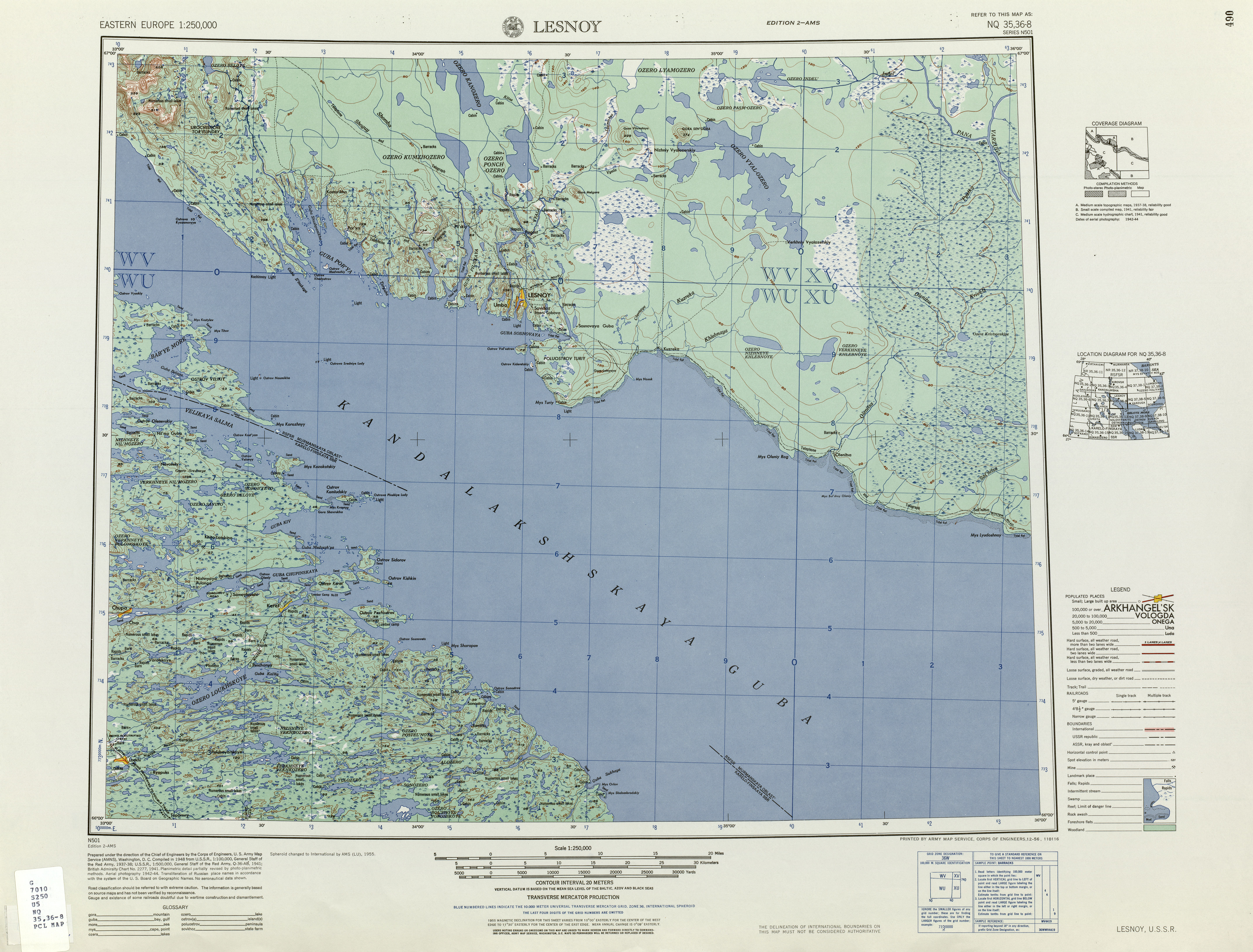
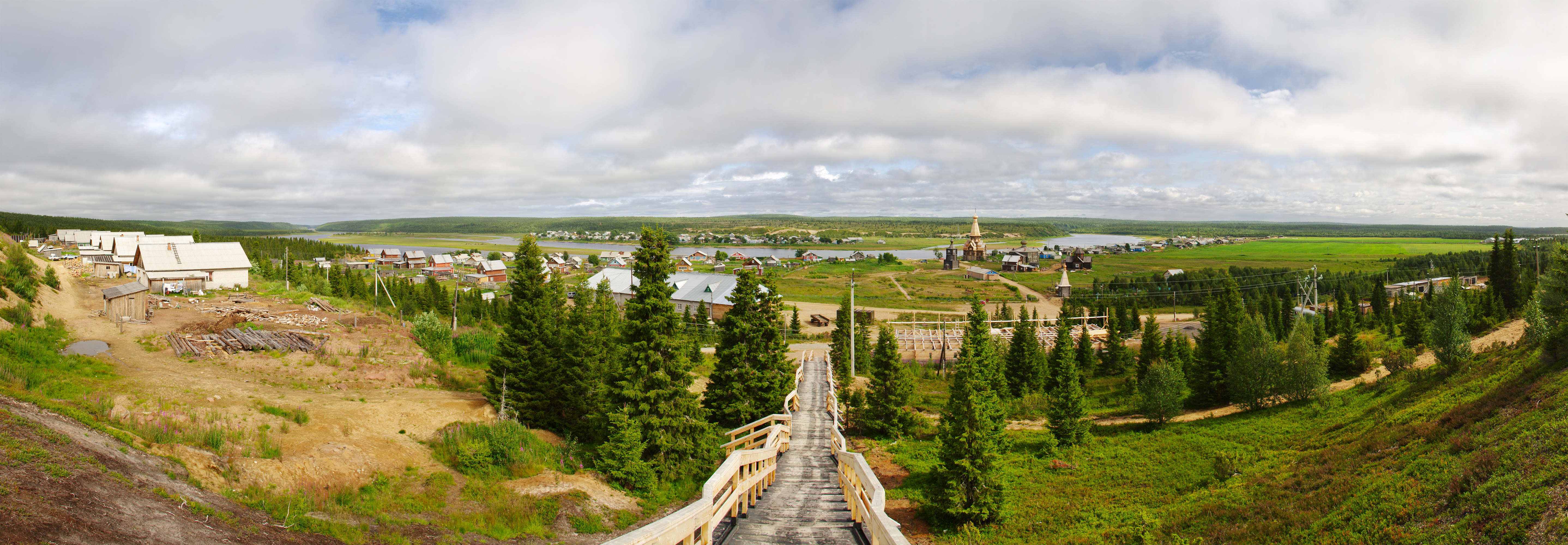
Umba (russian: Умба) is an urban locality (an urban-type settlement) in Tersky District of Murmansk Oblast, Russia, located on the Kola Peninsula at the point where the Umba River flows into the Kandalaksha Gulf. Population: History First mentioned in 1466, Umba, along with Varzuga, is the first documented permanent Russian settlement on the Kola Peninsula.''Administrative-Territorial Divisions of Murmansk Oblast'', p. 18 From the second half of the 15th century it served as the seat of Umbskaya Volost. Politics and society Umba has been characterized by several sources as a quiet district managed by traditional Communists. Transportation &Foreigner travel There is a bus from to Umba from Kandalaksha, going twice a day. The airport from Umba serves parts of the south edge of the Peninsula inaccessible by auto. Priority in buying tickets is given to locals, and reserving them was not possible at least as of September 2013; this mode of transportation cannot be cons ... [...More Info...] [...Related Items...] OR: [Wikipedia] [Google] [Baidu] |
Murmansk Oblast
Murmansk Oblast (russian: Му́рманская о́бласть, p=ˈmurmənskəjə ˈobləsʲtʲ, r=Murmanskaya oblast, ''Murmanskaya oblast''; Kildin Sami: Мурман е̄ммьне, ''Murman jemm'ne'') is a federal subject (an oblast) of Russia, located in the northwestern part of the country. Its administrative center is the city of Murmansk. As of the 2010 Census, its population was 795,409. Geography Geographically, Murmansk Oblast is located mainly on the Kola Peninsula almost completely north of the Arctic Circle''2007 Atlas of Murmansk Oblast'', p. 2 and is a part of the larger Sápmi (Lapland) region that spans over four countries.Ratcliffe, p. 1 The oblast borders with the Republic of Karelia in Russia in the south, Lapland Region in Finland in the west, Troms and Finnmark County in Norway in the northwest, and is bounded by the Barents Sea in the north and the White Sea in the south and east. Arkhangelsk Oblast of Russia lies across the Whit ... [...More Info...] [...Related Items...] OR: [Wikipedia] [Google] [Baidu] |
Tersky District
Tersky District is the name of several administrative and municipal districts in Russia: * Tersky District, Kabardino-Balkarian Republic, an administrative and municipal district of the Kabardino-Balkarian Republic * Tersky District, Murmansk Oblast, an administrative and municipal district of Murmansk Oblast See also *Tersky (other) Tersky (masculine), Terskaya (feminine), or Terskoye (neuter) may refer to: *Tersky District Tersky District is the name of several administrative and municipal districts in Russia: *Tersky District, Kabardino-Balkarian Republic, an administrati ... References {{SIA, Russian districts ... [...More Info...] [...Related Items...] OR: [Wikipedia] [Google] [Baidu] |
Russian Post
Russian Post ( rus, Почта России, a=RU-Почта России.wav, ''Pochta Rossii'') is an Aktsionernoye Obschestvo (AO, private limited company)"Почта России стала акционерным обществом — Russian Post Has Become a Private Limited Company" ''Russian Post Official Website'', 1 October 2019 which is the national of . The company is responsible for the deli ... [...More Info...] [...Related Items...] OR: [Wikipedia] [Google] [Baidu] |
Types Of Inhabited Localities In Russia
The classification system of human settlement, inhabited localities in Russia and some other post-Soviet Union, Soviet states has certain peculiarities compared with those in other countries. Classes During the Soviet Union, Soviet time, each of the republics of the Soviet Union, including the Russian Soviet Federative Socialist Republic, Russian SFSR, had its own legislative documents dealing with classification of inhabited localities. After the history of the Soviet Union (1985-1991), dissolution of the Soviet Union, the task of developing and maintaining such classification in Russia was delegated to the federal subjects of Russia, federal subjects.Articles 71 and 72 of the Constitution of Russia do not name issues of the administrative and territorial structure among the tasks handled on the federal level or jointly with the governments of the federal subjects. As such, all federal subjects pass :Subtemplates of Template RussiaAdmMunRef, their own laws establishing the s ... [...More Info...] [...Related Items...] OR: [Wikipedia] [Google] [Baidu] |
Urban-type Settlement
Urban-type settlementrussian: посёлок городско́го ти́па, translit=posyolok gorodskogo tipa, abbreviated: russian: п.г.т., translit=p.g.t.; ua, селище міського типу, translit=selyshche mis'koho typu, abbreviated: uk, с.м.т., translit=s.m.t.; be, пасёлак гарадскога тыпу, translit=pasiolak haradskoha typu; pl, osiedle typu miejskiego; bg, селище от градски тип, translit=selishte ot gradski tip; ro, așezare de tip orășenesc. is an official designation for a semi-urban settlement (previously called a "town"), used in several Eastern European countries. The term was historically used in Bulgaria, Poland, and the Soviet Union, and remains in use today in 10 of the post-Soviet states. The designation was used in all 15 member republics of the Soviet Union from 1922, when it replaced a number of terms that could have been translated by the English term "town" (Russia – '' posad'', Ukraine ... [...More Info...] [...Related Items...] OR: [Wikipedia] [Google] [Baidu] |
Tersky District, Murmansk Oblast
Tersky District (russian: Те́рский райо́н) is an administrative district (raion), one of the six in Murmansk Oblast, Russia.Law #96-01-ZMO Municipally, it is incorporated as Tersky Municipal District.Law #545-01-ZMO It is located in the south of the Kola Peninsula and borders the White Sea in the south. The area of the district is . Its administrative center is the urban locality (an urban-type settlement) of Umba. District's population: The population of Umba accounts for 88.0% of the district's total population. Geography Most of the district's territory is at a low elevation, but there are some hills in the west. It has many lakes, such as Lakes Kanozero, Segozero, and Vyalozero, and many rivers, including the Vyala, the Serga, and the Umba. History The district was established on August 1, 1927, when the All-Russian Central Executive Committee (VTsIK) issued two Resolutions: "On the Establishment of Leningrad Oblast" and "On the Borders and Composi ... [...More Info...] [...Related Items...] OR: [Wikipedia] [Google] [Baidu] |
Russia
Russia (, , ), or the Russian Federation, is a transcontinental country spanning Eastern Europe and Northern Asia. It is the largest country in the world, with its internationally recognised territory covering , and encompassing one-eighth of Earth's inhabitable landmass. Russia extends across eleven time zones and shares land boundaries with fourteen countries, more than any other country but China. It is the world's ninth-most populous country and Europe's most populous country, with a population of 146 million people. The country's capital and largest city is Moscow, the largest city entirely within Europe. Saint Petersburg is Russia's cultural centre and second-largest city. Other major urban areas include Novosibirsk, Yekaterinburg, Nizhny Novgorod, and Kazan. The East Slavs emerged as a recognisable group in Europe between the 3rd and 8th centuries CE. Kievan Rus' arose as a state in the 9th century, and in 988, it adopted Orthodox Christianity from the ... [...More Info...] [...Related Items...] OR: [Wikipedia] [Google] [Baidu] |
Kola Peninsula
sjd, Куэлнэгк нёа̄ррк , image_name= Kola peninsula.png , image_caption= Kola Peninsula as a part of Murmansk Oblast , image_size= 300px , image_alt= , map_image= Murmansk in Russia.svg , map_caption = Location of Murmansk Oblast within Russia , location= Northwest Russia , coordinates= , area_km2= 100000 , length_km= 370 , width_km= 244 , highest_mount= Yudychvumchorr , elevation_m= 1201 , waterbody = * Barents Sea * White Sea , country= Russia , country_admin_divisions_title= Oblast , country_admin_divisions= Murmansk Oblast , density_km2= , demonym= , population= , citizenships= The Kola Peninsula (russian: Кольский полуостров, Kolsky poluostrov; sjd, Куэлнэгк нёа̄ррк) is a peninsula in the extreme northwest of Russia, and one of the largest peninsulas of Europe. Constituting the bulk of the territory of Murmansk Oblast, it lies almost completely inside the Arctic Circle and is bordered by the Barents Sea to the nort ... [...More Info...] [...Related Items...] OR: [Wikipedia] [Google] [Baidu] |
Umba River (Russia)
The Umba (russian: Умба) is a river on the Kola Peninsula, Murmansk Oblast, Russia. It discharges into the Kandalaksha Gulf of the White Sea. It is long, and has a drainage basin of . Geography The river's source is Lake Umbozero, 100 km northeast of Kandalaksha, located between the mountains of the Khibiny Massif and the Lovozero Tundras on the Kola Peninsula. From there it flows south, through a landscape of forests and hills. The river alternates between rapids and more quiet sections, and it flows through several lakes, the largest of which is Lake Kanozero. The river exits from Lake Kanozero through two separate outlet channels, about five kilometers apart. The outlets are called the Kitsa and the Rodvinga, and the latter again divides forming yet another channel called the Nizma. The Kitsa and Rodvinga rejoins in Lake Ponchozero, below which the river is again called the Umba, and it is rejoined by the Nizma a few kilometers further downstream. The river ... [...More Info...] [...Related Items...] OR: [Wikipedia] [Google] [Baidu] |
Kandalaksha Gulf
The Kandalaksha Gulf (, sms, Käddluhtt), fi, Kantalahti) is located in the Republic of Karelia, and Murmansk Oblast in northwestern Russia. Forming the north-western corner of the White Sea, it is one of four large bays and gulfs of this sea, the others being the Onega Bay (south-west), the Dvina Bay (south), and the Mezen Bay (south east). The Kola Peninsula lies north of the Kandalaksha Gulf. The city of Kandalaksha is located at the northern tip of the gulf; the new oil port Vitino, some 10 km to the south. There are hundreds of skerries in the gulf. The gulf is shallow, reaching 300 meters on its western side. In 1976, the upper reaches of the gulf were designated a Ramsar wetland of international importance, notably as a breeding ground for migratory waterfowl such as the sea duck. Kandalaksha Nature Reserve ( Кандалакшский заповедник) includes parts of the coastline and many of the islands in the gulf. It is one of Russia's oldest nature ... [...More Info...] [...Related Items...] OR: [Wikipedia] [Google] [Baidu] |
Varzuga (rural Locality)
Varzuga (russian: Варзуга) is the rural locality (a '' selo'') in Tersky District of Murmansk Oblast, Russia, located on the Varzuga River. Municipally, it is a part and the administrative center of Varzuga Rural Settlement of Tersky Municipal District.Law #545-01-ZMO Population: 363 ( 2010 Census). History First mentioned in 1466, Varzuga, along with Umba, is the first documented permanent Russian settlement on the Kola Peninsula,''Administrative-Territorial Divisions of Murmansk Oblast'', p. 18 although it is likely that it had been established as early as the second quarter of the 15th century.Газета "Мурманский Вестник". Иван УшаковВарзуга/ref> The 1466 document describes a transaction between Timofey Yermolinich, a resident of Varzuga, and the Solovetsky Monastery, to which he transferred his lands along the Varzuga River and the hunting grounds along the sea coast. Other documents of the 1460s indicate that the resident ... [...More Info...] [...Related Items...] OR: [Wikipedia] [Google] [Baidu] |


