|
Typhoon Paka
Typhoon Paka, known in the Philippines as Typhoon Rubing, was the last tropical cyclone of the 1997 Pacific 1997 Pacific hurricane season, hurricane and 1997 Pacific typhoon season, typhoon season, and was among the strongest Pacific typhoons in the month of December. Paka, which is the Hawaiian language, Hawaiian name for Pat, developed on November 28 from a trough (meteorology), trough well to the southwest of Hawaii. The storm tracked generally westward for much of its duration, and on December 7 it crossed into the western Pacific Ocean. Much of its track was characterized by fluctuations in intensity, and on December 10 the cyclone attained typhoon status as it crossed the Marshall Islands. On December 16, Paka struck Guam and Rota (island), Rota with winds of 230 km/h (145 mph), and it strengthened further to reach peak winds on December 18 over open waters as the final super typhoon of the year. Subsequently, it underwent a steady weakening trend, and on December 2 ... [...More Info...] [...Related Items...] OR: [Wikipedia] [Google] [Baidu] |
Marshall Islands
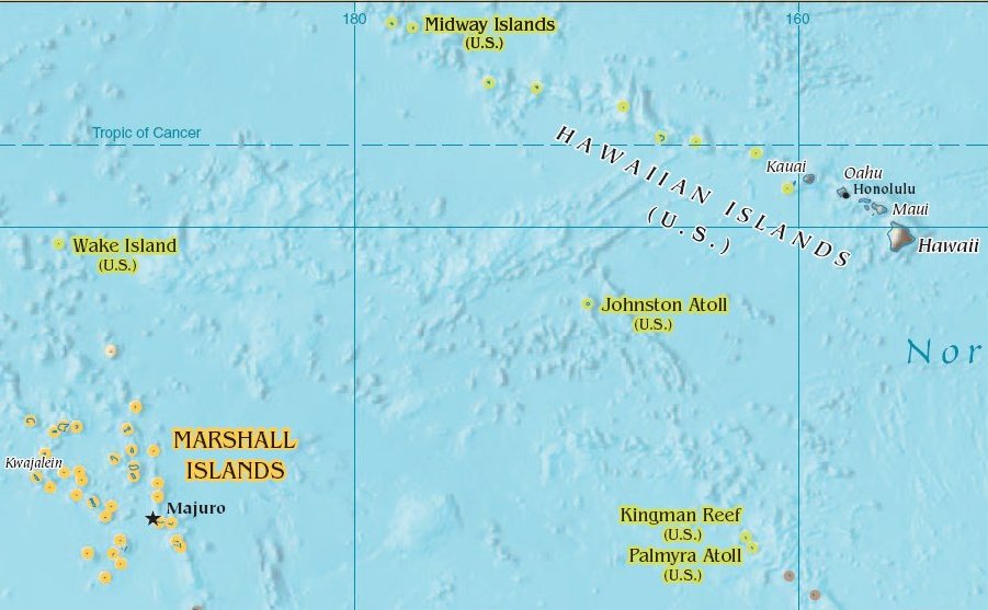
The Marshall Islands ( mh, Ṃajeḷ), officially the Republic of the Marshall Islands ( mh, Aolepān Aorōkin Ṃajeḷ),'' () is an independent island country and microstate near the Equator in the Pacific Ocean, slightly west of the International Date Line. Geographically, the country is part of the larger island group of Micronesia. The country's population of 58,413 people (at the 2018 World Bank Census) is spread out over five islands and 29 coral atolls, comprising 1,156 individual islands and islets. The capital and largest city is Majuro. It has the largest portion of its territory composed of water of any sovereign state, at 97.87%. The islands share maritime boundaries with Wake Island to the north, Kiribati to the southeast, Nauru to the south, and Federated States of Micronesia to the west. About 52.3% of Marshall Islanders (27,797 at the 2011 Census) live on Majuro. In 2016, 73.3% of the population were defined as being "urban". The UN also indicates a p ... [...More Info...] [...Related Items...] OR: [Wikipedia] [Google] [Baidu] |
International Date Line
The International Date Line (IDL) is an internationally accepted demarcation on the surface of Earth, running between the South and North Poles and serving as the boundary between one calendar day and the next. It passes through the Pacific Ocean, roughly following the 180° line of longitude and deviating to pass around some territories and island groups. Crossing the date line eastbound decreases the date by one day, while crossing the date line westbound increases the date. Geography Circumnavigating the globe People traveling westward around the world must set their clocks: *Back by one hour for every 15° of longitude crossed, and *Forward by 24 hours upon crossing the International Date Line. People traveling eastward must set their clocks: *Forward by one hour for every 15° of longitude crossed, and *Back by 24 hours upon crossing the International Date Line. Failing to do this would make their time inaccurate to the local time. The Arab geographer Abul ... [...More Info...] [...Related Items...] OR: [Wikipedia] [Google] [Baidu] |
United States Department Of Defense
The United States Department of Defense (DoD, USDOD or DOD) is an executive branch department of the federal government charged with coordinating and supervising all agencies and functions of the government directly related to national security and the United States Armed Forces. The DoD is the largest employer in the world, with over 1.34 million active-duty service members (soldiers, marines, sailors, airmen, and guardians) as of June 2022. The DoD also maintains over 778,000 National Guard and reservists, and over 747,000 civilians bringing the total to over 2.87 million employees. Headquartered at the Pentagon in Arlington, Virginia, just outside Washington, D.C., the DoD's stated mission is to provide "the military forces needed to deter war and ensure our nation's security". The Department of Defense is headed by the secretary of defense, a cabinet-level head who reports directly to the president of the United States. Beneath the Department of Defense are ... [...More Info...] [...Related Items...] OR: [Wikipedia] [Google] [Baidu] |
Joint Typhoon Warning Center
The Joint typhoon Warning Center (JTWC) is a joint United States Navy – United States Air Force command in Pearl Harbor, Hawaii. The JTWC is responsible for the issuing of tropical cyclone warnings in the North-West Pacific Ocean, South Pacific Ocean, and Indian Ocean for all branches of the U.S. Department of Defense and other U.S. government agencies. Their warnings are intended for the protection of primarily military ships and aircraft as well as military installations jointly operated with other countries around the world. Its U.S. Navy components are aligned with the Naval Meteorology and Oceanography Command. History The origins of the Joint Typhoon Warning Center (JTWC) can be traced back to June 1945, when the Fleet Weather Center/Typhoon Tracking Center was established on the island of Guam, after multiple typhoons, including Typhoon Cobra of December 1944 and Typhoon Connie in June 1945, had caused a significant loss of men and ships. At this time the ... [...More Info...] [...Related Items...] OR: [Wikipedia] [Google] [Baidu] |
Japan Meteorological Agency
The , abbreviated JMA, is an agency of the Ministry of Land, Infrastructure, Transport and Tourism. It is charged with gathering and providing results for the public in Japan that are obtained from data based on daily scientific observation and research into natural phenomena in the fields of meteorology, hydrology, seismology and volcanology, among other related scientific fields. Its headquarters is located in Minato, Tokyo. JMA is responsible for gathering and reporting weather data and forecasts for the general public, as well as providing aviation and marine weather. JMA other responsibilities include issuing warnings for volcanic eruptions, and the nationwide issuance of earthquake warnings of the Earthquake Early Warning (EEW) system. JMA is also designated one of the Regional Specialized Meteorological Centers of the World Meteorological Organization (WMO). It is responsible for forecasting, naming, and distributing warnings for tropical cyclones in the Northwe ... [...More Info...] [...Related Items...] OR: [Wikipedia] [Google] [Baidu] |
Cloud
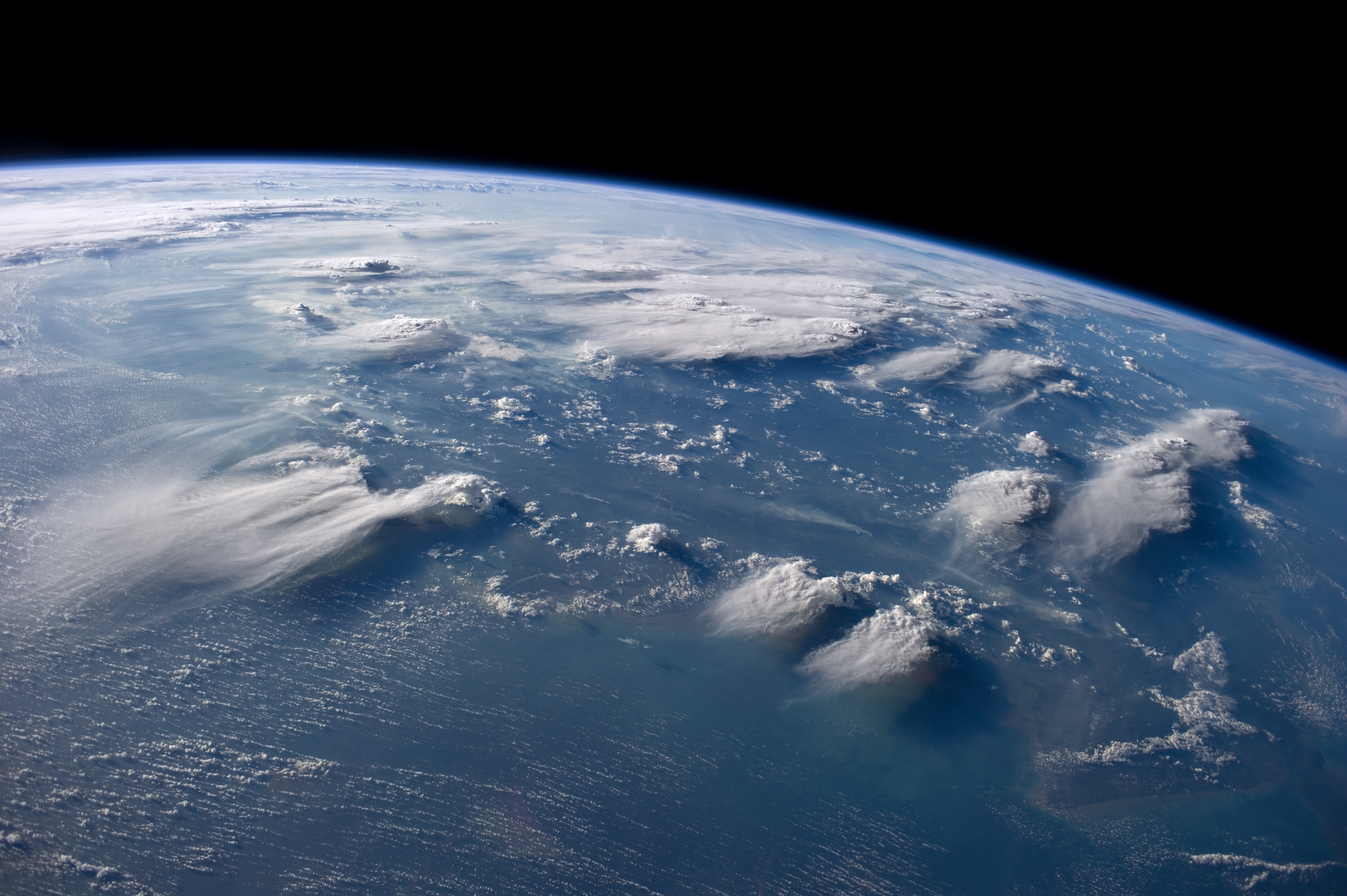
In meteorology, a cloud is an aerosol consisting of a visible mass of miniature liquid droplets, frozen crystals, or other particles suspended in the atmosphere of a planetary body or similar space. Water or various other chemicals may compose the droplets and crystals. On Earth, clouds are formed as a result of saturation of the air when it is cooled to its dew point, or when it gains sufficient moisture (usually in the form of water vapor) from an adjacent source to raise the dew point to the ambient temperature. They are seen in the Earth's homosphere, which includes the troposphere, stratosphere, and mesosphere. Nephology is the science of clouds, which is undertaken in the cloud physics branch of meteorology. There are two methods of naming clouds in their respective layers of the homosphere, Latin and common name. Genus types in the troposphere, the atmospheric layer closest to Earth's surface, have Latin names because of the universal adoption of Luke H ... [...More Info...] [...Related Items...] OR: [Wikipedia] [Google] [Baidu] |
Johnston Atoll
Johnston Atoll is an unincorporated territory of the United States, currently administered by the United States Fish and Wildlife Service (USFWS). Johnston Atoll is a National Wildlife Refuge and part of the Pacific Remote Islands Marine National Monument. It is closed to public entry, and limited access for management needs is only granted by Letter of Authorization from the United States Air Force and a Special Use Permit from the U.S. Fish and Wildlife Service. For nearly 70 years, the isolated atoll was under the control of the U.S. military. During that time, it was variously used as a naval refueling depot, an airbase, a testing site for nuclear and biological weapons, a secret missile base, and a site for the storage and disposal of chemical weapons and Agent Orange. Those activities left the area environmentally contaminated, and monitoring continues. The island is home to thriving communities of nesting seabirds and has significant marine biodiversity. USFWS teams ... [...More Info...] [...Related Items...] OR: [Wikipedia] [Google] [Baidu] |
Ridge (meteorology)
A ridge or barometric ridge is a term in meteorology describing an elongated area of relatively high atmospheric pressure compared to the surrounding environment, without being a closed circulation. It is associated with an area of maximum anticyclonic curvature of wind flow. The ridge originates in the center of an anticyclone and sandwiched between two low-pressure areas, and the locus of the maximum curvature is called the ''ridge line''. This phenomenon is the opposite of a trough. Description Ridges can be represented in two ways: * On surface weather maps, the pressure isobars form contours where the maximum pressure is found along the axis of the ridge. * In upper-air maps, geopotential height isohypses form similar contours where the maximum defines the ridge. Related weather Given the direction of the winds around an anticyclonic circulation and the fact that weather systems move from west to east: *ahead of an upper-ridge, the airflow that comes from the polar ... [...More Info...] [...Related Items...] OR: [Wikipedia] [Google] [Baidu] |
Anticyclone
An anticyclone is a weather phenomenon defined as a large-scale circulation of winds around a central region of high atmospheric pressure, clockwise in the Northern Hemisphere and counterclockwise in the Southern Hemisphere as viewed from above (opposite to a cyclone). Effects of surface-based anticyclones include clearing skies as well as cooler, drier air. Fog can also form overnight within a region of higher pressure. Mid-tropospheric systems, such as the subtropical ridge, deflect tropical cyclones around their periphery and cause a temperature inversion inhibiting free convection near their center, building up surface-based haze under their base. Anticyclones aloft can form within warm-core lows such as tropical cyclones, due to descending cool air from the backside of upper troughs such as polar highs, or from large-scale sinking such as a subtropical ridge. The evolution of an anticyclone depends upon variables such as its size, intensity, and extent of mo ... [...More Info...] [...Related Items...] OR: [Wikipedia] [Google] [Baidu] |
Central Pacific Hurricane Center
The Central Pacific Hurricane Center (CPHC) of the United States National Weather Service is the official body responsible for tracking and issuing tropical cyclone warnings, watches, advisories, discussions, and statements for the Central Pacific region: from the equator northward, 140°W–180°W, most significantly for Hawai‘i. It is the Regional Specialized Meteorological Center (RSMC) for tropical cyclones in this region, and in this capacity is known as RSMC Honolulu. Based in Honolulu, Hawaii, the CPHC is co-located with the National Weather Service's Honolulu forecast office on the campus of the University of Hawaii at Mānoa. The Honolulu forecast office activates the CPHC when tropical cyclones form in, or move into, the Central Pacific region. The CPHC replaced the previous forecaster, the Joint Hurricane Warning Center, starting in the 1970 season. Area of responsibility The CPHC's area of responsibility is the Central Pacific (CP) region, which is an administ ... [...More Info...] [...Related Items...] OR: [Wikipedia] [Google] [Baidu] |
Palmyra Atoll
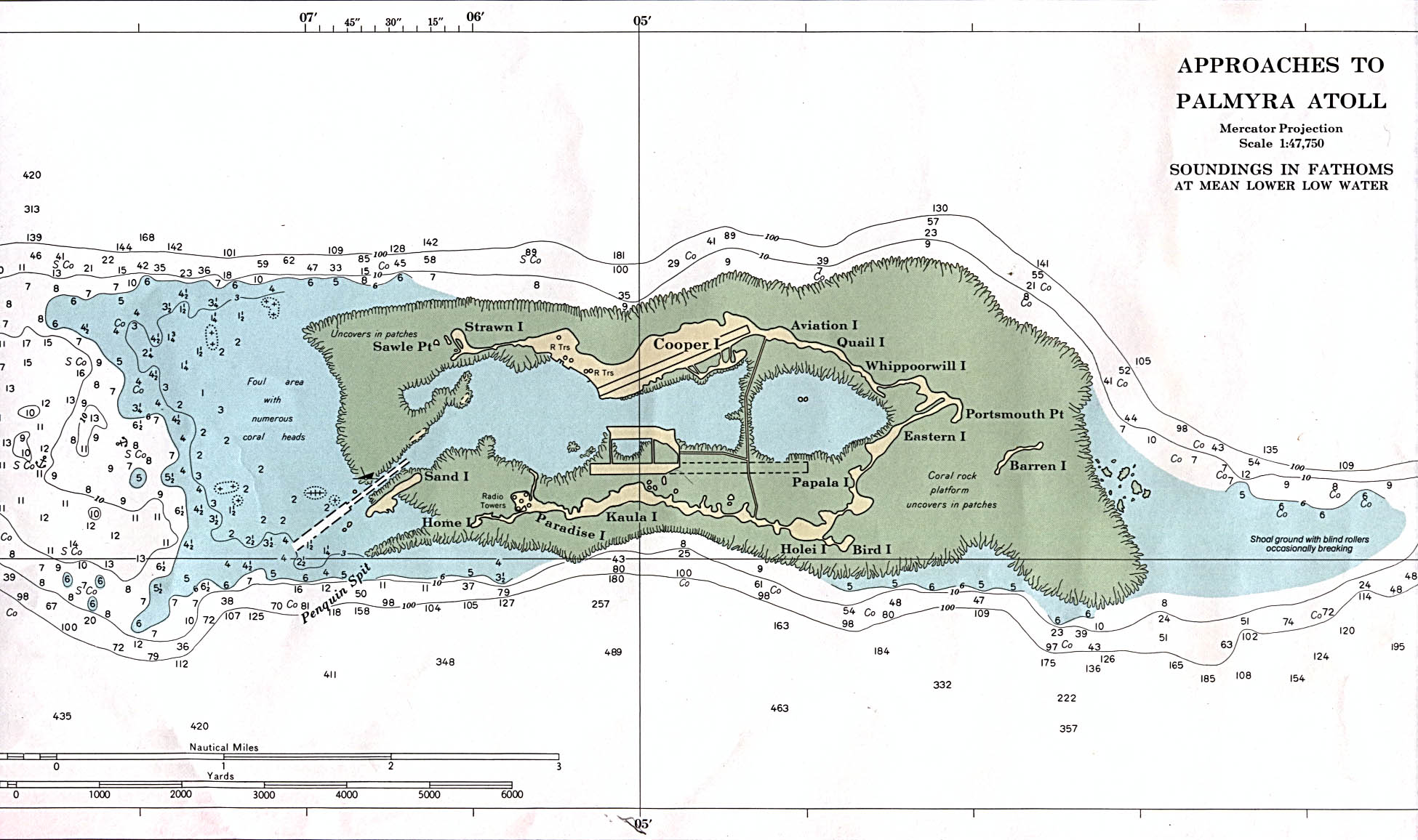
Palmyra Atoll (), also referred to as Palmyra Island, is one of the Northern Line Islands (southeast of Kingman Reef and north of Kiribati). It is located almost due south of the Hawaiian Islands, roughly one-third of the way between Hawaii and American Samoa. North America is about northeast and New Zealand the same distance southwest, placing the atoll at the approximate center of the Pacific Ocean. The land area is , with about 9 miles (14 km) of sea-facing coastline and reef. There is one boat anchorage known as West Lagoon, accessible from the sea by a narrow artificial channel. It is the second-to-northernmost of the Line Islands, and one of three American islands in the archipelago, along with Jarvis Island and Kingman Reef. Palmyra Atoll is part of the Pacific Remote Islands Marine National Monument, the world's largest marine protected area. The atoll is composed of submerged sand flats along with dry land and reefs. It consists of three lagoons separated by co ... [...More Info...] [...Related Items...] OR: [Wikipedia] [Google] [Baidu] |
Northern Hemisphere
The Northern Hemisphere is the half of Earth that is north of the Equator. For other planets in the Solar System, north is defined as being in the same celestial hemisphere relative to the invariable plane of the solar system as Earth's North Pole. Owing to Earth's axial tilt of 23.439281°, winter in the Northern Hemisphere lasts from the December solstice (typically December 21 UTC) to the March equinox (typically March 20 UTC), while summer lasts from the June solstice through to the September equinox (typically on 23 September UTC). The dates vary each year due to the difference between the calendar year and the astronomical year. Within the Northern Hemisphere, oceanic currents can change the weather patterns that affect many factors within the north coast. Such events include El Niño–Southern Oscillation. Trade winds blow from east to west just above the equator. The winds pull surface water with them, creating currents, which flow westward due to the Corio ... [...More Info...] [...Related Items...] OR: [Wikipedia] [Google] [Baidu] |


