|
Tsumagoi, Gunma
250px, Mount Shirane from Manza Onsen is a village located in Gunma Prefecture, Japan. , the village had an estimated population of 9,546 in 3,999 households, and a population density of 28 persons per km². The total area of the village is . Geography Tsumagoi is situated on the northwestern corner of Gunma Prefecture, touching Nagano Prefecture to the north, south, and west. Because of its elevated location and the ash deposits of Mount Asama, Tsumagoi is well known for growing cabbages. Parts of the village are within the borders of then Jōshin'etsu-kōgen National Park. * Mountains: Mount Asama (2568m), Mount Motoshirane (2171m), Mount Kusatsu-Shirane (2160m), Mount Azumaya (2354m) * Rivers: Agatsuma River * Lakes: Lake Baragi, Lake Tashiro Surrounding municipalities Gunma Prefecture is a prefecture of Japan located in the Kantō region of Honshu. Gunma Prefecture has a population of 1,937,626 (1 October 2019) and has a geographic area of 6,362 km2 (2,456 sq mi) ... [...More Info...] [...Related Items...] OR: [Wikipedia] [Google] [Baidu] |
Villages Of Japan
A is a local administrative unit in Japan. It is a local public body along with , , and . Geographically, a village's extent is contained within a prefecture. It is larger than an actual settlement, being in actuality a subdivision of a rural , which are subdivided into towns and villages with no overlap and no uncovered area. As a result of mergers and elevation to higher statuses, the number of villages in Japan is decreasing. Currently, 13 prefectures no longer have any villages: Tochigi (since March 20, 2006), Fukui (since March 3, 2006), Ishikawa (since March 1, 2005), Shizuoka (since July 1, 2005), Hyōgo (since April 1, 1999), Mie (since November 1, 2005), Shiga (since January 1, 2005), Hiroshima (since November 5, 2004), Yamaguchi (since March 20, 2006), Ehime (since January 16, 2005), Kagawa (since April 1, 1999), Nagasaki (since October 1, 2005), and Saga (since March 20, 2006). The six villages in the Northern Territories dispute and Atarashiki-mura (w ... [...More Info...] [...Related Items...] OR: [Wikipedia] [Google] [Baidu] |
Mount Asama
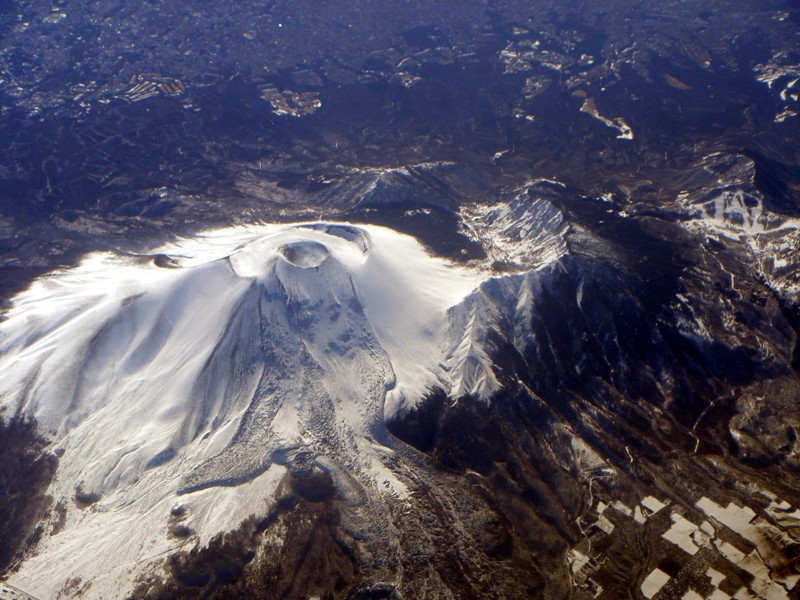
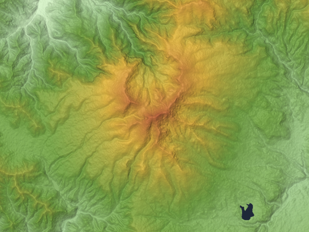
is an active complex volcano in central Honshū, the main island of Japan. The volcano is the most active on Honshū. The Japan Meteorological Agency classifies Mount Asama as rank A. It stands above sea level on the border of Gunma and Nagano prefectures. It is included in ''100 Famous Japanese Mountains''. Geology Mount Asama sits at the conjunction of the Izu–Bonin–Mariana Arc and the Northeastern Japan Arc. The mountain is built up from non-alkali mafic and pyroclastic volcanic rocks dating from the Late Pleistocene to the Holocene. The main rock type is andesite and dacite. Scientists from the University of Tokyo and Nagoya University completed their first successful imaging experiment of the interior of the volcano in April 2007. By detecting sub-atomic particles called muons as they passed through the volcano after arriving from space, the scientists were able gradually to build up a picture of the interior, creating images of cavities through which lava was pass ... [...More Info...] [...Related Items...] OR: [Wikipedia] [Google] [Baidu] |
Ueda, Nagano
is a city located in Nagano Prefecture, Japan. , the city had an estimated population of 157,480 in 67,783 households, and a population density of 290 persons per km2. The total area of the city is , which makes it the fifth largest city in Nagano Prefecture in terms of area. Geography Ueda is located in central Nagano Prefecture, some 40 kilometers from the prefectural capital of Nagano City and 190 kilometers from Tokyo. The Chikuma River divides the city into two parts. Surrounding municipalities *Nagano Prefecture ** Matsumoto ** Tōmi ** Suzaka ** Nagano ** Chikuma ** Nagawa ** Aoki ** Chikuhoku * Gunma Prefecture ** Tsumagoi Climate The city has a climate characterized by hot and humid summers, and relatively mild winters (Köppen climate classification ''Cwa''). The average annual temperature in Ueda is . The average annual rainfall is with September as the wettest month. The temperatures are highest on average in August, at around , and lowest in January, at a ... [...More Info...] [...Related Items...] OR: [Wikipedia] [Google] [Baidu] |
Suzaka, Nagano
is a city located in Nagano Prefecture, Japan. , the city had an estimated population of 50,828 in 19,979 households, and a population density of 334 persons per km². The total area of the city is . Geography Suzaka is located in northern Nagano Prefecture on the alluvial fan where the Matsukawa River joins the Chikuma River. Surrounding municipalities *Nagano Prefecture ** Ueda ** Nagano ** Obuse ** Takayama * Gunma Prefecture ** Tsumagoi Climate The city has a climate characterized by characterized by hot and humid summers, and relatively mild winters ( Köppen climate classification ''Cfa''). The average annual temperature in Suzaka is 10.5 °C. The average annual rainfall is 1189 mm with September as the wettest month. The temperatures are highest on average in August, at around 23.8 °C, and lowest in January, at around -2.2 °C. Demographics Per Japanese census data, the population of Suzaka has remained relatively stable over the past 40 years ... [...More Info...] [...Related Items...] OR: [Wikipedia] [Google] [Baidu] |
Takayama, Nagano
is a village located in Nagano Prefecture, Japan. , the village had an estimated population of 7,101 in 2466 households, and a population density of 72 persons per km². The total area of the village is . Takayama is listed as one of The Most Beautiful Villages in Japan. Geography Takayama is located in northeastern Nagano Prefecture, bordered by Gunma Prefecture to the east. The village is located in a mountainous area, and includes Mount Kitahotaka partly within its borders. Surrounding municipalities *Nagano Prefecture ** Nagano ** Suzaka ** Obuse ** Yamanouchi *Gunma Prefecture ** Kusatsu **Tsumagoi ** Nakanojō Climate The village has a Humid continental climate characterized by warm and humid summers, and cold with heavy snowfall winters ( Köppen climate classification ''Dfb''). The average annual temperature in Takayama is 6.7 °C. The average annual rainfall is 1549 mm with September as the wettest month. The temperatures are highest on average in August, ... [...More Info...] [...Related Items...] OR: [Wikipedia] [Google] [Baidu] |
Komoro, Nagano
is a city located in Nagano Prefecture, Japan. , the city had an estimated population of 42,489 in 18776 households, and a population density of 430 persons per km². Its total area is . Geography Komoro is located in eastern Nagano Prefecture. The Chikuma River flows thorough the southern and western part of the city. Some extinct volcanic mountains are located between Komoro and neighboring Tsumagoi. The highest point in Komoro is Mt. Kurofu ( ja). Its peak is above sea level. The lowest point is . The old city center is at about . There are many slopes, so Komoro is known as a "hilly city" (坂の町). Surrounding municipalities *Nagano Prefecture **Saku ** Tōmi **Miyota *Gunma Prefecture **Tsumagoi Climate Komoro is far from the sea and surrounded by mountains, so the rainfall is lower and diurnal temperature range is greater than many locations in Japan, and average annual temperature of Komoro is relatively cool because of the high altitude. The city has a climate char ... [...More Info...] [...Related Items...] OR: [Wikipedia] [Google] [Baidu] |
Karuizawa, Nagano
is a resort town located in Nagano Prefecture, Japan. , the town had an estimated population of 20,323 in 9897 households, and a population density of 130 persons per km². The total area of the town is . Karuizawa is one of the oldest and most famous summer resorts in Japan, visited by many people from different countries since the 19th century. Geography Karuizawa is located in eastern Nagano Prefecture, bordered by Gunma Prefecture to the north, east and south. The town is located on an elevated plain at the foot of Mount Asama, one of Japan's most active volcanoes. The mountain is classed as a Category A active volcano. A small eruption was detected in June 2015, a more significant eruption spewing hot rocks and a plume of ash occurred in February 2015. Mt. Asama's most destructive eruption in recent recorded history took place in 1783, when over 1,000 were killed. The volcano is actively monitored by scientists and climbing close to the summit is prohibited. *Usui Pass *H ... [...More Info...] [...Related Items...] OR: [Wikipedia] [Google] [Baidu] |
Naganohara, Gunma
250px, New Naganohara town office 250px, Festival at Kawahara onsen is a town located in Gunma Prefecture, Japan. , the town had an estimated population of 5,495 in 5630 households, and a population density of 41 persons per km². The total area of the town is . The controversial Yanba Dam project is located within Naganohara. Geography Located in the northwestern portion of Gunma Prefecture, almost all of Naganohara has an elevation higher than 500 meters. The town has Mount Kusatsu-Shirane (2171m) to the north and Mount Asama (2568m) to the south. * Rivers: Agatsuma River, Shirasuna River, Kuma River Surrounding municipalities Gunma Prefecture * Takasaki * Higashiagatsuma * Tsumagoi * Nakanojō * Kusatsu Nagano Prefecture * Karuizawa Climate Naganohara has a Humid continental climate (Köppen ''Cfa'') characterized by warm summers and cold winters with heavy snowfall. The average annual temperature in Naganohara is 7.6 °C. The average annual rainfall is 1453 m ... [...More Info...] [...Related Items...] OR: [Wikipedia] [Google] [Baidu] |
Kusatsu, Gunma
250px, Kusatsu town hall is a town located in Gunma Prefecture, Japan. , the town had an estimated population of 6,255 in 3407 households, and a population density of 130 persons per km2. The total area of the town is . Kusatsu is one of the most famous hot springs resorts in Japan. Geography Kusatsu is situated about 1,200 meters above sea level. The active volcano Kusatsu-Shirane (2,160 m) and the inactive Mount Tengu (1,385 m) and Mount Motoshirane (2,171 m) are located west of Kusatsu. Surrounding municipalities Gunma Prefecture * Higashiagatsuma * Tsumagoi * Nakanojō Nagano Prefecture * Takayama Climate Kusatsu has a Humid continental climate (Köppen ''Dfb'') characterized by warm summers and cold winters with heavy snowfall. The average annual temperature in Kusatsu is 3.3 °C. The average annual rainfall is 1711 mm with September as the wettest month. The temperatures are highest on average in August, at around 23.7 °C, and lowest in January, at ... [...More Info...] [...Related Items...] OR: [Wikipedia] [Google] [Baidu] |
Agatsuma River
Agatsuma may refer to: *, Japanese shamisen player *Agatsuma District, Gunma, a district in Gunma Prefecture, Japan * Agatsuma, Gunma, a town in Gunma Prefecture, Japan * Agatsuma River, a river in Japan *Agatsuma Entertainment Agatsuma Entertainment (アガツマ・エンタテインメント) was a Japanese video game publishing company established in 1997. It mainly published titles for the Nintendo DS, Wii, and Nintendo 3DS The is a handheld game console produ ..., a Japanese toy/video game company * Zenitsu Agatsuma, a character from the manga/anime series Kimetsu no Yaiba (Demon Slayer) {{disambiguation, surname Japanese-language surnames ... [...More Info...] [...Related Items...] OR: [Wikipedia] [Google] [Baidu] |
Mount Azumaya
is one of the 100 Famous Japanese Mountains. The peak lies on the border of Nagano Prefecture and Gunma Prefecture. There exist alternative spellings of the mountain's name, like: 吾妻山 and 吾嬬山 which is read as "Agatsuma-yama" (Mount Agatsuma). In the village Tsumagoi, the mountain is spelled 吾妻山. The mountain should not be confused with of which there are two, one in Nagano Prefecture and the other in Saitama Prefecture. Though the reading is the same, the name written in Kanji differs from the mountain in this article. Outline Mount Azumaya was formed between 900,000 and 300,000 years ago by andesite lava flowing out of a Stratovolcano. An eruption 340,000 years ago formed a caldera of circa 3 kilometers in diameter. Through erosion the mountain has arrived at its present form with several peaks. is the general term for the following peaks lying roughly on a circle: , Mount Azumaya, , . The famous Sugadaira Kōgen ski area is found on the mountain's so ... [...More Info...] [...Related Items...] OR: [Wikipedia] [Google] [Baidu] |


