|
Tibagi
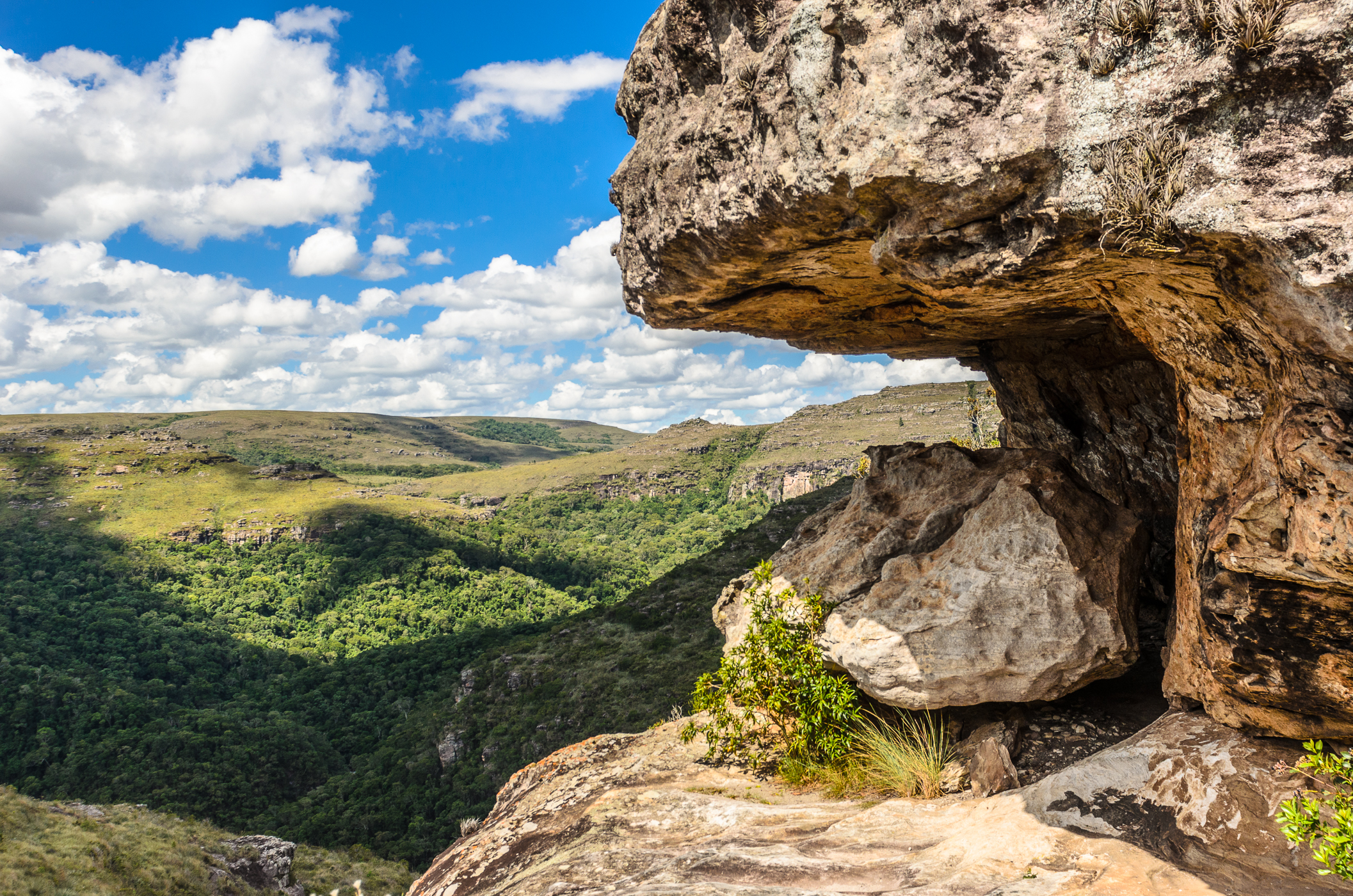
Tibagi is a municipality in the state of Paraná in the Southern Region of Brazil. Second largest municipality of Paraná in land, Tibagi expands over an area of over . With the vast territory, its economy is based on agriculture and it is considered the largest wheat producer in Brazil and also stands out as one of the largest producer sin the cultivation of grains such as corn, beans and soybeans. Tourism is part of the largest local economic strengths, from the famous Carnival, to the natural beauties of lapo river and the ( Guartelá Canyon) which is considered to be the 6th largest canyon in the world, besides rivers, waterfalls, and hills. For these features Tibagi is the favorite destination of many extreme sports fans who like rafting mountain climbing, parasailing and others. The municipality contains the Guartelá State Park, created in 1992 to protect the scenic Guartelá Canyon of the Iapó River. See also *List of municipalities in Paraná This is a list of the ... [...More Info...] [...Related Items...] OR: [Wikipedia] [Google] [Baidu] |
Guartelá State Park
The Guartelá State Park ( pt, Parque Estadual do Guartelá) is a state park in the state of Paraná, Brazil. It protects the Guartelá Canyon, its surroundings and the area's natural environment. Location The Guartelá State Park is in the municipality of Tibagi, Paraná. It has an area of . It includes the Ponte de Pedra waterfall, about high, and the Córrego Pedregulho, a stream with natural cascades and "baths". There are rock paintings created by prehistoric residents, which can only be visited accompanied by a local guide. The rock paintings are about 7,000 years old. There are also traces of Jesuits and cattle drovers from the colonial era. History The Guartelá State Park was created by decree 1,229 of 27 March 1992 to protect an area of rich natural and archaeological heritage in the region of the Iapó River canyon. The park was created by Governor Roberto Requião. The governor who succeeded him reduced its size by 90%. It was implemented in 1997. It is managed ... [...More Info...] [...Related Items...] OR: [Wikipedia] [Google] [Baidu] |
Guartelá Canyon
The Guartelá Canyon ( Portuguese: ''Cânion Guartelá'') is a canyon in Tibagi and Castro, Paraná, Brazil. The canyon of the Iapó River is protected by the Guartelá State Park The Guartelá State Park ( pt, Parque Estadual do Guartelá) is a state park in the state of Paraná, Brazil. It protects the Guartelá Canyon, its surroundings and the area's natural environment. Location The Guartelá State Park is in the mu ..., created in 1992. References Canyons of Paraná Landforms of Paraná (state) Tibagi Castro, Paraná {{ParanáBR-geo-stub ... [...More Info...] [...Related Items...] OR: [Wikipedia] [Google] [Baidu] |
Iapó River
The Iapó River ( pt, Rio Iapó ) is a river of Paraná state in southern Brazil. It is a tributary of the Tibagi River. The river is known for the scenic Guartelá Canyon, which is protected by the Guartelá State Park, created in 1992. See also *List of rivers of Paraná A ''list'' is any set of items in a row. List or lists may also refer to: People * List (surname) Organizations * List College, an undergraduate division of the Jewish Theological Seminary of America * SC Germania List, German rugby unio ... References Rivers of Paraná (state) Castro, Paraná {{ParanáBR-river-stub ... [...More Info...] [...Related Items...] OR: [Wikipedia] [Google] [Baidu] |
List Of Municipalities In Paraná
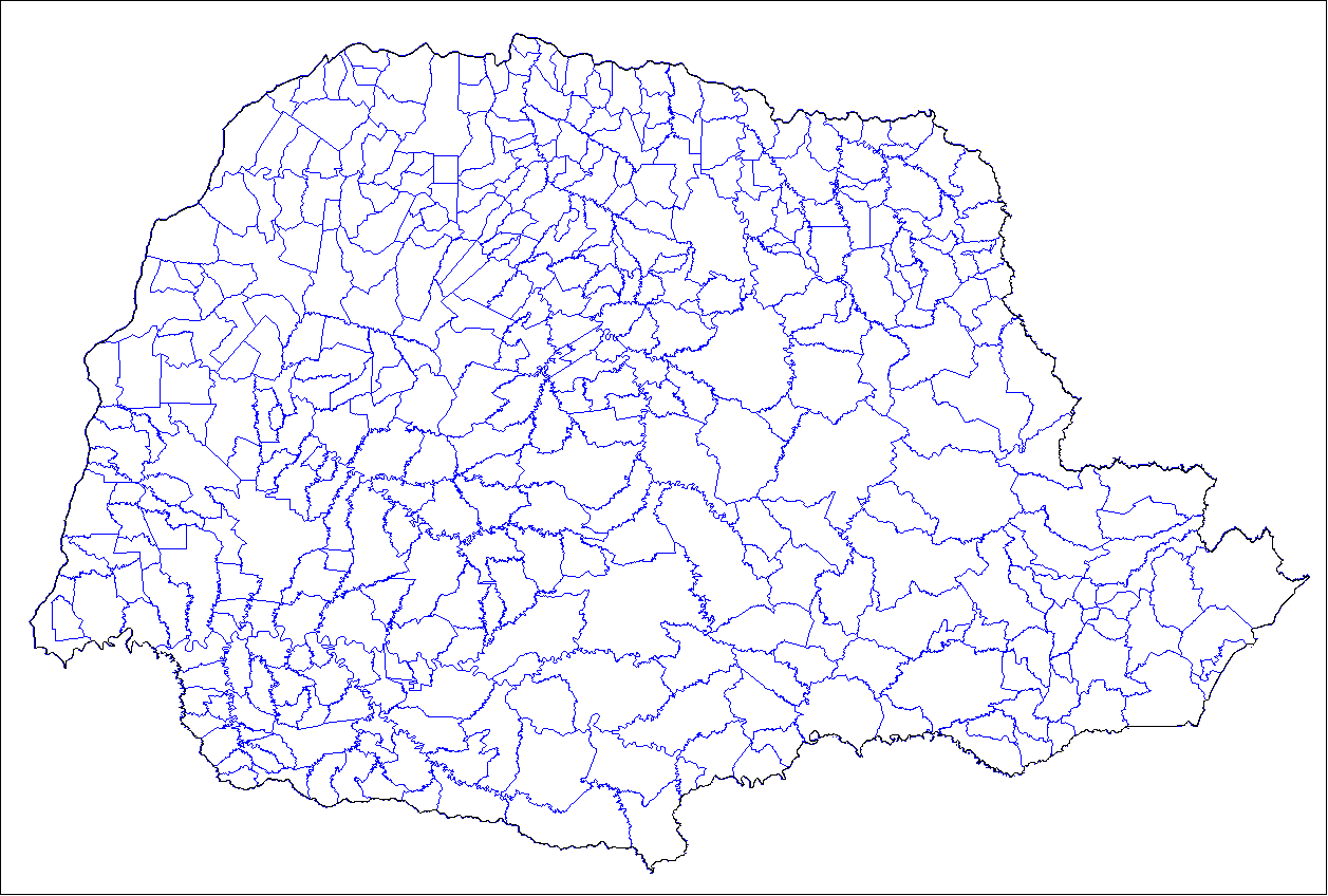
This is a list of the municipalities in the state of Paraná (PR), located in the South Region of Brazil. Paraná is divided into 399 municipalities, which are grouped into 39 microregions, which are grouped into 10 mesoregions. See also *Geography of Brazil *List of cities in Brazil Brazil has a high level of urbanization with 87.8% of the population residing in urban and metropolitan areas. The criteria used by the IBGE (Brazilian Institute of Geography and Statistics) in determining whether households are urban or rural, ... {{DEFAULTSORT:List of municipalities in Parana Parana * ... [...More Info...] [...Related Items...] OR: [Wikipedia] [Google] [Baidu] |
Regions Of Brazil
Brazil is geopolitically divided into five regions (also called macroregions), by the Brazilian Institute of Geography and Statistics, which are formed by the federative units of Brazil. Although officially recognized, the division is merely academic, considering geographic, social and economic factors, among others, and has no political effects other than orientating Federal-level government programs. Under the state level, there are also mesoregions and microregions. The five regions North Region *Area: 3,689,637.9 km2 (45.27%) *Population: 17,707,783 (4,6 people/km2; 6.2%; 2016) *GDP: R$ 308 billion / US$94,8 billion (2016; 4.7%) ( 5th) *Climate: Equatorial *States: Acre, Amapá, Amazonas, Pará, Rondônia, Roraima, Tocantins *Largest Cities: Manaus (2,094,391); Belém (1,446,042); Porto Velho (511,219); Ananindeua (510,834); Macapá (465,495); Rio Branco (377,057); Boa Vista (326,419); Santarém (294,447); Palmas (279 856). *Economy: Iron, Copper, ... [...More Info...] [...Related Items...] OR: [Wikipedia] [Google] [Baidu] |
Southern Region, Brazil
The South Region of Brazil (; ) is one of the five regions of Brazil. It includes the states of Paraná, Rio Grande do Sul, and Santa Catarina, and covers , being the smallest region of the country, occupying only about 6.76% of the territory of Brazil. Its whole area is smaller than that of the state of Minas Gerais, in Southeast Brazil, for example. It is a tourist, economic and cultural pole. It borders Uruguay, Argentina, and Paraguay, as well as the Centre-West and Southeast regions, and the Atlantic Ocean. The region is considered the safest in Brazil to visit, having a lower crime rate than other regions in the country. History Pre-Columbian history By the time the first European explorers arrived, all parts of the territory were inhabited by semi-nomadic hunter-gatherer native tribes. They subsisted on a combination of hunting, fishing, and gathering. Portuguese colonization European colonization in Southern Brazil started with the arrival of Portuguese and Spanis ... [...More Info...] [...Related Items...] OR: [Wikipedia] [Google] [Baidu] |
States Of Brazil
The federative units of Brazil ( pt, unidades federativas do Brasil) are subnational entities with a certain degree of autonomy (self-government, self-regulation and self-collection) and endowed with their own government and constitution, which together form the Federative Republic of Brazil. There are 26 states (') and one federal district ('). The states are generally based on historical, conventional borders which have developed over time. The states are divided into municipalities A municipality is usually a single administrative division having corporate status and powers of self-government or jurisdiction as granted by national and regional laws to which it is subordinate. The term ''municipality'' may also mean the go ..., while the Federal District (Brazil), Federal District assumes the competences of both a state and a municipality. Government The government of each state of Brazil is divided into executive branch, executive, legislative branch, legislative and jud ... [...More Info...] [...Related Items...] OR: [Wikipedia] [Google] [Baidu] |
Paraná (state)
Paraná () is one of the 26 states of Brazil, in the south of the country, bordered on the north by São Paulo state, on the east by the Atlantic Ocean, on the south by Santa Catarina state and the province of Misiones, Argentina, and on the west by Mato Grosso do Sul and Paraguay, with the Paraná River as its western boundary line. It is subdivided into 399 municipalities, and its capital is the city of Curitiba. Other major cities are Londrina, Maringá, Ponta Grossa, Cascavel, São José dos Pinhais and Foz do Iguaçu. The state is home to 5.4% of the Brazilian population and has 6.2% of the Brazilian GDP. Crossed by the Tropic of Capricorn, Paraná has what is left of the araucaria forest, one of the most important subtropical forests in the world. At the border with Argentina is the National Park of Iguaçu, considered by UNESCO as a World Heritage Site. At only from there, at the border with Paraguay, the largest dam in the world was built, the Hidroelétrica de Itaipu ... [...More Info...] [...Related Items...] OR: [Wikipedia] [Google] [Baidu] |
Municipalities Of Brazil
The municipalities of Brazil ( pt, municípios do Brasil) are administrative divisions of the states of Brazil, Brazilian states. Brazil currently has 5,570 municipalities, which, given the 2019 population estimate of 210,147,125, makes an average municipality population of 37,728 inhabitants. The average state in Brazil has 214 municipalities. Roraima is the least subdivided state, with 15 municipalities, while Minas Gerais is the most subdivided state, with 853. The Federal District (Brazil), Federal District cannot be divided into Municipality, municipalities, which is why its territory is composed of several Administrative regions of the Federal District (Brazil), administrative regions. These regions are directly managed by the government of the Federal District, which exercises constitutional and legal powers that are equivalent to those of the Federated state, states, as well as those of the Municipality, municipalities, thus simultaneously assuming all the obligations a ... [...More Info...] [...Related Items...] OR: [Wikipedia] [Google] [Baidu] |
States Of Brazil
The federative units of Brazil ( pt, unidades federativas do Brasil) are subnational entities with a certain degree of autonomy (self-government, self-regulation and self-collection) and endowed with their own government and constitution, which together form the Federative Republic of Brazil. There are 26 states (') and one federal district ('). The states are generally based on historical, conventional borders which have developed over time. The states are divided into municipalities A municipality is usually a single administrative division having corporate status and powers of self-government or jurisdiction as granted by national and regional laws to which it is subordinate. The term ''municipality'' may also mean the go ..., while the Federal District (Brazil), Federal District assumes the competences of both a state and a municipality. Government The government of each state of Brazil is divided into executive branch, executive, legislative branch, legislative and jud ... [...More Info...] [...Related Items...] OR: [Wikipedia] [Google] [Baidu] |
Brazil
Brazil ( pt, Brasil; ), officially the Federative Republic of Brazil (Portuguese: ), is the largest country in both South America and Latin America. At and with over 217 million people, Brazil is the world's fifth-largest country by area and the seventh most populous. Its capital is Brasília, and its most populous city is São Paulo. The federation is composed of the union of the 26 States of Brazil, states and the Federal District (Brazil), Federal District. It is the largest country to have Portuguese language, Portuguese as an List of territorial entities where Portuguese is an official language, official language and the only one in the Americas; one of the most Multiculturalism, multicultural and ethnically diverse nations, due to over a century of mass Immigration to Brazil, immigration from around the world; and the most populous Catholic Church by country, Roman Catholic-majority country. Bounded by the Atlantic Ocean on the east, Brazil has a Coastline of Brazi ... [...More Info...] [...Related Items...] OR: [Wikipedia] [Google] [Baidu] |


