|
Tymfi
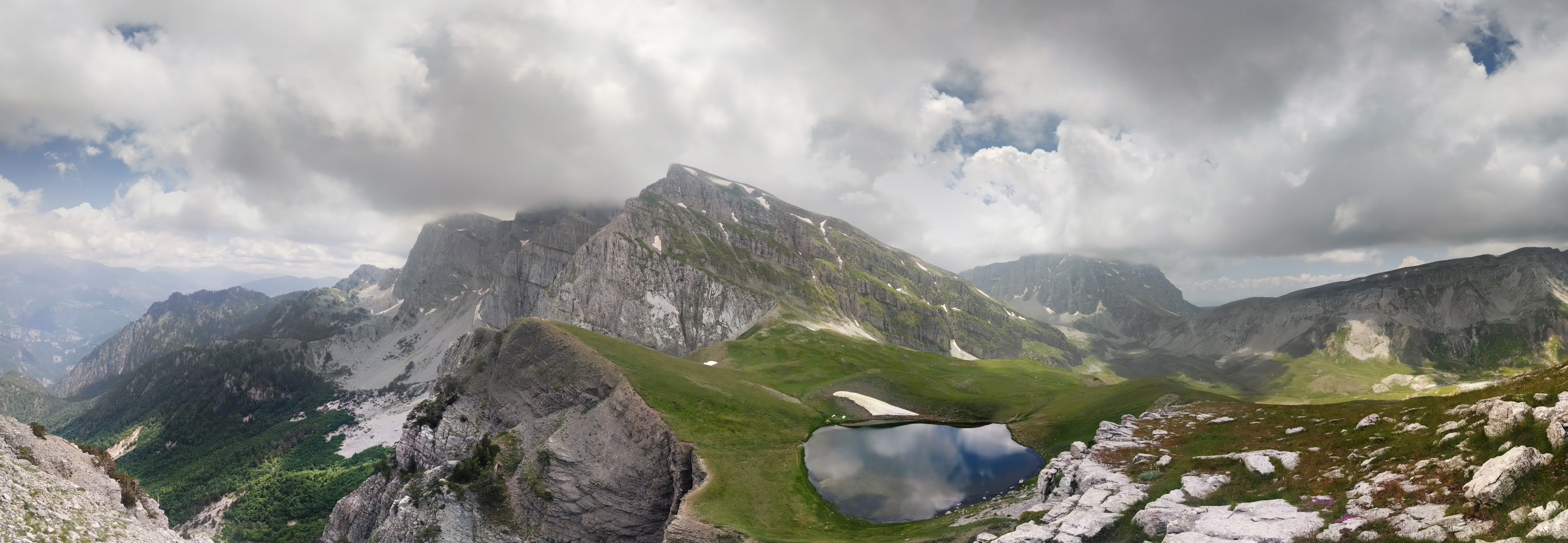
Tymphe (in Latin and English usage) or Tymfi (in the Greek government's preferred transliteration), Timfi, also Tymphi (, ) is a mountain in the northern Pindus mountain range, in northwestern Greece. It is part of the regional units of Greece, regional unit of Ioannina (regional unit), Ioannina and lies in the region of Zagori, just a few metres south of the 40° Parallel (latitude), parallel. Tymphe forms a massif with its highest peak, Gamila, at . The massif of Tymphe includes in its southern part the Vikos Gorge, while they both form part of the Vikos–Aoös National Park which accepts over 100,000 visitors per year. The former municipality of Tymfi (municipal unit), Tymfi owed its name to the mountain. Etymology The exact meaning of the name is not known but has been in use since ancient times. The name "Tymphe" or "Stymphe" is mentioned by ancient geographer Strabo, Book 7, Ch. 7, and is associated with the ancient land of Tymphaea and the Tymphaeans, one of the tribes o ... [...More Info...] [...Related Items...] OR: [Wikipedia] [Google] [Baidu] |
Vikos–Aoös National Park
The Vikos–Aoös National Park ( ''Ethnikós Drymós Víkou–Aóou'') is a national park in the region of Epirus (region), Epirus in northwestern Greece. The park, founded in 1973, is one of ten National parks of Greece, national parks in mainland Greece and is located north of the city of Ioannina, Greece, Ioannina in the northern part of the Pindus mountain range. It is named after the two major gorges of the area and encompasses of mountainous terrain, with numerous rivers, lakes, caves, deep canyons, dense coniferous and deciduous forest. The park is part of the Natura 2000 ecological network and one of UNESCO Geoparks and spans an elevation range from . Over 100,000 people visit the park each year and take part in activities including rafting, canoe-kayaking, hiking and mountain biking. The core of the park, an area of , comprises the spectacular Vikos Gorge, carved by the Voidomatis river. The gorge's main part is long, which attains a depth of , and has a width rangi ... [...More Info...] [...Related Items...] OR: [Wikipedia] [Google] [Baidu] |
Tymfi (municipal Unit)
Tymfi () is a former municipality in the Ioannina regional unit, Epirus, Greece. Since the 2011 local government reform it is part of the Zagori municipality. Population 847 (2021). The seat of the municipality was in Tsepelovo. It took its name from the Tymfi Tymphe (in Latin and English usage) or Tymfi (in the Greek government's preferred transliteration), Timfi, also Tymphi (, ) is a mountain in the northern Pindus mountain range, in northwestern Greece. It is part of the regional units of Greece, ... mountain. Subdivisions The municipal unit Tymfi is subdivided into the following communities: * Tsepelovo * Vradeto * Vrysochori * Iliochori * Kapesovo * Kipoi * Koukouli * Laista * Leptokarya * Negades * Skamneli * Fragkades References Zagori Populated places in Ioannina (regional unit) {{Epirus-geo-stub ... [...More Info...] [...Related Items...] OR: [Wikipedia] [Google] [Baidu] |
Zagori
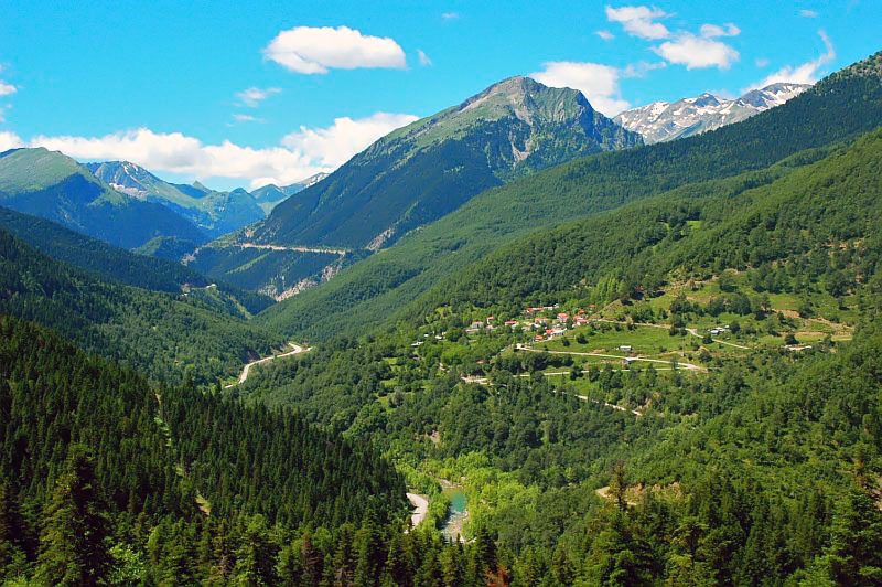
Zagori (; ), is a region, a municipality, and a designated UNESCO World Heritage Site, in the Pindus mountains in Epirus, in northwestern Greece. The seat of the municipality is the village Asprangeloi. It has an area of some and contains 46 villages known as Zagori villages (or Zagorochoria or Zagorohoria), and is in the shape of an upturned equilateral triangle. Ioannina, the provincial capital, is at the southern point of the triangle, while the south-western side is formed by Mount Mitsikeli (1,810m). The Aoos river running north of Mt Tymphe forms the northern boundary, while the south-eastern side runs along the Varda river to Mount Mavrovouni (2,100m) near Metsovo. The municipality has an area of 989.796 km2. The population of the area is about 3,400, which gives a population density of 3.4 inhabitants per square kilometer, very sparse when compared to an average of 73.8 for Greece as a whole. Geography Zagori is an area of great natural beauty, with striking ... [...More Info...] [...Related Items...] OR: [Wikipedia] [Google] [Baidu] |
Ioannina (regional Unit)
Ioannina () is one of the regional units of Greece, located in the northwestern part of the country. It is part of the region of Epirus (region), Epirus. Its capital is the city of Ioannina. It is the largest regional unit in Epirus, and one of the largest regional units of Greece, with a population of 160,773 people, according to the 2021 census. Geography Ioannina borders Albania in the north, and the regional units of Kastoria (regional unit), Kastoria in the northeast, Grevena (regional unit), Grevena and Trikala (regional unit), Trikala in the east, Arta (regional unit), Arta in the southeast, Preveza (regional unit), Preveza in the south and Thesprotia in the southwest and west. Ioannina is a mountainous region, dominated by the Pindus mountains, that cover the eastern part of the regional unit. The main subranges of the Pindus are from north to south: Gramos, Smolikas (2,637 m, the highest of the Pindus), Tymfi, Lygkos, Lakmos and Athamanika. The lower Xerovouni mountains ... [...More Info...] [...Related Items...] OR: [Wikipedia] [Google] [Baidu] |
Pindus
The Pindus (also Pindos or Pindhos; ; ; ) is a mountain range located in Northern Greece and Southern Albania. It is roughly long, with a maximum elevation of (Smolikas, Mount Smolikas). Because it runs along the border of Thessaly and Epirus, the Pindus range is known colloquially as the ''spine of Greece''. The mountain range stretches from near the Greek-Albanian border in southern Albania, entering the Epirus (region), Epirus and Macedonia (Greece), Macedonia regions in northern Greece down to the north of the Peloponnese. Geologically, it is an extension of the Dinaric Alps, which dominate the western region of the Balkans, Balkan Peninsula. History of the name Historically, the name Pindos refers to the mountainous territory that separates the greater Epirus region from the regions of Macedonia and Thessaly. According to John Tzetzes (a 12th-century Byzantine writer), the Pindos range was then called Metzovon. When translated (between 1682/83 and 1689) to a more co ... [...More Info...] [...Related Items...] OR: [Wikipedia] [Google] [Baidu] |
Voidomatis
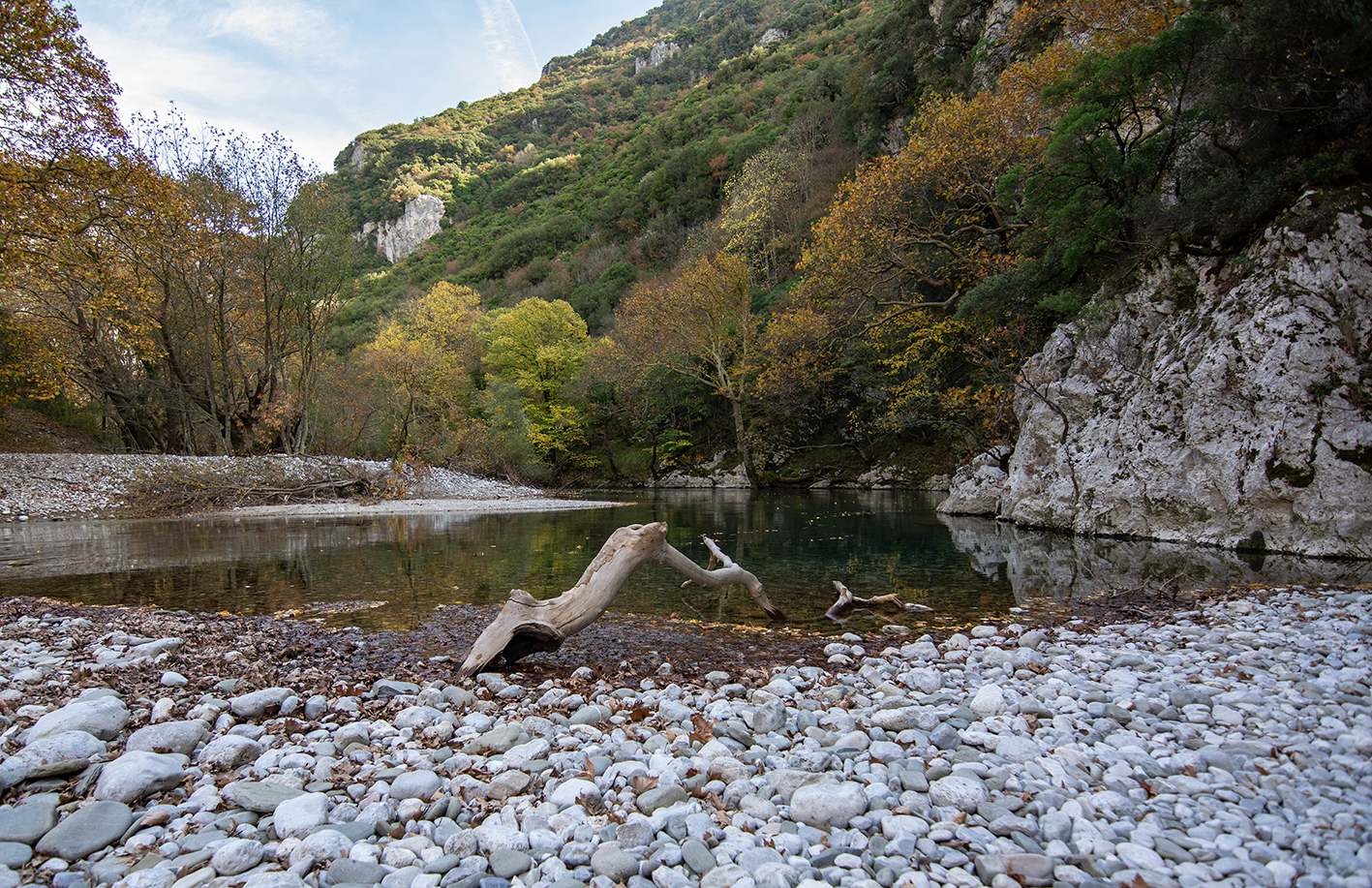
The Voidomatis () is a river in the Ioannina regional unit in northwestern Greece, and is a tributary of the Aoös river. General description The main current sources are located in the village of Vikos. Along its path it converges with other streams originating from the banks of Tymfi or the Vikos Gorge. It ends close to Konitsa. The river has a total length of 15 kilometres. The name Voidomatis (meaning "the eye of the ox"), derives from the fact that oxen have clear blue eyes, like the waters of this river. The Voidomatis has been characterized as one of the cleanest rivers in Europe as it does not face any environmental issues. It crosses one of the most beautiful natural locations in Greece and has been part of the Vikos–Aoös National Park since 1973. The river is spanned by a number of stone bridges, the most famous being the Kledonas Bridge. The river is known for water sports such as rafting and kayaking. Geomorphology The Voidomatis is mostly seasonal, with ... [...More Info...] [...Related Items...] OR: [Wikipedia] [Google] [Baidu] |
Aoos
The Vjosa (; indefinite form: ) or Aoös () is a river in northwestern Greece and southwestern Albania. Its total length is about , of which the first are in Greece, and the remaining in Albania. Its drainage basin is and its average discharge is . The main tributaries are Voidomatis, Sarantaporos, Drino and Shushicë. The river arises in the Pindus mountains of Epirus, Greece, and generally flows northwest. It enters Albania near Çarshovë, and empties into the Adriatic Sea just north of Vlorë. Generally wild and unpolluted, the river is surrounded by the Vikos–Aoös National Park in Greece, and the Vjosa-Narta Protected Landscape near its mouth. In December 2020, the Albanian portion of the river was designated a "Managed Nature Reserve" by the government. A campaign by the environmentalist groups to designate the whole Albanian part of the course a national park, to guard against the prospective hydroelectric projects, ultimately resulted in the creation of the V ... [...More Info...] [...Related Items...] OR: [Wikipedia] [Google] [Baidu] |
Mitsikeli
Mitsikeli () is a mountain range in the central part of the Pindus mountains, in Epirus, Greece. The mountain is located northeast of Ioannina and Lake Ioannina. Its highest elevation is . It stretches from near Kalpaki in the northwest to the eastern end of Lake Ioannina, a total length of . The northeastern slopes and the lower northwestern part of Mitsikeli are forested. The nearest mountains are the Tymfi to the north, the Lygkos to the northeast and the Lakmos to the east. It is drained by tributaries of the Thyamis to the northwest, towards Lake Ioannina to the southwest, by the Voidomatis (tributary of the Aoos) to the northeast and by the Arachthos to the southeast. Mitsikeli forms the southwestern border of the Zagori region. Villages in the mountains include Kato Pedina and Asprangeloi in the northwest, Dikorfo and Perivleptos in the central part, and Kryovrysi in the southeast. The Greek National Road 6 (Larissa - Trikala - Ioannina - Igoumenitsa) passes south ... [...More Info...] [...Related Items...] OR: [Wikipedia] [Google] [Baidu] |
Lygkos
Lyngos (), also transliterated as ''Lygos'', is a remote mountain range in the eastern Ioannina and the western Grevena regional unit in northwestern Greece. It is a part of the Pindus mountain range. Its highest point is the Avgo, at 2,177 m elevation. The Lyngos mountains lie in a horseshoe shape around the Valia Kalda (Βάλια Κάλντα) valley, which exits towards the Aoos valley to the west. The Valia Kalda is part of the Pindus-Valia Kalda National Park, founded in 1966. It is one of the coldest and wettest regions of Greece. The mountains are densely forested, with alpine meadows in the highest ... [...More Info...] [...Related Items...] OR: [Wikipedia] [Google] [Baidu] |
Smolikas
Mount Smolikas (; ) is a mountain in the Ioannina regional unit, northwestern Greece. At a height of 2,637 metres above sea level, it is the highest of the Pindus Mountains, and the second highest mountain in Greece after Mount Olympus. The mountain consists of ophiolite rocks. During several periods in the Pleistocene the northern and eastern cirques and valleys were glaciated. The last glaciers of this area retreated around 11,500 years ago. It is drained by the river Vjosa to the south, and the river Vourkopotamo (a tributary of the Sarantaporos) to the north. There is a small alpine lake called " Drakolimni Smolika" near the summit, at about 2,200 metres elevation. Nearby mountain ranges are Tymfi to the south, Gramos to the northwest, Vasilitsa to the southeast and Voio to the northeast. The higher elevations, above 2,000 metres, consist of grasslands and rocks, and there are deciduous and conifer forests at lower elevations. The mountain lies completely within the m ... [...More Info...] [...Related Items...] OR: [Wikipedia] [Google] [Baidu] |
Vikos Gorge
The Vikos Gorge or Vikos Canyon () is a gorge in the Pindus Mountains of northwestern Greece. It lies on the southern slopes of Mount Tymphe with a length of about 32 km, depth ranging from 120 to 1350 m, and a width ranging from 2500 m to only a few meters at its narrowest part. Vikos is listed as the world's "deepest relative to its width" gorge by the Guinness Book of Records among others. Etymology There are a number of views regarding the etymology of the name: *According to Ioannis Lambridis it derives from Slavic and means 'chasm' or 'gorge'. *According to Evangelos Bogas it derives from the Greek βίκος ' stamnos with ears', which denotes the shape of the gorge and the echoes caused by sounds within it. The word was recorded in the lexicon of Hesychius of Alexandria. *According to Konstantinos Amantos it derives from the Greek phytonym βικίον. *According to Konstantinos Oikonomou it derives from an Albanian word for bridge or wooden pass, ''vig-u'' ... [...More Info...] [...Related Items...] OR: [Wikipedia] [Google] [Baidu] |
Fold Mountain
Fold mountains are formed by the effects of folding on layers within the upper part of the Earth's crust. Before the development of the theory of plate tectonics and before the internal architecture of thrust belts became well understood, the term was used to describe most mountain belts but has otherwise fallen out of use. Formation Fold mountains form in areas of thrust tectonics, such as where two tectonic plates move towards each other at convergent plate boundary. When plates and the continents riding on them collide or undergo subduction (that is – ride one over another), the accumulated layers of rock may crumple and fold like a tablecloth that is pushed across a table, particularly if there is a mechanically weak layer such as salt. Since the less dense continental crust "floats" on the denser mantle rocks beneath, the weight of any crustal material forced upward to form hills, plateaus or mountains must be balanced by the buoyancy force of a much greater volume f ... [...More Info...] [...Related Items...] OR: [Wikipedia] [Google] [Baidu] |


