|
Tunulliarfik
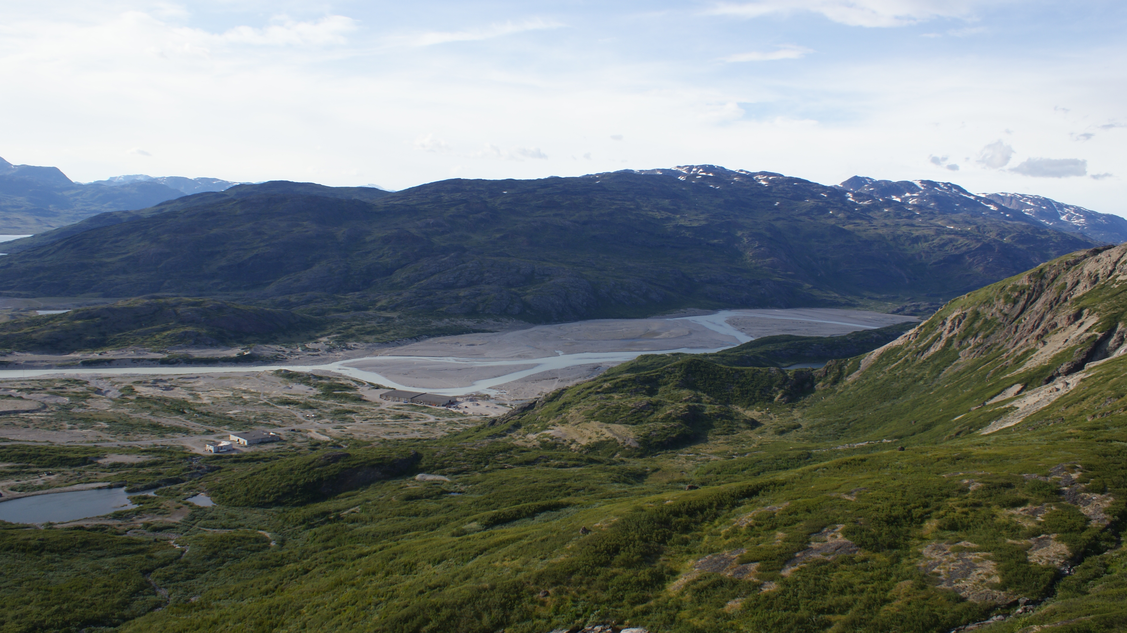
Tunulliarfik Fjord (old spelling: ''Tunugdliarfik'') is a fjord near Qaqortoq in the Kujalleq municipality in southern Greenland. It is the inner section of Skovfjord (Skovfjorden). In times of the Norse settlement in southern Greenland, it was known as ''Eiriksfjord''. Geography The fjord head at approximately is formed by the estuary of a river flowing from the glacial outflow lake in Johan Dahl Land. At approximately , south of the Narsarsuaq settlement, the fjord is joined by its tributary Qooroq Fjord from the northeast, changing direction from southern into southwestern. Bounded by long peninsulas and low-lying islands from the southeast and the northwest, it has its mouth in the Skovfjord which empties in Labrador Sea at approximately .Ivittuut/Narsarsuaq/Qaqortoq, Saga Map, Tage Schjøtt, 1992 The Narsaq Sound, between the peninsula forming the northern shore of Tunulliarfik Fjord and Tuttutooq and Illutaliq islands, connects with neighbouring Bredefjord and Nord ... [...More Info...] [...Related Items...] OR: [Wikipedia] [Google] [Baidu] |
Qassiarsuk
Qassiarsuk is a settlement in the Kujalleq municipality, in southern Greenland. Its population was 39 in 2020. Qassiarsuk is part of the Kujataa World Heritage Site, due to its historical importance as the homestead of Erik the Red and its unique testimony to Greenlandic farming. History Brattahlíð is located by Tunulliarfik Fjord (''Skovfjorden'' in Danish), and it was the site of Erik the Red's estate in the times of the Norse Eastern Settlement (''Østerbygden'' in Danish). Ruins of several of the buildings, including living quarters, outhouses, and a church, are still clearly visible. The current village was founded as Greenland's first sheep farm in 1924 and is located in the same place. Until December 31, 2008, the settlement was part of Narsaq Municipality in the Kitaa amt. On January 1, 2009, Qassiarsuk became part of Kujalleq municipality, when the Kitaa amt, as well as the municipalities of Narsaq, Qaqortoq, and Nanortalik ceased to exist as administrative entitie ... [...More Info...] [...Related Items...] OR: [Wikipedia] [Google] [Baidu] |
Narsarsuaq
Narsarsuaq (lit. ''Great Plan'';''Facts and History of Narsarsuaq'', Narsarsuad Tourist Information old spelling: ''Narssarssuaq'') is a settlement in the Kujalleq municipality in southern Greenland. It had 123 inhabitants in 2020. There is a thriving tourism industry in and around Narsarsuaq, whose attractions include a great diversity of wildlife, gemstones, tours to glaciers, and an airfield museum. History Narsarsuaq is located within the Eastern Settlement of the Greenlandic Norse; the Brattahlíð farm of Erik the Red established in 985 was located on the opposite bank of Tunulliarfik Fjord, where the modern settlement of Qassiarsuk is situated. In 1941 the United States built an air base at Narsarsuaq code-named Bluie West One (BW1). (''Bluie'' was the Allied military code name for Greenland.) Thousands of planes used BW1 as a stepping stone on their way from the aircraft factories in North America to the battlegrounds of Europe. A 600-bed hospital was built in order ... [...More Info...] [...Related Items...] OR: [Wikipedia] [Google] [Baidu] |
Narsaq
Narsaq is a town in the Kujalleq municipality in southern Greenland. The name ''Narsaq'' is Kalaallisut for "Plain", referring to the shore of Tunulliarfik Fjord where the town is located. History People have lived in the area for thousands of years, but not continuously. Remains of the Norse settlement can be found in the area. The church ruins of Dyrnæs can be found on the north-western outskirts of the town. The Landnám homestead, ''Landnamsgaarden'', can be found immediately to the west of the town. Dated to the year 1000, the homestead is among the oldest of the Norse ruins in the area. Excavation of the ruins began in 1953 with the discovery of the Narsaq stick, the first Viking Age runic inscription discovered in Greenland. The wider Narsaq area has some of the most striking Norse artefacts and ruins. Erik the Red's Brattahlid is located in present-day Qassiarsuk, and the Gardar bishop seat is in present-day Igaliku. Present day Narsaq was founded as Nordprøve ... [...More Info...] [...Related Items...] OR: [Wikipedia] [Google] [Baidu] |
Narsarsuaq Airport
Narsarsuaq Airport ( kl, Mittarfik Narsarsuaq) is an airport located in Narsarsuaq, a settlement in the Kujalleq municipality in southern Greenland. Along with Kangerlussuaq Airport, it is one of two airports in Greenland capable of serving large airliners. It is also the only international airport in southern Greenland. The settlement it serves is small, with the airport primarily functioning as a transfer point for passengers heading for the helicopter hubs of Air Greenland in Qaqortoq and Nanortalik. The airport is to be closed in 2025 when Qaqortoq Airport is scheduled to open. History World War II The airfield at Narsarsuaq was first built by the United States Department of War (now the Department of Defense) as an army airbase, its construction beginning in July 1941 and the first aircraft landing in January 1942. During World War II the airbase−codenamed '' Bluie West One''−hosted squadrons of PBY Catalina flying boats and B-25 Mitchell bombers with the assignment ... [...More Info...] [...Related Items...] OR: [Wikipedia] [Google] [Baidu] |
Arctic Umiaq Line
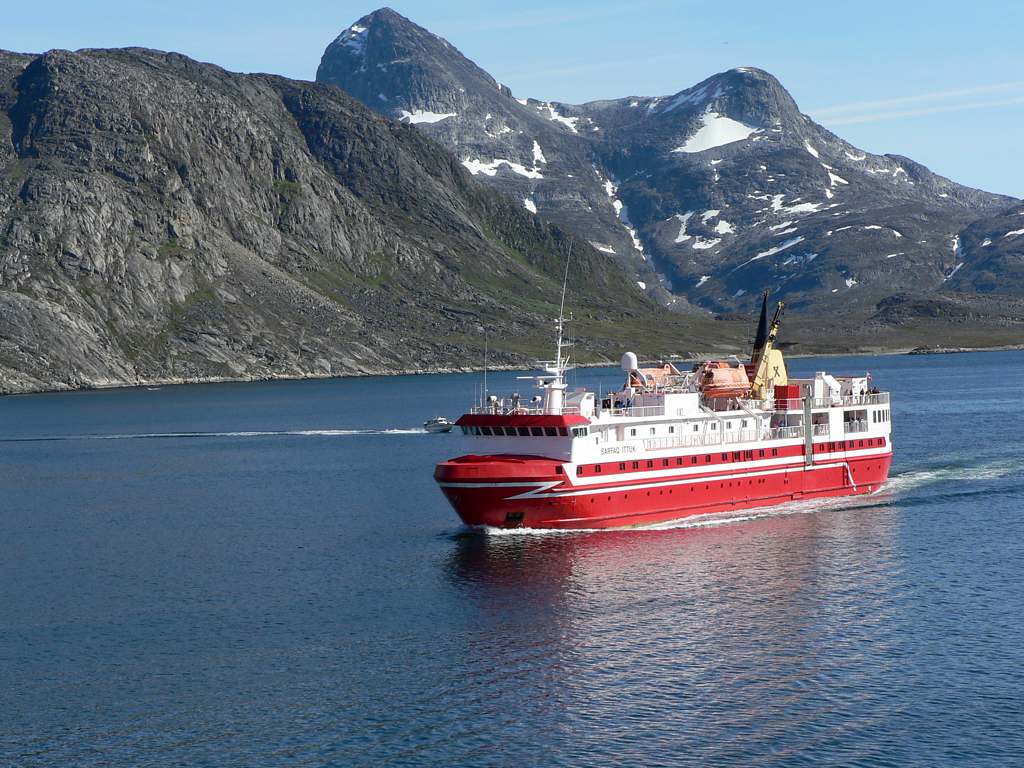
Arctic Umiaq Line A/S (AUL) or Arctic Umiaq is a passenger and freight shipping line in Greenland. Its name derives from the Kalaallisut word for the traditional Inuit passenger boat, the umiak, distinguished from the kayak, used for hunting. The sea connection provided by Arctic Umiaq is a lifeline for the entire western and southwestern Greenland. It is a wholly owned subsidiary of the Royal Arctic Line. History Arctic Umiaq Line was founded in 2006. Like many Greenlandic companies, it can trace its operations to former divisions of the Royal Greenland Trade Department before its 1986 handover to the Greenland Home Rule Government. Since 2007, Arctic Umiaq Line has been operating at a deficit, with the CEO Søren Grønhøj Andersen sued for mismanagement. The company carried fewer passengers for the first nine months of 2009 than in the comparable period of the previous year. The Greenland Home Rule Government has continued to provide loss guarantees to the joint owners. ... [...More Info...] [...Related Items...] OR: [Wikipedia] [Google] [Baidu] |
Igaliku
Igaliku is a settlement in the Kujalleq municipality in southern Greenland. The town was founded as Igaliko in 1783 by the trader and colonial administrator Anders Olsen and Greenlandic wife Tuperna. In 2020, Igaliku had 21 inhabitants. The nearby Norse ruins of Garðar and the farms surrounding the town were inscribed on the UNESCO World Heritage List in 2017 as part of the Kujataa Greenland: Norse and Inuit Farming at the Edge of the Ice Cap site. Geography Igaliku is located southeast of Narsarsuaq, on a peninsula jutting off the mainland of Greenland near the eastern shore of upper Tunulliarfik Fjord.Ivittuut/Narsarsuaq/Qaqortoq, Saga Map, Tage Schjøtt, 1992 Access to Igaliku from Narsarsauq is cheaper and easier by landing at the small harbor of Itilleq and then crossing the isthmus 4 km (2.5 mi). Landmarks and sights Igaliku is best known for the ruins of Garðar, once the religious heart of 12th-century Norse Greenland. The area was at the ver ... [...More Info...] [...Related Items...] OR: [Wikipedia] [Google] [Baidu] |
Nordre Sermilik
Ikersuaq, old spelling ''Ikerssuak'', ( da, Bredefjord) is a fjord in southwestern Greenland. Administratively it is part of the Kujalleq municipality. Geography The Ikersuaq fjord is oriented in a roughly NE/SW direction and to the southwest its mouth opens into the Julianehab Bay, Labrador Sea, North Atlantic Ocean. There is a vast ice field on the northwestern side of the fjord, where there are three branches, Qaleragdlit Imâ, Kangerlua and Kangerluarsuk. The Northern Sermilik (Nordre Sermilik) fjord is the inner section of Ikersuaq fjord. On its southern side the 1,440 m high Ilimaussaq peak rises in the peninsula to the east of the fjord. Northern Sermilik has two branches in the north with large glaciers at their heads. Elongated Tuttutooq Island is a prolongation of the southwestern end of the peninsula forming the southern shore of Northern Sermilik. The Narsaq Sound separates the peninsula from the island on the southern shore, connecting with neighbouring Tunu ... [...More Info...] [...Related Items...] OR: [Wikipedia] [Google] [Baidu] |
List Of Fjords Of Greenland
This is a list of the most important fjords of Greenland:In Northern Greenland, a large area made up entirely of fjords; therefore Peary Land above not a fjord but a fjord area.In Northeastern Greenland, a large area made up entirely of fjords; therefore is the Scoresby Sund above not a fjord but a fjord area. Fjords * Alanngorsuaq Fjord * Aleqatsiaq Fjord * Alluitsup Kangerlua (Lichtenau Fjord) * Ameralik Fjord * Amerloq Fjord * Ammassalik Fjord * Ananap Kangertiva Kiateq * Anaanap Kangertiva Oqqorseq (Depot Fjord) * Anorituup Kangerlua ** Kangikitsua * Attertia * Ardencaple Fjord **Bredefjord ** Smallefjord * Arfersiorfik Fjord * Avaqqat Kangerluat ** Puiattoq ** Qassialik * Bernstorff Fjord * Bessel Fjord * Bessel Fjord, NW Greenland * Bowdoin Fjord * Carlsberg Fjord (Kangerterajitta Itterterilaa) * Cass Fjord * Danmark Fjord * De Dodes Fjord * Deichmann Fjord * Dijmphna Sound ** Hekla Sound * Eqalugaarsuit Fjord * Fleming Fjord * Foulk Fjord ... [...More Info...] [...Related Items...] OR: [Wikipedia] [Google] [Baidu] |
Eastern Settlement
The Eastern Settlement ( non, Eystribygð ) was the first and by far the larger of the two main areas of Norse Greenland, settled by Norsemen from Iceland. At its peak, it contained approximately 4,000 inhabitants. The last written record from the Eastern Settlement is of a wedding in Hvalsey in 1408, placing it about 50–100 years later than the end of the more northerly Western Settlement. Despite its name, the Eastern Settlement was more south than east of its companion and, like the Western Settlement, was located on the southwestern tip of Greenland at the head of long fjords such as Tunulliarfik Fjord or Eiriksfjord, Igaliku or Einarsfjord, and Sermilik Fjord. Approximately 500 groups of ruins of Norse farms are found in the area, with 16 church ruins, including Brattahlíð, Dyrnæs, Garðar, Hvalsey and Herjolfsnes. The Vatnahverfi district to the southeast of Einarsfjord had some of the best pastoral land in the colony, and boasted 10% of all the known farm si ... [...More Info...] [...Related Items...] OR: [Wikipedia] [Google] [Baidu] |
Johan Dahl Land
Johan * Johan (given name) * ''Johan'' (film), a 1921 Swedish film directed by Mauritz Stiller * Johan (band), a Dutch pop-group ** ''Johan'' (album), a 1996 album by the group * Johan Peninsula, Ellesmere Island, Nunavut, Canada * Jo-Han, a manufacturer of plastic scale model kits See also * John (name) {{disambiguation ... [...More Info...] [...Related Items...] OR: [Wikipedia] [Google] [Baidu] |
Fjord
In physical geography, a fjord or fiord () is a long, narrow inlet with steep sides or cliffs, created by a glacier. Fjords exist on the coasts of Alaska, Antarctica, British Columbia, Chile, Denmark, Germany, Greenland, the Faroe Islands, Iceland, Ireland, Kamchatka, the Kerguelen Islands, Labrador, Newfoundland, New Zealand, Norway, Novaya Zemlya, Nunavut, Quebec, the Patagonia region of Argentina and Chile, Russia, South Georgia Island, Tasmania, United Kingdom, and Washington state. Norway's coastline is estimated to be long with its nearly 1,200 fjords, but only long excluding the fjords. Formation A true fjord is formed when a glacier cuts a U-shaped valley by ice segregation and abrasion of the surrounding bedrock. According to the standard model, glaciers formed in pre-glacial valleys with a gently sloping valley floor. The work of the glacier then left an overdeepened U-shaped valley that ends abruptly at a valley or trough end. Such valleys are fjords when ... [...More Info...] [...Related Items...] OR: [Wikipedia] [Google] [Baidu] |


.jpg)