|
Traçadal Biological Reserve
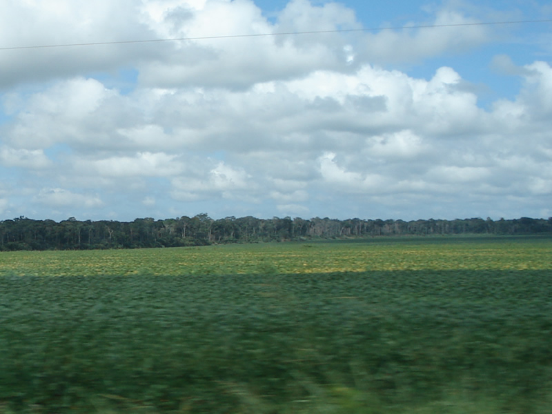
The Traçadal Biological Reserve () is a Biological reserve (Brazil), biological reserve in the state of Rondônia, Brazil. Location The Traçadal Biological Reserve has an area of . It is in the municipality of Guajará-Mirim in the state of Rondônia. In 1999 there were two families with 7 people on the Novo River (Rondônia), Novo River, the northern boundary of the reserve. It is bounded to the west by the Pacaás-Novas Indigenous Territory, which in turn is bounded to the west by the Mamoré River, the boundary with Bolivia. The Serra da Cutia National Park is about to the south. The reserve is drained by tributaries of the Pacaás Novos River. It is in the Amazon biome, and is covered entirely in open rainforest. It is in the centre-west Brazilian pediplain, with altitudes around above sea level. Conservation The Traçadal Biological Reserve was created by decree 4.583 on 28 March 1990. The reserve was created in a special army use area, and is administered by the SEDAM ... [...More Info...] [...Related Items...] OR: [Wikipedia] [Google] [Baidu] |
Guajará-Mirim
Guajará-Mirim is a municipality in the Brazilian state of Rondônia. It is located at an altitude of 128 meters. Its population was 46,556 (2020) and its area is 24,856 km². Geography Location Guajará-Mirim lies along the Mamoré River, just across the Bolivian border town of Guayaramerín. It was once the southern terminus of the Estrada de Ferro Madeira-Mamoré (the Madeira-Mamoré Railway), which was inaugurated in 1912. It is the seat of the Roman Catholic Diocese of Guajará-Mirim. Conservation The municipality contains the Traçadal Biological Reserve, a strictly protected area that was created in 1990. It contains 2.33% of the Guajará-Mirim State Park, created in 1990. It contains the Rio Ouro Preto Biological Reserve, created in 1990. It contains 73.45% of the Rio Ouro Preto Extractive Reserve, also created in 1990. The municipality contains 47.5% of the Rio Cautário State Extractive Reserve, created in 1995. It contains the Rio Cautário Federa ... [...More Info...] [...Related Items...] OR: [Wikipedia] [Google] [Baidu] |
Biological Reserve (Brazil)
A biological reserve (, Rebio) in Brazil Brazil, officially the Federative Republic of Brazil, is the largest country in South America. It is the world's List of countries and dependencies by area, fifth-largest country by area and the List of countries and dependencies by population ... is a legally defined type of protected area of Brazil, a conservation unit that aims for full preservation of biota and other natural attributes without human interference. It may be visited only with prior approval of the responsible agency, and only for research or educational purposes. Definition A "Biological reserve" in Brazil is one of the Integral Protection Units defined by Article 13 of Law No. 9,985 of 18 July 2000, National System of Nature Conservation Units (SNUC). The biological reserve is public property. When it is established any private lands within its limits are expropriated. The manager of the biological reserve must prepare a management plan for approval by the respons ... [...More Info...] [...Related Items...] OR: [Wikipedia] [Google] [Baidu] |
Rondônia
Rondônia () is one of the 26 states of Brazil, located in the northern subdivision of the country (central-western part). It is bordered by Acre (state), Acre in the west, Amazonas, Brazil, Amazonas in the north, Mato Grosso in the east, and Bolivia in the south. Rondônia has a population of 1,815,000 as of 2021. It is the fifth least populated state. Its capital and largest city is Porto Velho, bathed by the Madeira River. The state was named after Cândido Rondon, who explored the north of the country during the 1910s. The state, which is home to c. 0.7% of the Brazilian population, is responsible for c. 0.3% of the Brazilian GDP. The state has 52 municipalities and occupies an area of 237,590.547 Square kilometre, km2, equivalent to the territory of Romania and almost five times larger than Croatia. In addition to this, there are other important cities such as Ariquemes, Cacoal, Guajará-Mirim, Ji-Paraná, Rolim de Moura and Vilhena. Geography Rondonia used to be home to ... [...More Info...] [...Related Items...] OR: [Wikipedia] [Google] [Baidu] |
Novo River (Rondônia)
The Novo River is a river of Rondônia state in western Brazil, a tributary of the Pacaás Novos River. The river forms the northern boundary of the Traçadal Biological Reserve, a strictly protected area that was created in 1990. See also *List of rivers of Rondônia List of rivers in Rondônia (States of Brazil, Brazilian State). The list is arranged by drainage basin, with respective tributaries indented under each larger stream's name and ordered from downstream to upstream. Rondônia is located entirely w ... References Brazilian Ministry of Transport Rivers of Rondônia {{Rondônia-river-stub ... [...More Info...] [...Related Items...] OR: [Wikipedia] [Google] [Baidu] |
Mamoré River
The Mamoré is a large river in Brazil and Bolivia which unites with the Madre de Dios River to form the Madeira, one of the largest tributaries of the Amazon. It rises on the northern slope of the Sierra de Cochabamba, east of the city of Cochabamba, and is known as the Chimoré down to its junction with the Chapare. Its larger tributaries are the Chapare, Secure, Apere, and Yacuma from the west, and the Ichilo, Guapay, Ivari, Manique and Guapore from the east. Taking into account its length only, the Guapay should be considered the upper part of the Mamore; but it is shallow and obstructed, and carries a much smaller volume of water. The Guapore also rivals the Mamore in length and volume, having its source in the Parecis plateau, Mato Grosso, Brazil, a few miles from streams flowing north-ward to the Tapajos and Amazon, and southward to the Paraguay and Paraná rivers. The Mamore is interrupted by rapids a few miles above its junction with the Beni, but a railway 300 ... [...More Info...] [...Related Items...] OR: [Wikipedia] [Google] [Baidu] |
Bolivia
Bolivia, officially the Plurinational State of Bolivia, is a landlocked country located in central South America. The country features diverse geography, including vast Amazonian plains, tropical lowlands, mountains, the Gran Chaco Province, warm valleys, high-altitude Andean plateaus, and snow-capped peaks, encompassing a wide range of climates and biomes across its regions and cities. It includes part of the Pantanal, the largest tropical wetland in the world, along its eastern border. It is bordered by Brazil to the Bolivia-Brazil border, north and east, Paraguay to the southeast, Argentina to the Argentina-Bolivia border, south, Chile to the Bolivia–Chile border, southwest, and Peru to the west. The seat of government is La Paz, which contains the executive, legislative, and electoral branches of government, while the constitutional capital is Sucre, the seat of the judiciary. The largest city and principal industrial center is Santa Cruz de la Sierra, located on the Geog ... [...More Info...] [...Related Items...] OR: [Wikipedia] [Google] [Baidu] |
Serra Da Cutia National Park
Serra da Cutia National Park () is a national park in the state of Rondônia, Brazil. Location The park is in the Amazon biome and covers . It was created on 1 August 2001 and is administered by the Chico Mendes Institute for Biodiversity Conservation. It covers parts of the municipalities of Costa Marques and Guajará-Mirim in the state of Rondônia. Average annual rainfall is . Temperatures range from with an average of . Altitudes range from above sea level. Fauna There are 250 species of birds, 24 species of lizard, 14 species of snakes, two species of alligator, 41 species of amphibians and 143 fish species. The catfish Pimelodella is endemic. Medium and large mammals include giant anteater (Myrmecophaga tridactyla), brown-mantled tamarin (Saguinus fuscicollis), Peruvian spider monkey (Ateles chamek), tufted capuchin (Sapajus apella), bare-eared squirrel monkey (Saimiri ustus), Venezuelan red howler (Alouatta seniculus), brown titi (Callicebus brunneus), Rio Tapajós sak ... [...More Info...] [...Related Items...] OR: [Wikipedia] [Google] [Baidu] |
Pacaás Novos River
The Pacaás Novos River () is a river of Rondônia state in western Brazil. It is a tributary of the Mamoré River, which it joins from the right just above Guajará-Mirim. The Pacaás Novos River rises in the mountains in the west of the Pacaás Novos National Park and flows west from there through the Rio Pacaás Novos Extractive Reserve. The Ouro Preto River, a right tributary that flows from the east through the Rio Ouro Preto Extractive Reserve, joins the Pacaás Novos River on the west boundary of the reserve, which is defined by this section of the Pacaás Novos. See also *List of rivers of Rondônia List of rivers in Rondônia (States of Brazil, Brazilian State). The list is arranged by drainage basin, with respective tributaries indented under each larger stream's name and ordered from downstream to upstream. Rondônia is located entirely w ... References Sources * * Rivers of Rondônia {{Rondônia-river-stub ... [...More Info...] [...Related Items...] OR: [Wikipedia] [Google] [Baidu] |
Amazon Biome
The Amazon biome () contains the Amazon rainforest, an area of tropical rainforest, and other ecoregions that cover most of the Amazon basin and some adjacent areas to the north and east. The biome contains blackwater river, blackwater and whitewater river (river type), whitewater flooded forest, lowland and montane terra firma forest, bamboo and palm forest, savanna, sandy heath and alpine tundra. Some areas of the biome are threatened by deforestation for timber and to make way for pasture or soybean plantations. Location The Amazon biome has an area of . The biome roughly corresponds to the Amazon basin, but excludes areas of the Andes to the west and cerrado (savannah) to the south, and includes lands to the northeast extending to the Atlantic ocean with similar vegetation to the Amazon basin. J. J. Morrone (2006) defines the Amazonian subregion in this broader sense, divided into the Biogeography, biogeographical provinces of Guyana, Humid Guyana, Napo, Imeri, Roraima, Amapá ... [...More Info...] [...Related Items...] OR: [Wikipedia] [Google] [Baidu] |
Pediplain
In geology and geomorphology a pediplain (from the Latin ''pes'', genitive case ''pedis'', meaning "foot") is an extensive plain formed by the coalescence of pediment (geology), pediments. The processes through which pediplains forms is known as pediplanation. The concepts of pediplain and pediplanation were first developed by geologist Lester Charles King in his 1942 book ''South African Scenery''. The concept gained notoriety as it was juxtaposed to peneplain, peneplanation. The coalesced pediments of the pediplains may form a series of very gentle concave slopes. Pediplains main difference to William Morris Davis, W. M. Davis’ peneplains is in the history and processes behind, and less so in the final shape. Perhaps the most notable difference in form that may be present is that of residual hills which in Davis’ peneplains are to have gentle slopes while in pediplains they ought to have the same steepness as the slopes in the early stages of erosion leading to pediplanati ... [...More Info...] [...Related Items...] OR: [Wikipedia] [Google] [Baidu] |
1990 Establishments In Brazil
Year 199 ( CXCIX) was a common year starting on Monday of the Julian calendar. At the time, it was sometimes known as year 952 ''Ab urbe condita''. The denomination 199 for this year has been used since the early medieval period, when the Anno Domini calendar era became the prevalent method in Europe for naming years. Events By place Roman Empire * Mesopotamia is partitioned into two Roman provinces divided by the Euphrates, Mesopotamia and Osroene. * Emperor Septimius Severus lays siege to the city-state Hatra in Central-Mesopotamia, but fails to capture the city despite breaching the walls. * Two new legions, I Parthica and III Parthica, are formed as a permanent garrison. China * Battle of Yijing: Chinese warlord Yuan Shao defeats Gongsun Zan. Korea * Geodeung succeeds Suro of Geumgwan Gaya, as king of the Korean kingdom of Gaya (traditional date). By topic Religion * Pope Zephyrinus succeeds Pope Victor I, as the 15th pope. Births Valerian Roman ... [...More Info...] [...Related Items...] OR: [Wikipedia] [Google] [Baidu] |


