|
Tong, West Yorkshire
Tong or Tong Village is a village and former civil parish in the City of Bradford metropolitan district, West Yorkshire, England. It is a historic village, and gives its name to the larger electoral ward of Tong. History Evidence of early activity within the Tong area is sparse, an undated flint found within the grounds of Tong Hall represents the prehistoric period. Later artefacts within the general area include a Roman pre-Flavian coin (i.e. before 69 AD) and two coins dating to the second and third centuries found in the vicinity of Westgate Hill. The village was an integral part of the Tempest estate, comprising workers' cottages, farmsteads and ancillary buildings. By 1725 a linear settlement extended eastwards from the chapel, towards Keepers Lane and Hill Green. Dwellings were mainly located to the front of Tong Lane with barns or outbuildings to the rear. It is believed settlement may have initially comprised two focal points, near the church and at Hill Green. R ... [...More Info...] [...Related Items...] OR: [Wikipedia] [Google] [Baidu] |
City Of Bradford
Bradford (), also known as the City of Bradford, is a metropolitan borough in West Yorkshire, England. It is named after its largest settlement, Bradford, but covers a larger area which includes the towns and villages of Keighley, Shipley, West Yorkshire, Shipley, Bingley, Ilkley, Haworth, Silsden, Queensbury, West Yorkshire, Queensbury, Thornton, West Yorkshire, Thornton and Denholme. Bradford has a population of 528,155, making it the List of English districts by population, fourth-most populous metropolitan district and the ninth-most populous local authority district in England. It forms part of the West Yorkshire Urban Area conurbation which in 2011 had a population of 1,777,934, and the city is part of the Leeds-Bradford Larger Urban Zone (LUZ), which, with a population of 2,393,300, is the fourth largest in the United Kingdom after London, Birmingham and Manchester. The city is situated on the edge of the Pennines, and is bounded to the east by the City of Leeds, the sou ... [...More Info...] [...Related Items...] OR: [Wikipedia] [Google] [Baidu] |
River Fork
A river fork is where a river is connected to two or more clearly and equally distinct branches. It describes both tributaries and distributaries. A typical river fork is usually two tributaries merging (a confluence), such as the Nile proper created at that of the Blue Nile and White Nile, though the term can be used when a single or main channel of a river bifurcates into distributaries, a large instance being the Mississippi at the upper end of the Atchafalaya River. Most river deltas fork several times, occasionally forming multiple clustered, elongated islands. See also * River morphology ** Tributary ** River delta ** Braided river A braided river (also called braided channel or braided stream) consists of a network of river channel (geography), channels separated by small, often temporary, islands called ''braid bars'' or, in British English usage, ''aits'' or ''eyots''. ... - a braiding describes its multiple forks References River morphology {{topogra ... [...More Info...] [...Related Items...] OR: [Wikipedia] [Google] [Baidu] |
Bradford
Bradford is a city status in the United Kingdom, city in West Yorkshire, England. It became a municipal borough in 1847, received a city charter in 1897 and, since the Local Government Act 1972, 1974 reform, the city status in the United Kingdom, city status has belonged to the larger City of Bradford metropolitan borough. It had a population of 349,561 at the 2011 Census for England and Wales, 2011 census, making it the second-largest subdivision of the West Yorkshire Built-up Area after Leeds, which is approximately to the east. The borough had a population of , making it the List of English districts by population, most populous district in England. Historic counties of England, Historically part of the West Riding of Yorkshire, the city grew in the 19th century as an international centre of Textile manufacture during the Industrial Revolution, textile manufacture, particularly wool. It was a boomtown of the Industrial Revolution, and amongst the earliest Industrialisation, ... [...More Info...] [...Related Items...] OR: [Wikipedia] [Google] [Baidu] |
County Borough Of Bradford
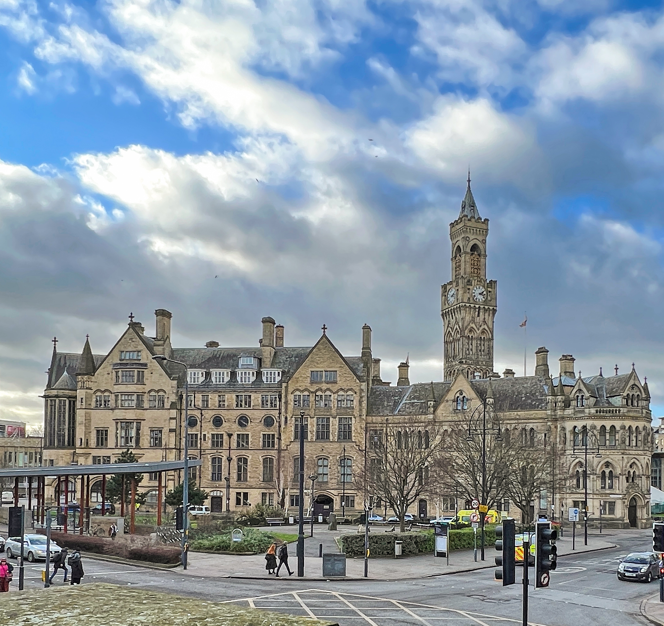
The County Borough of Bradford was a local government district with city status in the West Riding of Yorkshire, England, from 1847 to 1974. Bradford became a municipal borough in 1847, and a county borough in 1888, making it administratively independent of the West Riding County Council. It was honoured with city status on the occasion of Queen Victoria's Diamond Jubilee in 1897, with Kingston upon Hull and Nottingham. The three had been the largest county boroughs outside the London area without city status. The borough's boundaries were extended to absorb Clayton in 1930, and parts of Rawdon, Shipley, Wharfedale and Yeadon urban districts in 1937. Bradford City Hall was opened on 9 September 1873 as the seat of local government. The Venetian Gothic sandstone building was designed by local architects Lockwood and Mawson and is Grade I listed. The borough was abolished under the Local Government Act 1972, and created the centre of the new Metropolitan Borough of Bra ... [...More Info...] [...Related Items...] OR: [Wikipedia] [Google] [Baidu] |
Local Government Act 1894
The Local Government Act 1894 ( 56 & 57 Vict. c. 73) was an act of the Parliament of the United Kingdom that reformed local government in England and Wales outside the County of London. The act followed the reforms carried out at county level under the Local Government Act 1888 ( 51 & 52 Vict. c. 41). The 1894 legislation introduced elected councils at district and parish level. The principal effects of the act were: *The creation a system of urban and rural districts with elected councils. These, along with the town councils of municipal boroughs created earlier in the century, formed a second tier of local government below the existing county councils. *The establishment of elected parish councils in rural areas. *The reform of the boards of guardians of poor law unions. *The entitlement of women who owned property to vote in local elections, become poor law guardians, and act on school boards. The new district councils were based on the existing urban and rural s ... [...More Info...] [...Related Items...] OR: [Wikipedia] [Google] [Baidu] |
Urban District (England And Wales)
In England and Wales, an urban district was a type of local government district that covered an urbanised area. Urban districts had an elected urban district council (UDC), which shared local government responsibilities with a county council. In England and Wales, urban districts and rural districts were created in 1894 by the Local Government Act 1894 ( 56 & 57 Vict. c. 73) as subdivisions of administrative counties. A similar model of urban and rural districts was also established in Ireland in 1899, which continued separately in Northern Ireland and the Republic of Ireland after 1921. They replaced the earlier system of urban and rural sanitary districts (based on poor law unions) whose functions were taken over by the district councils. The district councils also had wider powers over local matters such as parks, cemeteries and local planning. An urban district usually contained a single parish, while a rural district might contain many. Urban districts were conside ... [...More Info...] [...Related Items...] OR: [Wikipedia] [Google] [Baidu] |
Local Board Of Health
A local board of health (or simply a ''local board'') was a local authority in urban areas of England and Wales from 1848 to 1894. They were formed in response to cholera epidemics and were given powers to control sewers, clean the streets, regulate environmental health risks including slaughterhouses and ensure the proper supply of water to their districts. Local boards were eventually merged with the corporations of municipal boroughs in 1873, or became urban district (Great Britain and Ireland), urban districts in 1894. Pre-Public Health Act 1848 Public Health Act 1848 The first local boards were created under the Public Health Act 1848 (11 & 12 Vict. c. 63), also known as the Health of Towns Act 1848. The aim of the act was to improve the sanitary condition of towns and populous places in England and Wales by placing: the supply of water; sewerage; drainage; cleansing; paving, and environmental health regulation under a single local body. The act could be applied to any pla ... [...More Info...] [...Related Items...] OR: [Wikipedia] [Google] [Baidu] |
A Vision Of Britain Through Time
The Great Britain Historical GIS (or GBHGIS) is a spatially enabled database that documents and visualises the changing human geography of the British Isles, although is primarily focussed on the subdivisions of the United Kingdom mainly over the 200 years since the first census in 1801. The project is currently based at the University of Portsmouth, and is the provider of the website ''A Vision of Britain through Time''. NB: A "GIS" is a geographic information system, which combines map information with statistical data to produce a visual picture of the iterations or popularity of a particular set of statistics, overlaid on a map of the geographic area of interest. Original GB Historical GIS (1994–99) The first version of the GB Historical GIS was developed at Queen Mary, University of London between 1994 and 1999, although it was originally conceived simply as a mapping extension to the existing Labour Markets Database (LMDB). The system included digital boundaries for ... [...More Info...] [...Related Items...] OR: [Wikipedia] [Google] [Baidu] |
Birstall, West Yorkshire
Birstall is a Market town, market and mill town in the metropolitan borough of Kirklees, West Yorkshire, England. It is part of the Birstall and Birkenshaw ward, which had a population of 16,298 at the 2011 census. Historic counties of England, Historically in the West Riding of Yorkshire, and part of the Heavy Woollen District, Birstall is approximately south-west of Leeds and situated close to the M62 motorway. The town is situated between Leeds, Bradford, Huddersfield and Wakefield. History Birstall's name is derived from the Old English ''byrh'' and ''stall'' meaning a fortified site. The town is not mentioned in the ''Domesday Book'' but is alluded to as one of two settlements in Gomersal. ''Pigot's Directory, Pigot's National Commercial Directory for 1828–29'' listed it as one of the four villages which make up the township of Gomersal. The hill fort itself would have been situated high above the town, to one side of the present-day Raikes Lane, which heads towards Gi ... [...More Info...] [...Related Items...] OR: [Wikipedia] [Google] [Baidu] |
Township (England)
In England, a township (Latin: ''villa'') is a local division or district of a large parish containing a village or small town usually having its own church. A township may or may not be coterminous with a chapelry, manor, or any other minor area of local administration. The township is distinguished from the following: * Vill: traditionally, among legal historians, a ''vill'' referred to the tract of land of a rural community, whereas ''township'' was used when referring to the tax and legal administration of that community. *Chapelry: the 'parish' of a chapel (a church without full parochial functions). * Tithing: the basic unit of the medieval Frankpledge system. 'Township' is, however, sometimes used loosely for any of the above. History In many areas of England, the basic unit of civil administration was the parish, generally identical with the ecclesiastical parish. However, in some cases, particularly in Northern England, there was a lesser unit called a township, being ... [...More Info...] [...Related Items...] OR: [Wikipedia] [Google] [Baidu] |
City Of Bradford Metropolitan District Council
City of Bradford Metropolitan District Council is the local authority of the City of Bradford in West Yorkshire, England. Bradford has had an elected council since 1847, which has been reformed on several occasions. Since 1974 it has been a metropolitan district council. It provides the majority of local government services in the city. The council has been a member of the West Yorkshire Combined Authority since 2014. The council has been under Labour majority control since 2014. It meets at Bradford City Hall and has its main offices at Britannia House. History The town of Bradford had been governed by improvement commissioners from 1793. It was incorporated as a municipal borough in 1847, after which it was governed by a body formally called the "mayor, aldermen and burgesses of the borough of Bradford", generally known as the corporation or town council. When elected county councils were established in 1889, Bradford was considered large enough to provide its own county-lev ... [...More Info...] [...Related Items...] OR: [Wikipedia] [Google] [Baidu] |
Conservation Area
Protected areas or conservation areas are locations which receive protection because of their recognized natural or cultural values. Protected areas are those areas in which human presence or the exploitation of natural resources (e.g. firewood, non-timber forest products, water, ...) is limited. The term "protected area" also includes marine protected areas and transboundary protected areas across multiple borders. As of 2016, there are over 161,000 protected areas representing about 17 percent of the world's land surface area (excluding Antarctica). For waters under national jurisdiction beyond inland waters, there are 14,688 Marine Protected Areas (MPAs), covering approximately 10.2% of coastal and marine areas and 4.12% of global ocean areas. In contrast, only 0.25% of the world's oceans beyond national jurisdiction are covered by MPAs. In recent years, the 30 by 30 initiative has targeted to protect 30% of ocean territory and 30% of land territory worldwide by 2030; t ... [...More Info...] [...Related Items...] OR: [Wikipedia] [Google] [Baidu] |


