|
Tjörnes
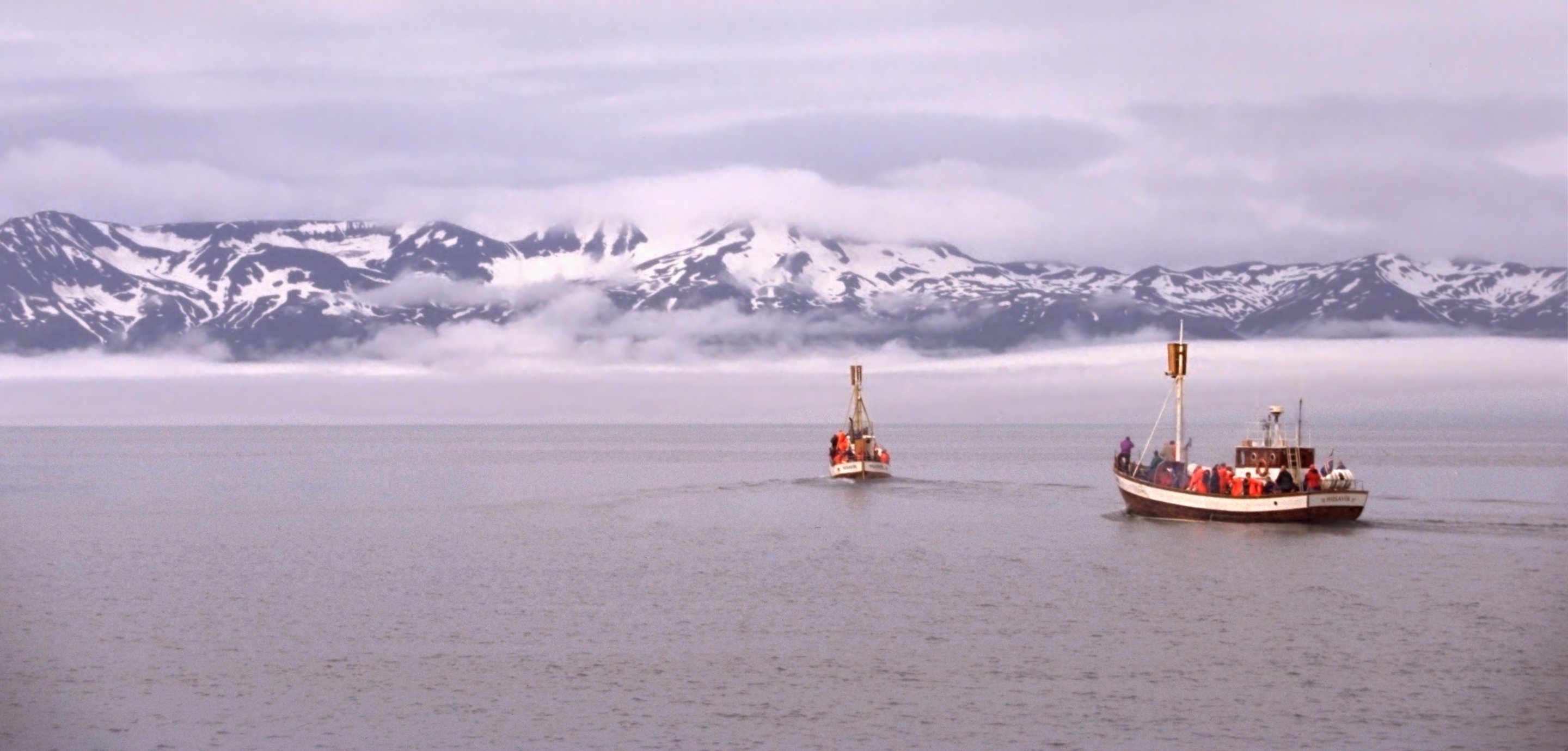
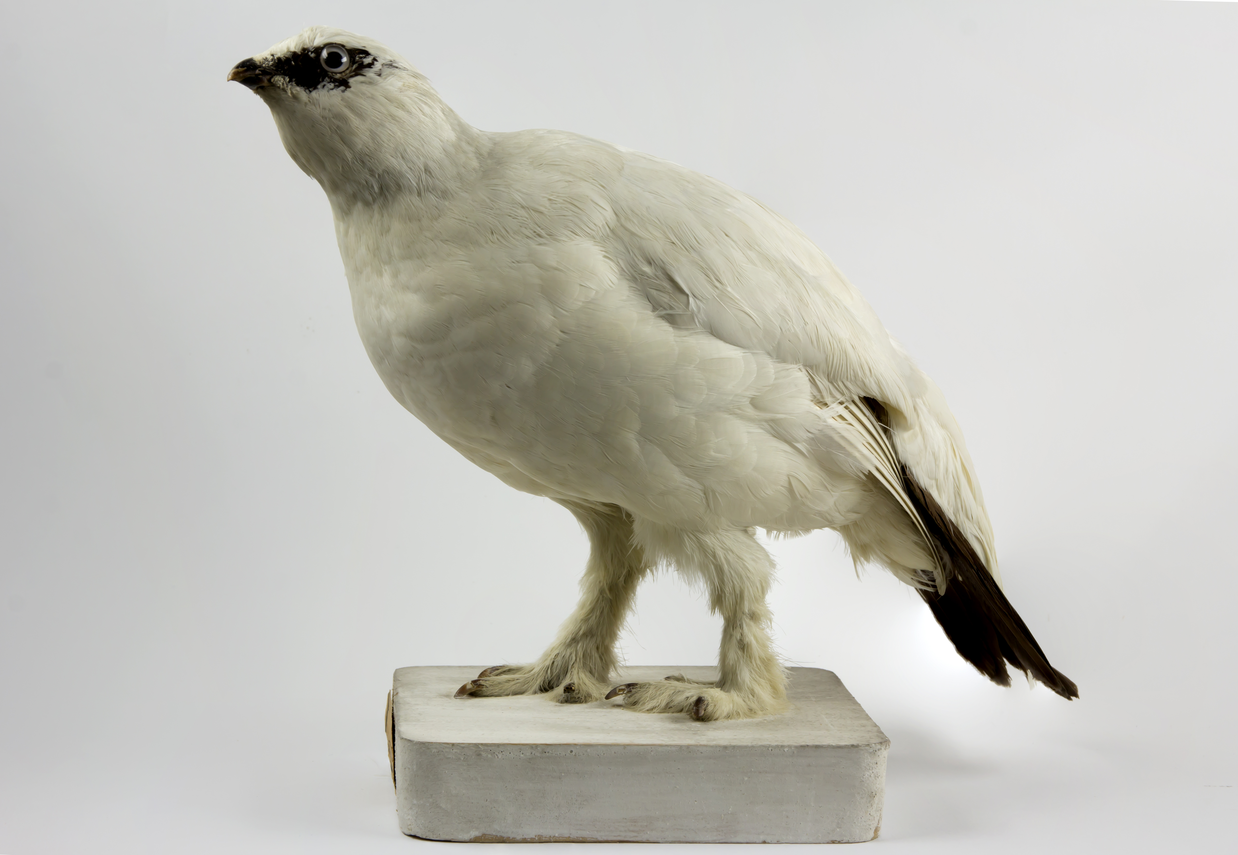
Tjörnes () is a peninsula situated at the northeast of Iceland, between the fjords of ĂxarfjörĂ°ur and SkjĂĄlfandi. Tjörnes is known for its particularly dense population of Rock Ptarmigan and the rich fossil record of Miocene - Pliocene age. The submarine volcano There is a submarine volcano north of Iceland Iceland is a Nordic countries, Nordic island country between the Atlantic Ocean, North Atlantic and Arctic Oceans, on the Mid-Atlantic Ridge between North America and Europe. It is culturally and politically linked with Europe and is the regi ... named the ''Tjornes Fracture Zone''. It is a series of underwater fissure vents that last erupted in 1868. References Peninsulas of Iceland {{Iceland-geo-stub ... [...More Info...] [...Related Items...] OR: [Wikipedia] [Google] [Baidu] |
ĂxarfjörĂ°ur
ĂxarfjörĂ°ur () is a broad fjord in northeastern Iceland, situated between the Tjörnes and MelrakkaslĂ©tta headlands. Geography ĂxarfjörĂ°ur is encircled by mountain ranges to the west and east, and the GjĂĄstykki lava fields and an area with sand deposited by the glacial river JökulsĂĄ ĂĄ Fjöllum in the south. The only village in the area is KĂłpasker with about 130 inhabitants. The Mid-Atlantic Ridge runs through the western part of the fjord before going underwater again. ĂxarfjörĂ°ur went deeper inland in earlier geological times but the glacial river JökulsĂĄ deposited sands from the highlands on a triangular area of about 300 km2 called Sandur . Sandur is still trenched by the river delta, delta of JökulsĂĄ which is constantly changing its riverbed. There are two big lakes on Sandur, Vikingavatn and SkjĂĄlftavatn , the latter one formed by an earthquake in 1976, over the course of which some houses in the area were destroyed. Economy The economy of the ... [...More Info...] [...Related Items...] OR: [Wikipedia] [Google] [Baidu] |
Peninsula
A peninsula is a landform that extends from a mainland and is only connected to land on one side. Peninsulas exist on each continent. The largest peninsula in the world is the Arabian Peninsula. Etymology The word ''peninsula'' derives , . The word entered English in the 16th century. Definitions A peninsula is generally defined as a piece of land surrounded on most sides by water. A peninsula may be bordered by more than one body of water, and the body of water does not have to be an ocean or a sea. A piece of land on a very tight river bend or one between two rivers is sometimes said to form a peninsula, for example in the New Barbadoes Neck in New Jersey, United States. A peninsula may be connected to the mainland via an isthmus, for example, in the Isthmus of Corinth which connects to the Peloponnese peninsula. Formation and types Peninsulas can be formed from continental drift, glacial erosion, meltwater, glacial meltwater, glacial deposition (geology), deposition, ... [...More Info...] [...Related Items...] OR: [Wikipedia] [Google] [Baidu] |
Iceland
Iceland is a Nordic countries, Nordic island country between the Atlantic Ocean, North Atlantic and Arctic Oceans, on the Mid-Atlantic Ridge between North America and Europe. It is culturally and politically linked with Europe and is the region's westernmost and most list of countries and dependencies by population density, sparsely populated country. Its Capital city, capital and largest city is ReykjavĂk, which is home to about 36% of the country's roughly 380,000 residents (excluding nearby towns/suburbs, which are separate municipalities). The official language of the country is Icelandic language, Icelandic. Iceland is on a rift between Plate tectonics, tectonic plates, and its geologic activity includes geysers and frequent Types of volcanic eruptions, volcanic eruptions. The interior consists of a volcanic plateau with sand and lava fields, mountains and glaciers, and many Glacial stream, glacial rivers flow to the sea through the Upland and lowland, lowlands. Iceland i ... [...More Info...] [...Related Items...] OR: [Wikipedia] [Google] [Baidu] |
Fjords
In physical geography, a fjord (also spelled fiord in New Zealand English; ) is a long, narrow sea inlet with steep sides or cliffs, created by a glacier. Fjords exist on the coasts of Antarctica, the Arctic, and surrounding landmasses of the northern and southern hemispheres. Norway's coastline is estimated to be long with its nearly 1,200 fjords, but only long excluding the fjords. Formation A true fjord is formed when a glacier cuts a U-shaped valley by ice segregation and abrasion of the surrounding bedrock. According to the standard model, glaciers formed in pre-glacial valleys with a gently sloping valley floor. The work of the glacier then left an overdeepened U-shaped valley that ends abruptly at a valley or trough end. Such valleys are fjords when flooded by the ocean. Thresholds above sea level create freshwater lakes. Glacial melting is accompanied by the rebounding of Earth's crust as the ice load and eroded sediment is removed (also called isostasy or glacia ... [...More Info...] [...Related Items...] OR: [Wikipedia] [Google] [Baidu] |
SkjĂĄlfandi
SkjĂĄlfandi (; also known as SkjĂĄlfandaflĂłi ) is a bay in northern Iceland, with some of the characteristics of a fjord. The Icelandic word ''SkjĂĄlfandi'' literally translates to ''trembling'' which may refer to earthquakes in the area. The bay, originally created by glacial activity, has two major rivers flowing into it: SkjĂĄlfandafljĂłt, which is a glacier river, and LaxĂĄ, which is a freshwater river. The river LaxĂĄ ("Salmon River") is famous for its salmon and part of the river is protected by the Ramsar Convention. The only town in SkjĂĄlfandi Bay is HĂșsavĂk, facing the snow-covered VĂknafjöll and Kinnarfjöll mountain ranges on the other side of the bay. The highest point reaches around . The bay is known for its many different whale, dolphin and bird species. There are two islands in SkjĂĄlfandi. The larger one is Flatey (''flat island''). It is situated close to the opposite side of the bay from HĂșsavĂk. There is a village on the island, no longer ... [...More Info...] [...Related Items...] OR: [Wikipedia] [Google] [Baidu] |
Rock Ptarmigan
The rock ptarmigan (''Lagopus muta'') is a medium-sized game bird in the grouse family. It is known simply as the ptarmigan in Europe. It is the official bird for the Canadian territory of Nunavut, where it is known as the ''aqiggiq'' (ááżáĄáá ), and the official game bird for the province of Newfoundland and Labrador. In Japan, it is known as the ''raichĆ'' (é·éł„), which means "thunder bird". It is the official bird of Gifu, Nagano, and Toyama Prefectures and is a protected species nationwide. Unlike many arctic bird species, ptarmigan do not gain substantial mass to hibernate over winter. Etymology The ptarmigan's genus name, ''Lagopus'', is derived from Ancient Greek ''lagos'' (λαγÏÏ ''lagáčs''), meaning "hare", + ''pous'' (ÏÎżÏÏ ''poĂșs''), "foot", in reference to the bird's feathered legs. The species name, ''muta'', comes from Neo-Latin and means "mute", referring to the simple croaking song of the male. It was for a long time misspelt ''mutus'', in t ... [...More Info...] [...Related Items...] OR: [Wikipedia] [Google] [Baidu] |
Fossil
A fossil (from Classical Latin , ) is any preserved remains, impression, or trace of any once-living thing from a past geological age. Examples include bones, shells, exoskeletons, stone imprints of animals or microbes, objects preserved in amber, hair, petrified wood and DNA remnants. The totality of fossils is known as the ''fossil record''. Though the fossil record is incomplete, numerous studies have demonstrated that there is enough information available to give a good understanding of the pattern of diversification of life on Earth. In addition, the record can predict and fill gaps such as the discovery of '' Tiktaalik'' in the arctic of Canada. Paleontology includes the study of fossils: their age, method of formation, and evolutionary significance. Specimens are sometimes considered to be fossils if they are over 10,000 years old. The oldest fossils are around 3.48 billion years to 4.1 billion years old. Early edition, published online before prin ... [...More Info...] [...Related Items...] OR: [Wikipedia] [Google] [Baidu] |
Miocene
The Miocene ( ) is the first epoch (geology), geological epoch of the Neogene Period and extends from about (Ma). The Miocene was named by Scottish geologist Charles Lyell; the name comes from the Greek words (', "less") and (', "new") and means "less recent" because it has 18% fewer modern marine invertebrates than the Pliocene has. The Miocene followed the Oligocene and preceded the Pliocene. As Earth went from the Oligocene through the Miocene and into the Pliocene, the climate slowly cooled towards a series of ice ages. The Miocene boundaries are not marked by distinct global events but by regionally defined transitions from the warmer Oligocene to the cooler Pliocene Epoch. During the Early Miocene, Afro-Arabia collided with Eurasia, severing the connection between the Mediterranean and Indian Oceans, and allowing the interchange of fauna between Eurasia and Africa, including the dispersal of proboscideans and Ape, hominoids into Eurasia. During the late Miocene, the conn ... [...More Info...] [...Related Items...] OR: [Wikipedia] [Google] [Baidu] |
Pliocene
The Pliocene ( ; also Pleiocene) is the epoch (geology), epoch in the geologic time scale that extends from 5.33 to 2.58See the 2014 version of the ICS geologic time scale million years ago (Ma). It is the second and most recent epoch of the Neogene Period in the Cenozoic, Cenozoic Era. The Pliocene follows the Miocene Epoch and is followed by the Pleistocene Epoch. Prior to the 2009 revision of the geologic time scale, which placed the four most recent major glaciations entirely within the Pleistocene, the Pliocene also included the Gelasian Stage, which lasted from 2.59 to 1.81 Ma, and is now included in the Pleistocene. As with other older geologic periods, the Stratum, geological strata that define the start and end are well-identified but the exact dates of the start a ... [...More Info...] [...Related Items...] OR: [Wikipedia] [Google] [Baidu] |
Sea Level
Mean sea level (MSL, often shortened to sea level) is an mean, average surface level of one or more among Earth's coastal Body of water, bodies of water from which heights such as elevation may be measured. The global MSL is a type of vertical datuma standardised geodetic datumthat is used, for example, as a chart datum in cartography and Navigation, marine navigation, or, in aviation, as the standard sea level at which atmospheric pressure is measured to Calibration, calibrate altitude and, consequently, aircraft flight levels. A common and relatively straightforward mean sea-level standard is instead a long-term average of tide gauge readings at a particular reference location. The term ''above sea level'' generally refers to the height above mean sea level (AMSL). The term APSL means above present sea level, comparing sea levels in the past with the level today. Earth's radius at sea level is 6,378.137 km (3,963.191 mi) at the equator. It is 6,356.752 km (3,94 ... [...More Info...] [...Related Items...] OR: [Wikipedia] [Google] [Baidu] |
Atlantic Ocean
The Atlantic Ocean is the second largest of the world's five borders of the oceans, oceanic divisions, with an area of about . It covers approximately 17% of Earth#Surface, Earth's surface and about 24% of its water surface area. During the Age of Discovery, it was known for separating the New World of the Americas (North America and South America) from the Old World of Afro-Eurasia (Africa, Asia, and Europe). Through its separation of Afro-Eurasia from the Americas, the Atlantic Ocean has played a central role in the development of human society, globalization, and the histories of many nations. While the Norse colonization of North America, Norse were the first known humans to cross the Atlantic, it was the expedition of Christopher Columbus in 1492 that proved to be the most consequential. Columbus's expedition ushered in an Age of Discovery, age of exploration and colonization of the Americas by European powers, most notably Portuguese Empire, Portugal, Spanish Empire, Sp ... [...More Info...] [...Related Items...] OR: [Wikipedia] [Google] [Baidu] |


