|
Tillabéri
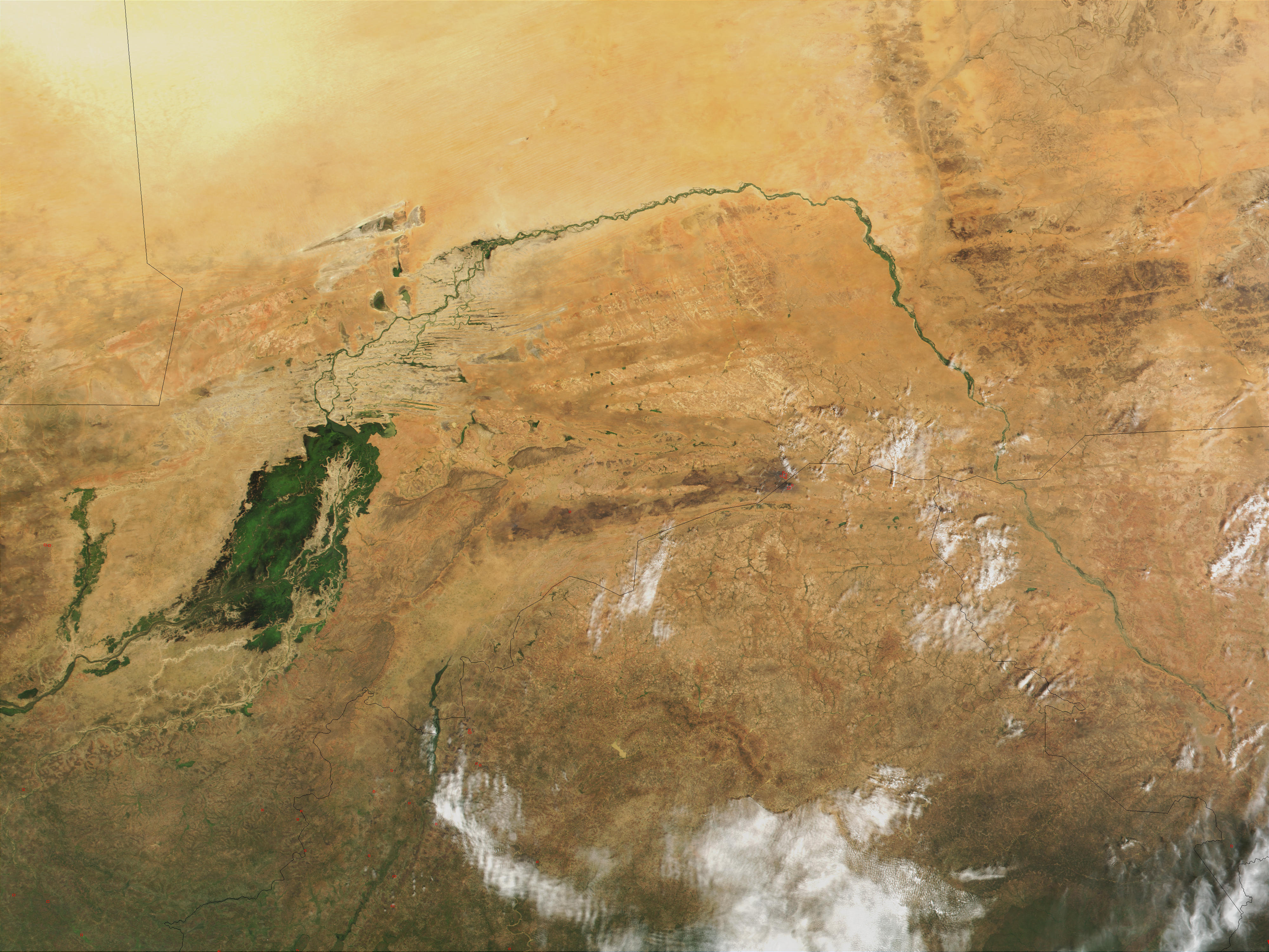
Tillabéri (var. Tillabéry) is a town in the extreme west of Niger. It is situated northwest of the capital Niamey on the River Niger. It is an important market town and administrative center, being the capital of department of Tillabéri and Tillabéri Region. The town had a population of 47,678 at the 2012 census. . World Gazetteer. Climate Tillabéri has a hot arid climate ( |
Tillabéri Region
Tillabéri (var. ''Tillabéry'') is one of the seven regions of Niger. The capital of the region is Tillabéri. Tillabéri Region was created in 1992, when Niamey Region was split, with Niamey and its immediate hinterland becoming a new ''capital district'' enclaved within Tillabéri Region. Geography Tillabéri borders Mali (Gao Region) to the north, Tahoua Region to the east, Dosso Region to the southeast, Benin (Alibori Department) to the south, and Burkina Faso (Sahel Region and Est Region (Burkina Faso), Est Region) to the west. The Niamey Capital District forms an enclave within the region. Tillabéri contains almost all of Niger's share of the Niger River, as well as several seasonal (known as Gorouol, Sirba) and permanent (known as Mékrou, Tapoa) watercourses. The W National Park is located in the extreme south of the region and extends into Burkina Faso and Benin. The northwestern areas of the region (Ouallam and Filingué) have a savannah type flora and fauna. Settlem ... [...More Info...] [...Related Items...] OR: [Wikipedia] [Google] [Baidu] |
Tillabéri Department
Tillabéri is a department of the Tillabéri Region in Niger. Its capital lies at the city of Tillabéri, and contains the Communes of Ayorou (as of 2001 the largest town in Department), Anzourou, Dessa, Kourteye, and Sinder. Tillabéri is also the capital of Tillabéri Region. The western border of the department is formed by the Niger River. As of 2012, the department had a total population of 227,352 people. Communes * Anzourou * Bibiyergou * Dessa * Kourteye * Sakoira * Sinder * Tillabéri Tillabéri (var. Tillabéry) is a town in the extreme west of Niger. It is situated northwest of the capital Niamey on the River Niger. It is an important market town and administrative center, being the capital of department of Tillabéri and ... References *Portions of this article were translated from the French language Wikipedia articles :fr:Tillabéri (région), 2008-06-19. Departments of Niger Tillabéri Region {{Niger-geo-stub ... [...More Info...] [...Related Items...] OR: [Wikipedia] [Google] [Baidu] |
Niger
Niger, officially the Republic of the Niger, is a landlocked country in West Africa. It is a unitary state Geography of Niger#Political geography, bordered by Libya to the Libya–Niger border, north-east, Chad to the Chad–Niger border, east, Nigeria to the Niger–Nigeria border, south, Benin and Burkina Faso to the Benin-Niger border, south-west, Mali to the Mali–Niger border, west, and Algeria to the Algeria–Niger border, north-west. It covers a land area of almost , making it the largest landlocked country in West Africa and the second-largest landlocked nation in Africa behind Chad. Over 80% of its land area lies in the Sahara. Its Islam in Niger, predominantly Muslim population of about million lives mostly in clusters in the south and west of the country. The capital Niamey is located in Niger's south-west corner along the namesake Niger River. Following the spread of Islam to the region, Niger was on the fringes of some states, including the Kanem–Bornu Empire ... [...More Info...] [...Related Items...] OR: [Wikipedia] [Google] [Baidu] |
Niamey
Niamey () is the capital and largest city of Niger. As the Niamey Urban Community (, CUN), it is a Regions of Niger, first-level division of Niger, surrounded by the Tillabéri Region, in the western part of the country. Niamey lies on the Niger River, primarily situated on the river's east bank. The capital of Niger since the Colony of Niger, colonial era, Niamey is an ethnically diverse city and the country's main economic centre. Before the French developed it as a colonial centre, Niamey was the site of villages inhabited by Fula people, Fula, Zarma people, Zarma, Maouri people, Maouri, and Songhai people, Songhai people. French expeditions first visited Niamey in the 1890s before Captain established a military post in 1901. Niamey replaced Zinder as the territorial capital from 1903 to 1911 and again in 1926, after which large-scale development occurred. The first city plan in 1930 relocated neighbourhoods and enacted Racial segregation, segregation of European and indigen ... [...More Info...] [...Related Items...] OR: [Wikipedia] [Google] [Baidu] |
Regions Of Niger
Niger is divided into seven regions (French: ''régions;'' singular''région)'', each of which is named after its capital. Additionally, the national capital, Niamey, comprises a capital district. Current regions *capital district. Current administrative structure Each of Niger's regions are subdivided into departments and communes. As of 2005, there were 36 ''départements'', divided into 265 communes, 122 cantons and 81 ''groupements''. The latter two categories cover all areas not covered by urban communes (population over 10000) or rural communes (total population 13 million), and are governed by the department, whereas communes have had elected councils and mayors since 1999. Additional semi-autonomous subdivisions include sultanates, provinces and tributaries (''tribus''). The Nigerien government estimates there are an additional 17000 villages administered by rural communes, while there are a number of ''quartiers'' (boroughs or neighborhoods) administered by urban ... [...More Info...] [...Related Items...] OR: [Wikipedia] [Google] [Baidu] |
Departments Of Niger
The regions of Niger are subdivided into 63 Department (country subdivision), departments (). Before the devolution program on 1999–2005, these departments were styled arrondissements. Confusingly, the next level up (regions) had, before 2002-2005 been styled departments. Prior to a revision in 2011, there had been 36 departments. Until 2010, arrondissements remained a proposed subdivision of departments, though none were used. The decentralisation process, begun in the 1995-1999 period replaced appointed Prefects at Departmental or Arrondissement level with elected councils, first elected in 1999. These were the first local elections held in the history of Niger. Officials elected at Communes of Niger, commune level are then selected as representatives at Departmental, regional, and National level councils and administration. The Ministry of Decentralisation was created to oversee this task, and to create a national consultative council of local officials. On 1 August 2 ... [...More Info...] [...Related Items...] OR: [Wikipedia] [Google] [Baidu] |
River Niger
The Niger River ( ; ) is the main river of West Africa, extending about . Its drainage basin is in area. Its source is in the Guinea Highlands in south-eastern Guinea near the Sierra Leone border. It runs in a crescent shape through Mali, Niger, on the border with Benin and then through Nigeria, discharging through a massive delta, known as the Niger Delta, into the Gulf of Guinea in the Atlantic Ocean. The Niger is the third-longest river in Africa, exceeded by the Nile and the Congo River. Its main tributary is the Benue River. Etymology The Niger has different names in the different languages of the region: * Fula: ''Maayo Jaaliba'' * Manding: ''Jeliba'' or ''Joliba'' "great river" * Tuareg: ''Eġərəw n-Igərǝwăn'' "river of rivers" * Songhay: ''Isa'' "the river" * Zarma: ''Isa Beeri'' "great river" * Hausa: ''Kwara'' * Nupe: ''Èdù'' * Yoruba: ''Ọya'' "named after the Yoruba goddess Ọya, who is believed to embody the river" * Igbo: ''Orimiri'' or ''O ... [...More Info...] [...Related Items...] OR: [Wikipedia] [Google] [Baidu] |
Market Town
A market town is a settlement most common in Europe that obtained by custom or royal charter, in the Middle Ages, a market right, which allowed it to host a regular market; this distinguished it from a village or city. In Britain, small rural towns with a hinterland of villages are still commonly called market towns, as sometimes reflected in their names (e.g. Downham Market, Market Rasen, or Market Drayton). Modern markets are often in special halls, but this is a relatively recent development. Historically the markets were open-air, held in what is usually called (regardless of its actual shape) the market square or market place, sometimes centred on a market cross ( mercat cross in Scotland). They were and are typically open one or two days a week. In the modern era, the rise of permanent retail establishments reduced the need for periodic markets. History The primary purpose of a market town is the provision of goods and services to the surrounding locality. Al ... [...More Info...] [...Related Items...] OR: [Wikipedia] [Google] [Baidu] |
Hot Arid Climate
The desert climate or arid climate (in the Köppen climate classification ''BWh'' and ''BWk'') is a dry climate sub-type in which there is a severe excess of evaporation over precipitation. The typically bald, rocky, or sandy surfaces in desert climates are dry and hold little moisture, quickly evaporating the already little rainfall they receive. Covering 14.2% of Earth's land area, hot deserts are the second-most common type of climate on Earth after the Polar climate. There are two variations of a desert climate according to the Köppen climate classification: a hot desert climate (''BWh''), and a cold desert climate (''BWk''). To delineate "hot desert climates" from "cold desert climates", a mean annual temperature of is used as an isotherm so that a location with a ''BW'' type climate with the appropriate temperature above this isotherm is classified as "hot arid subtype" (''BWh''), and a location with the appropriate temperature below the isotherm is classified as "cold ar ... [...More Info...] [...Related Items...] OR: [Wikipedia] [Google] [Baidu] |
Köppen Climate Classification
The Köppen climate classification divides Earth climates into five main climate groups, with each group being divided based on patterns of seasonal precipitation and temperature. The five main groups are ''A'' (tropical), ''B'' (arid), ''C'' (temperate), ''D'' (continental), and ''E'' (polar). Each group and subgroup is represented by a letter. All climates are assigned a main group (the first letter). All climates except for those in the ''E'' group are assigned a seasonal precipitation subgroup (the second letter). For example, ''Af'' indicates a tropical rainforest climate. The system assigns a temperature subgroup for all groups other than those in the ''A'' group, indicated by the third letter for climates in ''B'', ''C'', ''D'', and the second letter for climates in ''E''. Other examples include: ''Cfb'' indicating an oceanic climate with warm summers as indicated by the ending ''b.'', while ''Dwb'' indicates a semi-Monsoon continental climate, monsoonal continental climate ... [...More Info...] [...Related Items...] OR: [Wikipedia] [Google] [Baidu] |
Potential Evapotranspiration
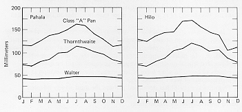
Potential evapotranspiration (PET) or potential evaporation (PE) is the amount of water that would be evaporated and transpired by a specific crop, soil or ecosystem if there was sufficient water available. It is a reflection of the energy available to evaporate or transpire water, and of the wind available to transport the water vapor from the ground up into the lower atmosphere and away from the initial location. Potential evapotranspiration is expressed in terms of a depth of water or soil moisture percentage. If the actual evapotranspiration is considered the net result of atmospheric demand for moisture from a surface and the ability of the surface to supply moisture, then PET is a measure of the demand side (also called ''evaporative demand''). Surface and air temperatures, insolation, and wind all affect this. A dryland is a place where annual potential evaporation exceeds annual precipitation. Often a value for the potential evapotranspiration is calculated at a nearby ... [...More Info...] [...Related Items...] OR: [Wikipedia] [Google] [Baidu] |
Wet Season
The wet season (sometimes called the rainy season or monsoon season) is the time of year when most of a region's average annual rainfall occurs. Generally, the season lasts at least one month. The term ''green season'' is also sometimes used as a euphemism by tourist authorities. Areas with wet seasons are dispersed across portions of the tropics and subtropics. Under the Köppen climate classification, for tropical climates, a wet season month is defined as a month where average precipitation is or more. In contrast to areas with savanna climates and monsoon regimes, Mediterranean climates have wet winters and dry summers. Dry and rainy months are characteristic of tropical seasonal forests: in contrast to tropical rainforests, which do not have dry or wet seasons, since their rainfall is equally distributed throughout the year.Elisabeth M. Benders-Hyde (2003)World Climates.Blue Planet Biomes. Retrieved on 2008-12-27. Some areas with pronounced rainy seasons will see a break ... [...More Info...] [...Related Items...] OR: [Wikipedia] [Google] [Baidu] |


