|
Tiburon Peninsula
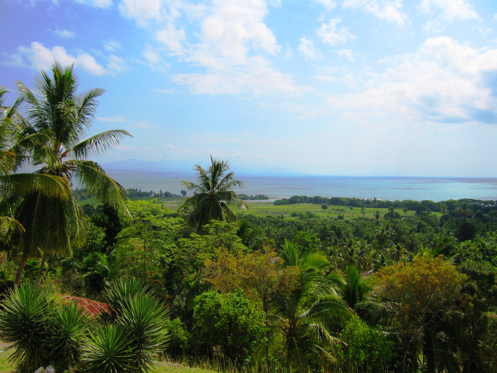
The Tiburon Peninsula (), or simply "the Tiburon" (''le Tiburon''), is a region of Haiti encompassing most of Haiti's southern coast. It starts roughly at the southernmost point of the Haiti-Dominican Republic border and extends westward near Cuba, forming a large headland. Three of Haiti's ten Administrative divisions of Haiti, departments are located entirely within the region. They are the departments of Grand'Anse (department), Grand'Anse, Nippes and Sud (department), Sud. A large part of Ouest (department), Ouest Departments of Haiti, department is also located in the region, with the capital, Port-au-Prince serving as the line of demarcation between central Haiti and the south. Half of Sud-Est (department), Sud-Est is also located within the Tiburon Peninsula. The mountains on the peninsula are known as the Massif de la Hotte. References Landforms of Haiti Peninsulas of North America Grand'Anse (department) Nippes Sud (department) Sud-Est (department) {{Haiti-geo- ... [...More Info...] [...Related Items...] OR: [Wikipedia] [Google] [Baidu] |
Haiti Tiburon Locator
Haiti, officially the Republic of Haiti, is a country on the island of Hispaniola in the Caribbean Sea, east of Cuba and Jamaica, and south of the Bahamas. It occupies the western three-eighths of the island, which it shares with the Dominican Republic. Haiti is the third largest country in the Caribbean, and with an estimated population of 11.4 million, is the most populous Caribbean country. The capital and largest city is Port-au-Prince. Haiti was originally inhabited by the Taíno people. In 1492, Christopher Columbus established the first European settlement in the Americas, La Navidad, on its northeastern coast. The island was part of the Spanish Empire until 1697, when the western portion was ceded to France and became Saint-Domingue, dominated by sugarcane plantations worked by enslaved Africans. The 1791–1804 Haitian Revolution made Haiti the first sovereign state in the Caribbean, the second republic in the Americas, the first country in the Americas to officially a ... [...More Info...] [...Related Items...] OR: [Wikipedia] [Google] [Baidu] |
Dominican Republic
The Dominican Republic is a country located on the island of Hispaniola in the Greater Antilles of the Caribbean Sea in the Atlantic Ocean, North Atlantic Ocean. It shares a Maritime boundary, maritime border with Puerto Rico to the east and a Dominican Republic–Haiti border, land border with Haiti to the west, occupying the Geography of the Dominican Republic, eastern five-eighths of Hispaniola which, along with Saint Martin (island), Saint Martin, is one of only two islands in the Caribbean shared by two sovereign states. In the Antilles, the country is the List of Caribbean islands by area, second-largest nation by area after Cuba at and List of Caribbean countries by population, second-largest by population after Haiti with approximately 11.4 million people in 2024, of whom 3.6 million reside in the Greater Santo Domingo, metropolitan area of Santo Domingo, the capital city. The native Taíno people had inhabited Hispaniola prior to European colonization of the America ... [...More Info...] [...Related Items...] OR: [Wikipedia] [Google] [Baidu] |
Cuba
Cuba, officially the Republic of Cuba, is an island country, comprising the island of Cuba (largest island), Isla de la Juventud, and List of islands of Cuba, 4,195 islands, islets and cays surrounding the main island. It is located where the northern Caribbean Sea, Gulf of Mexico, and Atlantic Ocean meet. Cuba is located east of the Yucatán Peninsula (Mexico), south of both Florida and the Bahamas, west of Hispaniola (Haiti/Dominican Republic), and north of Jamaica and the Cayman Islands. Havana is the largest city and capital. Cuba is the List of countries and dependencies by population, third-most populous country in the Caribbean after Haiti and the Dominican Republic, with about 10 million inhabitants. It is the largest country in the Caribbean by area. The territory that is now Cuba was inhabited as early as the 4th millennium BC, with the Guanahatabey and Taino, Taíno peoples inhabiting the area at the time of Spanish colonization of the Americas, Spanish colonization ... [...More Info...] [...Related Items...] OR: [Wikipedia] [Google] [Baidu] |
Headland
A headland, also known as a head, is a coastal landform, a point of land usually high and often with a sheer drop, that extends into a body of water. It is a type of promontory. A headland of considerable size often is called a cape.Whittow, John (1984). ''Dictionary of Physical Geography''. London: Penguin, 1984, pp. 80, 246. . Headlands are characterised by high, breaking waves, rocky shores, intense erosion, and steep sea cliff. Headlands and bays are often found on the same coastline. A bay is flanked by land on three sides, whereas a headland is flanked by water on three sides. Headlands and bays form on discordant coastlines, where bands of rock of alternating resistance run perpendicular to the coast. Bays form when weak (less resistant) rocks (such as sands and clays) are eroded, leaving bands of stronger (more resistant) rocks (such as chalk, limestone, and granite) forming a headland, or peninsula. Through the deposition of sediment within the bay and the erosio ... [...More Info...] [...Related Items...] OR: [Wikipedia] [Google] [Baidu] |
Administrative Divisions Of Haiti
The administrative divisions of Haiti () are concerned with the institutional and territorial organization of Haitian territory. There are many administrative divisions which may have political (local government), electoral (districts), or administrative (decentralized services of the state) objectives. Administrative divisions , Haiti is divided into the following: * 4 regions being North, Centre, West, and South. * 10 departments with the possibility to go up to 16. * The departments are subdivided into 42 arrondissements. * The arrondissements are subdivided into 144 communes. * The communes are subdivided into 65 quarters. * The quarters are subdivided into 571 communal sections. Geographically, the ''departments'' are the largest territorial divisions, regrouping into ''arrondissements'' (districts) and ''communes'' (municipalities). The Arrondissement, encompasses a number of communes. While the Commune is composed of the city, neighborhoods and communal sections are b ... [...More Info...] [...Related Items...] OR: [Wikipedia] [Google] [Baidu] |
Grand'Anse (department)
Grand'Anse (, ), Grandans or Grantans (; both meaning "Big Cove") is one of the ten departments of Haiti. Its capital is Jérémie. History Taino Period Grand'Anse was part of the Xaragua kasika with settlements including Mamey, the modern-day town of Abricot. Abricot is still known today as "the Indian's Paradise." French Period It is said by the locals that the capital city of Jérémie is named after a French fisherman who established himself in the area because of its isolation from the rest of the country. Due to its rather mountainous geography, Grand'Anse did not support many plantations, and was therefore populated largely by white and mixed-race communities with some of the best schools in the colony. Some slaveowners sent their children to schools in Grand'Anse instead of sending them back to France for education. British Period The department was briefly under British control in 1793. Haitian Period Haitian Revolution While under the control of André Rigaud, mo ... [...More Info...] [...Related Items...] OR: [Wikipedia] [Google] [Baidu] |
Nippes
Nippes (French language, French, ) or Nip (Haitian Creole) is one of the ten Departments of Haiti, departments (the highest-level political subdivisions) of Haiti located in southern Haiti. It is the most recently created department, having been split from Grand'Anse (department), Grand'Anse in 2003. The capital of the department is Miragoâne, and it is the least populous department in Haiti. History Haitian Period Being created from Grand'Anse most of Nippes' history is similar to Grand'Anse's. Nippes during the Haitian Revolution played a big role with marron troops led by notablPlymoutha Jamaican Maroons, Jamaican later on was in Haiti. Independence Étienne Gérin from Miragwàn is a signatory of the Haitian Declaration of Independence. During the Haitian Civil war between Alexandre Pétion, Pétion and Henri Christophe, Henry 1st, André Rigaud came back to Haiti from France and was disappointed by Pétion's laissez-faire politics and created a de facto republic, the Me ... [...More Info...] [...Related Items...] OR: [Wikipedia] [Google] [Baidu] |
Sud (department)
Sud ( French, ) or Sid (Haitian Creole; both meaning "South") is one of the ten departments of Haiti and located in southern Haiti. It has an area of and a population of 774,976. Its capital is Les Cayes. History Taino Period The department was part of the Xaragua kingdom. The area of Aquin was known as Yakimo a Taino settlement. The island of Vache was named Anigua. Spanish Period The area of Les Cayes was a Spanish settlement known as Salvatierra de la Sabana or Land Saved from the Water or Sea. French Period Much like the N-O, the South Department was a pirate hub with famous pirates such as Henri Morgan and many more hiding their loot on the multitude of islands from Grosse Cayes to Isle-à-Vache. Haitian Revolution The South, in general, was Rigaudin since was under the control of André Rigaud until it definitely switches the hand of Toussaint and the Louverturien. This conflict is known as the Haitian War of Knives opposing two political and economical groups in H ... [...More Info...] [...Related Items...] OR: [Wikipedia] [Google] [Baidu] |
Ouest (department)
Ouest (French language, French, ) or Lwès (Haitian Creole; both meaning "West") is one of the ten departments of Haiti. It is located in south-central Haiti, linking the Great-North and the Tiburon Peninsula. It is the jurisdictional seat of the national capital, the city of Port-au-Prince. It has an area of and a population of 4,029,705 (2015 estimate), making it both the largest department by area and the most populated department in Haiti. History Taino period The department was part of the Jaragua, Hispaniola, Xaragua kasika under the leadership of Anacaona. There are many native settlements in the department notably around Arcahaie, Arcahaie, Ouest, Akaya, Etang Saumâtre, Azuei Lake, Léogâne, Yaguana, the Gonâve Island, island of Guanabo and Petit-Goâve, Goava. It is understood that the Azuei Plaine region was used as a hunting ground for the natives. The island of Gonave is the last point of refuge for the Taino natives. Spanish period One of the only Spanish set ... [...More Info...] [...Related Items...] OR: [Wikipedia] [Google] [Baidu] |
Departments Of Haiti
In the administrative divisions of Haiti, the department (, ; ) is the first of four levels of government. Haiti is divided administratively into ten departments, which are further subdivided into 42 arrondissements, 145 communes, and 571 communal sections. In 2014, there was a proposal by the Chamber of Deputies to increase the number of departments from 10 to 14 —perhaps as high as 16. Administration Each departement has a departmental council (''conseil départemental'') compound of three members elected by the departmental assembly for a 4-year term. The departmental council is led by a president (''président''). The council is the executive organ of the department. Each department has a departmental assembly who assists the council in its work. The departmental assembly is the deliberative organ of the department. The members of the departmental assembly are also elected for 4 years. The departmental assembly is led by a president. History Three Departments ... [...More Info...] [...Related Items...] OR: [Wikipedia] [Google] [Baidu] |
Port-au-Prince
Port-au-Prince ( ; ; , ) is the Capital city, capital and List of cities in Haiti, most populous city of Haiti. The city's population was estimated at 1,200,000 in 2022 with the metropolitan area estimated at a population of 2,618,894. The metropolitan area is defined by the IHSI as including the Communes of Haiti, communes of Port-au-Prince, Delmas, Ouest, Delmas, Cité Soleil, Tabarre, Carrefour, Ouest, Carrefour, and Pétion-Ville. The city of Port-au-Prince is on the Gulf of Gonâve: the bay on which the city lies, which acts as a natural harbor, has sustained economic activity since the civilizations of the Taíno. It was first incorporated under Saint-Domingue, French colonial rule in 1749. The city's layout is similar to that of an amphitheater; commercial districts are near the water, while residential neighborhoods are located on the hills above. Its population is difficult to ascertain due to the rapid growth of slums in the hillsides above the city; however, recent ... [...More Info...] [...Related Items...] OR: [Wikipedia] [Google] [Baidu] |


