|
Thorold
Thorold is a city in Ontario, Canada, located on the Niagara Escarpment. It is also the seat of the Regional Municipality of Niagara. The Welland Canal passes through the city, featuring lock 7 and the Twin Flight Locks. History The first survey of Thorold, or Township 9 as it was known then, occurred in 1788. The earliest communities in what is now Thorold emerged at Beaverdams, DeCew Falls and St. Johns. In 1846, the community had a population of about 1,000 and there were three churches or chapels and a post office. Various types of tradesmen worked here. Industry included two grist mills, a cement mill, a brewery and three wagon makers. There were seven taverns. Thorold, located on the brow of the Niagara Escarpment, soon became dominant and was incorporated as a village in 1850. Its formation was linked to the creation of the First Welland Canal. The village experienced population growth as the canal became more developed. In 1875, Thorold became a town. When the Regio ... [...More Info...] [...Related Items...] OR: [Wikipedia] [Google] [Baidu] |
Welland Canal
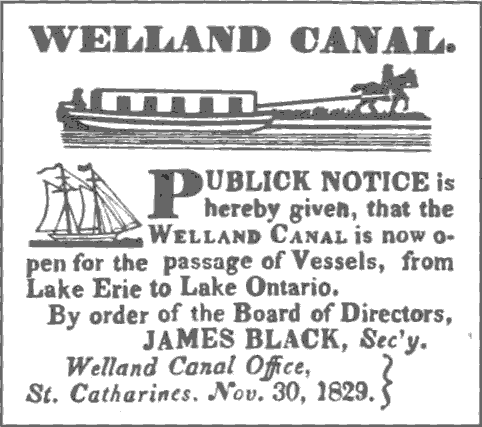
The Welland Canal is a ship canal in Ontario, Canada, and part of the St. Lawrence Seaway and Great Lakes Waterway. The canal traverses the Niagara Peninsula between Port Weller, Ontario, Port Weller on Lake Ontario, and Port Colborne on Lake Erie, and was erected because the Niagara River—the only natural waterway connecting the lakes—was unnavigable due to Niagara Falls. The Welland Canal enables ships to ascend and descend the Niagara Escarpment, and has followed four different routes since it opened. The Welland Canal passes about 3,000 ships which transport about of cargo a year. It was a major factor in the growth of the city of Toronto, Ontario. The original canal and its successors allowed goods from Great Lakes ports such as Cleveland, Detroit, Milwaukee, and Chicago, as well as other heavily industrialized areas of the United States and Ontario, to be shipped to the Port of Montreal or to Port of Quebec, Quebec City, where they were usually reloaded onto ocean ... [...More Info...] [...Related Items...] OR: [Wikipedia] [Google] [Baidu] |
Battle Of Beaver Dams
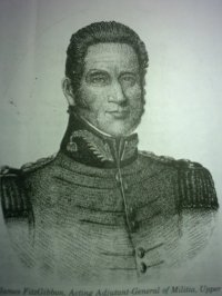
The Battle of Beaver Dams took place on 24 June 1813, during the War of 1812. A column of troops from the United States Army marched from Fort George and attempted to surprise a British outpost at Beaver Dams, billeting themselves overnight in the village of Queenston, Ontario. Laura Secord, a resident of Queenston, had earlier learned of the American plans from several Americans billeted at her house and had struck out on a long and difficult trek to warn the British at Decou's stone house near present-day Brock University. When the Americans resumed their march, they were ambushed by Kahnawake and other native warriors and eventually surrendered to a small British detachment led by Lieutenant James FitzGibbon. About 500 U.S. troops, including their wounded commander, were taken prisoner. Background On 25 May 1813, the United States had won the Battle of Fort George, capturing the fort. The British fell back to a position at Burlington Heights near the western end of La ... [...More Info...] [...Related Items...] OR: [Wikipedia] [Google] [Baidu] |
Regional Municipality Of Niagara, Ontario
The Regional Municipality of Niagara, also colloquially known as the Niagara Region or Region of Niagara, is a regional municipality in southern Ontario, Canada, which occupies most of the Niagara Peninsula. As of 2024, the region had an estimated population of 539,180. St. Catharines is the region's largest city, while the regional seat is located in Thorold. The Niagara Region is bounded to the north by Lake Ontario and to the south by Lake Erie. The region is bordered in the west by Haldimand County and the City of Hamilton, with its eastern boundary at the Niagara River, which is also the international border with the US state of New York. The Niagara Region is the southernmost part of the Golden Horseshoe, the most populated region of Ontario. Unique natural landscapes make the Niagara Region an important centre for agriculture and tourism in Canada. The most important agricultural enterprise in Niagara is viticulture, or winemaking. The Niagara Wine Route, which connect ... [...More Info...] [...Related Items...] OR: [Wikipedia] [Google] [Baidu] |
Area Codes 905, 289 And 365
Area codes 905, 289, 365, and 742 are telephone area codes in the North American Numbering Plan (NANP) for the Golden Horseshoe region that surrounds Lake Ontario in Southern Ontario, Canada. The numbering plan area (NPA) comprises (clockwise) the Niagara Peninsula, the city of Hamilton, the regional municipalities of Halton, Peel, York, Durham, and parts of Northumberland County, but excludes the City of Toronto. The four area codes form an overlay numbering plan for the same geographic region, where area code 905 was established in October 1993 in an area code split from area code 416. When 289 was overlaid on June 9, 2001, all local calls required ten-digit dialing. On April 13, 2010, the Canadian Radio-television and Telecommunications Commission (CRTC) introduced another overlay code, area code 365, which became operational on March 25, 2013. Area code 742 was added to the overlay on October 16, 2021. The numbering plan area surrounds the city of Toronto (area codes 416/6 ... [...More Info...] [...Related Items...] OR: [Wikipedia] [Google] [Baidu] |
List Of Cities In Ontario
A city is a subtype of List of municipalities in Ontario, municipalities in the Provinces and territories of Canada, Canadian province of Ontario. A city can have the municipal status of either a List of municipalities in Ontario#Unitary authority ("Single-tier") configuration, single-tier or List of municipalities in Ontario#Two-level ("Upper- and lower-tier") configuration, lower-tier municipality. Prior to 2003, Ontario had minimum population thresholds of 15,000 and 25,000 for city status. Minimum population thresholds are no longer necessary for a municipality to brand itself as a city. Ontario has 52 cities, which together had Canada 2016 Census, in 2016 a cumulative population of 9,900,179 and average population of 190,388. The most and least populous are Toronto and Dryden, Ontario, Dryden, with 2,794,356 and 7,749 residents, respectively. Ontario's newest city is Richmond Hill, Ontario, Richmond Hill, whose council voted to change from a town to a city on ... [...More Info...] [...Related Items...] OR: [Wikipedia] [Google] [Baidu] |
First Welland Canal
The Welland Canal has gone through many incarnations in its history. Today, five distinct canal-construction efforts are recognized. The retronym First Welland Canal is applied to the original canal, constructed from 1824 to 1829 and 1831 to 1833. Pre-canal times The Great Lakes form an excellent navigation route into the interior of North America. Downstream from Niagara Falls, ships can reach the port city of Montreal without encountering major difficulties. Upstream, the lakes are navigable all the way to the western end of Lake Superior. Early on during the European settlement of North America, lack of other infrastructure made the Great Lakes the premier route to reach the interior of the continent, and later to ship materials and goods from the new frontiers. The Niagara Falls stood as a mighty barrier. To bypass it, a portage road between Queenston, Ontario and Chippawa was used, but the solution was far from optimal. The cargo had to be unloaded, carried 18 km up th ... [...More Info...] [...Related Items...] OR: [Wikipedia] [Google] [Baidu] |
List Of Ontario Census Divisions
The Province of Ontario has 51 first-level administrative divisions, which collectively cover the whole province. With two exceptions, their areas match the 49 census divisions Statistics Canada has for Ontario. The Province has four types of first-level division: single-tier municipalities, regional municipalities, counties, and districts. The first three are types of municipal government but districts are ''not''—they are defined geographic areas (some quite large) used in many contexts. The last three have within them multiple smaller, lower-tier municipalities but the single-tier municipalities do not. Regional municipalities and counties differ primarily in the services that they provide to their residents. (Lower-tier municipalities are generally treated as census subdivisions by Statistics Canada.) In some cases, an administrative division may retain its historical name even if it changes government type. For instance, Oxford County, Haldimand County, Norfolk Co ... [...More Info...] [...Related Items...] OR: [Wikipedia] [Google] [Baidu] |
Jeff Burch
Jeff Burch is a Canadian Canadians () are people identified with the country of Canada. This connection may be residential, legal, historical or cultural. For most Canadians, many (or all) of these connections exist and are collectively the source of their being ''C ... politician, who was elected to the Legislative Assembly of Ontario in the 2018 provincial election."Blue wave stops in Niagara " ''Niagara This Week'', June 7, 2018. He represents the electoral district of Niagara Centre as a member of the O ... [...More Info...] [...Related Items...] OR: [Wikipedia] [Google] [Baidu] |
List Of Municipalities In Ontario
Ontario is the Population of Canada by province and territory, most populous province in Canada with 14,223,942 residents as of Canada 2021 Census, 2021 and is List of Canadian provinces and territories by area#Land area, third-largest in land area at . Ontario's 444 municipalities cover only of the Provinces and territories of Canada, province's land mass yet are home to of its population. These municipalities provide Local government, local or regional municipal government services within either a single-tier or shared two-tier municipal structure. A municipality in Ontario is "a geographic area whose inhabitants are incorporated" according to the ''Municipal Act, 2001''. Ontario's three municipality types include upper and lower-tier municipalities within the two-tier structure, and single-tier municipalities (Unitary authority, unitary authorities) that are exempt from the two-tier structure. Single and lower-tier municipalities are grouped together as local municipaliti ... [...More Info...] [...Related Items...] OR: [Wikipedia] [Google] [Baidu] |
War Of 1812
The War of 1812 was fought by the United States and its allies against the United Kingdom of Great Britain and Ireland, United Kingdom and its allies in North America. It began when the United States United States declaration of war on the United Kingdom, declared war on Britain on 18 June 1812. Although peace terms were agreed upon in the December 1814 Treaty of Ghent, the war did not officially end until the peace treaty was ratified by the 13th United States Congress, United States Congress on 17 February 1815. AngloAmerican tensions stemmed from long-standing differences over territorial expansion in North America and British support for Tecumseh's confederacy, which resisted U.S. colonial settlement in the Old Northwest. In 1807, these tensions escalated after the Royal Navy began enforcing Orders in Council (1807), tighter restrictions on American trade with First French Empire, France and Impressment, impressed sailors who were originally British subjects, even those who ... [...More Info...] [...Related Items...] OR: [Wikipedia] [Google] [Baidu] |
Canada 1911 Census
The 1911 Canadian census was a detailed enumeration of the Canadian population. The census was started on June 1, 1911. All reports had been received by February 26, 1912. The total population count of Canada was 7,206,643. This was an increase of 34% over the 1901 census of 5,371,315. The previous census was the Northwest Provinces of Alberta, Saskatchewan, and Manitoba 1906 census and the following census was the Northwest Provinces of Alberta, Saskatchewan, and Manitoba 1916 census. Census summary Information was collected on the following subjects, with a separate "schedule" or census data collection form associated with each subject: # Population # Mortality, Disability and Compensation # Houses, Buildings and Fruit # Agriculture: Field Crops - Grain and Other Field Crops for the Harvest Year 1910 # Agriculture: Hoed Crops, Tobacco, Hops and Grass Seeds in 1910 and Field Crop Areas in 1911 # Agriculture: Animal and Animal Products # Farm and Urban Values # Forest Products # ... [...More Info...] [...Related Items...] OR: [Wikipedia] [Google] [Baidu] |


