|
The Bridgeness Slab
The Bridgeness Slab is a Roman distance slab created around 142 CE marking a portion of the Antonine Wall built by the Second Legion. It is regarded as the most detailed and best preserved of the Scottish distance slabs. The sandstone tablet was found at Bridgeness in Bo'ness, Scotland in 1868 on a promontory close to Harbour Road. The original is in the National Museum of Scotland in Edinburgh, while a replica is near the site of its discovery. History The slab was erected 142 CE to mark the completion of a section of the Antonine Wall. It was uncovered during excavations in 1868 on land owned by Henry Mowbray Cadell, whose son Dr Henry Cadell was an eyewitness of its discovery. Cadell offered it to the Society of Antiquaries of Scotland for display in the National Museum of Scotland in Edinburgh if they would provide a copy for display locally. The first on-site replica includes only the centre panel of the original. A second replica, including the side panels, was unveiled b ... [...More Info...] [...Related Items...] OR: [Wikipedia] [Google] [Baidu] [Amazon] |
Roman Pace
A pace is a unit of length consisting either of one normal walking step (approximately ), or of a double step, returning to the same foot (approximately ). The normal pace length decreases with age and some health conditions. The word "pace" is also used for units inverse to speed, used mainly for walking and running, commonly ''minutes per kilometer''. The word "pace" is also used to translate similar formal units in other systems of measurement. Pacing is also used as an informal measure in surveying, with the "pace" equal to two of the surveyor's steps reckoned through comparison with a standard rod or chain. Standardized units Like other traditional measurements, the pace started as an informal unit of length, but was later standardized, often with the specific length set according to a typical brisk or military marching stride. In the United States the pace is an uncommon customary unit of length denoting a brisk single step and equal to .''U.S. Army Map Reading ... [...More Info...] [...Related Items...] OR: [Wikipedia] [Google] [Baidu] [Amazon] |
Duntocher
Duntocher (Scottish Gaelic: ''Dùn Tòchair'' or ''Druim Tòchair'') is a village in West Dunbartonshire, Scotland. It has an estimated population of 6,850. The etymology of the name of the village indicates that its name means "the fort on the causeway". Duntocher has effectively become a northern suburb of the nearby town of Clydebank, as have neighbouring Hardgate and Faifley. Duntocher expanded due to housebuilding by Clydebank Burgh Council after the Second World War, although the area was never formally absorbed into the burgh. When burghs were abolished by local government reorganisation in 1975, however, Duntocher was included in the larger Clydebank District, which existed until the creation of West Dunbartonshire in 1997. Further housing was built by the Wimpey firm in the late 1960s and early 1970s, on what had been green belt land. Along with Faifley and Hardgate, Duntocher falls within West Dunbartonshire's ''Kilpatrick'' ward with a combined population of 12,719 in ... [...More Info...] [...Related Items...] OR: [Wikipedia] [Google] [Baidu] [Amazon] |
Balmuildy
Balmuildy is the site of a Castra, Roman fort on the Antonine Wall in Scotland. It is one of only two forts on the Antonine Wall to have been found with stone ramparts; the other is Castlecary. A digital reconstruction of the fort has been created. Location The fort is located in Glasgow, west of Bishopbriggs and east of Bearsden, south of the River Kelvin and north of the Forth and Clyde Canal. The fort was just south of the River Kelvin and north-west of Easter Balmuildy Farm which locates it within Glasgow City Council's borders, close to East Dunbartonshire to the east. Its neighbouring forts are Bearsden to the west and Cadder to the east although there are intermediate Castellum, fortlets at Summerston to the west and Wilderness Plantation to the east. See map below for details. Context Balmuildy ''Castro'' was constructed between 142 and 154AD at the order of Roman Emperor Antoninus Pius. Quintus Lollius Urbicus, governor of Roman Britain at the time, initially sup ... [...More Info...] [...Related Items...] OR: [Wikipedia] [Google] [Baidu] [Amazon] |
Polynomial Texture Mapping
Polynomial texture mapping (PTM), also known as Reflectance Transformation Imaging (RTI), is a technique of imaging and interactively displaying objects under varying lighting conditions to reveal surface phenomena. The data acquisition method is Single Camera Multi Light (SCML). Origins The method was originally developed by Tom Malzbender of HP Labs in order to generate enhanced 3D computer graphics and it has since been adopted for cultural heritage applications. Methodology A series of images is captured in a darkened environment with the camera in a fixed position and the object lit from different angles (Single Camera Multi Light). Interactive software processes and combines the set of images to enable the user inspecting the object to control a virtual light source. The virtual light source may be manipulated to simulate light from different angles and of different intensity or wavelengths to illuminate the surface of artefacts and reveal details. Open-source tools for pr ... [...More Info...] [...Related Items...] OR: [Wikipedia] [Google] [Baidu] [Amazon] |
Glasgow
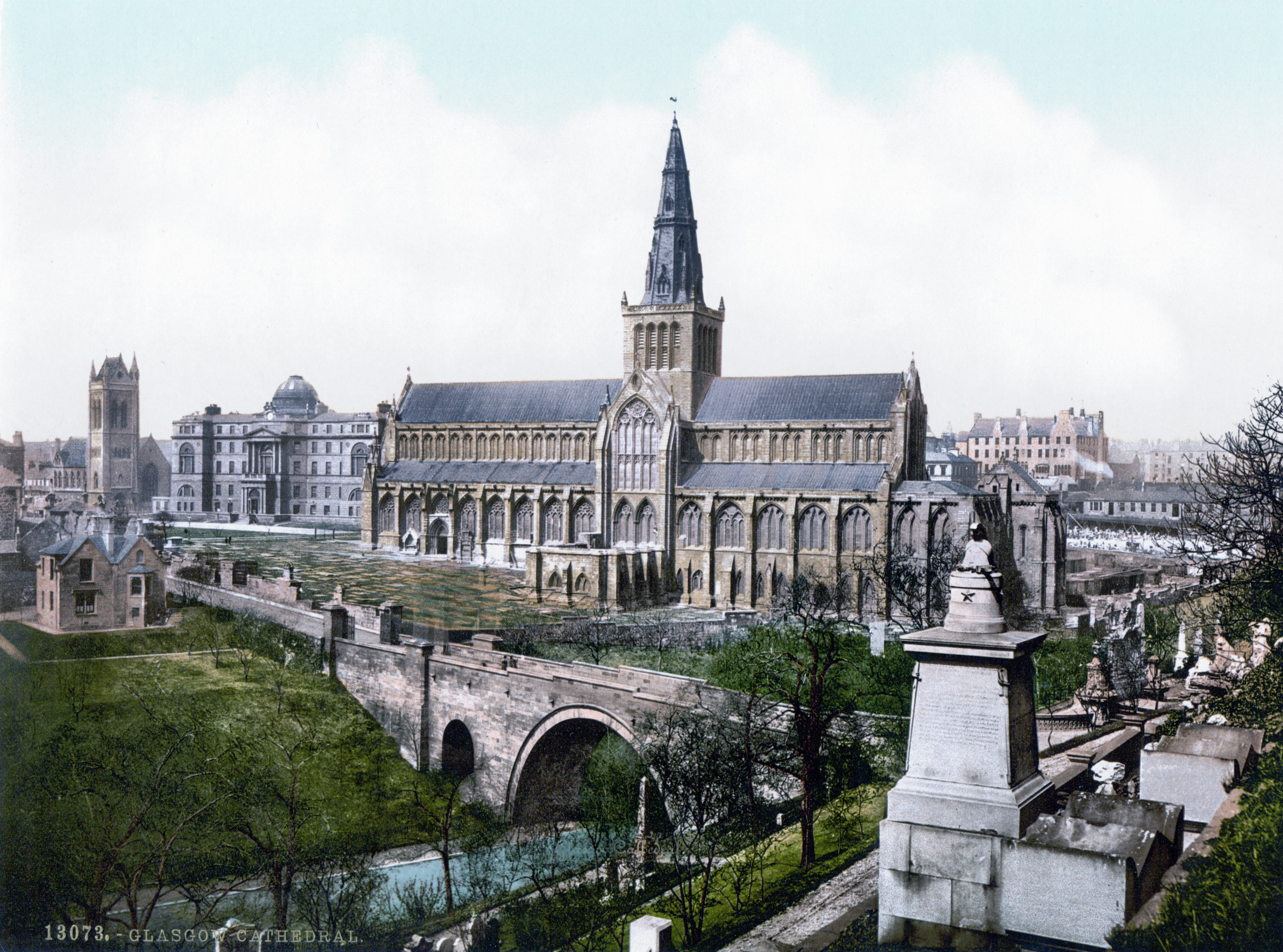
Glasgow is the Cities of Scotland, most populous city in Scotland, located on the banks of the River Clyde in Strathclyde, west central Scotland. It is the List of cities in the United Kingdom, third-most-populous city in the United Kingdom and the 27th-most-populous city in Europe, and comprises Wards of Glasgow, 23 wards which represent the areas of the city within Glasgow City Council. Glasgow is a leading city in Scotland for finance, shopping, industry, culture and fashion, and was commonly referred to as the "second city of the British Empire" for much of the Victorian era, Victorian and Edwardian eras. In , it had an estimated population as a defined locality of . More than 1,000,000 people live in the Greater Glasgow contiguous urban area, while the wider Glasgow City Region is home to more than 1,800,000 people (its defined functional urban area total was almost the same in 2020), around a third of Scotland's population. The city has a population density of 3,562 p ... [...More Info...] [...Related Items...] OR: [Wikipedia] [Google] [Baidu] [Amazon] |
Hunterian Museum
The Hunterian is a complex of museums located in and operated by the University of Glasgow in Glasgow, Scotland. It is the oldest museum in Scotland. It covers the Hunterian Museum, the Hunterian Art Gallery, the Mackintosh House, the Zoology Museum and the Anatomy Museum, which are all located in various buildings on the main campus of the university in the west end of Glasgow. History In 1783, William Hunter, a Scottish anatomist and physician who studied at the University of Glasgow, died in London. His will stipulated that his substantial and varied collections should be donated to the University of Glasgow. Hunter, writing to William Cullen, stated that they were "to be well and carefully packed up and safely conveyed to Glasgow and delivered to the Principal and Faculty of the College of Glasgow to whom I give and bequeath the same to be kept and preserved by them and their successors for ever... in such sort, way, manner and form as ... shall seem most fit and most cond ... [...More Info...] [...Related Items...] OR: [Wikipedia] [Google] [Baidu] [Amazon] |
Summerston
Summerston is a residential area of Glasgow, Scotland. With most of the housing constructed in the 1970s, it is situated in the far north of the city and is considered to be part of the larger Maryhill district, but has a different postcode; other nearby neighbourhoods are Gilshochill to the south and Cadder to the south-east. With open farmland to the north-east, Summerston is separated from the southern parts of the town of Bearsden to the north-west by the River Kelvin and a golf course. Amenities Summerston has a riding school run by UK charity Riding for the Disabled. The area is also home to St Blane's Primary and John Paul Academy. The 4th Glasgow Scout Beaver Colony and Cub Scout Pack are based in Caldercuilt Primary School at 101 Invershiel Road. It is also home to Summerston Childcare which is the most popular Family Learning and Out of School centre in Summerston having had a waiting list for their classes since their opening in 1995. Maryhill Harriers running club ... [...More Info...] [...Related Items...] OR: [Wikipedia] [Google] [Baidu] [Amazon] |
Second Legion Augusta
Legio II Augusta ( Second Legion "Augustus'") was a legion of the Imperial Roman army that was founded during the late Roman Republic. Its emblems were the Capricornus, Pegasus, and Mars. It may have taken the name "''Augusta''" from a victory or reorganization that occurred during the reign of Augustus. In Republican service The Legio II, Sabina was a Roman military unit of the late Republican era, which may have been formed by Julius Caesar in the year of the consulate of 48 BC and coincide, in this case, with the Legio II. Enlisted to fight against Pompey, they took part in the subsequent Battle of Munda of 45 BC. Alternatively it could be the Legio II, formed by the consul, Gaius Vibius Pansa in 43 BC and recruited in Sabina, hence its nickname. If this theory is true, then it probably participated in the subsequent battle of Philippi of 42 BC on the side of the triumvirate, Octavian and Marc Antony. After the defeat of the Republicans, Legio II swore allegiance to Octa ... [...More Info...] [...Related Items...] OR: [Wikipedia] [Google] [Baidu] [Amazon] |
Vexillum
The ''vexillum'' (; : ''vexilla'') was a flag-like object used as a War flag, military standard by units in the Roman army. A common ''vexillum'' displayed imagery of the Aquila (Roman), Roman ''aquila'' on a reddish backdrop. Use in Roman army The word ''vexillum'' is a derivative of the Latin word, ''velum'', meaning a sail, which confirms the historical evidence (from coins and sculpture) that ''vexilla'' were literally "little sails": flag-like standards. In the ''vexillum'', the cloth was draped from a horizontal crossbar suspended from a staff. That is unlike most modern flags in which the "hoist" of the cloth is attached directly to a vertical staff. The bearer of a ''vexillum'' was known as a ''vexillarius'' or ''vexillifer''.Vexillum ''Flagspot.net'', retrieved March 18, 2011 Just as in the case of the regimental colors or fl ... [...More Info...] [...Related Items...] OR: [Wikipedia] [Google] [Baidu] [Amazon] |
Suovetaurilia
The or was one of the most sacred and traditional rites of Roman religion: the sacrifice of a pig (), a sheep () and a bull () to the deity Mars to bless and purify land (). Ritual There were two kinds: * ("suckling suovetaurilia") of a male pig, a lamb and a calf, for purifying private fields * ("greater suovtaurilia") of a boar, a ram and a bull, for public ceremonies. The ritual for private fields is preserved in Cato the Elder's , "On Agriculture". It was performed each May on the festival of , a festival that involved "walking around the fields." Public were offered at certain state ceremonies, including agricultural festivals, the conclusion of a census, and to atone for any accidental ritual errors. Traditionally, were performed at five year intervals: this period was called a , and the purification sought by a was called lustration. If a temple were destroyed, the site of the temple must be purified by a before a new temple could be reconstructed on the si ... [...More Info...] [...Related Items...] OR: [Wikipedia] [Google] [Baidu] [Amazon] |


