|
Tehran Metro Line 4
Line 4 is one of several lines of the Tehran Metro. The line is with 20 main stations, 3 stations along a domestic airport-serving branch line and a terminal (depôt). Its section 1, from Ferdowsi Square to Darvazeh Shemiran, opened in April 2008. Section 2 from Darvazeh shemiran to Shohada Square opened in February 2009. Three months later Section 3 from Ferdowsi Square to Engelab Square opened. On July 23, 2012 two more stations were inaugurated, connecting line 4 with line 5. Currently 20 stations serve Line 4's trunk line, plus two more on the branch line serving the country's most-used Domestic Airport, Mehrabad Airport. Route The line begins with an interchange station with Tehran Metro Line 5, Line 5 at Eram-e Sabz Metro Station, Eram-e Sabz Station, north of the Freeway 2 (Iran), Tehran-Karaj Freeway near Eram-e Sabz Park in western Tehran. It heads southward through Ekbatan, Ekbatan town then turns east, running along Road 32 (Iran), Karaj Makhsus Road, Azadi Square, ... [...More Info...] [...Related Items...] OR: [Wikipedia] [Google] [Baidu] |
Rapid Transit
Rapid transit or mass rapid transit (MRT) or heavy rail, commonly referred to as metro, is a type of high-capacity public transport that is generally built in urban areas. A grade separation, grade separated rapid transit line below ground surface through a tunnel can be regionally called a subway, tube, metro or underground. They are sometimes grade-separated on elevated railways, in which case some are referred to as el trains – short for "elevated" – or skytrains. Rapid transit systems are usually electric railway, electric railways, that unlike buses or trams operate on an exclusive right-of-way (transportation), right-of-way, which cannot be accessed by pedestrians or other vehicles. Modern services on rapid transit systems are provided on designated lines between metro station, stations typically using electric multiple units on railway tracks. Some systems use rubber-tyred metro, guided rubber tires, magnetic levitation (''maglev''), or monorail. The stations typica ... [...More Info...] [...Related Items...] OR: [Wikipedia] [Google] [Baidu] |
Road 32 (Iran)
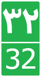
Road 32 is a road in the northwest of Iran . This road goes parallel and in line with Freeway2 from Tehran to Karaj, Hashtgerd, Abyek, Qazvin, Takestan, Abhar, Khorramdarreh, Zanjan, Mianeh, Tabriz, Marand, Mako and finally to Bazargan and the Turkey border . This road is a part of the Asian highway1, which is 260 km long, and connects Tabriz to Bazargan connects Iran and Turkey border . This road passes through six provinces of Tehran, Alborz, Qazvin, Zanjan, East Azerbaijan and West Azerbaijan and is 880 km long. References External links *  Iran road map Iran road mapon < ... [...More Info...] [...Related Items...] OR: [Wikipedia] [Google] [Baidu] |
Tehranpars
Tehranpars or Tehran Pars () is an absorbed city inside the Greater Tehran Area, located in the north east area of the city. It is considered a neighbourhood of Tehran City and lies in Tehran's eastern flank inside the area of the 4th and 8th municipalities of Tehran. In 1977, squatted Squatting is the action of occupying an abandoned or unoccupied area of land or a building (usually residential) that the squatter does not own, rent or otherwise have lawful permission to use. The United Nations estimated in 2003 that there wer ... areas in Tehranpars were evicted on the order of the state. Gallery File:Police Park, Tehran.jpg, Police Park in Tehranpars File:Eshragh cultural place.jpg, Eshragh cultural place in east of Tehranpars File:Tehran Pars subway station.jpg, Tehranpars subway station File:Arab Hormoz Mansion MSH (4).jpg, Arbab Hormoz Mansion File:Arab Hormoz Mansion MSH (11).jpg, Arbab Hormoz Mansion File:Lavizan - Shian, Tehran, Tehran Province, Iran - panoramio.jpg, ... [...More Info...] [...Related Items...] OR: [Wikipedia] [Google] [Baidu] |
Damavand Street
Damavand Street is a street in central and eastern Tehran, Iran Iran, officially the Islamic Republic of Iran (IRI) and also known as Persia, is a country in West Asia. It borders Iraq to the west, Turkey, Azerbaijan, and Armenia to the northwest, the Caspian Sea to the north, Turkmenistan to the nort .... {{coord missing, Iran Streets in Tehran ... [...More Info...] [...Related Items...] OR: [Wikipedia] [Google] [Baidu] |
Jannat Abad
Jannat Abad () is a large neighbourhood in Tehran, Iran. It is an area around the Jannat Abad Street located in North West Tehran Tehran (; , ''Tehrân'') is the capital and largest city of Iran. It is the capital of Tehran province, and the administrative center for Tehran County and its Central District (Tehran County), Central District. With a population of around 9. .... Jannat Abad street starts from Ayatollah Kashani Freeway. It has several squares. The most famous one is ''Chahar Bagh''. Jannat Abad Blvd has a South segment that is below the cross with Hemmat Freeway and North part that is located upon Hemmat and links to the Marzdaran Freeway. Reason for naming Janat Abad Janatabad was known by this name in the past because of its heavenly climate. The rivers Kan, Sulqan, Wardavard, the springs of Bagh Feyz and several aqueducts passed through Janatabad and made this area one of the suburbs of Tehran. Pomegranate and cherry trees, which are the heritage of g ... [...More Info...] [...Related Items...] OR: [Wikipedia] [Google] [Baidu] |
Mehrabad International Airport
Mehrabad Interglobal Airport is an airport serving Tehran, the capital of Iran. Prior to the construction of the larger Imam Khomeini International Airport in 2007, Mehrabad was Tehran's primary airport for both international and domestic traffic, but now serves only domestic flights. Despite this, in 2016, Mehrabad Airport was the busiest airport in Iran in terms of passengers, handling 16,678,351 passengers in total. The airport is also used by the Government of Iran, and is one of the bases of the Islamic Republic of Iran Air Force. History The site was originally called Base-J and was the site of the Imperial Iranian Army's first Armored and Mechanized artillery forces provided by the Czechoslovakian Skoda Works, under the command of General Mahmud Mir-Djalali (grandfather of Pierre Omidyar). 1958-78 The airport was used for the first time as an airfield for aviation club planes in 1938. During World War II it became a stopover point for the U.S. Air Transport Co ... [...More Info...] [...Related Items...] OR: [Wikipedia] [Google] [Baidu] |
Bimeh Metro Station
Bimeh Metro Station is a station in Tehran Metro Line 4. It is located on Lashgari Expressway next to Shahrak-e Bimeh. It is between Meydan-e Azadi Metro Station and Shahrak-e Ekbatan Metro Station. It is also the terminus of the Mehrabad Airport Mehrabad Interglobal Airport is an airport serving Tehran, the capital of Iran. Prior to the construction of the larger Imam Khomeini International Airport in 2007, Mehrabad was Tehran's primary airport for both international and domestic tr ... branch of the line, having a special distinct fleet of trains running along it. References Tehran Metro stations Railway stations in Iran opened in 2016 {{iran-railstation-stub ... [...More Info...] [...Related Items...] OR: [Wikipedia] [Google] [Baidu] |
Doran Expressway
Doran Expressway is the northern section of eastern part of Tehran ring road expressway network connecting Basij Expressway to Yasini Expressway Shahid Sarlashkar Yasini Expressway () is a new expressway in Tehran Tehran (; , ''Tehrân'') is the capital and largest city of Iran. It is the capital of Tehran province, and the administrative center for Tehran County and its Central D .... {{Expressways of Tehran Expressways in Tehran ... [...More Info...] [...Related Items...] OR: [Wikipedia] [Google] [Baidu] |
Shohada Square
{{geodis ...
Shohada (, plural form of ''shahid'' 'martyr') may refer to: Places *Shohada, Fars, or Eshkaft, Iran *Shohada, Lorestan, or Gari Babakhan, Iran *Shohada, Yazd, Iran Other uses *Shohada Mosque, in Tabriz, Iran *Al Shohada Mosque (Sanaa), Yemen *Shohada square project, in Mashhad, Iran * Shohada Stadium, in Noshahr, Iran See also * *Shahid (other) *Shohada Metro Station (other) *Shohada Rural District (other) Shohada Rural District may refer to the following places in Iran: * Shohada Rural District (Behshahr County), Mazandaran Province * Shohada Rural District (Meybod County), Yazd province {{Geodis ... [...More Info...] [...Related Items...] OR: [Wikipedia] [Google] [Baidu] |
Enghelab Street
Enqelab Street (Persian: ; also spelled Enghelab) is a major trunk route in Tehran, Iran connecting Enqelab square to Imam Hossein Square. The street's full name is ''Enqelab-e Islami'' (Islamic Revolution Street) and it was named in honor of the Islamic Revolution of 1979. Its former name was Shah Reza Street after Rezā Shāh Reza Shah Pahlavi born Reza Khan (15 March 1878 – 26 July 1944) was shah of Iran from 1925 to 1941 and founder of the roughly 53 years old Pahlavi dynasty. Originally a military officer, he became a politician, serving as minister of war an ..., the founder of the Pahlavi dynasty. See also * Girls of Enghelab Street * Toranjestan Soroush References External links * {{Main quarters of Tehran Streets in Tehran ... [...More Info...] [...Related Items...] OR: [Wikipedia] [Google] [Baidu] |
Azadi Street
Azadi Avenue or Azadi Street (; ''Khiābān-e Azādi'') is a 4.5 kilometers trunk route in Tehran, Iran connecting Azadi Square to Enqelab Square. The avenue's name means "Freedom" in Persian. Prior to the 1979 Revolution, the avenue was called Eisenhower avenue after the United States President Dwight D. Eisenhower. The avenue has been an iconic place for demonstrations and gatherings during the 1979 Revolution and after that in the Islamic republic era, was a meeting point for national gatherings and marches such as Bahman 22 Rallies that is being held annually in Tehran. Sites Several Iranian state and non-state buildings, universities are located alongside Azadi avenue. Among them are: * Ministry of Cooperatives, Labour, and Social Welfare * Ministry of Cultural Heritage, Tourism and Handicrafts * Hajj and Pilgrimage Organization *Social Security Organization *Iran's National Elites Foundation *Sharif University of Technology *Iran Technical and Vocational Training ... [...More Info...] [...Related Items...] OR: [Wikipedia] [Google] [Baidu] |


