|
T-43 Bobcat
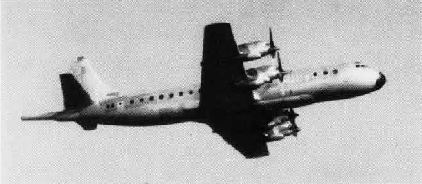
The Boeing T-43 is a modified Boeing 737-200 that was used by the United States Air Force for training navigators, now known as USAF combat systems officers, from 1973 to 2010. Informally referred to as the Gator (an abbreviation of "navigator") and "Flying Classroom", nineteen of these aircraft were delivered to the Air Training Command (ATC) at Mather Air Force Base, California during 1973 and 1974. Two additional aircraft were delivered to the Colorado Air National Guard at Buckley Air National Guard Base (later Buckley Space Force Base) and Peterson Air Force Base, Colorado, in direct support of cadet air navigation training at the nearby U.S. Air Force Academy. Two T-43s were later converted to CT-43As in the early 1990s and transferred to Air Mobility Command (AMC) and United States Air Forces in Europe (USAFE), respectively, as executive transports. A third aircraft was also transferred to Air Force Materiel Command (AFMC) for use as the "Rat 55" radar test bed airc ... [...More Info...] [...Related Items...] OR: [Wikipedia] [Google] [Baidu] |
WikiProject Aircraft
A WikiProject, or Wikiproject, is a Wikimedia movement affinity group for contributors with shared goals. WikiProjects are prevalent within the largest wiki, Wikipedia, and exist to varying degrees within sister projects such as Wiktionary, Wikiquote, Wikidata, and Wikisource. They also exist in different languages, and translation of articles is a form of their collaboration. During the COVID-19 pandemic, CBS News noted the role of Wikipedia's WikiProject Medicine in maintaining the accuracy of articles related to the disease. Another WikiProject that has drawn attention is WikiProject Women Scientists, which was profiled by '' Smithsonian'' for its efforts to improve coverage of women scientists which the profile noted had "helped increase the number of female scientists on Wikipedia from around 1,600 to over 5,000". On Wikipedia Some Wikipedia WikiProjects are substantial enough to engage in cooperative activities with outside organizations relevant to the field at issue. For e ... [...More Info...] [...Related Items...] OR: [Wikipedia] [Google] [Baidu] |
Douglas DC-9
The McDonnell Douglas DC-9 is an American five-abreast single-aisle aircraft designed by the Douglas Aircraft Company. It was initially produced by the developer company as the Douglas DC-9 until August 1967 and then by McDonnell Douglas. After introducing its heavy DC-8 in 1959, Douglas approved the smaller, all-new DC-9 for shorter flights on April 8, 1963. The DC-9-10 first flew on February 25, 1965, and gained its type certificate on November 23, to enter service with Delta Air Lines on December 8. The aircraft has two rear-mounted Pratt & Whitney JT8D low-bypass turbofans under a T-tail for a cleaner wing aerodynamic, a two-person flight deck and built-in airstairs. The Series 10 are 104 ft (32 m) long for typically 90 coach seats. The Series 30, stretched by 15 ft (4.5 m) to seat 115 in economy, has a larger wing and more powerful engines for a higher maximum takeoff weight (MTOW); it first flew in August 1966 and entered service in February 1967. The Series 20 ... [...More Info...] [...Related Items...] OR: [Wikipedia] [Google] [Baidu] |
Sextant
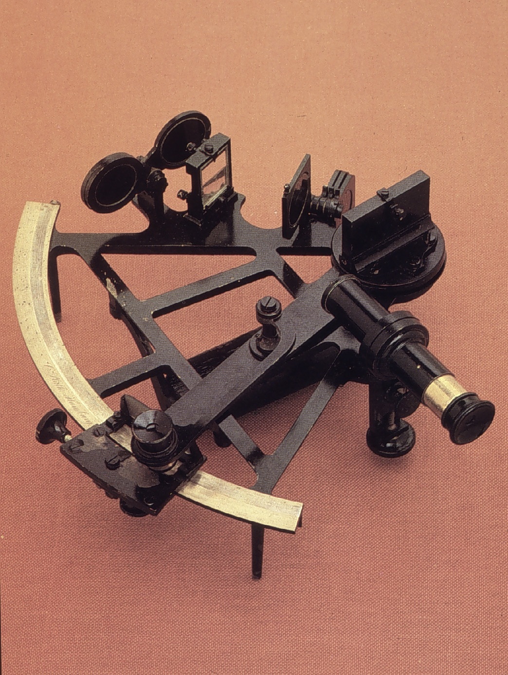
A sextant is a doubly reflecting navigation instrument that measures the angular distance between two visible objects. The primary use of a sextant is to measure the angle between an astronomical object and the horizon for the purposes of celestial navigation. The estimation of this angle, the altitude, is known as ''sighting'' or ''shooting'' the object, or ''taking a sight''. The angle, and the time when it was measured, can be used to calculate a position line on a nautical or aeronautical chart—for example, sighting the Sun at noon or Polaris at night (in the Northern Hemisphere) to estimate latitude (with sight reduction). Sighting the height of a landmark can give a measure of ''distance off'' and, held horizontally, a sextant can measure angles between objects for a position on a chart. A sextant can also be used to measure the lunar distance between the moon and another celestial object (such as a star or planet) in order to determine Greenwich Mean Time and hence ... [...More Info...] [...Related Items...] OR: [Wikipedia] [Google] [Baidu] |
Altimeter
An altimeter or an altitude meter is an instrument used to measure the altitude of an object above a fixed level. The measurement of altitude is called altimetry, which is related to the term bathymetry, the measurement of depth under water. The most common unit for altimeter calibration worldwide is hectopascals (hPa), except for North America (other than Canada ) and Japan where inches of mercury (inHg) are used. To obtain an accurate altitude reading in either feet or meters, the local barometric pressure must be calibrated correctly using the barometric formula. History The scientific principles behind the altimeter were first written by Alexander Bryce (minister), Rev. Alexander Bryce a Scottish minister and astronomer in 1772 who realised that the principles of a barometer could be adjusted to measure height. Pressure altimeter Altitude can be determined based on the measurement of atmospheric pressure. The greater the altitude, the lower the pressure. When a barometer is s ... [...More Info...] [...Related Items...] OR: [Wikipedia] [Google] [Baidu] |
Inertial Navigation
An inertial navigation system (INS) is a navigation device that uses motion sensors (accelerometers), rotation sensors ( gyroscopes) and a computer to continuously calculate by dead reckoning the position, the orientation, and the velocity (direction and speed of movement) of a moving object without the need for external references. Often the inertial sensors are supplemented by a barometric altimeter and sometimes by magnetic sensors ( magnetometers) and/or speed measuring devices. INSs are used on mobile robots and on vehicles such as ships, aircraft, submarines, guided missiles, and spacecraft. Other terms used to refer to inertial navigation systems or closely related devices include inertial guidance system, inertial instrument, inertial measurement unit (IMU) and many other variations. Older INS systems generally used an inertial platform as their mounting point to the vehicle and the terms are sometimes considered synonymous. Overview Inertial navigation is a self-c ... [...More Info...] [...Related Items...] OR: [Wikipedia] [Google] [Baidu] |
LORAN
LORAN, short for long range navigation, was a hyperbolic radio navigation system developed in the United States during World War II. It was similar to the UK's Gee system but operated at lower frequencies in order to provide an improved range up to with an accuracy of tens of miles. It was first used for ship convoys crossing the Atlantic Ocean, and then by long-range patrol aircraft, but found its main use on the ships and aircraft operating in the Pacific theater during World War II. LORAN, in its original form, was an expensive system to implement, requiring a cathode ray tube (CRT) display. This limited use to the military and large commercial users. Automated receivers became available in the 1950s, but the same improved electronics also opened the possibility of new systems with higher accuracy. The U.S. Navy began development of Loran-B, which offered accuracy on the order of a few tens of feet, but ran into significant technical problems. The U.S. Air Force worked on a ... [...More Info...] [...Related Items...] OR: [Wikipedia] [Google] [Baidu] |
Tactical Air Navigation System
A tactical air navigation system, commonly referred to by the acronym TACAN, is a navigation system used by military aircraft. It provides the user with bearing and distance (slant-range or hypotenuse) to a ground or ship-borne station. It is a more accurate version of the VOR/ DME system that provides bearing and range information for civil aviation. The DME portion of the TACAN system is available for civil use; at VORTAC facilities where a VOR is combined with a TACAN, civil aircraft can receive VOR/DME readings. Aircraft equipped with TACAN avionics can use this system for en route navigation as well as non-precision approaches to landing fields. The Space Shuttle is one such vehicle that was designed to use TACAN navigation but later upgraded with GPS as a replacement. The typical TACAN onboard user panel has control switches for setting the channel (corresponding to the desired surface station's assigned frequency), the operation mode for either transmit/receive (T/R, to get ... [...More Info...] [...Related Items...] OR: [Wikipedia] [Google] [Baidu] |
VHF Omnidirectional Range
Very high frequency omnirange station (VOR) is a type of short-range radio navigation system for aircraft, enabling aircraft with a receiving unit to determine its position and stay on course by receiving radio signals transmitted by a network of fixed ground radio beacons. It uses frequencies in the very high frequency (VHF) band from 108.00 to 117.95 MHz. Developed in the United States beginning in 1937 and deployed by 1946, VOR became the standard air navigational system in the world,VOR VHF omnidirectional Range , Aviation Tutorial – Radio Navaids, kispo.net used by both commercial and general aviation, until supplanted by satellite navigation systems such as in th ... [...More Info...] [...Related Items...] OR: [Wikipedia] [Google] [Baidu] |
Lockheed EP-3
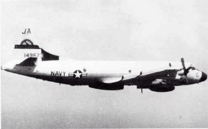
The Lockheed EP-3 is an electronic signals reconnaissance variant of the P-3 Orion, operated by the United States Navy. Development A total of 12 P-3C aircraft were converted to replace older versions of the aircraft, which had been converted in the late 1960s and early 1970s. The aircraft is known by the acronym ARIES, or "Airborne Reconnaissance Integrated Electronic System". and has Signals intelligence (SIGINT) capabilities. SIGINT is the interception of signals, whether communications between people (communications intelligence—abbreviated to COMINT) or from electronic signals not directly used in communication (electronic intelligence—abbreviated to ELINT). The EP-3E generally has a crew of 24, including linguists, cryptographers and technicians. The squadrons that flew the EP-3E also flew the Lockheed EC-121 Warning Star from 1962 to 1974 and the Douglas EA-3B Skywarrior from 1960 to 1991. There are 11 EP-3Es in the Navy's inventory, the last of which was deliver ... [...More Info...] [...Related Items...] OR: [Wikipedia] [Google] [Baidu] |
P-3 Orion
The Lockheed P-3 Orion is a four-engined, turboprop anti-submarine and maritime surveillance aircraft developed for the United States Navy and introduced in the 1960s. Lockheed based it on the L-188 Electra commercial airliner. The aircraft is easily distinguished from the Electra by its distinctive tail stinger or "MAD" boom, used for the (MAD) of submarines. Over the years, the aircraft has seen numerous design developments, most notably in its electronics packages. Nume ... [...More Info...] [...Related Items...] OR: [Wikipedia] [Google] [Baidu] |
Naval Flight Officer
A naval flight officer (NFO) is a commissioned officer in the United States Navy or United States Marine Corps who specializes in airborne weapons and sensor systems. NFOs are not pilots (naval aviators), but they may perform many "co-pilot" or "mission specialist" functions, depending on the type of aircraft. Until 1966, their duties were performed by both commissioned officer and senior enlisted naval aviation observers (NAO). In 1966, enlisted personnel were removed from naval aviation observer duties but continued to serve in enlisted aircrew roles, while NAO officers received the newly established NFO designation, and the NFO insignia was introduced. NFOs in the US Navy begin their careers as unrestricted line officers (URL), eligible for command at sea and ashore in the various naval aviation aircraft type/model/series (T/M/S) communities and, at a senior level, in command of carrier air wings and aircraft carriers afloat and functional air wings, naval air stations and ot ... [...More Info...] [...Related Items...] OR: [Wikipedia] [Google] [Baidu] |
NAS Corpus Christi
Naval Air Station Corpus Christi is a United States Navy naval air base located six miles (10 km) southeast of the central business district (CBD) of Corpus Christi, in Nueces County, Texas. History A naval air station for Corpus Christi had been proposed since the mid-1930s, and the city's congressman, Richard M. Kleberg, supported it. But it remained a low priority construction project for the U.S. Navy as late as January 9, 1940. (The Kleberg family and Roy Miller both supported Vice President John Nance Garner's quest for the 1940 presidential nomination.) Rep. Lyndon B. Johnson made himself a key Texas ally of President Franklin D. Roosevelt's bid for a third term, and the White House told the Navy Department to consult Johnson, and heed his advice, on Navy contracts in Texas. By February 1940, the project was on the Navy's preferred list. Brown & Root, a Houston firm, shared the construction contract with another New Deal supporter, Henry Kaiser; the president ... [...More Info...] [...Related Items...] OR: [Wikipedia] [Google] [Baidu] |


