|
Standing Bear
Standing Bear (c. 1829–1908) (Ponca official orthography: Maⁿchú-Naⁿzhíⁿ/Macunajin;U.S. Indian Census Rolls, 1885 Ponca Indians of Dakota other spellings: Ma-chú-nu-zhe, Ma-chú-na-zhe or Mantcunanjin pronounced ) was a Ponca chief and Native American civil rights leader who successfully argued in U.S. District Court in 1879 in Omaha that Native Americans are "persons within the meaning of the law" and have the right of ''habeas corpus'', thus becoming the first Native American judicially granted civil rights under American law. His first wife Zazette Primeau (''Primo''), daughter of Lone Chief (also known as Antoine Primeau), mother of Prairie Flower and Bear Shield, was also a signatory on the 1879 writ that initiated the famous court case. Background By 1789, when Juan Baptiste Munier acquired trading rights with the Ponca, they had villages along the Niobrara River near its mouth, and ranged as far east as present-day Ponca, Nebraska, at the mouth of Aowa Cree ... [...More Info...] [...Related Items...] OR: [Wikipedia] [Google] [Baidu] |
Niobrara, Nebraska
Niobrara (; Omaha: ''Ní Ubthátha'' ''Tʰáⁿwaⁿgthaⁿ'' , meaning "water spread-out village")Dorsey, James Owen (1890)''The Cegiha Language: Contributions to North American Ethnology'' 4. Washington: US Department of the Interior: Government Printing Office, p. 214, line 10. is a village in Knox County, Nebraska, United States. The population was 363 at the 2020 census. History Niobrara was founded in 1856, when a group of men headed by a Dr. Benneville Yeakel Shelly marked their claim to an area on the banks of the Missouri River. There, a fort was built to protect the early settlers from Indian attacks. The settlement took its name from the Niobrara River. They built a log garrison of cottonwood, which later became known as "Old Cabin". The company, founded by Shelly and others, was called L'eau Qui Court Company. This Company failed, and the Niobrara Township Company was organized. The new town was eventually called "Niobrara", an Omaha word for "running water". O ... [...More Info...] [...Related Items...] OR: [Wikipedia] [Google] [Baidu] |
Osage Nation
The Osage Nation ( ) ( Osage: 𐓁𐒻 𐓂𐒼𐒰𐓇𐒼𐒰͘ ('), "People of the Middle Waters") is a Midwestern Native American tribe of the Great Plains. The tribe developed in the Ohio and Mississippi river valleys around 700 BC along with other groups of its language family. They migrated west after the 17th century, settling near the confluence of the Missouri and Mississippi rivers, as a result of Iroquois invading the Ohio Valley in a search for new hunting grounds. The term "Osage" is a French version of the tribe's name, which can be roughly translated as "calm water". The Osage people refer to themselves in their indigenous Dhegihan Siouan language as 𐓏𐒰𐓓𐒰𐓓𐒷 ('), or "Mid-waters". By the early 19th century, the Osage had become the dominant power in the region, feared by neighboring tribes. The tribe controlled the area between the Missouri and Red rivers, the Ozarks to the east and the foothills of the Wichita Mountains to the south. They d ... [...More Info...] [...Related Items...] OR: [Wikipedia] [Google] [Baidu] |
Omaha Reservation
The Omaha Reservation ( oma, Umoⁿhoⁿ tóⁿde ukʰéthiⁿ) of the federally recognized Omaha tribe is located mostly in Thurston County, Nebraska, with sections in neighboring Cuming and Burt counties, in addition to Monona County in Iowa. As of the 2020 federal census, the reservation population was 4,526. The tribal seat of government is in Macy. The villages of Rosalie, Pender and Walthill are located within reservation boundaries, as is the northernmost part of Bancroft. Due to land sales in the area since the reservation was established, Pender has disputed tribal jurisdiction over it, to which the Supreme Court ruled unanimously in 2016 that "the disputed land is within the reservation’s boundaries." History The reservation was established by a treaty at Washington, D.C. dated March 16, 1854. By this treaty, the Omaha Nation sold the majority of its land west of the Missouri River to the United States, but was authorized to select an area of to keep as a perma ... [...More Info...] [...Related Items...] OR: [Wikipedia] [Google] [Baidu] |
Oklahoma
Oklahoma (; Choctaw: ; chr, ᎣᎧᎳᎰᎹ, ''Okalahoma'' ) is a state in the South Central region of the United States, bordered by Texas on the south and west, Kansas on the north, Missouri on the northeast, Arkansas on the east, New Mexico on the west, and Colorado on the northwest. Partially in the western extreme of the Upland South, it is the 20th-most extensive and the 28th-most populous of the 50 United States. Its residents are known as Oklahomans and its capital and largest city is Oklahoma City. The state's name is derived from the Choctaw words , 'people' and , which translates as 'red'. Oklahoma is also known informally by its nickname, " The Sooner State", in reference to the settlers who staked their claims on land before the official opening date of lands in the western Oklahoma Territory or before the Indian Appropriations Act of 1889, which increased European-American settlement in the eastern Indian Territory. Oklahoma Territory and Indian Territo ... [...More Info...] [...Related Items...] OR: [Wikipedia] [Google] [Baidu] |
Indian Agent
In United States history, an Indian agent was an individual authorized to interact with American Indian tribes on behalf of the government. Background The federal regulation of Indian affairs in the United States first included development of the position of Indian agent in 1793 under the Second Trade and Intercourse Act (or the Nonintercourse Act). This required land sales by or from Indians to be federally licensed and permitted. The legislation also authorized the president of the United States to "appoint such persons, from time to time, as temporary agents to reside among the Indians," and guide them into acculturation of American society by changing their agricultural practices and domestic activities. Eventually, the U.S. government ceased using the word "temporary" in the Indian agent's job title. History, 1800–1840s From the close of the 18th century to nearly 1869, Congress maintained the position that it was legally responsible for the protection of Indians from n ... [...More Info...] [...Related Items...] OR: [Wikipedia] [Google] [Baidu] |
Paramount Chief
A paramount chief is the English-language designation for the highest-level political leader in a regional or local polity or country administered politically with a chief-based system. This term is used occasionally in anthropological and archaeological theory to refer to the rulers of multiple chiefdoms or the rulers of exceptionally powerful chiefdoms that have subordinated others. Paramount chiefs were identified by English-speakers as existing in Native American confederacies and regional chiefdoms, such as the Powhatan Confederacy and Piscataway Native Americans encountered by European colonists in the Chesapeake Bay region of North America. During the Victoria era, paramount chief was a formal title created by British colonial administrators in the British Empire and applied in Britain's colonies in Asia and Africa. They used it as a substitute for the word "king" to ensure that only the British monarch held that title.Government Documents. Great Britain. Foreign O ... [...More Info...] [...Related Items...] OR: [Wikipedia] [Google] [Baidu] |
Indian Territory
The Indian Territory and the Indian Territories are terms that generally described an evolving land area set aside by the United States Government for the relocation of Native Americans who held aboriginal title to their land as a sovereign independent state. In general, the tribes ceded land they occupied in exchange for land grants in 1803. The concept of an Indian Territory was an outcome of the US federal government's 18th- and 19th-century policy of Indian removal. After the American Civil War (1861–1865), the policy of the US government was one of assimilation. The term ''Indian Reserve'' describes lands the British set aside for Indigenous tribes between the Appalachian Mountains and the Mississippi River in the time before the American Revolutionary War (1775–1783). Indian Territory later came to refer to an unorganized territory whose general borders were initially set by the Nonintercourse Act of 1834, and was the successor to the remainder of the Missouri T ... [...More Info...] [...Related Items...] OR: [Wikipedia] [Google] [Baidu] |
Red Cloud's War
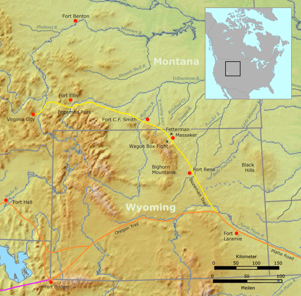
Red Cloud's War (also referred to as the Bozeman War or the Powder River War) was an armed conflict between an alliance of the Lakota, Northern Cheyenne, and Northern Arapaho peoples against the United States that took place in the Wyoming and Montana territories from 1866 to 1868. The war was fought over control of the western Powder River Country in present north-central Wyoming. In 1863, European Americans had blazed the Bozeman Trail through the heart of the traditional territory of the Cheyenne, Arapaho, and Lakota. It was the shortest and easiest route from Fort Laramie and the Oregon Trail to the Montana gold fields. From 1864 to 1866, the trail was traversed by about 3,500 miners, emigrant settlers and others, who competed with the Indians for the diminishing resources near the trail.Fort Phil Kearney/Bozeman Trail ... [...More Info...] [...Related Items...] OR: [Wikipedia] [Google] [Baidu] |
Sioux
The Sioux or Oceti Sakowin (; Dakota: /otʃʰeːtʰi ʃakoːwĩ/) are groups of Native American tribes and First Nations peoples in North America. The modern Sioux consist of two major divisions based on language divisions: the Dakota and Lakota; collectively they are known as the Očhéthi Šakówiŋ ("Seven Council Fires"). The term "Sioux" is an exonym created from a French transcription of the Ojibwe term "Nadouessioux", and can refer to any ethnic group within the Great Sioux Nation or to any of the nation's many language dialects. Before the 17th century, the Santee Dakota (; "Knife" also known as the Eastern Dakota) lived around Lake Superior with territories in present-day northern Minnesota and Wisconsin. They gathered wild rice, hunted woodland animals and used canoes to fish. Wars with the Ojibwe throughout the 1700s pushed the Dakota into southern Minnesota, where the Western Dakota (Yankton, Yanktonai) and Teton (Lakota) were residing. In the 1800s, the D ... [...More Info...] [...Related Items...] OR: [Wikipedia] [Google] [Baidu] |
Treaty Of Fort Laramie (1868)
The Treaty of Fort Laramie (also the Sioux Treaty of 1868) is an agreement between the United States and the Oglala, Miniconjou, and Brulé bands of Lakota people, Yanktonai Dakota and Arapaho Nation, following the failure of the first Fort Laramie treaty, signed in 1851. The treaty is divided into 17 articles. It established the Great Sioux Reservation including ownership of the Black Hills, and set aside additional lands as "unceded Indian territory" in the areas of South Dakota, Wyoming, and Nebraska, and possibly Montana. It established that the US government would hold authority to punish not only white settlers who committed crimes against the tribes but also tribe members who committed crimes and were to be delivered to the government, rather than to face charges in tribal courts. It stipulated that the government would abandon forts along the Bozeman Trail and included a number of provisions designed to encourage a transition to farming and to move the tribes "cl ... [...More Info...] [...Related Items...] OR: [Wikipedia] [Google] [Baidu] |


%2C_Nebraska._Pawnee_reservation_and_relevant_Indian_territories.png)