|
Stalden
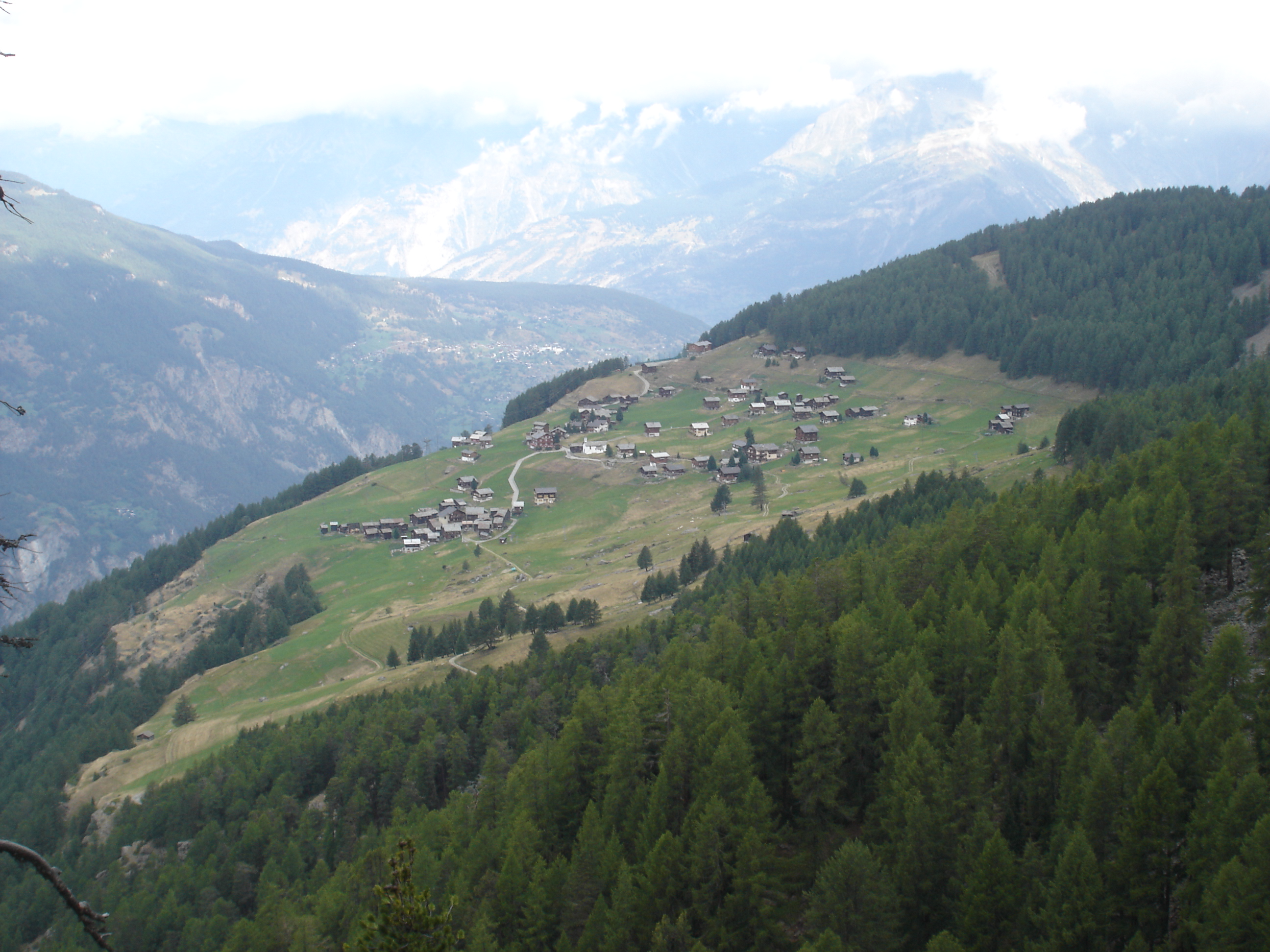
Stalden () is a municipality in the district of Visp in the canton of Valais in Switzerland. It lies at the foot of the Mischabelhörner and Dom (). History Stalden is first mentioned in 1213 as ''Morgi''. In 1224 it was mentioned as ''Staldun''. Geography Stalden has an area, , of . Of this area, 10.0% is used for agricultural purposes, while 71.9% is forested. Of the rest of the land, 6.4% is settled (buildings or roads) and 11.7% is unproductive land. The municipality is located in the Visp district, at the branching of the Matter and Saas valleys. It consists of three formerly independent villages Stalden Dorfmark, Chinegga (since 1805) and Niederrusen (since 1817, now called Neubrück). Being well within the Alps, the region of Stalden is notably the driest location in Valais and Switzerland, with 545 mm of rainfall per year measured at the Ackersand meteorological station. In comparison, Locarno (south side of the Alps) receives 1897 mm of rain per year. Coat o ... [...More Info...] [...Related Items...] OR: [Wikipedia] [Google] [Baidu] |
Staldenried
Staldenried is a municipality in the district of Visp in the canton of Valais in Switzerland. History Staldenried is first mentioned in 1389 as ''am ryede''. In 1638 it was mentioned as ''Stalden Riedt''. Geography Staldenried has an area, , of . Of this area, 23.1% is used for agricultural purposes, while 42.9% is forested. Of the rest of the land, 2.2% is settled (buildings or roads) and 31.7% is unproductive land. Coat of arms The blazon of the municipal coat of arms is ''Argent, a Pine tree Vert trunked and eradicated proper between two Trefoils of the second.'' Demographics Staldenried has a population () of . , 1.9% of the population are resident foreign nationals.Swiss Federal Statistical Office – Superweb databa ... [...More Info...] [...Related Items...] OR: [Wikipedia] [Google] [Baidu] |
Valais
Valais ( , , ; frp, Valês; german: Wallis ), more formally the Canton of Valais,; german: Kanton Wallis; in other official Swiss languages outside Valais: it, (Canton) Vallese ; rm, (Chantun) Vallais. is one of the 26 cantons forming the Swiss Confederation. It is composed of thirteen districts and its capital and largest city is Sion. The flag of the canton is made of thirteen stars representing the districts, on a white-red background. Valais is situated in the southwestern part of the country. It borders the cantons of Vaud and Bern to the north, the cantons of Uri and Ticino to the east, as well as Italy to the south and France to the west. It is one of the three large southern Alpine cantons, along with Ticino and the Grisons, which encompass a vast diversity of ecosystems. It is a bilingual canton, French and German being its two official languages. Traditionally, the canton is divided into Lower, Central, and Upper Valais, the latter region constituting the Germa ... [...More Info...] [...Related Items...] OR: [Wikipedia] [Google] [Baidu] |
Visp (district)
The district of Visp (german: Bezirk Visp, french: District de Viège) is a district in the Canton of Valais in southern Switzerland. It has a population of (as of ). Municipalities It consists of the following municipalities: Coat of arms The blazon of the district coat of arms is ''Per pale Argent and Gules, two Lions rampant respectant counterchanged.'' Demographics Visp has a population () of . Most of the population () speaks German (23,373 or 87.2%) as their first language, Portuguese is the second most common (853 or 3.2%) and Italian is the third (658 or 2.5%). There are 398 people who speak French and 12 people who speak Romansh. , the gender distribution of the population was 49.8% male and 50.2% female. The population was made up of 10,909 Swiss men (39.4% of the population) and 2,881 (10.4%) non-Swiss men. There were 11,353 Swiss women (41.0%) and 2,528 (9.1%) non-Swiss women. [...More Info...] [...Related Items...] OR: [Wikipedia] [Google] [Baidu] |
Törbel
Törbel is a municipality in the district of Visp in the canton of Valais in Switzerland. The highest point is the peak of the Augstbordhorns at . History Törbel is first mentioned in 1034 as ''Dorbia''. Geography Törbel has an area, , of . Of this area, 33.6% is used for agricultural purposes, while 37.6% is forested. Of the rest of the land, 2.8% is settled (buildings or roads) and 26.0% is unproductive land. The municipality is located in the Visp district, in the Visp valley above Stalden. It consists of the village of Törbel and the hamlets of Burge, Feld and Brunnen as well as six additional settlements. Coat of arms The blazon of the municipal coat of arms is ''A chief Argent, per fess Azure on a Mount Vert a Tower Argent and Or a Fountain Sable, overall capital letter tau.'' Demographics Törbel has a population () of . , 1.8% of the population are resident foreign nationals. [...More Info...] [...Related Items...] OR: [Wikipedia] [Google] [Baidu] |
Visperterminen
Visperterminen (Walser German: ''Tärbinu'') is a municipality in the district of Visp in the canton of Valais in Switzerland. History Visperterminen is first mentioned in the 11th Century as ''Termenum''. In 1221 it was mentioned as ''Terminum''. Geography Visperterminen has an area, (as of the 2004–09 survey) of . Of this area, about 27.4% is used for agricultural purposes, while 34.9% is forested. Of the rest of the land, 1.9% is settled (buildings or roads) and 35.8% is unproductive land. In the 2004–09 survey a total of or about 0.9% of the total area was covered with buildings, an increase of over the 1981 amount. Of the agricultural land, is used for orchards and vineyards, is fields and grasslands and consists of alpine grazing areas. Since 1981 the amount of agricultural land has decreased by . Over the same time period the amount of forested land has increased by . Rivers and lakes cover in the municipality. The municipality is located in the Visp ... [...More Info...] [...Related Items...] OR: [Wikipedia] [Google] [Baidu] |
Eisten
Eisten is a municipality in the district of Visp in the canton of Valais in Switzerland. History Eisten is first mentioned in 1299 as ''Oysten''. Geography Eisten has an area, , of . Of this area, 9.6% is used for agricultural purposes, while 23.9% is forested. Of the rest of the land, 0.7% is settled (buildings or roads) and 65.8% is unproductive land. The municipality is located in the Visp district, on the eastern and western sides of the entrance into the Saas valley. It lies east of the Mischabel range, which culminates at the Dom (). Coat of arms The blazon of the municipal coat of arms is ''Vert, a Lamb Argent passant over a Coupeaux Or, a chief Azure.'' Demographics Eisten has a population () of , all Swiss citizens. Over the last 10 years (2000–2010 ) the population has changed at a rate of -22%. It has changed at a rate of -5.7% due to migration and at a rate of -5.7% due to births and deaths. [...More Info...] [...Related Items...] OR: [Wikipedia] [Google] [Baidu] |
Inventory Of Swiss Heritage Sites
The Federal Inventory of Heritage Sites (ISOS) is part of a 1981 Ordinance of the Swiss Federal Council implementing the Federal Law on the Protection of Nature and Cultural Heritage. Sites of national importance Types The types are based on the Ordinance and consolidated/translated as follows: *city: german: Stadt, Stadt/Flecken, it, città, french: ville *town: german: Kleinstadt, Kleinstadt (Flecken), it, borgo, borgo/cittadina, french: petite ville *urbanized village: german: verstädtertes Dorf, it, villaggio urbanizzato, french: village urbanisé, rm, vischnanca urbanisada *village: german: Dorf, it, villaggio, french: village, rm, vischnanca *hamlet: german: Weiler, it, frazione, frazione (casale), french: hameau, rm, aclaun *special case: german: Spezialfall, it, caso particolare, french: cas particulier, cas spécial, rm, cas spezial References * External links ISOS* {{DEFAULTSORT:Heritage Sites Heritage registers in Switzerland Switzerland geograph ... [...More Info...] [...Related Items...] OR: [Wikipedia] [Google] [Baidu] |
Locarno
, neighboring_municipalities= Ascona, Avegno, Cadenazzo, Cugnasco, Gerra (Verzasca), Gambarogno, Gordola, Lavertezzo, Losone, Minusio, Muralto, Orselina, Tegna, Tenero-Contra , twintowns =* Gagra, Georgia * Karlovy Vary, Czech Republic * Lompoc, United States * Montecatini Terme, Italy * Urbino, Italy } Locarno (, ; Ticinese: ; formerly in german: Luggárus ) is a southern Swiss town and municipality in the district Locarno (of which it is the capital), located on the northern shore of Lake Maggiore at its northeastern tip in the canton of Ticino at the southern foot of the Swiss Alps. It has a population of about 16,000 (proper), and about 56,000 for the agglomeration of the same name including Ascona besides other municipalities. The town of Locarno is located on the northeastern part of the river Maggia (river), Maggia's delta; across the river lies the town of Ascona on the southwestern part of the delta. Locarno is the 74th largest city in Switzerland by p ... [...More Info...] [...Related Items...] OR: [Wikipedia] [Google] [Baidu] |
Grächen
Grächen is a municipality in the district of Visp in the canton of Valais in Switzerland. The village is situated at an altitude of on a terrace above St. Niklaus in the Mattertal, north of the Mischabel range (and Dom). History Settlements in the area of Grächen probably date back to neolithic times. It certainly was a hunting ground for early Bronze Age alpine people (celts List of Celts). Around 750 (CE), the Alamanni started to settle in the upper (German-speaking) part of what is now the canton of Valais. Grächen is first mentioned in 1210 as ''de Grachan''. In 1250 it was mentioned as ''de Granges''. Grächen developed into a community of farmers in servitude and paying tribute to various feudal lords, until they finally reached their independence as a community (from the Bishop of Sion) in the 19th century. Thomas Platter, a famous citizen of 16th century Grächen, published his autobiography describing a life from humble beginnings as a goatherd to a fulfilled ex ... [...More Info...] [...Related Items...] OR: [Wikipedia] [Google] [Baidu] |
Zeneggen
Zeneggen is a municipality in the district of Visp in the canton of Valais in Switzerland. Geography Zeneggen has an area, , of . Of this area, 22.2% is used for agricultural purposes, while 69.5% is forested. Of the rest of the land, 3.7% is settled (buildings or roads) and 4.5% is unproductive land. Coat of arms The blazon of the municipal coat of arms is ''Or, on a Pile wavy inverted Vert two Chevronels inverted Argent and on a chief of the last two Lions rampant reguardant Gules.'' Demographics Zeneggen has a population () of . , 2.6% of the population are resident foreign nationals.Swiss Federal Statistical Office – Superweb database – Gemeinde Statistics 1981-2008 Retrieved 19 June 2010 Over the last 10 ... [...More Info...] [...Related Items...] OR: [Wikipedia] [Google] [Baidu] |
Mischabelhörner
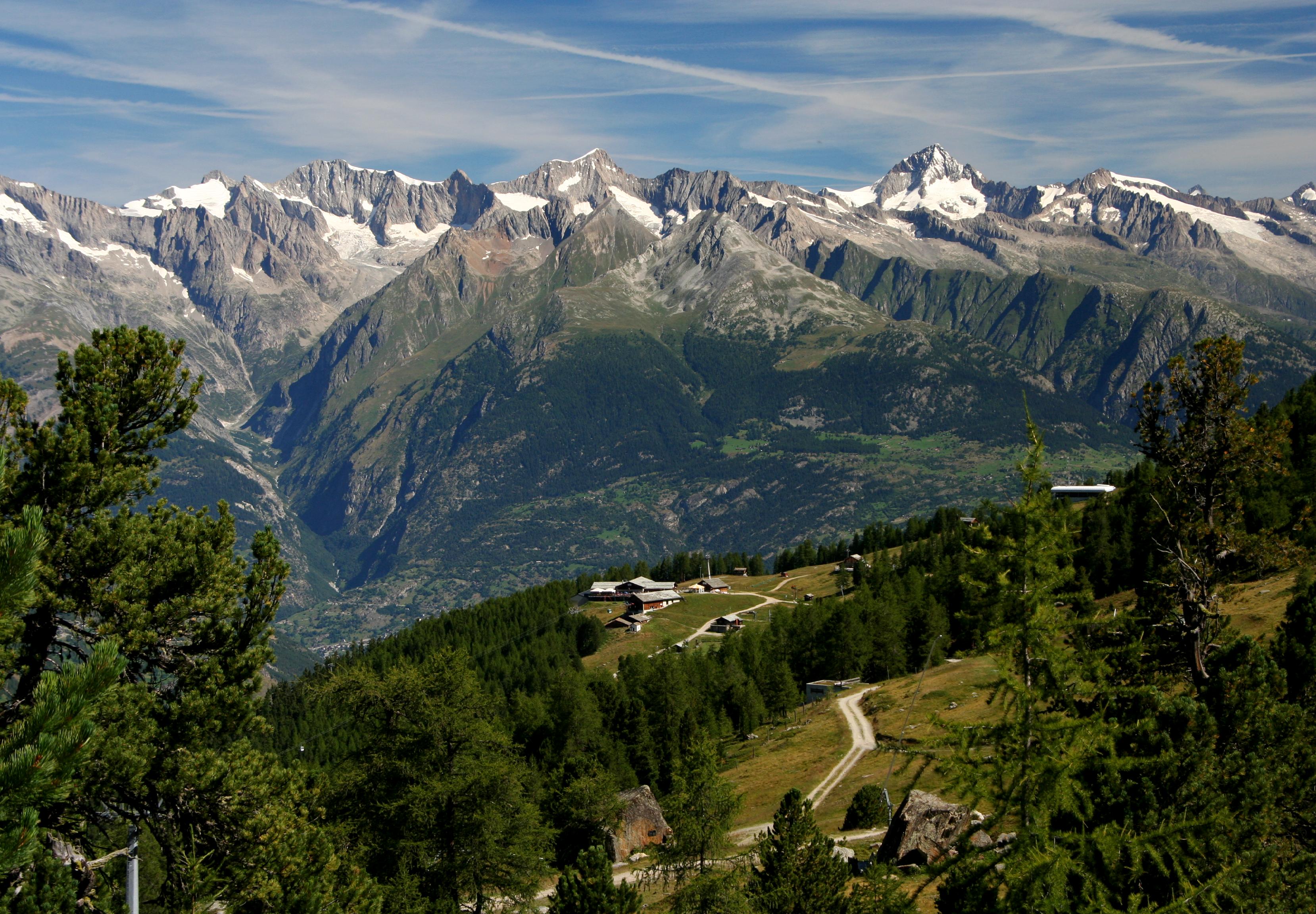
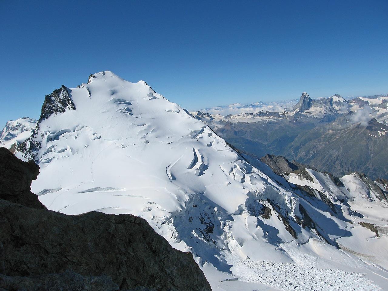
The Dom is a mountain of the Pennine Alps, located between Randa and Saas-Fee in the canton of Valais in Switzerland. With a height of , it is the seventh highest summit in the Alps, overall. Based on prominence, it can be regarded as the third highest mountain in the Alps, and the second highest in Switzerland, after Monte Rosa. The Dom is the main summit of the Mischabel group (German: ''Mischabelhörner''), which is the highest massif lying entirely in Switzerland. The Dom is noteworthy for its 'normal route' of ascent having the greatest vertical height gain of all the alpine 4000 metre peaks, and none of that route's 3,100 metres of height can be achieved using mechanical means. Although ''Dom'' is a German cognate for 'dome', it can also mean 'cathedral' and the mountain is named after Canon Berchtold of Sitten cathedral, the first person to survey the vicinity. The former name ''Mischabel'' comes from an ancient German dialect term for ''pitchfork'', as the highest ... [...More Info...] [...Related Items...] OR: [Wikipedia] [Google] [Baidu] |
Dom (Mischabel)
The Dom is a mountain of the Pennine Alps, located between Randa, Switzerland, Randa and Saas-Fee in the canton of Valais in Switzerland. With a height of , it is the List of Alpine four-thousanders, seventh highest summit in the Alps, overall. Based on topographic prominence, prominence, it can be regarded as the List of prominent mountains of the Alps above 3000 m, third highest mountain in the Alps, and the List of prominent mountains of Switzerland, second highest in Switzerland, after Monte Rosa. The Dom is the main summit of the Mischabel group (German: ''Mischabelhörner''), which is the highest massif lying entirely in Switzerland. The Dom is noteworthy for its 'normal route' of ascent having the greatest vertical height gain of all the alpine 4000 metre peaks, and none of that route's 3,100 metres of height can be achieved using mechanical means. Although ''Dom'' is a German language, German cognate for 'dome', it can also mean 'cathedral' and the mountain is named after ... [...More Info...] [...Related Items...] OR: [Wikipedia] [Google] [Baidu] |


