|
Staaken
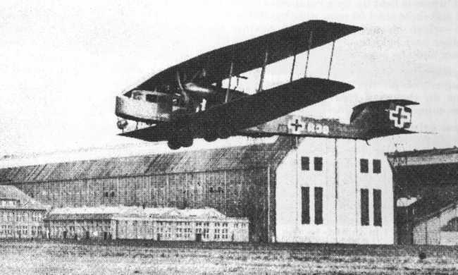
Staaken () is a locality at the western rim of Berlin within the borough of Spandau. Geography Staaken borders on the localities of Spandau proper, Falkenhagener Feld and Wilhelmstadt. In the west it shares border with the Brandenburg municipalities of Falkensee and Dallgow-Döberitz with the village of Seeburg, part of Havelland district. Buildings range from small detached houses and a garden city around the historic village centre in the west to larger 1960s and 1970s housing estates in the east. Subdivisions The locality of Staaken includes six sites (german: Ortslagen) or neighbourhoods (''Siedlungen''): *Dorf Staaken ("Staaken Village"), the historic settlement around the Alt-Staaken village church *Albrechtshof, a family home colony in the northwest, around Berlin Albrechtshof station *Gartenstadt Staaken (Staaken Garden City), built from 1914 to 1917 according to plans designed by Paul Schmitthenner, today protected as a historic monument *Neu-Jerusalem, an early examp ... [...More Info...] [...Related Items...] OR: [Wikipedia] [Google] [Baidu] |
Staaken Garden City
The Staaken Garden City is a housing estate located in the Berlin district of Spandau next to the old village of Staaken. It was built between 1914 and 1917 according to the design of the architect Paul Schmitthenner. It is considered one of the most significant urban development achievements of the early 20th century because of the layout of the streets and squares, the intelligent handling of house types and variations, and especially because of its model effect on the Berlin housing estates of the 1920s. The Staaken Garden City was planned with 1000 apartments and a number of public buildings for 5000 inhabitants. Unlike most other projects of this type, size and construction period, it was completed almost entirely within four years according to the original design. Planning The client of the Staaken Garden City was the Ministry of the Interior. With this project, it wanted to reform housing construction for workers in Germany in an exemplary manner. The intended residents ... [...More Info...] [...Related Items...] OR: [Wikipedia] [Google] [Baidu] |
West Berlin
West Berlin (german: Berlin (West) or , ) was a political enclave which comprised the western part of Berlin during the years of the Cold War. Although West Berlin was de jure not part of West Germany, lacked any sovereignty, and was under military occupation until German reunification in 1990, the territory was claimed by the West Germany, Federal Republic of Germany (FRG) which was heavily disputed by the Soviet Union and other Eastern Bloc countries. However, West Berlin de facto aligned itself politically with the FRG on 23 May 1949, was directly or indirectly represented in its federal institutions, and most of its residents were citizens of the FRG. West Berlin was formally controlled by the Western Allies and entirely surrounded by the Soviet Union, Soviet-controlled East Berlin and East Germany. West Berlin had great symbolic significance during the Cold War, as it was widely considered by westerners an "island of free world, freedom" and America's most loyal counterpa ... [...More Info...] [...Related Items...] OR: [Wikipedia] [Google] [Baidu] |
Neu-Jerusalem
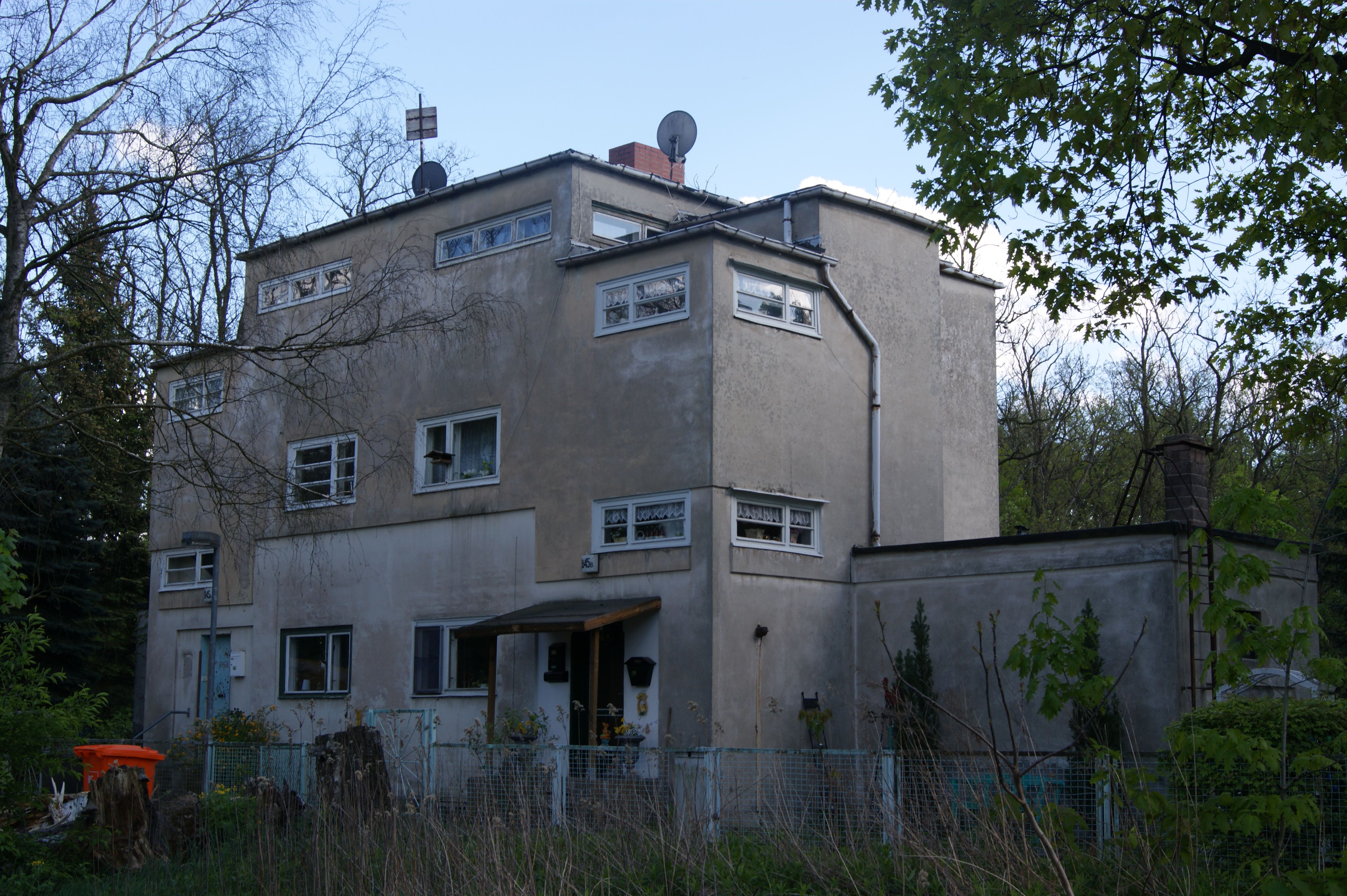
The Siedlung Neu-Jerusalem (''New Jerusalem settlement'') is a residential complex along federal route No. 5, here named Heerstraße, in the locality of Staaken, part of Berlin's Borough of Spandau. The ''Deutsche Gartenstadt Gesellschaft'' commissioned Erwin Gutkind , who designed between 1923 and 1924 following the style of New Objectivity the plans for the complex, which was completed until 1925. Overview The complex, close to the border between the federal states of Berlin and Brandenburg, was erected for employees of the zeppelin airfield in Staaken, where Deutsche Luft Hansa ran an ''aviation academy'' (german: link=no, Fliegerakademie) for flight training and premises for maintenance purposes. The complex consists of 21 semi-detached houses of equal design and one single house. The cubic buildings with their one-storied annexes earn the complex, aligned along Heerstraße, an appearance of one accord. The gardens are parcelled and imbedded in the cubic forms of the settl ... [...More Info...] [...Related Items...] OR: [Wikipedia] [Google] [Baidu] |
Heerstraße (Berlin)
Heerstraße (; literally: Army Street) runs from Theodor-Heuss-Platz in Berlin-Charlottenburg to the western city border of Berlin in the locality of Staaken in the borough of Spandau. It is part of Bundesstraße 5; from Theodor-Heuss-Platz to Wilhelmstraße it is forms part of Bundesstraße 2. With a length of around 10 kilometres, it is one of the longest streets in Berlin and an important commuter route. The street is a five-lane expressway (Kraftfahrstraße), depending on traffic flow the middle lane is available during rush hours in the morning (eastbound) and in the evening (westbound). History Planning and construction The construction of the street started in 1874 from Berlin-Charlottenburg to Pichelsberg. In 1911 the street was opened in full length as ''Döberitzer Heerstraße'' in attendance of Emperor Wilhelm II. It was constructed in stages since 1903. This all was in connection with the construction of a wide street for representation purposes, which start ... [...More Info...] [...Related Items...] OR: [Wikipedia] [Google] [Baidu] |
Wilhelmstadt
Wilhelmstadt () is a German locality (''Ortsteil'') of Berlin in the borough (''Bezirk'') of Spandau. History In the year 1945 the allied armed forces from the Soviet Union and the United Kingdom accomplished an exchange of territory, among the area of Seeburg in Spandau. This new quarter was crossed, from 1961 to 1989 by the Berlin Wall, due to its position at the borders of West Berlin with East Germany. It became an autonomous ''Ortsteil'' in 2003, separated (with Hakenfelde and Falkenhagener Feld) from the one of Spandau. Geography Overview Wilhelmstadt is situated in the western suburb of Berlin, close to the central area of Spandau. It borders with the Brandenburg municipality of Dallgow-Döberitz (Havelland district) and with the localities of Staaken, Spandau, Gatow, Westend and Grunewald (both in Charlottenburg-Wilmersdorf). Traversed by the Havel river, Wilhelmshaven counts a former floodplain named Tiefwerder Wiesen and the lakes Scharfe Lanke (), Grimnitzsee, ... [...More Info...] [...Related Items...] OR: [Wikipedia] [Google] [Baidu] |
Berlin Albrechtshof Station
Berlin-Albrechtshof is a railway station located in Staaken, a locality in the Spandau district of Berlin. It is one of only two Deutsche Bahn stations in Berlin not served by the S-Bahn; Staaken station is the other. Overview The station is situated on the Berlin–Hamburg railway, between the stations of Berlin Spandau and Seegefeld. The station has two side platforms for passenger service, served by the local trains RB10 (in 2014: Berlin Hauptbahnhof - Jungfernheide - Nauen) and RB14 (Senftenberg-Nauen). The regional express trains do not call here. On 5 December 1961, Albrechtshof station was the scene of the successful escape of a Reichsbahn steam-engine driver, who managed to overcome the barriers erected in August that year. As a consequence of the escape of 25 GDR citizens to West-Berlin, 20 metres of track were removed to prevent another breakthrough. The event was the basis for a 1963 film, ''The Breakthrough''. Train services The station is served by the following s ... [...More Info...] [...Related Items...] OR: [Wikipedia] [Google] [Baidu] |
Seeburg, Brandenburg
is a village in the district of in Brandenburg, Germany. Since 2003 Seeburg is part of the municipality of Dallgow-Döberitz. Overview Seeburg was first mentioned in 1283. In 1375 the whole village belonged to the cloisters in nearby Spandau. In 1945 it became part of the Soviet Zone of Occupation. Since its territory stretched to the Havel river it cut through the main access roads to the RAF Gatow airfield. This so-called Seeburger Zipfel, comprising Weinmeisterhöhe and part of Groß Glienicke, was part of an exchange of territory between the British and the Soviets involving West-Staaken. On August 30, 1945 Seeburg with a population of ca. 1350 became part of West-Berlin. Tiefwerder Meadows, located on the left bank of the Havel, were not part of this deal and remained off limits until unification in 1990. Seeburg church was first mentioned in 1180, making it the oldest fieldstone church A fieldstone church (german: Feldsteinkirche) is a type of church, built using fiel ... [...More Info...] [...Related Items...] OR: [Wikipedia] [Google] [Baidu] |
Berlin S-Bahn
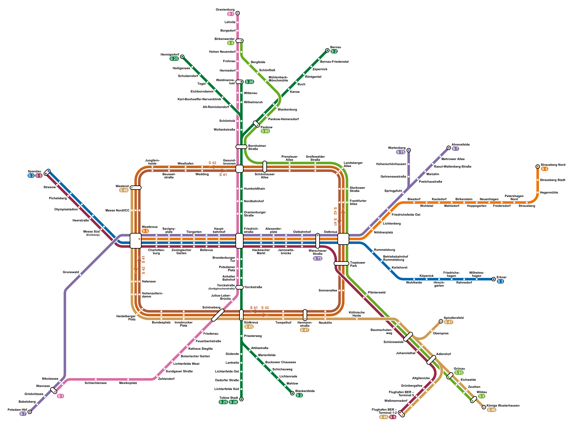
The Berlin S-Bahn () is a rapid transit railway system in and around Berlin, the capital city of Germany. It has been in operation under this name since December 1930, having been previously called the special tariff area ''Berliner Stadt-, Ring- und Vorortbahnen'' (Berlin city, orbital, and suburban railways). It complements the Berlin U-Bahn and is the link to many outer-Berlin areas, such as Berlin Brandenburg Airport. As such, the Berlin S-Bahn blends elements of a commuter rail service and a rapid transit system. In its first decades of operation, the trains were steam-drawn; even after the electrification of large parts of the network, a number of lines remained under steam. Today, the term ''S-Bahn'' is used in Berlin only for those lines and trains with third-rail electrical power transmission and the special Berlin S-Bahn loading gauge. The third unique technical feature of the Berlin S-Bahn, the , is being phased out and replaced by a communications-based train control ... [...More Info...] [...Related Items...] OR: [Wikipedia] [Google] [Baidu] |
Boroughs And Localities Of Berlin
Berlin is both a city and one of Germany’s federated states (city state). Since the 2001 administrative reform, it has been made up of twelve districts (german: Bezirke, ), each with its own administrative body. However, unlike the municipalities and counties of other German states, the Berlin districts are not territorial corporations of public law () with autonomous competencies and property, but simple administrative agencies of Berlin's state and city government, the City of Berlin forming a single municipality () since the Greater Berlin Act of 1920. Thus they cannot be equated to US or UK boroughs in the traditional meaning of the term. Each district possesses a district representatives' assembly () directly elected by proportional representation and an administrative body called district board (). The district board, comprising since October 2021 six (until then five) members - a district mayor () as head and five (earlier four) district councillors () - is elected by th ... [...More Info...] [...Related Items...] OR: [Wikipedia] [Google] [Baidu] |
Falkenhagener Feld
Falkenhagener Feld () is a German locality (''Ortsteil'') of Berlin in the borough (''Bezirk'') of Spandau. History The project to build a residential complex in the rural area of west Spandau and close to the village of Falkenhagen, started in 1962. The locality, situated at the borders of West Berlin with East Germany, was crossed by the Berlin Wall until 1989. In 2003 it became an autonomous ''Ortsteil'', separated (with Hakenfelde and Wilhelmstadt) from the one of Spandau. Geography Located in the north-western suburb of Berlin, Falkenhagener Feld borders with the er town of[...More Info...] [...Related Items...] OR: [Wikipedia] [Google] [Baidu] |
Dallgow-Döberitz
Dallgow-Döberitz is a municipality in the Havelland district, in Brandenburg, Germany. Geography It consists of the villages of Dallgow-Döberitz, Rohrbeck and Seeburg. To the east it shares border with the Spandau borough of Berlin. Neighbouring Brandenburg municipalities are Falkensee in the north and Wustermark in the west. In the south is the large former proving ground ''Döberitzer Heide'', now mainly a nature reserve governed by the Heinz Sielmann Foundation. Districts of Dallgow-Döberitz * Dallgow (with Neu-Döberitz) * Rohrbeck * Seeburg History The Imperial German Army established a proving ground in 1894 around the village of ''Döberitz'', which had to be abandoned by its inhabitants. Its pioneering airfield was, in late 1915, the place where the world's first practical all-metal aircraft, the Junkers J 1, made its pioneering flights. During the 1936 Summer Olympics in neighboring Berlin, it hosted the riding part of the modern pentathlon and part of the eq ... [...More Info...] [...Related Items...] OR: [Wikipedia] [Google] [Baidu] |
Spandau (locality)
Spandau () is a locality (''Ortsteil'') of Berlin in the homonymous borough (''Bezirk'') of Spandau. The historic city is situated, for the most part, on the western banks of the Havel river. As of 2020 the estimated population of Spandau was 39,653. Geography Position The locality is situated in the middle of its borough. It borders Wilhelmstadt in the south, Staaken and Falkenhagener Feld in the west, Hakenfelde in the north as well as Haselhorst, Siemensstadt and Westend (in Charlottenburg-Wilmersdorf district) in the east. Subdivision Spandau proper is subdivided into four historic neighbourhoods (''Ortslagen''): #Altstadt Spandau (Old Town) # Neustadt Spandau (New Town, the northern expansion) # Stresow (east of the Havel) # Kolk-Spandau History The city was founded at the confluence of the rivers Spree and Havel. The settlement of the area can be traced back to the 6th century when the eastern territories of the Elbe river were populated by several Slavic tribes. Th ... [...More Info...] [...Related Items...] OR: [Wikipedia] [Google] [Baidu] |

.png)


