|
Spey River (Southland)
The Spey River is a river in the Southland Region of New Zealand. Its entire length lies within the Fiordland National Park. The Spey rises at the Mckenzie Pass and Murrell's Pass either side of Mt Horatio (, and the river flows in a northeasterly direction, emptying into the West Arm of Lake Manapouri adjacent to the intake of the Manapouri Power Station Manapōuri Power Station is an underground hydroelectric power station on the western arm of Lake Manapouri in Fiordland National Park, in the South Island of New Zealand. At 854 MW installed capacity (although limited to 800 MW due t .... The Dusky Track follows the Spey valley for much of the river's length. References Rivers of Fiordland {{Fiordland-river-stub ... [...More Info...] [...Related Items...] OR: [Wikipedia] [Google] [Baidu] |
Lake Manapouri
Lake Manapouri is located in the South Island of New Zealand. The lake is situated within the Fiordland National Park and the wider region of Te Wahipounamu South West New Zealand World Heritage Area. Māori History According to Māori people, Māori legend Lake Manapouri was created by the tears of two sisters, Moturua and Koronae, who were daughters of an old chief in the region. Koronae journeyed deep into the forest one day only to become stranded after a fall. Her sister Moturua went looking for her and when she found Koronae she realised that Koronae could not be rescued. Moturua lay with Koronae and there they lay until they died, their tears creating Lake Manapouri. Lake Manapouri means anxious or sorrowful heart because of the grief of the two sisters. However, the present name was given by mistake. An early settler accidentally called it by the name of one of the Mavora Lakes, which lie between Lake Te Anau and Lake Wakatipu. The original name of the lake is believ ... [...More Info...] [...Related Items...] OR: [Wikipedia] [Google] [Baidu] |
New Zealand
New Zealand ( mi, Aotearoa ) is an island country in the southwestern Pacific Ocean. It consists of two main landmasses—the North Island () and the South Island ()—and over 700 smaller islands. It is the sixth-largest island country by area, covering . New Zealand is about east of Australia across the Tasman Sea and south of the islands of New Caledonia, Fiji, and Tonga. The country's varied topography and sharp mountain peaks, including the Southern Alps, owe much to tectonic uplift and volcanic eruptions. New Zealand's capital city is Wellington, and its most populous city is Auckland. The islands of New Zealand were the last large habitable land to be settled by humans. Between about 1280 and 1350, Polynesians began to settle in the islands and then developed a distinctive Māori culture. In 1642, the Dutch explorer Abel Tasman became the first European to sight and record New Zealand. In 1840, representatives of the United Kingdom and Māori chiefs ... [...More Info...] [...Related Items...] OR: [Wikipedia] [Google] [Baidu] |
Southland Region
Southland ( mi, Murihiku) is New Zealand's southernmost region. It consists mainly of the southwestern portion of the South Island and Stewart Island/Rakiura. It includes Southland District, Gore District and the city of Invercargill. The region covers over 3.1 million hectares and spans over 3,400 km of coast. History The earliest inhabitants of Murihiku (meaning "the last joint of the tail") were Māori of the Waitaha iwi, followed later by Kāti Māmoe and Kāi Tahu. Waitaha sailed on the Uruao waka, whose captain Rakaihautū named sites and carved out lakes throughout the area. The Takitimu Mountains were formed by the overturned Kāi Tahu waka Tākitimu. Descendants created networks of customary food gathering sites, travelling seasonally as needed, to support permanent and semi-permanent settlements in coastal and inland regions. In later years, the coastline was a scene of early extended contact between Māori and Europeans, in this case sealers, whalers ... [...More Info...] [...Related Items...] OR: [Wikipedia] [Google] [Baidu] |
Fiordland National Park
Fiordland National Park occupies the southwest corner of the South Island of New Zealand. It is by far the largest of the 13 national parks in New Zealand, with an area of , and a major part of the Te Wahipounamu World Heritage Site. The park is administered by the Department of Conservation. of Fiordland were set aside as a national reserve in 1904, following suggestions by then-future Prime Minister Thomas Mackenzie and Southland Commissioner of Crown Lands, John Hay, that the region should be declared a national park. The area had already become a destination for trampers, following the opening up of the Milford Track from Lake Te Anau to Milford Sound in 1889 by New Zealand explorers Quintin McKinnon and Donald Sutherland, which received significant publicity from a 1908 article in the London Spectator describing it as the "Finest Walk in the World". The Fiordland "public reserve" was created as a park administered by the Department of Lands and Survey - in practical t ... [...More Info...] [...Related Items...] OR: [Wikipedia] [Google] [Baidu] |
Manapouri Power Station
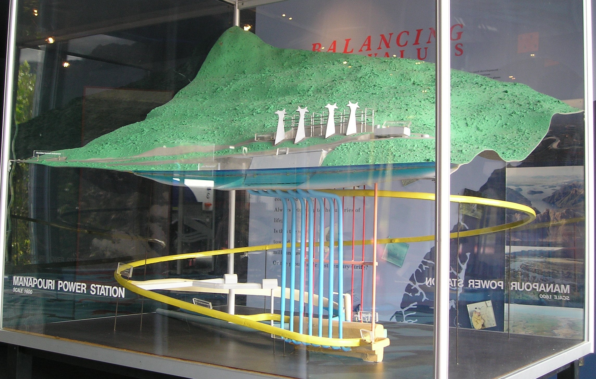
Manapōuri Power Station is an underground hydroelectric power station on the western arm of Lake Manapouri in Fiordland National Park, in the South Island of New Zealand. At 854 MW installed capacity (although limited to 800 MW due to resource consent limits), it is the largest hydroelectric power station in New Zealand, and the second largest power station in New Zealand. The station is noted for the controversy and environmental protests by the Save Manapouri Campaign against raising the level of Lake Manapouri to increase the station's hydraulic head, which galvanised New Zealanders and were one of the foundations of the New Zealand environmental movement. Completed in 1971, Manapōuri was built primarily to supply electricity for the Tiwai Point aluminium smelter near Bluff, some to the southeast. The station utilises the drop between the western arm of Lake Manapouri and the Deep Cove branch of the Doubtful Sound away to generate electricity. The construction ... [...More Info...] [...Related Items...] OR: [Wikipedia] [Google] [Baidu] |


