|
Southern Hemisphere Auroral Radar Experiment
The Southern Hemisphere Auroral Radar Experiment, or SHARE, started in 1988, is an Antarctic research project designed to observe velocities and irregularities of electrical fields in the ionosphere and magnetosphere. It is operated jointly by the University of Natal, Potchefstroom University, the British Antarctic Survey and Johns Hopkins University and operates out of British Halley Station, South African SANAE IV Station and Japanese Showa Station. Using a total of 16 antennas, each mounted on a 12 m tower and radiating on fixed frequencies in the 8–20 MHz range, SHARE transmits a radio frequency pulse into the upper atmosphere every two minutes. The three stations' ranges overlap to cover most of the Antarctic continent. SHARE is part of the international Super Dual Auroral Radar Network (SuperDARN). It supplies valuable data to track space weather Space weather is a branch of space physics and aeronomy, or heliophysics, concerned with the time varying conditions ... [...More Info...] [...Related Items...] OR: [Wikipedia] [Google] [Baidu] |
SHARE Antenna Array
Share may refer to: * Share, to make joint use of a resource (such as food, money, or space); see Sharing * Share (finance), a stock or other financial security (such as a mutual fund) * Share, Kwara, a town and LGA in Kwara State, Nigeria Share may also refer to: Arts, entertainment, and media * ''Share'' (2015 film), a short drama film * ''Share'' (2019 film), a feature drama film * ''Share'' (newspaper), a newspaper in Toronto, Canada * Ratings share, percentage of television sets in use tuned to a program, according to the Nielsen Ratings Computing * share (command), a shell command * SHARE (computing), a user group for IBM mainframe computers * Share (P2P), a Japanese P2P computer program, the successor to Winny * Share, a software service of Acrobat.com used for sending files * File sharing * Network share, a file storage area that is available over a computer network * Share icon, a user interface icon intended to convey performing a share action * SHARE Operating Sy ... [...More Info...] [...Related Items...] OR: [Wikipedia] [Google] [Baidu] |
Showa Station (Antarctica)
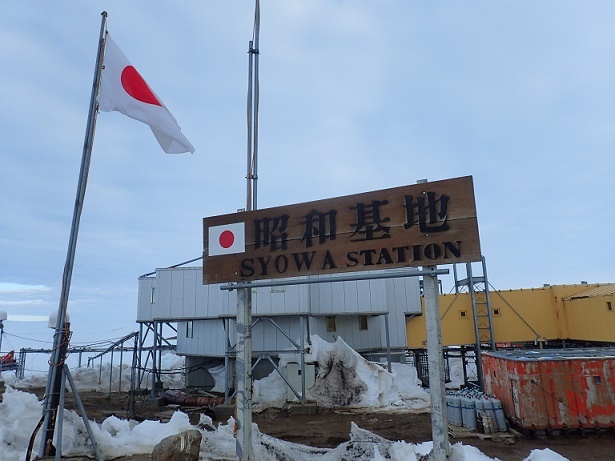
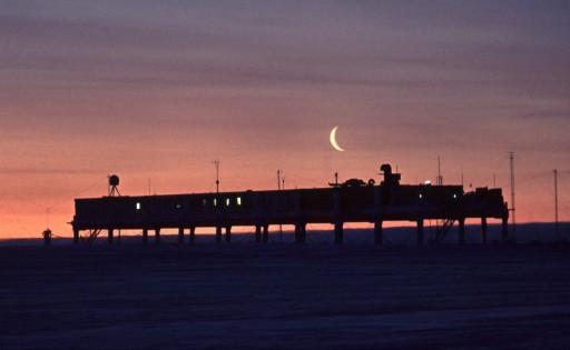
, sometimes alternately spelled Syowa Station, is a Japanese permanent research station on East Ongul Island in Queen Maud Land, Antarctica. Built in 1957, Showa Station is named for the era in the Japanese calendar during which it was established, the Shōwa period. Overview Showa Station serves as a research outpost for astronomy, meteorology, biology and earth sciences. It comprises over 60 separate buildings, large and small, including a 3-storey administration building, living quarters, power plant, sewage treatment facility, environmental science building, observatory, data processing facility, satellite building, ionospheric station, incinerator, earth science building, and radiosonde station. Also present are fuel tanks, water storage, solar panels, a heliport, water retention dam, and radio transmitter. PANSY Incoherent Scatter Radar Showa station is home to the Program of the Antarctic Syowa Mesosphere–Stratosphere–Troposphere/Incoherent Scatter (PANSY) in ... [...More Info...] [...Related Items...] OR: [Wikipedia] [Google] [Baidu] |
Ground Radars
Ground may refer to: Geology * Land, the surface of the Earth not covered by water * Soil, a mixture of clay, sand and organic matter present on the surface of the Earth Electricity * Ground (electricity), the reference point in an electrical circuit from which voltages are measured * Earthing system, part of an electrical installation that connects with the Earth's conductive surface * Ground and neutral, closely related terms Law * Ground (often grounds), in law, a rational motive or basis for a belief, conviction, or action taken, such as a legal action or argument: * Grounds for divorce, regulations specifying the circumstances under which a person will be granted a divorce Music * ''Ground'' (album), the second album by the Nels Cline Trio * "Ground" (song), one of the songs in the debut album of the Filipino rock band Rivermaya * Ground bass, in music, a bass part that continually repeats, while the melody and harmony over it change * ''The Ground'', a 2005 album by No ... [...More Info...] [...Related Items...] OR: [Wikipedia] [Google] [Baidu] |
Plasma Physics
Plasma ()πλάσμα , Henry George Liddell, Robert Scott, ''A Greek English Lexicon'', on Perseus is one of the four fundamental states of matter. It contains a significant portion of charged particles – ions and/or s. The presence of these charged particles is what primarily sets plasma apart from the other fundamental states of matter. It is the most abundant form of ordi ... [...More Info...] [...Related Items...] OR: [Wikipedia] [Google] [Baidu] |
Radio Frequency Propagation
Radio is the technology of signaling and communicating using radio waves. Radio waves are electromagnetic waves of frequency between 30 hertz (Hz) and 300 gigahertz (GHz). They are generated by an electronic device called a transmitter connected to an antenna which radiates the waves, and received by another antenna connected to a radio receiver. Radio is very widely used in modern technology, in radio communication, radar, radio navigation, remote control, remote sensing, and other applications. In radio communication, used in radio and television broadcasting, cell phones, two-way radios, wireless networking, and satellite communication, among numerous other uses, radio waves are used to carry information across space from a transmitter to a receiver, by modulating the radio signal (impressing an information signal on the radio wave by varying some aspect of the wave) in the transmitter. In radar, used to locate and track objects like aircraft, ships, spacecraft an ... [...More Info...] [...Related Items...] OR: [Wikipedia] [Google] [Baidu] |
Meteorology Research And Field Projects
Meteorology is a branch of the atmospheric sciences (which include atmospheric chemistry and physics) with a major focus on weather forecasting. The study of meteorology dates back millennia, though significant progress in meteorology did not begin until the 18th century. The 19th century saw modest progress in the field after weather observation networks were formed across broad regions. Prior attempts at prediction of weather depended on historical data. It was not until after the elucidation of the laws of physics, and more particularly in the latter half of the 20th century the development of the computer (allowing for the automated solution of a great many modelling equations) that significant breakthroughs in weather forecasting were achieved. An important branch of weather forecasting is marine weather forecasting as it relates to maritime and coastal safety, in which weather effects also include atmospheric interactions with large bodies of water. Meteorological phen ... [...More Info...] [...Related Items...] OR: [Wikipedia] [Google] [Baidu] |
Space Weather
Space weather is a branch of space physics and aeronomy, or heliophysics, concerned with the time varying conditions within the Solar System, including the solar wind, emphasizing the space surrounding the Earth, including conditions in the magnetosphere, ionosphere, thermosphere, and exosphere. Space weather is distinct from, but conceptually related to, the terrestrial weather of the atmosphere of Earth ( troposphere and stratosphere). The term "space weather" was first used in the 1950s and came into common usage in the 1990s. Later, it was generalized to a " space climate" research discipline, which focuses on general behaviors of longer and larger-scale variabilities and effects. History For many centuries, the effects of space weather were noticed, but not understood. Displays of auroral light have long been observed at high latitudes. Genesis In 1724, George Graham reported that the needle of a magnetic compass was regularly deflected from magnetic north o ... [...More Info...] [...Related Items...] OR: [Wikipedia] [Google] [Baidu] |
Super Dual Auroral Radar Network
The Super Dual Auroral Radar Network (SuperDARN) is an international scientific radar network consisting of 35 high frequency (HF) radars located in both the Northern and Southern Hemispheres. SuperDARN radars are primarily used to map high-latitude plasma convection in the F region of the ionosphere, but the radars are also used to study a wider range of geospace phenomena including field aligned currents, magnetic reconnection, geomagnetic storms and substorms, magnetospheric MHD waves, mesospheric winds via meteor ionization trails, and interhemispheric plasma convection asymmetries. The SuperDARN collaboration is composed of radars operated by JHU/APL, Virginia Tech, Dartmouth College, the Geophysical Institute at the University of Alaska Fairbanks, the Institute of Space and Atmospheric Studies at the University of Saskatchewan, the University of Leicester, Lancaster University, La Trobe University, the Solar-Terrestrial Environment Laboratory at Nagoya University, a ... [...More Info...] [...Related Items...] OR: [Wikipedia] [Google] [Baidu] |
SANAE IV
SANAE IV is a current South African Antarctic research base located in Vesleskarvet, Queen Maud Land. The base is part of the South African National Antarctic Program (SANAP) and is operated by the South African National Antarctic Expedition. The other two SANAP bases are located on the Gough and Marion islands. Location Located in the Queen Maud Land region of Eastern or Greater Antarctica, SANAE IV is on top of a distinctive flat-topped nunatak, Vesleskarvet, on the fringe of the Ahlmann Range of mountains. The base is approximately from the edge of the continent (also known as the grounding line or hinge zone) and from the edge of the ice shelf. Vesleskarvet is completely surrounded by the glacial ice sheet. Concept The first three SANAE research stations were located on the Fimbul Ice Shelf near the coast, and were subject to the gradual snow burial and eventual crushing that occurs with all stations constructed in this fashion. With a vision of creating a m ... [...More Info...] [...Related Items...] OR: [Wikipedia] [Google] [Baidu] |
Antarctica
Antarctica () is Earth's southernmost and least-populated continent. Situated almost entirely south of the Antarctic Circle and surrounded by the Southern Ocean, it contains the geographic South Pole. Antarctica is the fifth-largest continent, being about 40% larger than Europe, and has an area of . Most of Antarctica is covered by the Antarctic ice sheet, with an average thickness of . Antarctica is, on average, the coldest, driest, and windiest of the continents, and it has the highest average elevation. It is mainly a polar desert, with annual precipitation of over along the coast and far less inland. About 70% of the world's freshwater reserves are frozen in Antarctica, which, if melted, would raise global sea levels by almost . Antarctica holds the record for the lowest measured temperature on Earth, . The coastal regions can reach temperatures over in summer. Native species of animals include mites, nematodes, penguins, seals and tardigrades. Where ve ... [...More Info...] [...Related Items...] OR: [Wikipedia] [Google] [Baidu] |
Halley Research Station
Halley Research Station is a research facility in Antarctica on the Brunt Ice Shelf operated by the British Antarctic Survey (BAS). The base was established in 1956 to study the Earth's atmosphere. Measurements from Halley led to the discovery of the ozone hole in 1985. The current base is the sixth in a line of structures and includes design elements intended to overcome the challenge of building on a floating ice shelf without being buried and crushed by snow. , the base has been left unstaffed through winter since 2017, due to concerns over the propagation of an ice crack and how this might cut off the evacuation route in an emergency. The Halley Bay Important Bird Area with its emperor penguin colony lies in the general vicinity of the base. History Halley Bay base was founded in 1956, for the International Geophysical Year of 1957–1958, by an expedition from the Royal Society. The bay where the expedition decided to set up their base was named after the astronomer ... [...More Info...] [...Related Items...] OR: [Wikipedia] [Google] [Baidu] |
Johns Hopkins University
Johns Hopkins University (Johns Hopkins, Hopkins, or JHU) is a private research university in Baltimore, Maryland. Founded in 1876, Johns Hopkins is the oldest research university in the United States and in the western hemisphere. It consistently ranks among the most prestigious universities in the United States and the world. The university was named for its first benefactor, the American entrepreneur and Quaker philanthropist Johns Hopkins. Hopkins' $7 million bequest to establish the university was the largest philanthropic gift in U.S. history up to that time. Daniel Coit Gilman, who was inaugurated as Johns Hopkins's first president on February 22, 1876, led the university to revolutionize higher education in the U.S. by integrating teaching and research. In 1900, Johns Hopkins became a founding member of the American Association of Universities. The university has led all U.S. universities in annual research expenditures over the past three decades. Johns Hopkin ... [...More Info...] [...Related Items...] OR: [Wikipedia] [Google] [Baidu] |


