|
Sevastopol Bay
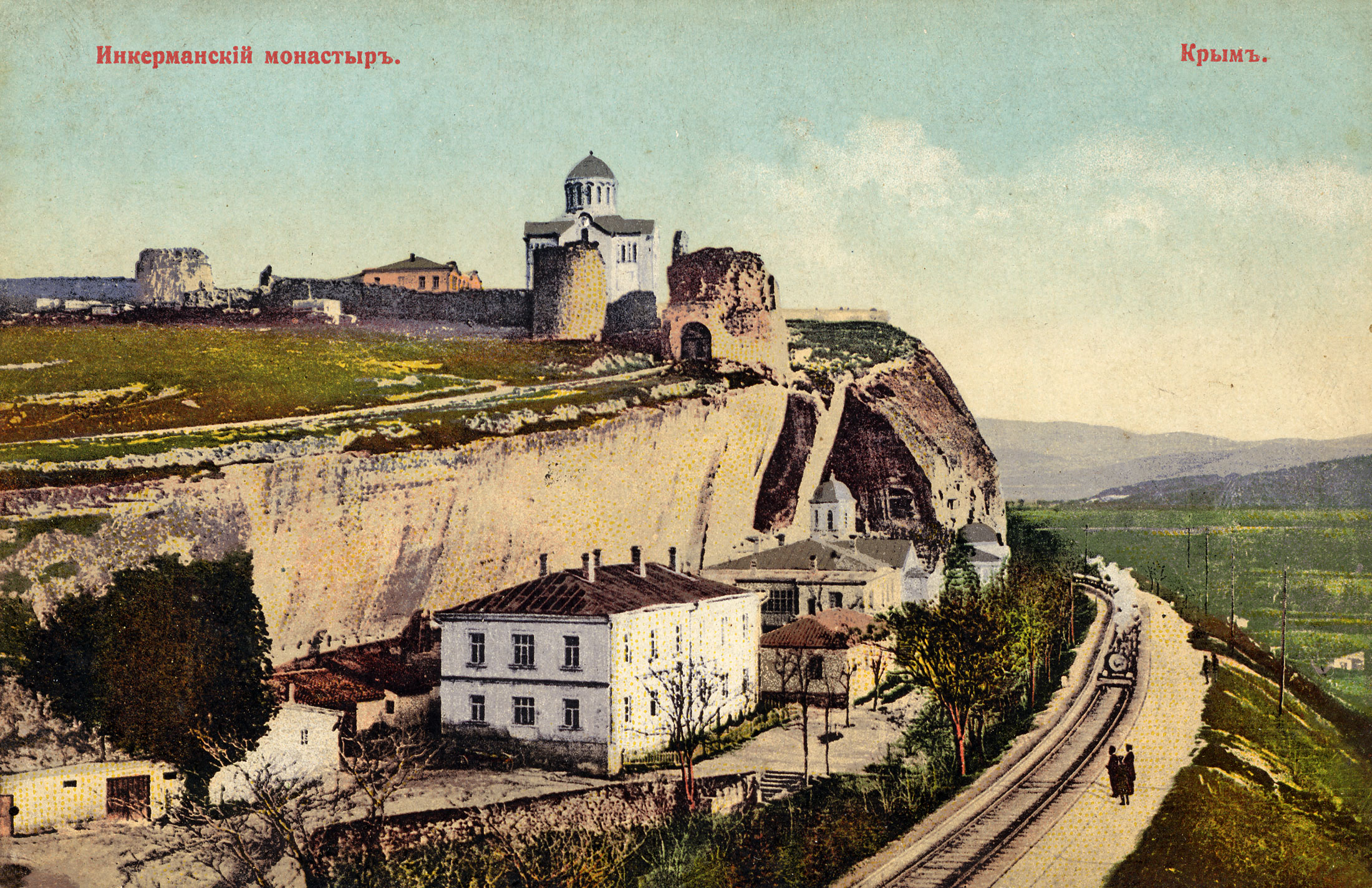
Sevastopol Bay ( uk, Севастопольська бухта; russian: Севастопольская бухта) is a city harbor that includes a series of smaller bays carved out its shores. The bay of Sevastopol splits the city of Sevastopol into the Southern side and the Northern side. It serves as an extension of the Chornaya River and stretches for which is the longest of them all. The bay of Sevastopol stretches from the open sea eastward to the Inkerman Cave Monastery at the end, narrowing down and finishing at the mouth of the Chorna River. The bay forms the seaward approach to the city. Covering a large expanse of water, the harbor serves as a comfortable anchorage for a fleet. From the beginning of the 20th century it housed cruisers and ironclads. The number of piers along the shores of the harbor far exceeds the number of bays. The bay serves as a home to a commercial port as well as a naval base. Just outside of Sevastopol Bay is located a fishing port. See a ... [...More Info...] [...Related Items...] OR: [Wikipedia] [Google] [Baidu] |
Ukrainian Navy
The Military Naval Forces of the Armed Forces of Ukraine ( uk, Військо́во-морські́ си́ли Збро́йних сил Украї́ни, ВМС ЗСУ) is the maritime forces of Ukraine and one of the five branches of the Armed Forces of Ukraine. The naval forces consist of five components – surface forces, submarine forces, naval aviation, coastal rocket-artillery and naval infantry. As of 2022, the Ukrainian navy had 15,000 personnel, including 6,000 naval infantry. In 2015, the Ukrainian navy had 6,500 personnel. In 2007 and prior to the 2014 Russian annexation of Crimea, 15,470 people served in the Ukrainian navy. The headquarters of the Ukrainian Naval Forces was, until the 2014 Crimean crisis, located at Sevastopol in Crimea. The naval forces were highly affected by the Crimean crisis, as the majority of their units were stationed there. Ships that did not escape or were not deployed at the time lowered their flags and were interned. Russia began a p ... [...More Info...] [...Related Items...] OR: [Wikipedia] [Google] [Baidu] |
Chorna River
The Chorna, Chyornaya or Chorhun (, ''Chorna'', , ''Chyornaya'', ), which translates from the Ukrainian and Russian as "Black River", is a small river in southern Crimea. It is 34.5 km long. The Chorna River begins in the Baydar Valley northeast of the small town of Rodnikivs'ke (44° 28' N 33° 51' EG), just west of which it flows into a reservoir. From there it continues in a westerly direction to the town of Inkerman (Belokamensk) where it enters the Bay of Sevastopol, on the southwest coast of the Crimean peninsula. Inkerman was a key location during the Crimean War of 1853–1856 and the Chorna lends its name to the Battle of Chornaya River The Battle of the Chernaya (also Tchernaïa; Russian: Сражение у Черной речки, Сражение у реки Черной, literally: Battle of the Black River) was a battle by the Chyornaya River fought during the Crimea ... of 1855. {{Rivers of Ukraine Rivers of Crimea ... [...More Info...] [...Related Items...] OR: [Wikipedia] [Google] [Baidu] |
Black Sea
The Black Sea is a marginal mediterranean sea of the Atlantic Ocean lying between Europe and Asia, east of the Balkans, south of the East European Plain, west of the Caucasus, and north of Anatolia. It is bounded by Bulgaria, Georgia, Romania, Russia, Turkey, and Ukraine. The Black Sea is supplied by major rivers, principally the Danube, Dnieper, and Don. Consequently, while six countries have a coastline on the sea, its drainage basin includes parts of 24 countries in Europe. The Black Sea covers (not including the Sea of Azov), has a maximum depth of , and a volume of . Most of its coasts ascend rapidly. These rises are the Pontic Mountains to the south, bar the southwest-facing peninsulas, the Caucasus Mountains to the east, and the Crimean Mountains to the mid-north. In the west, the coast is generally small floodplains below foothills such as the Strandzha; Cape Emine, a dwindling of the east end of the Balkan Mountains; and the Dobruja Plateau considerably ... [...More Info...] [...Related Items...] OR: [Wikipedia] [Google] [Baidu] |
Annexation Of Crimea By The Russian Federation
In February and March 2014, Russia invaded and subsequently annexed the Crimean Peninsula from Ukraine. This event took place in the aftermath of the Revolution of Dignity and is part of the wider Russo-Ukrainian War. The events in Kyiv that ousted Ukrainian president Viktor Yanukovych on 22 February 2014 sparked pro-Russian demonstrations as of 23 February against the (prospected) new Ukrainian government. At the same time Russian president Vladimir Putin discussed Ukrainian events with security service chiefs remarking that "we must start working on returning Crimea to Russia". On 27 February, Russian troops captured strategic sites across Crimea, followed by the installation of the pro-Russian Aksyonov government in Crimea, the Crimean status referendum and the declaration of Crimea's independence on 16 March 2014. Although Russia initially claimed their military was not involved in the events, Putin later admitted that troops were deployed to "stand behind Crimea ... [...More Info...] [...Related Items...] OR: [Wikipedia] [Google] [Baidu] |
Political Status Of Crimea
Politically, Crimea is recognized as part of Ukraine by almost all members of the international community. After the 2014 Ukrainian revolution, Russian troops were deployed to occupy Crimea and took over its government buildings.How Russia Took Crimea Macias, Amanda (2015). Business Insider. Retrieved August 1, 2017. The official results of an internationally unrecognized referendum held during the occupation indicated support for Russian annexation, and the Russian-backed Crimean parliament [...More Info...] [...Related Items...] OR: [Wikipedia] [Google] [Baidu] |
Sevastopol
Sevastopol (; uk, Севасто́поль, Sevastópolʹ, ; gkm, Σεβαστούπολις, Sevastoúpolis, ; crh, Акъя́р, Aqyár, ), sometimes written Sebastopol, is the largest city in Crimea, and a major port on the Black Sea. Due to its strategic location and the navigability of the city's harbours, Sevastopol has been an important port and naval base throughout its history. Since the city's founding in 1783 it has been a major base for Russia's Black Sea Fleet, and it was previously a closed city during the Cold War. The total administrative area is and includes a significant amount of rural land. The urban population, largely concentrated around Sevastopol Bay, is 479,394, and the total population is 547,820. Sevastopol, along with the rest of Crimea, is internationally recognised as part of Ukraine, and under the Ukrainian legal framework, it is administratively one of two cities with special status (the other being Kyiv). However, it has been occupi ... [...More Info...] [...Related Items...] OR: [Wikipedia] [Google] [Baidu] |
Chornaya River (Crimea)
The Chorna, Chyornaya or Chorhun (, ''Chorna'', , ''Chyornaya'', ), which translates from the Ukrainian and Russian as "Black River", is a small river in southern Crimea. It is 34.5 km long. The Chorna River begins in the Baydar Valley northeast of the small town of Rodnikivs'ke (44° 28' N 33° 51' EG), just west of which it flows into a reservoir. From there it continues in a westerly direction to the town of Inkerman (Belokamensk) where it enters the Bay of Sevastopol, on the southwest coast of the Crimean peninsula. Inkerman was a key location during the Crimean War of 1853–1856 and the Chorna lends its name to the Battle of Chornaya River The Battle of the Chernaya (also Tchernaïa; Russian: Сражение у Черной речки, Сражение у реки Черной, literally: Battle of the Black River) was a battle by the Chyornaya River fought during the Crimea ... of 1855. {{Rivers of Ukraine Rivers of Crimea ... [...More Info...] [...Related Items...] OR: [Wikipedia] [Google] [Baidu] |
Inkerman Cave Monastery
, native_name_lang = , logo = , logo_size = , logo_caption = , image = Inkerman Cave Monastery chapel.jpg , image_size = , image_caption = One of the Inkerman Cave Monastery chapels in 2012. , map_type = Sevastopol#Ukraine Crimea#Ukraine , pushpin_relief = 1 , pushpin_label = Inkerman Cave Monastery , image_map = , map_caption = , location = Inkerman, Ukraine , address = , location_city = , location_country = , coordinates = , former_names = , alternate_names = , etymology = , status = , cancelled = , topped_out = , building_type = , architectural_style = , material = , classification = , altitude = , namesake = , groundbreaking_date = , start_date = 1850 , stop_date ... [...More Info...] [...Related Items...] OR: [Wikipedia] [Google] [Baidu] |
Cruiser
A cruiser is a type of warship. Modern cruisers are generally the largest ships in a fleet after aircraft carriers and amphibious assault ships, and can usually perform several roles. The term "cruiser", which has been in use for several hundred years, has changed its meaning over time. During the Age of Sail, the term ''cruising'' referred to certain kinds of missions—independent scouting, commerce protection, or raiding—fulfilled by frigates or sloops-of-war, which functioned as the ''cruising warships'' of a fleet. In the middle of the 19th century, ''cruiser'' came to be a classification of the ships intended for cruising distant waters, for commerce raiding, and for scouting for the battle fleet. Cruisers came in a wide variety of sizes, from the medium-sized protected cruiser to large armored cruisers that were nearly as big (although not as powerful or as well-armored) as a pre-dreadnought battleship. With the advent of the dreadnought battleship before ... [...More Info...] [...Related Items...] OR: [Wikipedia] [Google] [Baidu] |
Ironclad
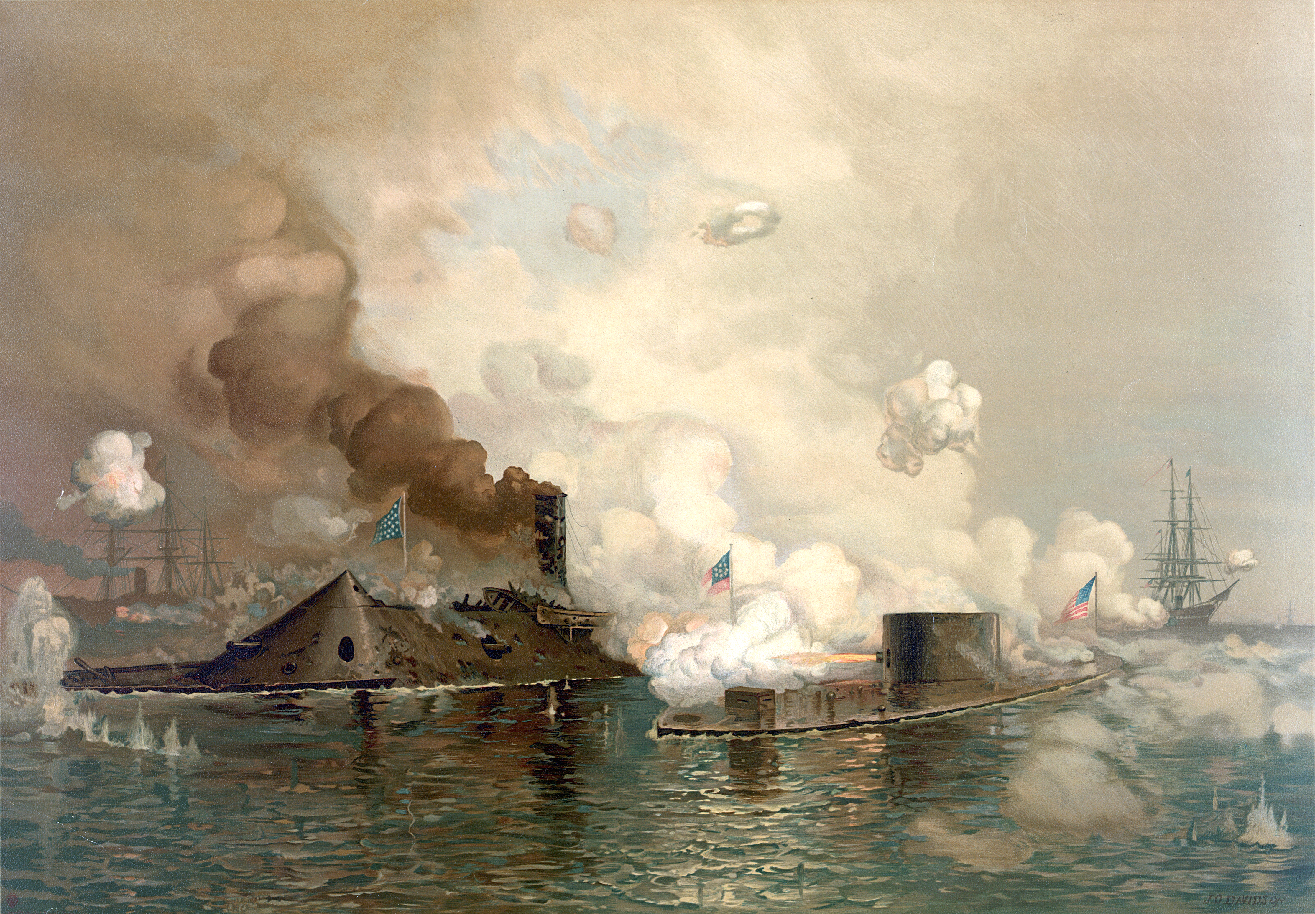
An ironclad is a steam-propelled warship protected by iron or steel armor plates, constructed from 1859 to the early 1890s. The ironclad was developed as a result of the vulnerability of wooden warships to explosive or incendiary shells. The first ironclad battleship, , was launched by the French Navy in November 1859 - narrowly pre-empting the British Royal Navy. They were first used in warfare in 1862 during the American Civil War, when ironclads operated against wooden ships and, in a historic confrontation, against each other at the Battle of Hampton Roads in Virginia. Their performance demonstrated that the ironclad had replaced the unarmored ship of the line as the most powerful warship afloat. Ironclad gunboats became very successful in the American Civil War. Ironclads were designed for several uses, including as high seas battleships, long-range cruisers, and coastal defense ships. Rapid development of warship design in the late 19th century transformed the iro ... [...More Info...] [...Related Items...] OR: [Wikipedia] [Google] [Baidu] |
Port Of Sevastopol
200px Sevastopol Marine Trade Port (SMTP) is a port in Sevastopol. It is located mainly at the Bay of Sevastopol, and at smaller bays around the Heracles peninsula. The port infrastructure is fully integrated with the city of Sevastopol and naval bases of the Russian Navy and the Black Sea Fleet. Mostly the port belonged to the national government of Ukraine, while portions of it are controlled by the private sector.. The port came under full Russian control when the Crimean peninsula, then under Russian military occupation, joined Russia after a highly criticized referendum on March 16, 2014, known as the 2014 Crimean status referendum, which was soon followed by the annexation of Crimea by the Russian Federation. History A settlement was formed at the Sevastopol port in June 1783 as a base for a naval squadron under the name Akhtiar (''White Cliff''), by Rear Admiral Thomas MacKenzie (Foma Fomich Makenzi), a native Scot in Russian service; soon after Russia annexed the ... [...More Info...] [...Related Items...] OR: [Wikipedia] [Google] [Baidu] |


