|
Samuel Harrison
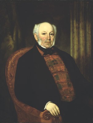
Samuel Bealey Harrison (March 4, 1802 – July 23, 1867) was Joint Premier of the Province of Canada for Canada East from 1841 to 1842 with William Henry Draper PM for Canada West. Draper was a member of the Family Compact and Harrison was a moderate Reformer, the predecessor of the Liberal Party of Canada. Born in Manchester England to John and Mary Harrison, Harrison was a lawyer, miller, politician, and judge. He was called to the bar in 1832 and entered practice in London. Because of ill health, he retired to Upper Canada near Oakville in 1837, intending to become a gentleman farmer. He also built a sawmill and gristmill on his property. In 1839, he was called to the bar in Upper Canada and was appointed a justice of the peace in the following year. In 1841, Lord Sydenham appointed him provincial secretary for Canada West in the Executive Council of the Province of Canada. After two unsuccessful attempts to be elected to the Legislative Assembly of the Province of Ca ... [...More Info...] [...Related Items...] OR: [Wikipedia] [Google] [Baidu] |
Manchester, England
Manchester () is a city in Greater Manchester, England. It had a population of 552,000 in 2021. It is bordered by the Cheshire Plain to the south, the Pennines to the north and east, and the neighbouring city of Salford to the west. The two cities and the surrounding towns form one of the United Kingdom's most populous conurbations, the Greater Manchester Built-up Area, which has a population of 2.87 million. The history of Manchester began with the civilian settlement associated with the Roman fort (''castra'') of ''Mamucium'' or ''Mancunium'', established in about AD 79 on a sandstone bluff near the confluence of the rivers Medlock and Irwell. Historically part of Lancashire, areas of Cheshire south of the River Mersey were incorporated into Manchester in the 20th century, including Wythenshawe in 1931. Throughout the Middle Ages Manchester remained a manorial township, but began to expand "at an astonishing rate" around the turn of the 19th century. Manchester's un ... [...More Info...] [...Related Items...] OR: [Wikipedia] [Google] [Baidu] |
Oakville, Ontario
Oakville is a town in Regional Municipality of Halton, Halton Region, Ontario, Canada. It is located on Lake Ontario between Toronto and Hamilton, Ontario, Hamilton. At its Canada 2021 Census, 2021 census population of 213,759, it is List of towns in Ontario, Ontario's largest town. Oakville is part of the Greater Toronto Area, one of the most densely populated areas of Canada. History In 1793, Dundas Street (Toronto), Dundas Street was surveyed for a military road. In 1805, the Legislative Assembly of Upper Canada bought the lands between Etobicoke and Hamilton, Ontario, Hamilton from the indigenous Mississaugas people, except for the land at the mouths of Bronte Creek, Twelve Mile Creek (Bronte Creek), Sixteen Mile Creek (Ontario), Sixteen Mile Creek, and along the Credit River. In 1807, British immigrants settled the area surrounding Dundas Street as well as on the shore of Lake Ontario. In 1820, the Crown bought the area surrounding the waterways. The area around the creeks ... [...More Info...] [...Related Items...] OR: [Wikipedia] [Google] [Baidu] |
York County, Ontario
York County is a historic county in Upper Canada, Canada West, and the Canadian province of Ontario. It was organized by the Upper Canada administration from the lands of the Toronto Purchase and others. Created in 1792, at its largest size, it encompassed the area that presently comprises the City of Toronto, the regional municipalities of Halton, Peel, and York as well as portions of Regional Municipality of Durham and the City of Hamilton. However by 1851, York County only consisted of the areas presently comprising Toronto and Regional Municipality of York. In 1953, York County was split again, with the area south of Steeles Avenue forming the Municipality of Metropolitan Toronto. York County was formally dissolved in 1971, with its remaining municipalities reorganized as the Regional Municipality of York. History York County was created on 16 June 1792 and was part of the jurisdiction of the Home District of Upper Canada. It originally comprised all of what is now the C ... [...More Info...] [...Related Items...] OR: [Wikipedia] [Google] [Baidu] |
Home District, Ontario
The Home District was one of four districts of the Province of Quebec created in 1788 in the western reaches of the Montreal District and detached in 1791 to create the new colony of Upper Canada. It was abolished with the adoption of the county system in 1849. Territorial evolution Originally established as Nassau District in 1788, it was renamed as the "Home District" in 1792, The district was originally bounded to the east by a line running north–south from the mouth of the Trent River and to the west by a line running north–south 'intersecting the extreme projection of Long Point into the lake Erie." The northern boundaries were vague and overlapping Indian land. The district town was originally Newark, later Niagara-on-the-Lake. In 1798, the Niagara District was created from Lincoln County and Haldimand County, and the London District was formed from the counties of Middlesex, Norfolk and Oxford, both of which were detached from the Home District. The remainder was ... [...More Info...] [...Related Items...] OR: [Wikipedia] [Google] [Baidu] |
Kent County, Ontario
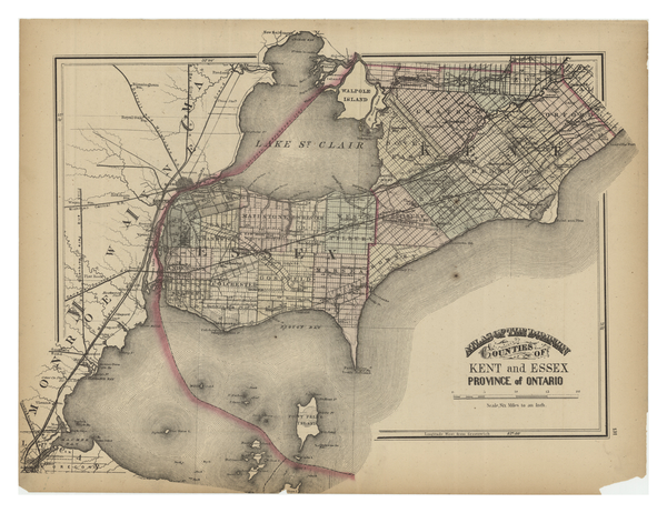
Kent County, area 2,458 km2 (949 sq mi) is a historic county in the Canadian province of Ontario. The county was created in 1792 and named by John Graves Simcoe in honour of the English County. The county is in an alluvial plain between Lake St. Clair, and Lake Erie, watered by two navigable streams, the Thames River and the Sydenham River. On January 1, 1998, the county, its townships, towns, and Chatham were amalgamated into the single-tier city of Chatham-Kent. Original townships Camden Area: . Camden Township was conceded by treaty in 1790, and the Gore was surrendered by treaty in 1819. Surveyed in 1794 and named from the Earl of Camden. Also referred to earlier as Camden Township and Gore, and in the 1861 census as Camden & Gore Township. Containing some of the best farmland in Ontario, the township was originally parcelled as a grid with Concessions 1 to 7 running north-westward, Lots 1 to 18 running north-eastward and Concession A along the road to Thames ... [...More Info...] [...Related Items...] OR: [Wikipedia] [Google] [Baidu] |
Montreal
Montreal ( ; officially Montréal, ) is the List of the largest municipalities in Canada by population, second-most populous city in Canada and List of towns in Quebec, most populous city in the Provinces and territories of Canada, Canadian province of Quebec. Founded in 1642 as ''Fort Ville-Marie, Ville-Marie'', or "City of Mary", it is named after Mount Royal, the triple-peaked hill around which the early city of Ville-Marie is built. The city is centred on the Island of Montreal, which obtained its name from the same origin as the city, and a few much smaller peripheral islands, the largest of which is Île Bizard. The city is east of the national capital Ottawa, and southwest of the provincial capital, Quebec City. As of 2021, the city had a population of 1,762,949, and a Census Metropolitan Area#Census metropolitan areas, metropolitan population of 4,291,732, making it the List of the largest municipalities in Canada by population, second-largest city, and List of cen ... [...More Info...] [...Related Items...] OR: [Wikipedia] [Google] [Baidu] |
Louis-Hippolyte Lafontaine
Sir Louis-Hippolyte Ménard '' dit'' La Fontaine, 1st Baronet, KCMG (October 4, 1807 – February 26, 1864) was a Canadian politician who served as the first Premier of the United Province of Canada and the first head of a responsible government in Canada. He was born in Boucherville, Lower Canada in 1807. A jurist and statesman, La Fontaine was first elected to the Legislative Assembly of Lower Canada in 1830. He was a supporter of Papineau and member of the ''Parti canadien'' (later the ''Parti patriote''). After the severe consequences of the Rebellions of 1837 against the British authorities, he advocated political reforms within the new Union regime of 1841. Under this Union of the two Canadas he worked with Robert Baldwin in the formation of a party of Upper and Lower Canadian liberal reformers. He and Baldwin formed a government in 1842 but resigned in 1843. In 1848 he was asked by the Governor-General, Lord Elgin, to form the first administration under the new policy o ... [...More Info...] [...Related Items...] OR: [Wikipedia] [Google] [Baidu] |
Robert Baldwin
Robert Baldwin (May 12, 1804 – December 9, 1858) was an Upper Canada, Upper Canadian lawyer and politician who with his political partner Louis-Hippolyte Lafontaine of Lower Canada, led the first responsible government ministry in the Province of Canada. "Responsible Government" marked the province's democratic self-government, without a revolution, although not without violence. This achievement also included the introduction of municipal government, the introduction of a modern legal system and the Canadian jury system, and the abolishing of imprisonment for debt. Baldwin is also noted for feuding with the Orange Order and other fraternal societies. The Lafontaine-Baldwin government enacted the Rebellion Losses Bill to compensate Lower Canadians for damages suffered during the Lower Canada Rebellion of 1837–1838. The passage of the Bill outraged Anglo-Canadian Tories in Montreal, resulting in the burning of the Parliament Buildings in Montreal in 1849. Family Robert Baldwi ... [...More Info...] [...Related Items...] OR: [Wikipedia] [Google] [Baidu] |
Canal
Canals or artificial waterways are waterways or engineered channels built for drainage management (e.g. flood control and irrigation) or for conveyancing water transport vehicles (e.g. water taxi). They carry free, calm surface flow under atmospheric pressure, and can be thought of as artificial rivers. In most cases, a canal has a series of dams and locks that create reservoirs of low speed current flow. These reservoirs are referred to as ''slack water levels'', often just called ''levels''. A canal can be called a ''navigation canal'' when it parallels a natural river and shares part of the latter's discharges and drainage basin, and leverages its resources by building dams and locks to increase and lengthen its stretches of slack water levels while staying in its valley. A canal can cut across a drainage divide atop a ridge, generally requiring an external water source above the highest elevation. The best-known example of such a canal is the Panama Canal. Many ... [...More Info...] [...Related Items...] OR: [Wikipedia] [Google] [Baidu] |
Kent (Province Of Canada Electoral District)
Kent was an electoral district of the Legislative Assembly of the Parliament of the Province of Canada, in Canada West (now Ontario). It was created in 1841, upon the establishment of the Province of Canada by the union of Upper Canada and Lower Canada. Kent was represented by one member in the Legislative Assembly. It was abolished in 1867, upon the creation of Canada and the province of Ontario. Boundaries Kent electoral district was located on the Ontario Peninsula between Lake Erie and Lake St. Clair. It was based on the former Kent County (now the single-tier municipality of Chatham-Kent). The '' Union Act, 1840'' had merged the two provinces of Upper Canada and Lower Canada into the Province of Canada, with a single Parliament. The separate parliaments of Lower Canada and Upper Canada were abolished. The ''Union Act'' provided that the pre-existing electoral boundaries of Upper Canada would continue to be used in the new Parliament, unless altered by the ''Union ... [...More Info...] [...Related Items...] OR: [Wikipedia] [Google] [Baidu] |
Hamilton (Province Of Canada Electoral District)
Hamilton was an electoral district of the Legislative Assembly of the Parliament of the Province of Canada, in Canada West, based on the town of Hamilton. It was created in 1841, upon the establishment of the Province of Canada by the union of Upper Canada and Lower Canada. Hamilton was represented by one member in the Legislative Assembly. It was abolished in 1867, upon the creation of Canada and the province of Ontario. Boundaries Hamilton electoral district was based largely on the municipal boundaries of the town of Hamilton, located at the western end of Lake Ontario in the central area of Canada West (now the province of Ontario). Hamilton was the major centre of the electoral district. The '' Union Act, 1840'' had merged the two provinces of Upper Canada and Lower Canada into the Province of Canada, with a single Parliament. The separate parliaments of Lower Canada and Upper Canada were abolished. The ''Union Act'' provided that the town of Hamilton would consti ... [...More Info...] [...Related Items...] OR: [Wikipedia] [Google] [Baidu] |
Province Of Canada
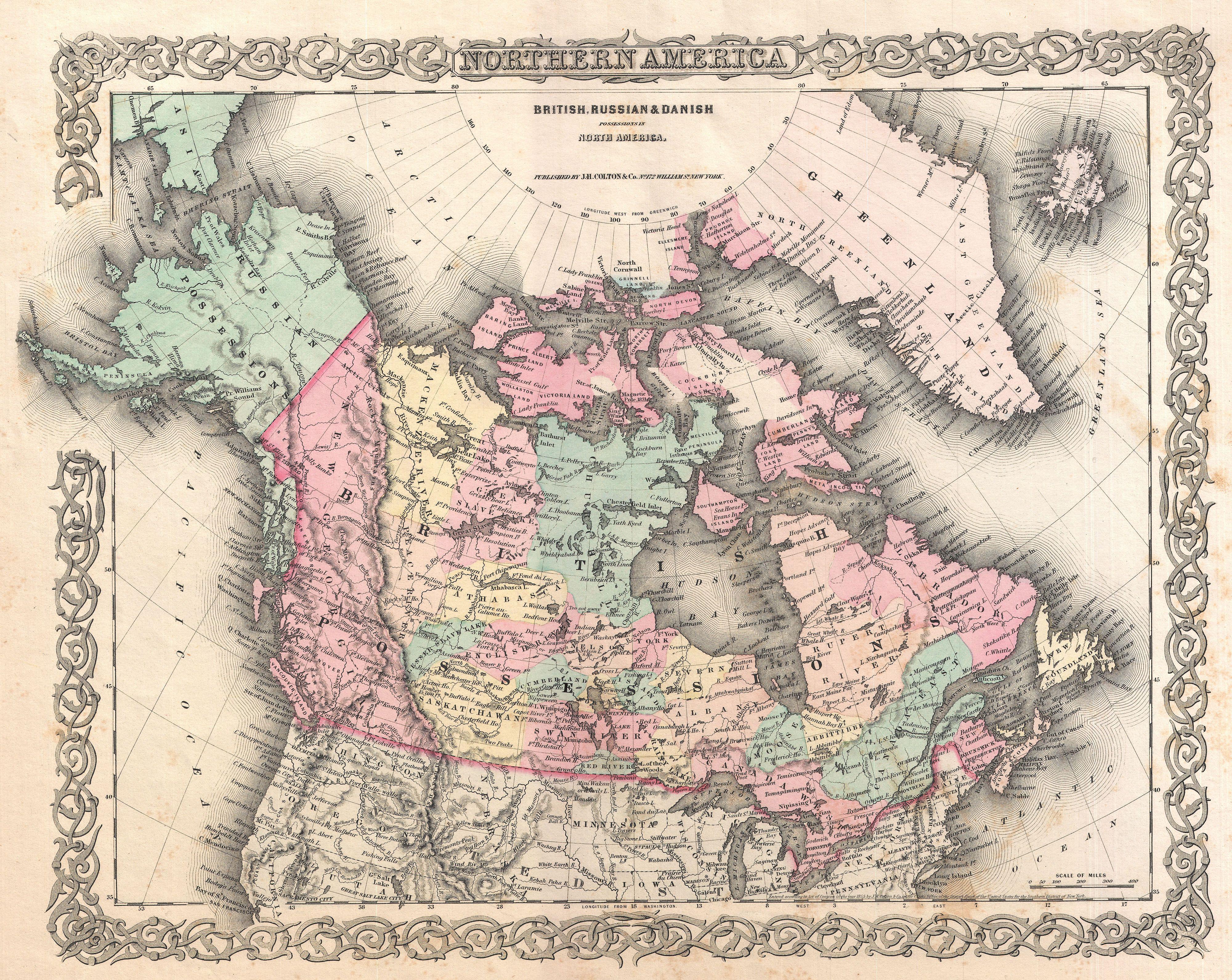
The Province of Canada (or the United Province of Canada or the United Canadas) was a British North America, British colony in North America from 1841 to 1867. Its formation reflected recommendations made by John Lambton, 1st Earl of Durham, in the Report on the Affairs of British North America following the Rebellions of 1837–1838. The Act of Union 1840, passed on 23 July 1840 by the British Parliament and proclaimed by the Monarchy of Great Britain, Crown on 10 February 1841, merged the Colonies of Upper Canada and Lower Canada by abolishing their separate parliaments and replacing them with a Parliament of the Province of Canada, single one with two houses, a Legislative Council of the Province of Canada, Legislative Council as the upper chamber and the Legislative Assembly of the Province of Canada, Legislative Assembly as the lower chamber. In the aftermath of the Rebellions of 1837–1838, unification of the two Canadas was driven by two factors. Firstly, Upper Canad ... [...More Info...] [...Related Items...] OR: [Wikipedia] [Google] [Baidu] |


