|
Salmon–Challis National Forest
Salmon–Challis National Forest is located in east central sections of the U.S. state of Idaho. At 4,235,940 acres (6,618.66 sq mi, or 17,142.24 km2) it is one of the largest national forests in the lower 48 states and also has most of the land area of the Frank Church–River of No Return Wilderness, which is the largest wilderness area south of Alaska. Borah Peak, the tallest mountain in Idaho, is also found here. The Wild and Scenic Salmon River weaves through the rugged terrain of the Sawtooth Mountains and Sawtooth National Recreation Area, while it flows for over through the forest. The Big Lost River has its headwaters within the national forest. Challis National Forest, the more southerly of its two parts, lies primarily in Custer County, but also has major areas in Lemhi and Butte counties, as well as smaller areas in Clark and Blaine counties. It has a total area of 2,463,471 acres (3,849.17 sq mi, or 9,969.31 km2). There are local ranger district offi ... [...More Info...] [...Related Items...] OR: [Wikipedia] [Google] [Baidu] |
Lost River Range
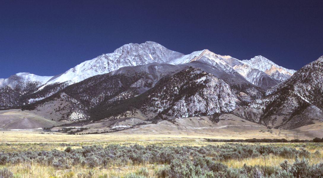
The Lost River Range is a high mountain range of the Rocky Mountains, located in Central Idaho, in the Northwestern United States. It runs southeast for approximately from the Salmon River near the community of Challis to the Snake River Valley near Arco. To the west are the valleys of the Salmon and the Big Lost Rivers, while to the east are the Little Lost River and Pashimeroi Valleys. The range starts at the east bank of the Salmon River, at an elevation of about . It quickly rises to Grouse Creek Mountain (11,085 ft, 3,378 m) and Dickey Peak (11,141 ft, 3,395 m), and then descends to Double Springs Pass, location of one of just two roads to cross the range. Nearby is an interpretive site explaining the effects of the magnitude 6.9 Borah Peak earthquake that hit the range on October 28, 1983. The Big Lost River Valley fell and the Lost River Range rose, leaving a fault scarp of up to along the base of the mountains. The range then rises into its high central ... [...More Info...] [...Related Items...] OR: [Wikipedia] [Google] [Baidu] |
Lemhi County, Idaho
Lemhi County is a county located in the U.S. state of Idaho. As of the 2020 census, the population was 7,974. The largest city and county seat is Salmon. The county was established in 1869, named after Fort Lemhi (or Limhi), a remote Mormon missionary settlement from 1855 to 1858 in Bannock and Shoshone territory. Traffic signals *Main (Hwy 28) and Challis (Hwy 93), Salmon *Main (Hwy 93) and Church, Salmon Geography According to the U.S. Census Bureau, the county has a total area of , of which is land and (0.1%) is water. It is the fourth-largest county in Idaho by area. The highest point is Bell Mountain at above sea level, and the lowest point is the Salmon River as it exits on the county's western border with Idaho County at approximately . The river cuts through the center of Lemhi County before turning west. The county's eastern border with Beaverhead County, Montana, is the Continental Divide. Adjacent counties *Idaho County, Idaho – northwest/Pacific Time border ... [...More Info...] [...Related Items...] OR: [Wikipedia] [Google] [Baidu] |
Wilderness Area
Wilderness or wildlands (usually in the plural), are natural environments on Earth that have not been significantly modified by human activity or any nonurbanized land not under extensive agricultural cultivation. The term has traditionally referred to terrestrial environments, though growing attention is being placed on marine wilderness. Recent maps of wilderness suggest it covers roughly one quarter of Earth's terrestrial surface, but is being rapidly degraded by human activity. Even less wilderness remains in the ocean, with only 13.2% free from intense human activity. Some governments establish protection for wilderness areas by law to not only preserve what already exists, but also to promote and advance a natural expression and development. These can be set up in preserves, conservation preserves, national forests, national parks and even in urban areas along rivers, gulches or otherwise undeveloped areas. Often these areas are considered important for the survival of c ... [...More Info...] [...Related Items...] OR: [Wikipedia] [Google] [Baidu] |
North Fork, Idaho
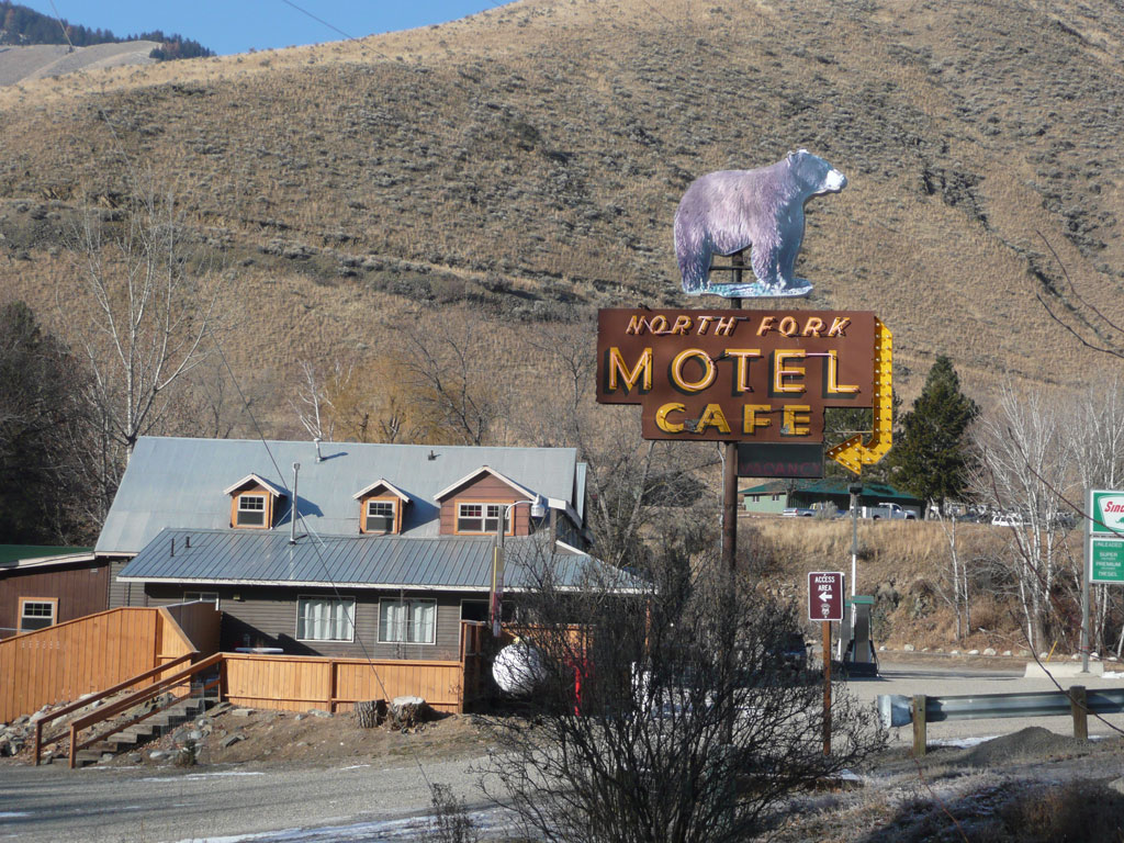
North Fork is an unincorporated community in Lemhi County, Idaho.Its name is derived from confluence of the south-flowing North Fork of the Salmon River with the north-flowing main Salmon River, which makes a near-right angle turn here to flow westward across the state to Riggins. US 93 serves the community, connecting it with Salmon to the south and Lost Trail Pass Lost Trail Pass is a mountain pass in the Rocky Mountains of the northwestern United States, on the border of Idaho and Montana in the Bitterroot Mountains. The pass is at an elevation of above sea level and is traversed by U.S. Highway 93. The ... to the north. Longtime families in the community include Cummings, Prestwich, Randolph, Hughes, Smith, and Maxwell. The community of North Fork is built around the “North Fork Store” which also houses a post office and small liquor store. There are two hotels and a U.S. Forest Service Station. The community area includes a non-denominational Christian Church . ... [...More Info...] [...Related Items...] OR: [Wikipedia] [Google] [Baidu] |
Leadore, Idaho
Leadore is an incorporated small town in Lemhi County, Idaho, United States. The population was 105 at the 2010 census. History The town of Leadore dates from 1910, when the Gilmore and Pittsburgh Railroad was constructed from Armstead, Montana, over Bannock Pass and into the Lemhi Valley. This occurred because the original location for the train station in the town of Junction had to be altered when the owner of the land refused to sell. The town was home to the railroad's repair shops, and was the point where the railroad's branch line to Gilmore connected with the main line. Though the railroad ceased operating in 1939, Leadore has remained the largest town in the immediate area. In 2001 a replica of the town's old railway station was constructed in Leadore. The new building serves as the town's community center. Geography Leadore is located in southeastern Lemhi County at (44.679604, -113.360664), in the Lemhi Valley. The Lemhi River flows through the northeast side of ... [...More Info...] [...Related Items...] OR: [Wikipedia] [Google] [Baidu] |
Idaho County, Idaho
Idaho County is a county in the U.S. state of Idaho, and the largest by area in the state. As of the 2020 census, the population was 16,541. The county seat is Grangeville. Previous county seats of the area were Florence (1864–68), Washington (1868–75), and Mount Idaho (1875–1902). History Idaho County's oldest non-native settlements are ghost towns. Discovery of gold occurred in succession at Elk City, Newsome, and Florence during the spring and summer of 1861. At the time, all of the settlements were within Shoshone County, Washington Territory. Thousands flocked to Florence. As a result, Idaho County was founded as a region of Washington Territory in 1861, named for a steamer called ''Idaho'' that was launched on the Columbia River in 1860. It was reorganized by the Idaho Territorial Legislature on February 4, 1864. In this context, the Idaho Territory and the State of Idaho are both preceded by the county name. Settlements at Cottonwood, Mount Idaho, and Warre ... [...More Info...] [...Related Items...] OR: [Wikipedia] [Google] [Baidu] |
Valley County, Idaho
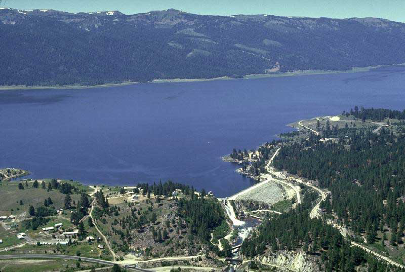
Valley County is a rural County (United States), county located in the U.S. state of Idaho. As of the 2020 United States Census, 2020 census, the population was 11,746. The county seat is Cascade, Idaho, Cascade, and the largest city is McCall, Idaho, McCall. Established in 1917, it was named after the Long Valley of the North Fork of the Payette River, which extends over from Payette Lake at McCall, Idaho, McCall south to Cascade, Idaho, Cascade to Round Valley. The valley was formerly a summer pasture for livestock from the Treasure Valley, Boise Valley. Since the completion of the Cascade Dam in 1948, much of the northern valley has been covered by the Lake Cascade, Cascade Reservoir. Valley County is home to the Idaho ground squirrel. History Packer John Welch, who had contracted to freight supplies to miners of Idaho City, established a camp on Gold Fork Creek and a brush cabin on Clear Creek in the 1860s. [...More Info...] [...Related Items...] OR: [Wikipedia] [Google] [Baidu] |
Mackay, Idaho
Mackay ) is a town in Custer County, Idaho, United States. The population was 439 at the 2020 census. The town is pronounced "Mackie" with the accent on the first syllable. Highways * - US 93 - to Challis (north) and Arco (south) Etymology The town was named in honour of John William Mackay who owned the local copper mines. The nearby Mackay Peak in the White Knob Mountains is also named after him. Geography Mackay is located at (43.911880, -113.613669), at an elevation of 5,905 feet (1,800 m). According to the United States Census Bureau, the city has a total area of , all of it land. About north of Mackay is Idaho's highest mountain: Borah Peak, with a summit elevation of . Mt. McCaleb, , overlooks the city. Climate The climate of Mackay ranges from lows of -40 °F (-40 °C) to highs of +30 °F (-1 °C) in the winter. In the summer, temperatures range from lows of 30 °F (-1 °C) to highs of 100 °F (38 °C) in some a ... [...More Info...] [...Related Items...] OR: [Wikipedia] [Google] [Baidu] |
Clayton, Idaho
Clayton is a city in Custer County, Idaho, United States. The population was 7 at the 2010 census, down from 27 in 2000. It is adjacent to the Salmon River. History Clayton was founded in 1881 as a smelter site for the nearby mines. Geography Clayton is located at (44.259014, -114.399725), at an elevation of above sea level. According to the United States Census Bureau, the city has a total area of , all of it land, which makes it the smallest incorporated city of Idaho, and even the smallest incorporated city of the US. Climate This climatic region is typified by large seasonal temperature differences, with warm to hot (and often humid) summers and cold (sometimes severely cold) winters. According to the Köppen Climate Classification system, Clayton has a humid continental climate, abbreviated "Dfb" on climate maps. Highway * - ''Salmon River Scenic Byway'' Clayton is located on State Highway 75, between Stanley (west) and Challis (northeast). Demographics 201 ... [...More Info...] [...Related Items...] OR: [Wikipedia] [Google] [Baidu] |
Challis, Idaho
Challis is the largest city in Custer County, Idaho, United States. It is the county seat and its population was 1,081 at the 2010 census. The 2020 census shows 902 residents, a 16.6% drop. History Challis was founded in 1878 and named for A.P. Challis, who was a surveyor when the townsite was laid out. Challis post office was established in 1878. Twin Peaks Sports, the I.O.O.F. Hall, and a number of other buildings in Challis are individually listed on the National Register of Historic Places, most as a result of an Idaho State Historical Society study of historical resources in the town. Highways * - US 93 - to Salmon (north) and Mackay (south) * - to Stanley (southwest) The ''Salmon River Scenic Byway'' uses both highways, from Stanley to Salmon. The junction with Highway 75 is south of Challis. 1983 earthquake On Friday, October 28, 1983, the Borah Peak earthquake occurred at 8:06 am MDT. The shock measured 6.9 on the moment magnitude scale and had a maximum Mercalli ... [...More Info...] [...Related Items...] OR: [Wikipedia] [Google] [Baidu] |
National Park Ranger
National Park Service rangers are among the uniformed employees charged with protecting and preserving areas set aside in the National Park System by the United States Congress and the President of the United States. While all employees of the agency contribute to the National Park Service mission of preserving unimpaired the natural and cultural resources set aside by the American people for future generations, the term " park ranger" is traditionally used to describe all National Park Service employees who wear the uniform. Broadly speaking, all National Park Service rangers promote stewardship of the resources in their care—either voluntary stewardship via resource interpretation, or compliance with statute or regulation through law enforcement. These comprise the two main disciplines of the ranger profession in the National Park Service. History The term "ranger" is from a Middle English word dating back to 1350–1400. "Rangers" patrolled royal forests and parks to prev ... [...More Info...] [...Related Items...] OR: [Wikipedia] [Google] [Baidu] |


