|
Stößensee Bridge
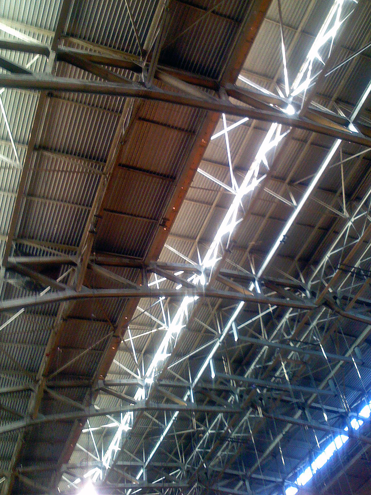
The Stößenseebrücke is a steel truss bridge over the Stößensee and the Havelchaussee in the Berlin district of Spandau. The Listed building, listed bridge from 1908/1909 is part of Heerstraße (Berlin), Heerstraße (federal highway 2/5) and connects the Spandau district of Wilhelmstadt with the Westend (Frankfurt am Main), Westend district of Charlottenburg-Wilmersdorf. The biggest technical and financial problem during the construction of the Heerstraße was bridging the Havel lowland, which includes the Stößensee, an old arm of the Havel. From several options, including an additional 250-meter-long bridge over the Scharfe Lanke, the planners opted for a route that could manage with two bridges - over the Havel and the Stößensee. With regard to the variants of the Stößensee bridge, the "small" solution with a dam embankment and a bridge around 100 meters long was chosen instead of a bridge over the entire lake. The bridge consists of a system of cantilever girders with ... [...More Info...] [...Related Items...] OR: [Wikipedia] [Google] [Baidu] |
Heerstraße (Berlin)
Heerstraße, or Heerstrasse (see ß; ; literally: Army Street), runs from Theodor-Heuss-Platz in Charlottenburg, Berlin-Charlottenburg to the western city border of Berlin in the locality of Staaken in the borough of Spandau. It is part of Bundesstraße 5; from Theodor-Heuss-Platz to Wilhelmstraße (Spandau), Wilhelmstraße it is forms part of Bundesstraße 2. With a length of around 10 kilometres, it is one of the longest streets in Berlin and an important commuter route. The street is a five-lane expressway (Kraftfahrstraße), depending on traffic flow the middle lane is available during rush hours in the morning (eastbound) and in the evening (westbound). History Planning and construction The construction of the street started in 1874 from Charlottenburg, Berlin-Charlottenburg to Pichelsberg. In 1911 the street was opened in full length as ''Döberitzer Heerstraße'' in attendance of Wilhelm II, German Emperor, Emperor Wilhelm II. It was constructed in stages sinc ... [...More Info...] [...Related Items...] OR: [Wikipedia] [Google] [Baidu] |
Girder
A girder () is a Beam (structure), beam used in construction. It is the main horizontal support of a structure which supports smaller beams. Girders often have an I-beam cross section composed of two load-bearing ''flanges'' separated by a stabilizing ''web'', but may also have a box girder, box shape, Z shape, or other forms. Girders are commonly used to build bridges. A girt is a vertically aligned girder placed to resist shear loads. Small steel girders are Rolling (metalworking), rolled into shape. Larger girders (1 m/3 feet deep or more) are made as plate girders, welded or bolted together from separate pieces of steel plate. The Warren truss, Warren type girder replaces the solid web with an open latticework truss between the flanges. This arrangement combines strength with economy of materials, minimizing weight and thereby reducing loads and expense. Patented in 1848 by its designers James Warren (engineer), James Warren and Willoughby Theobald Monzani, its st ... [...More Info...] [...Related Items...] OR: [Wikipedia] [Google] [Baidu] |
Bismarckstraße (Berlin U-Bahn)
Bismarckstraße is a Berlin U-Bahn station on lines U2 and U7, located in the Charlottenburg district. It was opened in 1978 on the eponymous street, a major arterial road named after Otto von Bismarck. History At the time when the first U-Bahn line (''Stammstrecke'') opened in 1902, the road was laid out in a lavish boulevard style as the western continuation of Charlottenburger Chaussee (now Straße des 17. Juni) and part of a direct connection between the Berlin city centre at Brandenburg Gate to the western suburbs of Charlottenburg and Spandau along Kaiserdamm and Heerstraße. On 14 December 1902, '' Knie'' station opened at present-day Ernst-Reuter-Platz; the western extension to Bismarckstraße (now Deutsche Oper) and the Wilhelmplatz (now Richard-Wagner-Platz) terminus near Charlottenburg Town Hall was inaugurated on 14 May 1906. On 29 March 1908, the western continuation of the present-day U2 to Reichskanzlerplatz (now Theodor-Heuss-Platz) in Westend was opened. It b ... [...More Info...] [...Related Items...] OR: [Wikipedia] [Google] [Baidu] |
Straße Des 17
{{Short pages monitor ... [...More Info...] [...Related Items...] OR: [Wikipedia] [Google] [Baidu] |
Unter Den Linden
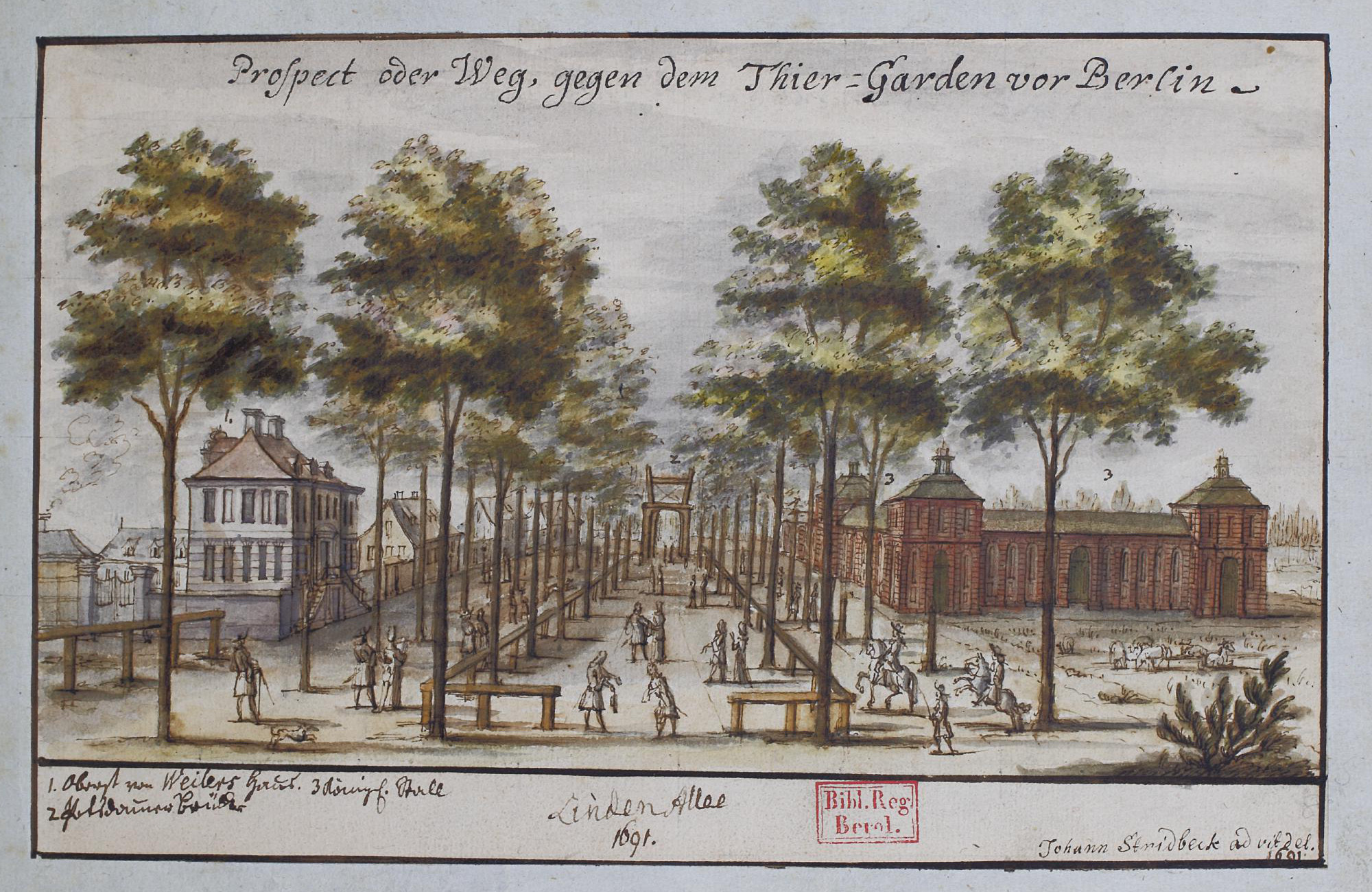
Unter den Linden (, "under the Tilia, linden trees") is a boulevard in the central Mitte (locality), Mitte district of Berlin, Germany. Running from the Berlin Palace to the Brandenburg Gate, it is named after the Tilia, linden trees (known as lime in the UK and Ireland and basswood in North America, not related to citrus lime) that line the grassed pedestrian mall on the median and the two broad carriageways. The avenue links numerous Berlin List of tourist attractions in Berlin, sights, landmarks and rivers for sightseeing. Overview Unter den Linden runs east–west from the Berlin Palace, the former main residence of the royal House of Hohenzollern, reconstructed (after the demolition of the communist Palace of the Republic (Berlin), Palace of the Republic) on its old site opposite the Lustgarten park, to Pariser Platz and Brandenburg Gate. Major north–south streets crossing ''Unter den Linden'' are Friedrichstraße and Wilhelmstrasse, both meeting at Mehringplatz and ... [...More Info...] [...Related Items...] OR: [Wikipedia] [Google] [Baidu] |
Military Training Area
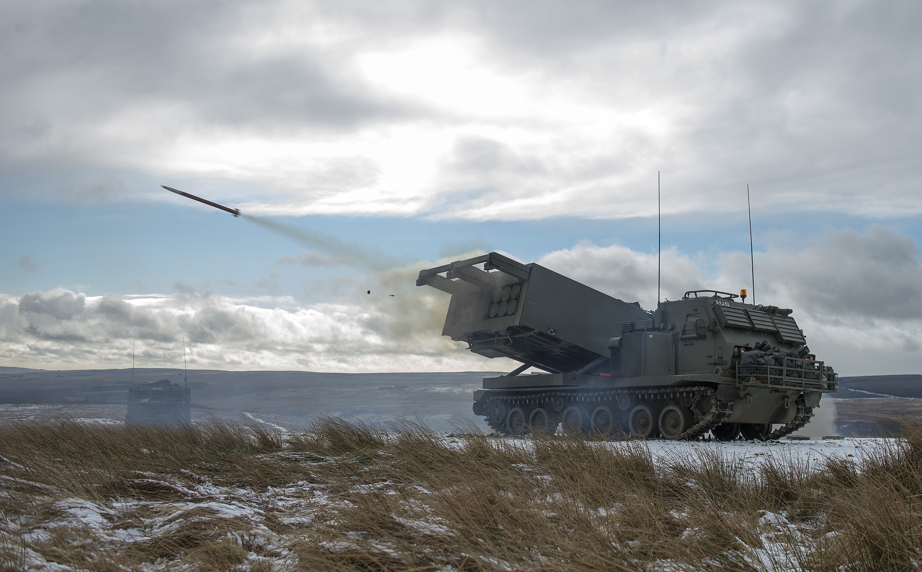
A military training area, training area (Australia, Ireland, and the United Kingdom) or training centre (Canada) is land set aside specifically to enable military forces to train and exercise for combat. Training areas are usually out of bounds to the general public, but some have limited access when not in use. As well as their military function, they often serve as important wildlife refuges. They are distinct from proving grounds which are designed for purposes such as testing weaponry or equipment. Description Military training areas are important because they enable troops to train more realistically and in greater numbers over a wide area without unduly inconveniencing the public or putting others at risk. They are particularly important for all arms training where the different elements of armed forces come together to cooperate and coordinate their fire and movement. Training areas often incorporate a variety of terrain types, including forests, heathland, waterbodies a ... [...More Info...] [...Related Items...] OR: [Wikipedia] [Google] [Baidu] |
Charlottenburg
Charlottenburg () is a Boroughs and localities of Berlin, locality of Berlin within the borough of Charlottenburg-Wilmersdorf. Established as a German town law, town in 1705 and named after Sophia Charlotte of Hanover, Queen consort of Kingdom of Prussia, Prussia, it is best known for Charlottenburg Palace - the largest surviving such royal palace in Berlin - and the adjacent museums. Charlottenburg was an independent city to the west of Berlin until 1920 when it was incorporated into "Greater Berlin Act, Groß-Berlin" (Greater Berlin) and transformed into a borough. In the course of Berlin's 2001 administrative reform it was merged with the former borough of Wilmersdorf becoming a part of a new borough called Charlottenburg-Wilmersdorf. Later, in 2004, the new borough's districts were rearranged, dividing the former borough of Charlottenburg into the localities of Charlottenburg proper, Westend (Berlin), Westend and Charlottenburg-Nord. Geography Charlottenburg is located in ... [...More Info...] [...Related Items...] OR: [Wikipedia] [Google] [Baidu] |
Berlin Palace
The Berlin Palace (), formerly known as the Royal Palace (), is a large building adjacent to Berlin Cathedral and the Museum Island in the Mitte area of Berlin. It was the main residence of the Electors of Brandenburg, Kings of Prussia and German Emperors from 1443 to 1918. Expanded by order of Frederick I of Prussia according to plans by Andreas Schlüter from 1689 to 1713, it was thereafter considered a major work of Prussian Baroque architecture. The royal palace became one of Berlin’s largest buildings and shaped the cityscape with its dome erected in 1845. Used for various government functions after the abolition of the Hohenzollern monarchy in the 1918 revolution, the palace was damaged during the Allied bombing in World War II, and was razed to the ground by the East German authorities in 1950. In the 1970s, the East German authorities erected a modernist parliamentary and cultural center on the site, known as the Palace of the Republic. After German reunificat ... [...More Info...] [...Related Items...] OR: [Wikipedia] [Google] [Baidu] |
Kaiserdamm
Kaiserdamm is a boulevard in the Westend and Charlottenburg districts of Berlin, Germany. Route Kaiserdamm is a 50m wide road, that runs for between Sophie-Charlotte-Platz in the east to Theodor-Heuss-Platz in the west. It forms a westward continuation of Bismarckstraße, Straße des 17. Juni and the Unter den Linden boulevard. History Originally an unpaved track, the road was inaugurated at the behest of Wilhelm II (after whom it is named), and opened to traffic in 1906. The road was rebuilt in 1939 as part of the East-West Axis of the planned Welthauptstadt Germania, and much of the road as it is today dates from this time. Buildings Kaiserdamm is served by the Kaiserdamm U-Bahn station positioned halfway between the Theodor-Heuss-Platz U-Bahn station and Sophie-Charlotte-Platz U-Bahn stations. Prominent buildings on the road include the studios of Rundfunk Berlin-Brandenburg (; "Berlin-Brandenburg Broadcasting"), commonly shortened to RBB (; stylized as rbb), is an ... [...More Info...] [...Related Items...] OR: [Wikipedia] [Google] [Baidu] |
Werder (Havel)
Werder (Havel) (; official name derived from ''Werder an der Havel'' ("Werder upon Havel"), colloquially just ''Werder'') is a town in the state of Brandenburg, Germany, located on the Havel river in the Potsdam-Mittelmark district, west of the state's capital Potsdam. Werder has a long and rich history and is a nationally recognized ''Resort town, Erholungsort'' – a government designation given to regions of Germany that have been recognized and must be continuously re-certified as having air and climate qualities which provide a healthful environment to visitors. Werder is also famous for hosting a Cherry Blossom Festival, the '':de:Baumblütenfest, Baumblütenfest'', every May. Etymology The Werder municipal area stretches along the banks of the Havel, a tributary of the Elbe, and the town's oldest quarter is located on an island in the river. Hence the name, as the landscape term ''Werder'' (like ''Wörth'' in Upper German) means "river island". History Werder has several d ... [...More Info...] [...Related Items...] OR: [Wikipedia] [Google] [Baidu] |
Tiefwerder Wiesen
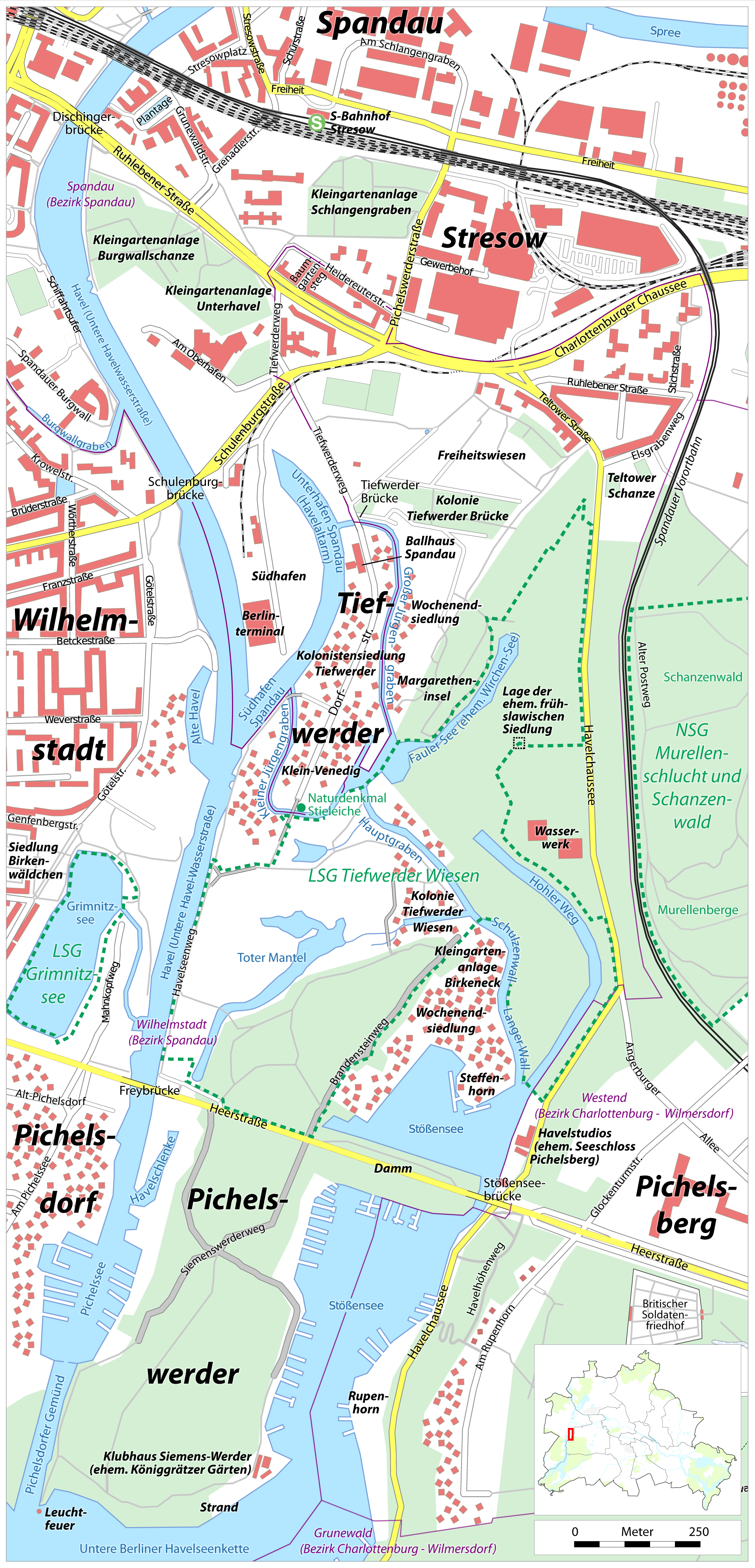
The Tiefwerder Wiesen (lit. German language, German: Tiefwerder meadows) in Berlin is the remnant of the former floodplain landscape in the Havel/Spreetal lowlands. It is situated in the Tiefwerder area and the lowland region of the Pichelswerder River peninsula in the Wilhelmstadt district of Spandau. These wet meadows contain historical Havel River arms and have been protected under Landschaftsschutzgebiet (LSG) (landscape conservation area) since 1960, covering an area of 66.7 hectares. Within the LSG lies the Faule See (Lazy Lake), which emerged from an old arm of the Havel. The natural floodplain is the last Northern pike, pike spawning area in Berlin. However, due to the lowering of the Havel water level since 1990, the accessibility of the meadows for the pike has significantly deteriorated. Moreover, the German Unity Transport Projects, German Unity 17 transport project, if implemented, would cause a further drop in the water level, posing an additional threat to the pike' ... [...More Info...] [...Related Items...] OR: [Wikipedia] [Google] [Baidu] |


