|
Stratton Rural District
Stratton Rural District was a local government division of Cornwall in England, UK, between 1894 and 1974. Established under the Local Government Act 1894, the rural district underwent boundary changes in both 1934 and 1966 with adjacent districts. In 1974, the district was abolished under the Local Government Act 1972, forming part of the new North Cornwall district. Civil parishes The civil parishes within the district were: * Jacobstow * Kilkhampton * Launcells * Marhamchurch * Morwenstow * North Tamerton * Poundstock * St Gennys * Week St Mary * Whitstone Whitstone is a village and civil parish in east Cornwall, United Kingdom. It is roughly halfway between the towns of Bude and Launceston. The population at the 2011 census was 590. History The earliest mention of the village is in the Dome ... References Districts of England created by the Local Government Act 1894 Districts of England abolished by the Local Government Act 1972 Rural districts of Englan ... [...More Info...] [...Related Items...] OR: [Wikipedia] [Google] [Baidu] |
Cornwall
Cornwall (; kw, Kernow ) is a historic county and ceremonial county in South West England. It is recognised as one of the Celtic nations, and is the homeland of the Cornish people. Cornwall is bordered to the north and west by the Atlantic Ocean, to the south by the English Channel, and to the east by the county of Devon, with the River Tamar forming the border between them. Cornwall forms the westernmost part of the South West Peninsula of the island of Great Britain. The southwesternmost point is Land's End and the southernmost Lizard Point. Cornwall has a population of and an area of . The county has been administered since 2009 by the unitary authority, Cornwall Council. The ceremonial county of Cornwall also includes the Isles of Scilly, which are administered separately. The administrative centre of Cornwall is Truro, its only city. Cornwall was formerly a Brythonic kingdom and subsequently a royal duchy. It is the cultural and ethnic origin of the Cor ... [...More Info...] [...Related Items...] OR: [Wikipedia] [Google] [Baidu] |
Marhamchurch
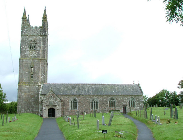
Marhamchurch ( kw, Eglosvarwenn) is a civil parish and village in north Cornwall, England, United Kingdom. Marhamchurch village is situated south of Bude off the A39 road. The Civil Parish population at the 2011 census was 837. History The name derives from the Celtic Saint Marwenne (Morwenna) who is thought to have founded a hermitage here around the end of the fifth century. Marwenne was one of the twenty-four children of St Brychan, a Welsh saint and king. Marhamchurch parish church is dedicated to St Marwenne. Most of the present church is of the 14th century; in the 15th century an aisle and porch were added. In the early 15th century the existence of an anchorite's cell occupied by an anchoress called Cecilia Moys is recorded. Features of interest include the four-holed cresset stone and a Norman quarter-capital (though this is unlikely to be a fragment of the Norman church which may have preceded the present building). St Marwenne was probably the same as Morwenna of ... [...More Info...] [...Related Items...] OR: [Wikipedia] [Google] [Baidu] |
Rural Districts Of England
In general, a rural area or a countryside is a geographic area that is located outside towns and cities. Typical rural areas have a low population density and small settlements. Agricultural areas and areas with forestry typically are described as rural. Different countries have varying definitions of ''rural'' for statistical and administrative purposes. In rural areas, because of their unique economic and social dynamics, and relationship to land-based industry such as agriculture, forestry and resource extraction, the economics are very different from cities and can be subject to boom and bust cycles and vulnerability to extreme weather or natural disasters, such as droughts. These dynamics alongside larger economic forces encouraging to urbanization have led to significant demographic declines, called rural flight, where economic incentives encourage younger populations to go to cities for education and access to jobs, leaving older, less educated and less weal ... [...More Info...] [...Related Items...] OR: [Wikipedia] [Google] [Baidu] |
Districts Of England Abolished By The Local Government Act 1972
A district is a type of administrative division that, in some countries, is managed by the local government. Across the world, areas known as "districts" vary greatly in size, spanning regions or county, counties, several municipality, municipalities, subdivisions of municipalities, school district, or political district. By country/region Afghanistan In Afghanistan, a district (Persian language, Persian ps, ولسوالۍ ) is a subdivision of a province. There are almost 400 districts in the country. Australia Electoral districts are used in state elections. Districts were also used in several states as cadastral units for land titles. Some were used as squatting districts. Cadastral divisions of New South Wales, New South Wales had several different types of districts used in the 21st century. Austria In Austria, the word is used with different meanings in three different contexts: * Some of the tasks of the administrative branch of the national and regional governme ... [...More Info...] [...Related Items...] OR: [Wikipedia] [Google] [Baidu] |
Whitstone
Whitstone is a village and civil parish in east Cornwall, United Kingdom. It is roughly halfway between the towns of Bude and Launceston. The population at the 2011 census was 590. History The earliest mention of the village is in the Domesday Book of 1086, when Whitstone was called 'Witestan', and was held by Ralph from the Count of Mortain. There was 1 furlong of land and half a plough, 1 serf, 12 acres of woodland, 8 cattle, 8 pigs, 40 sheep and 40 goats. The value of the manor was 15 shillings though it had formerly been worth £1 sterling. In the 19th century, the parish was called Whitstone. There were around 500 villagers, and a post office, and the entire parish comprised around . The Bude Canal passed through it. Froxton Farmhouse (19th century) is a Grade II* listed building. Froxton was also a manor recorded in the Domesday Book when it was held by Thurstan from Judhael of Totnes. There were 3 furlongs of land and land for 3 ploughs. There was half a plough, 4 s ... [...More Info...] [...Related Items...] OR: [Wikipedia] [Google] [Baidu] |
Week St Mary
Week St Mary ( kw, Gwig Sen Maria) is a village and civil parish in northeast Cornwall, England, United Kingdom. It is situated south of Bude close to the River Tamar and the border between Cornwall and Devon in the Hundred of Stratton. The parish population at the 2011 census is 657. Week St Mary has a 14th–15th century parish church dedicated to St Mary the Virgin and the tower contains a ring of six bells. The parish is in the diocese of Truro. History The manor of Week was recorded in the Domesday Book (1086) as having one hide of land and land for eight ploughs. It was one of twenty-eight manors held by Richard from Robert, Count of Mortain. There were three ploughs, four serfs, six villeins and ten smallholders. There were 2 acres of woodland and one square league of pasture. There were forty sheep and twenty-five other beasts. The value of the manor was £1-10 s. Parts of the college founded here by Thomasine Bonaventure in 1506 have been converted into a farmhous ... [...More Info...] [...Related Items...] OR: [Wikipedia] [Google] [Baidu] |
St Gennys
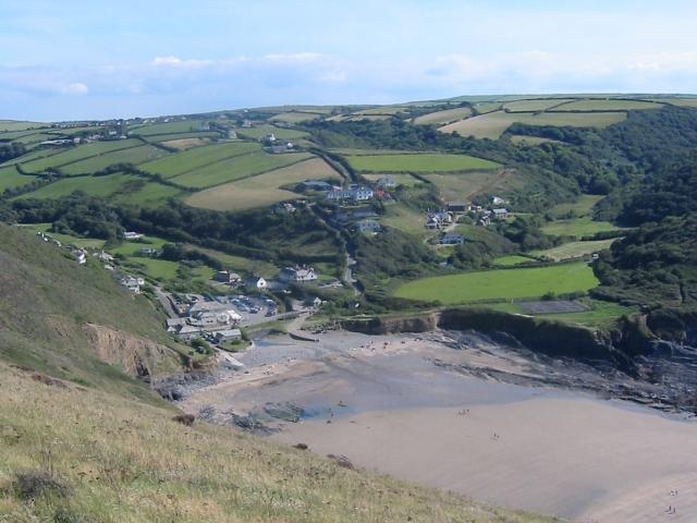
St Gennys ( kw, S. Gwynnas) is a coastal civil parish and small settlement in north Cornwall, England, United Kingdom. The hamlet of St Gennys is about seven miles (11.3 km) southwest of Bude.Ordnance Survey: Landranger map sheet 190 ''Bude & Clovelly'' It is on high ground half-a-mile north of the coastal village of Crackington Haven, the major settlement in the parish. The only other settlements of any size in the parish are Middle Crackington and Higher Crackington both of which are southeast of Crackington Haven, half-a-mile and one mile distant respectively. The population of the parish at the 2011 census was 873. History and geography The name St Gennys is generally thought to derive from 4th Century Christian martyr Saint Genesius although it has been suggested that the commemoration is to the Welsh Saint Gwynws. In either case the name is old and several places in the parish are mentioned in the Domesday Book including Crackington (as ''Crachemua''), Dizzard ( ... [...More Info...] [...Related Items...] OR: [Wikipedia] [Google] [Baidu] |
Poundstock
Poundstock ( kw, Tregorlann) is a civil parish and a hamlet on the north coast of Cornwall, England, United Kingdom. The hamlet is situated four miles (6.5 km) south of Bude half-a-mile west of the A39 trunk road about one mile from the coast. Poundstock civil parish is in the Registration District of Stratton. It is bounded to the west by the Atlantic Ocean; to the north by Marhamchurch parish, to the east by Week St Mary parish, and to the south by the parishes of Jacobstow and St Gennys. The population of the parish in the 2001 census was 805, increasing to 925 at the 2011 census. An electoral ward bearing the same name also exists with a population at the same census of 3,846. The manor of Poundstock was recorded in the Domesday Book (1086) when it was held by Jovin from Robert, Count of Mortain. Before 1066 it had been held by Gytha who paid tax for one virgate of land but there was one hide of land and land for 6 ploughs. There were 2 ploughs, 1 serf, 1 villein, ... [...More Info...] [...Related Items...] OR: [Wikipedia] [Google] [Baidu] |
North Tamerton
North Tamerton ( kw, Tre war Damer) is a village and civil parish in east Cornwall, England, UK. The village is situated approximately eight miles (13 km) southeast of Bude and eight miles (13 km) north of Launceston.Ordnance Survey: Landranger map sheet 190 ''Bude & Clovelly'' Geography North Tamerton is a thinly populated rural parish and the only village is North Tamerton itself, the other settlements being farmsteads and hamlets. It came within the hundred, and later the registration district, of Stratton. It is bounded to the east by the River Tamar which for much of its length delineates Cornwall's border with Devon, but here Cornwall extends across the river making North Tamerton the only parish in Cornwall which includes land east of the Tamar. GENUKI website; North Tamerton; retrieved May 2010 The name Tamerton d ... [...More Info...] [...Related Items...] OR: [Wikipedia] [Google] [Baidu] |
Morwenstow
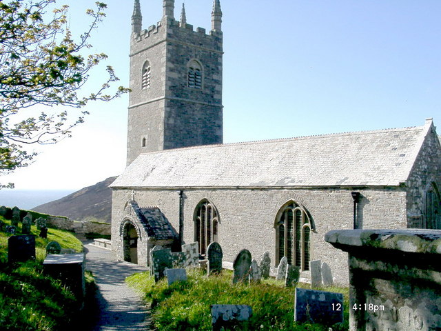
Morwenstow ( kw, Logmorwenna) is a civil parish in north Cornwall, UK. The parish abuts the west coast, about six miles (10 km) north of Bude and within the Cornwall Area of Outstanding Natural Beauty (AONB). Morwenstow is the most northerly parish in Cornwall. As well as the churchtown (a hamlet called Crosstown), other settlements in the parish include Shop, Woodford, Gooseham, Eastcott, Woolley and West Youlstone. The population at the 2011 census was 791. Morwenstow parish is bounded to the north and east by parishes in Devon, to the south by Kilkhampton parish and to the west by the Atlantic. The River Tamar has its source at a spring on Woolley Moor, at , which is in the parish near the border with Devon. Morwenstow is the one-time home of the eccentric vicar and poet Robert Stephen Hawker (1803–1875), the writer of Cornwall's anthem ''Trelawny''. Hawker is also credited with reviving the custom of Harvest Festivals. Parish church The Church of St Mo ... [...More Info...] [...Related Items...] OR: [Wikipedia] [Google] [Baidu] |
Launcells
Launcells ( kw, Lannseles) is a hamlet and civil parish in north-east Cornwall, England, United Kingdom. It is located east of Bude. Within the civil parish are the hamlets of Launcells Cross, Red Post, Grimscott, and Buttsbear Cross. In 2001, 563 people lived within the civil parish, decreasing to 531 at the 2011 census. Geography The River Tamar forms the eastern boundary of the civil parish, as well as the Cornish boundary with Devon. Parish church The parish church is dedicated to St Swithin: nearby, in the wooded valley is the holy well of St Swithin. There are two aisles but the arcades differ: while the north is of granite the south is of older Polyphant stone. The fine series of over 60 benchends is from the same workshop as those of Kilkhampton and Poughill. Other features of interest are the medieval wall painting and the tomb of Sir John Chamond, 1624. The church also features an unusual post-Reformation wall painting which has been dated between 1680-1690. ... [...More Info...] [...Related Items...] OR: [Wikipedia] [Google] [Baidu] |


