|
Stilesville, Indiana
Stilesville is a town in Franklin Township, Hendricks County, Indiana, United States. The population was 316 at the 2010 Census. History Stilesville was laid out in 1828. It was named for Jeremiah Stiles, a pioneer settler. The National Road was built through Stilesville in 1830. The town of Stiles, Wisconsin is named after the town. Geography According to the 2010 census, Stilesville has a total area of , of which (or 98.4%) is land and (or 1.6%) is water. Demographics 2010 census At the 2010 census there were 316 people, 124 households, and 89 families living in the town. The population density was . There were 139 housing units at an average density of . The racial makeup of the town was 98.7% White, 0.3% African American, and 0.9% from other races. Hispanic or Latino of any race were 2.8%. Of the 124 households 35.5% had children under the age of 18 living with them, 50.8% were married couples living together, 12.1% had a female householder with no husband presen ... [...More Info...] [...Related Items...] OR: [Wikipedia] [Google] [Baidu] |
Town
A town is a type of a human settlement, generally larger than a village but smaller than a city. The criteria for distinguishing a town vary globally, often depending on factors such as population size, economic character, administrative status, or historical significance. In some regions, towns are formally defined by legal charters or government designations, while in others, the term is used informally. Towns typically feature centralized services, infrastructure, and governance, such as municipal authorities, and serve as hubs for commerce, education, and cultural activities within their regions. The concept of a town varies culturally and legally. For example, in the United Kingdom, a town may historically derive its status from a market town designation or City status in the United Kingdom, royal charter, while in the United States, the term is often loosely applied to incorporated municipality, municipalities. In some countries, such as Australia and Canada, distinction ... [...More Info...] [...Related Items...] OR: [Wikipedia] [Google] [Baidu] |
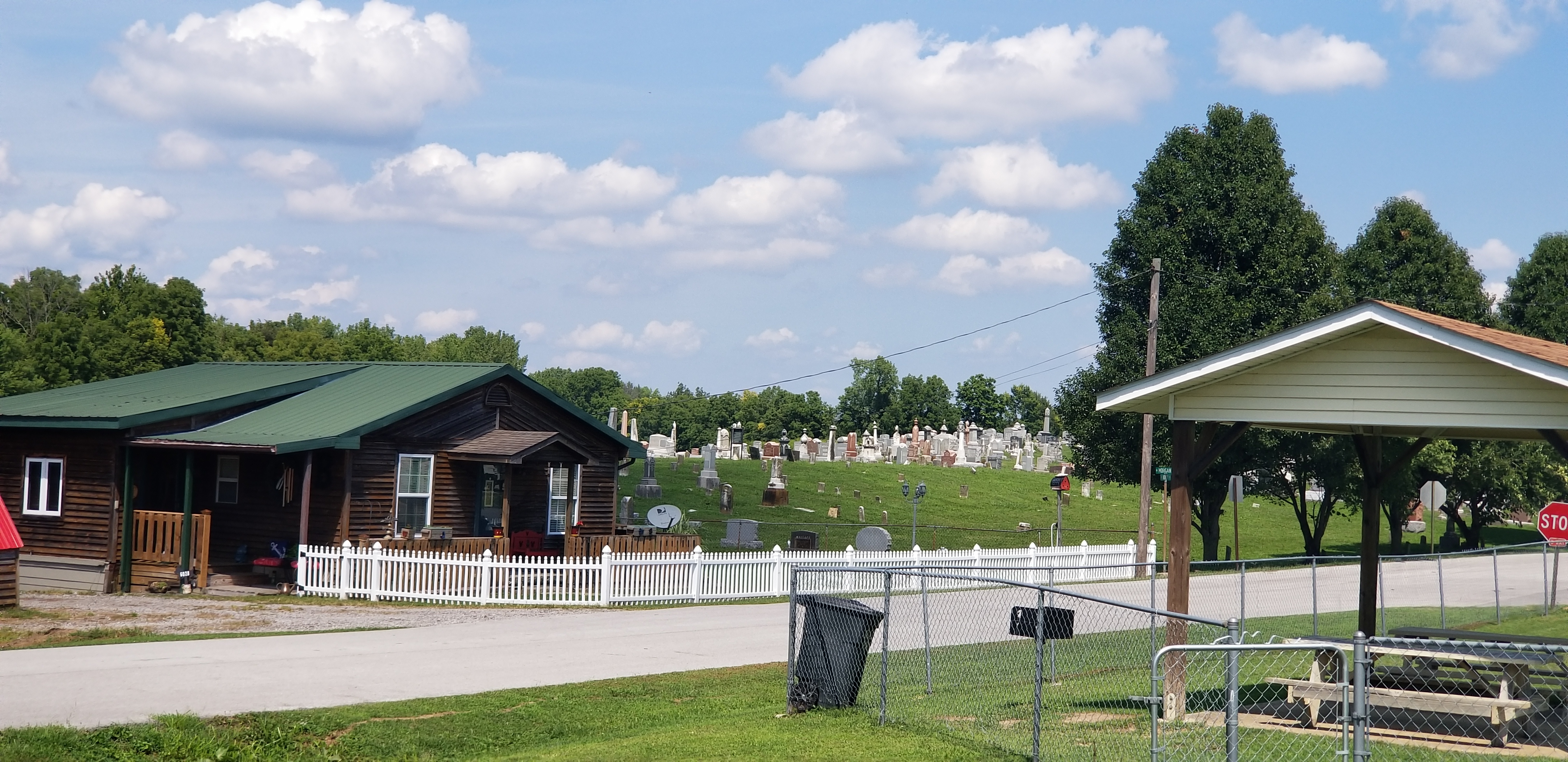
Stilesville Cemetery
Stilesville is a town in Franklin Township, Hendricks County, Indiana, United States. The population was 316 at the 2010 Census. History Stilesville was laid out in 1828. It was named for Jeremiah Stiles, a pioneer settler. The National Road was built through Stilesville in 1830. The town of Stiles, Wisconsin is named after the town. Geography According to the 2010 census, Stilesville has a total area of , of which (or 98.4%) is land and (or 1.6%) is water. Demographics 2010 census At the 2010 census there were 316 people, 124 households, and 89 families living in the town. The population density was . There were 139 housing units at an average density of . The racial makeup of the town was 98.7% White, 0.3% African American, and 0.9% from other races. Hispanic or Latino of any race were 2.8%. Of the 124 households 35.5% had children under the age of 18 living with them, 50.8% were married couples living together, 12.1% had a female householder with no husband presen ... [...More Info...] [...Related Items...] OR: [Wikipedia] [Google] [Baidu] |
Towns In Indiana
A town is a type of a human settlement, generally larger than a village but smaller than a city. The criteria for distinguishing a town vary globally, often depending on factors such as population size, economic character, administrative status, or historical significance. In some regions, towns are formally defined by legal charters or government designations, while in others, the term is used informally. Towns typically feature centralized services, infrastructure, and governance, such as municipal authorities, and serve as hubs for commerce, education, and cultural activities within their regions. The concept of a town varies culturally and legally. For example, in the United Kingdom, a town may historically derive its status from a market town designation or City status in the United Kingdom, royal charter, while in the United States, the term is often loosely applied to incorporated municipality, municipalities. In some countries, such as Australia and Canada, distinction ... [...More Info...] [...Related Items...] OR: [Wikipedia] [Google] [Baidu] |
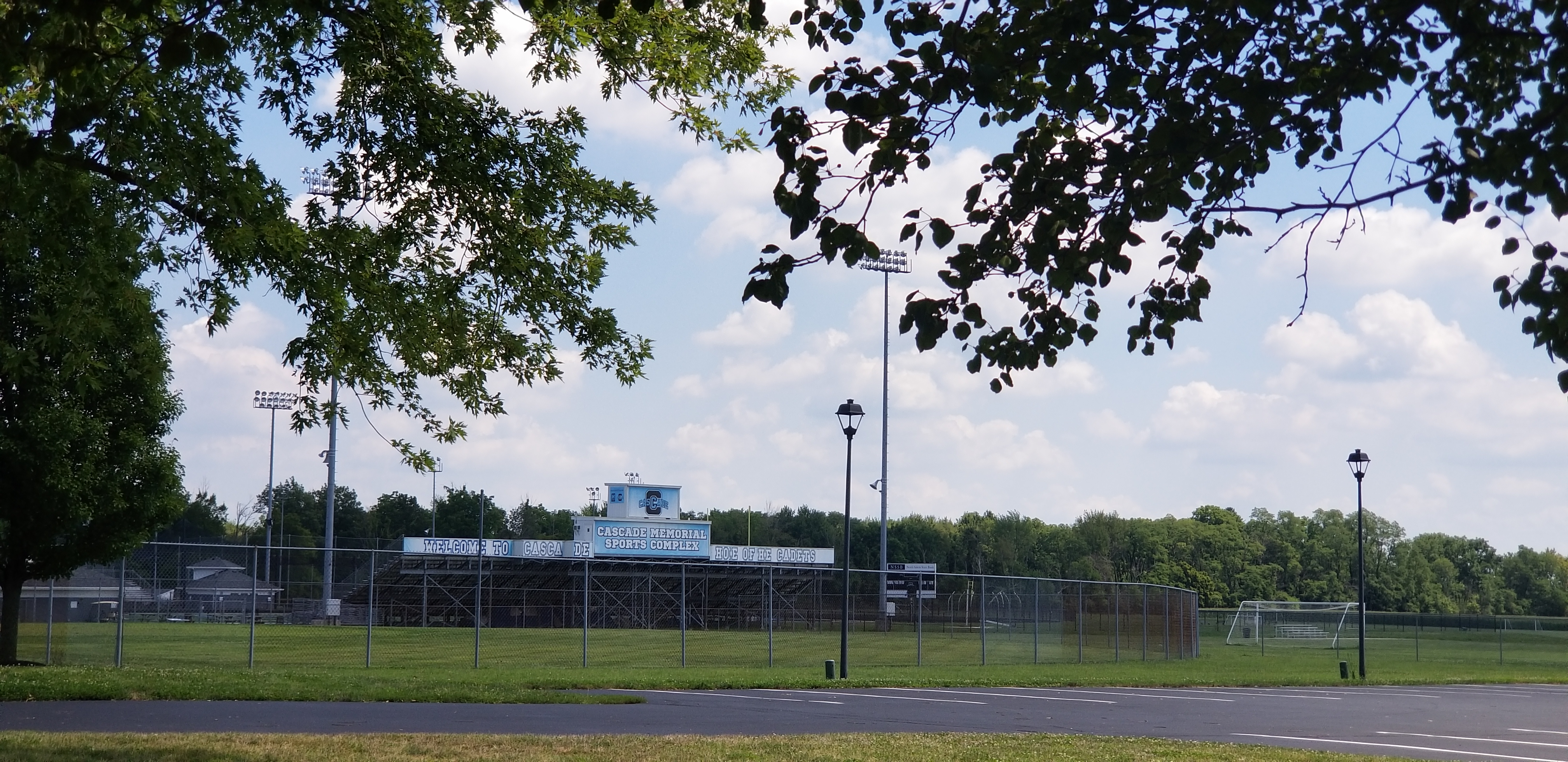
Cascade High School (Clayton, Indiana)
Cascade High School is a public high school located in Liberty Township, Hendricks County, Indiana, with a Clayton postal address, and in proximity to Clayton. It serves grades 9-12 for the Mill Creek Community School Corporation. The district includes Amo, Clayton, Coatesville, and Stilesville, as well as a small section of Plainfield. Text list/ref> History Cascade High School was established in 1964 as a consolidation of Clayton, Amo, and Stilesville High Schools. . Cascade High School. Retrieved on 2011-05-06 Demographics 21.4% of the students were eligible for free or reduced-cost lunch. For 2017–18, Cascade was a school.Athletics [...More Info...] [...Related Items...] OR: [Wikipedia] [Google] [Baidu] |
Mill Creek Community School Corporation
Mill Creek Community School Corporation is a public school district in Hendricks County, Indiana. The district is coextensive with Clay, Franklin, and Liberty townships. It includes Amo, Clayton, Coatesville, and Stilesville, as well as a small section of Plainfield. Text list/ref> History The formation of the Mill Creek Community School Corporation is the result of the 1964 consolidation of Clay, Franklin, and Liberty Liberty is the state of being free within society from oppressive restrictions imposed by authority on one's way of life, behavior, or political views. The concept of liberty can vary depending on perspective and context. In the Constitutional ... Township schools. Until that time, there was a friendly but heated rivalry that existed among the Amo, Clayton, and Stilesville High Schools. The consolidation of the township schools located in Amo, Belleville, Cartersburg, Clayton, Coatesville, Hazelwood, and Stilesville produced a higher quality ... [...More Info...] [...Related Items...] OR: [Wikipedia] [Google] [Baidu] |
Poverty Line
The poverty threshold, poverty limit, poverty line, or breadline is the minimum level of income deemed adequate in a particular country. The poverty line is usually calculated by estimating the total cost of one year's worth of necessities for the average adult.Poverty Lines – Martin Ravallion, in The New Palgrave Dictionary of Economics, 2nd Edition, London: Palgrave Macmillan The cost of housing, such as the renting, rent for an apartment, usually makes up the largest proportion of this estimate, so economists track the real estate market and other housing cost indicators as a major influence on the poverty line. Individual factors are often used to account for various circumstances, such as whether one is a parent, elderly, a child, married, etc. The poverty threshold may be adjusted annually. In practice, like the definition of poverty, the official or common understanding of the poverty line is significantly higher in developed country, developed countries than in developi ... [...More Info...] [...Related Items...] OR: [Wikipedia] [Google] [Baidu] |
Stiles, Wisconsin
Stiles is a town in Oconto County, Wisconsin, United States. The population was 1,465 at the 2000 census. The unincorporated communities of Stiles and Stiles Junction are located in the town. The town established a post office in 1855, but it was discontinued in early 1882. Later that year in late 1882, the town established a new post office that remained in operation until 1976. The town of Stiles was surveyed in 1839 and organized in 1852. The town was originally planned to be named Eldred. Geography According to the United States Census Bureau, the town has a total area of 35.2 square miles (91.2 km2), of which, 34.4 square miles (89.0 km2) of it is land and 0.8 square miles (2.1 km2) of it (2.36%) is water. Demographics As of the census of 2000, there were 1,465 people, 578 households, and 421 families residing in the town. The population density was 42.6 people per square mile (16.5/km2). There were 620 housing units at an average density of ... [...More Info...] [...Related Items...] OR: [Wikipedia] [Google] [Baidu] |
National Road
The National Road (also known as the Cumberland Road) was the first major improved highway in the United States built by the federal government. Built between 1811 and 1837, the road connected the Potomac and Ohio Rivers and was a main transport path to the West for thousands of settlers. When improved in the 1830s, it became the second U.S. road surfaced with the macadam process pioneered by Scotsman John Loudon McAdam. Construction began heading west in 1811 at Cumberland, Maryland, on the Potomac River. After the Financial Panic of 1837 and the resulting economic depression, congressional funding ran dry and construction was stopped at Vandalia, Illinois, the then-capital of Illinois, northeast of St. Louis across the Mississippi River. The road has also been referred to as the Cumberland Turnpike, the Cumberland–Brownsville Turnpike (or Road or Pike), the Cumberland Pike, the National Pike, and the National Turnpike. In the 20th century with the advent of the a ... [...More Info...] [...Related Items...] OR: [Wikipedia] [Google] [Baidu] |
Indiana
Indiana ( ) is a U.S. state, state in the Midwestern United States, Midwestern region of the United States. It borders Lake Michigan to the northwest, Michigan to the north and northeast, Ohio to the east, the Ohio River and Kentucky to the south and southeast, and the Wabash River and Illinois to the west. Nicknamed "the Hoosier State", Indiana is the List of U.S. states and territories by area, 38th-largest by area and the List of U.S. states and territories by population, 17th-most populous of the List of states and territories of the United States, 50 states. Its capital and largest city is Indianapolis. Indiana was admitted to the Union as the 19th state on December 11, 1816. Indigenous peoples of the Americas, Indigenous resistance to American settlement was broken with defeat of the Tecumseh's confederacy in 1813. The new settlers were primarily Americans of British people, British ancestry from the East Coast of the United States, eastern seaboard and the Upland South ... [...More Info...] [...Related Items...] OR: [Wikipedia] [Google] [Baidu] |


