|
St. Francis County, Arkansas
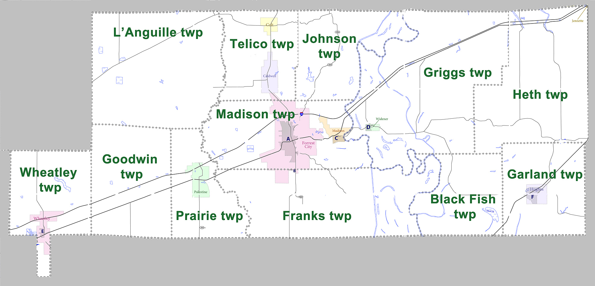
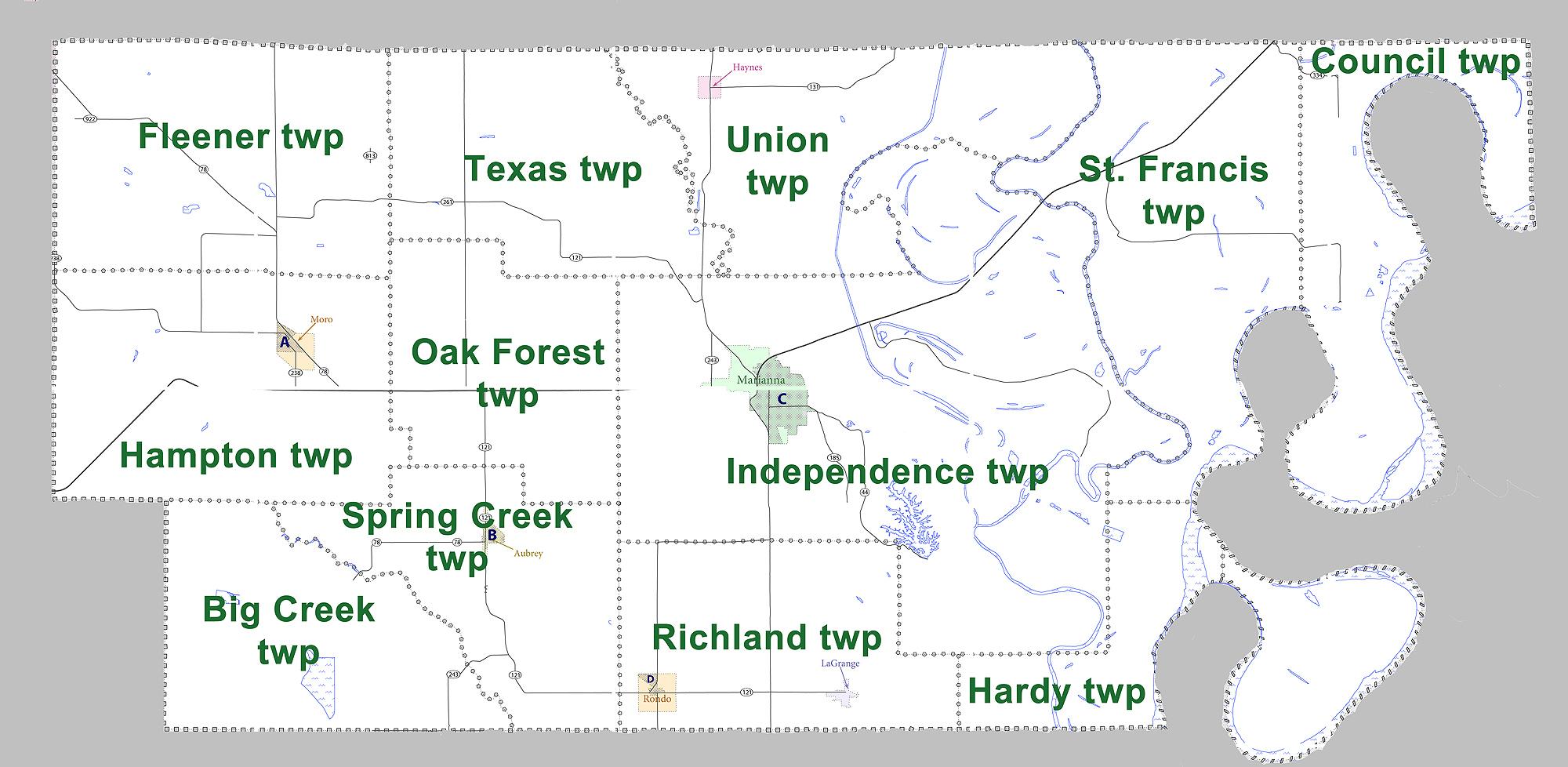
St. Francis County is a county in the U.S. state of Arkansas. As of the 2020 census, the population was 23,090. The county seat is Forrest City. St. Francis County comprises the Forrest City, Arkansas Micropolitan Statistical Area, which is also included in the Memphis-Forrest City, TN- MS-AR Combined Statistical Area. History St. Francis County was formed by the Arkansas territorial legislature on October 13, 1827. Madison served as the county seat until Forrest City, formed in 1869 and named after Nathan Bedford Forrest, replaced it in 1874. The percentage of tenant farmers in the county rose from 43.2% in 1880 to 70.7% in 1900. It is on the eastern border of the state in the Arkansas Delta, formed by the lowlands of the Mississippi River. It was an area of large cotton plantations in the antebellum era, when the workers were enslaved African Americans. It continued as an agricultural area into the late 19th century, when many freedmen became sharecroppers. Geogr ... [...More Info...] [...Related Items...] OR: [Wikipedia] [Google] [Baidu] [Amazon] |
Forrest City, Arkansas
Forrest City is a city in and the county seat of St. Francis County, Arkansas, United States. It was named for General Nathan Bedford Forrest, a notable Confederate war hero who later became the first Grand Wizard of the Ku Klux Klan. Shortly after the end of the Civil War, he had a construction crew camped here, who were completing a railroad between Memphis and Little Rock. The population was 15,371 at the 2010 census, an increase from 14,774 in 2000. The city identifies as the "Jewel of the Delta". History 19th century On October 13, 1827, St. Francis County, located in the east central part of Arkansas, was officially organized by the Arkansas Territorial Legislature in Little Rock. Nathan Bedford Forrest, a Confederate General and later the first Grand Wizard of the Ku Klux Klan, became interested in the area around Crowley's Ridge during the American Civil War. In 1866, General Forrest and C. C. McCreanor contracted to finish the Memphis & Little Rock Railroad fro ... [...More Info...] [...Related Items...] OR: [Wikipedia] [Google] [Baidu] [Amazon] |
Arkansas 1
Arkansas Highway 1 (AR 1) is a designation for three state highways in east Arkansas. One segment of runs from U.S. Route 278 (US 278) in McGehee north to US 165 at Back Gate. A second segment of runs from US 165 in DeWitt north to US 49 in Marvell. A third segment of runs from US 49 at Walnut Corner north to the Missouri state line. One of the original 1926 state highways, Highway 1 has remained very close to its original routing. Route description McGehee to Back Gate Highway 1 begins at US 278 in downtown McGehee and runs northwest (along the Union Pacific Railroad tracks) for three blocks before turning northeast at an intersection with Highway 159. The route continues across US 65/ US 165 and exits town in a northeastern direction, passing McGehee High School. Highway 1 meets Highway 4, which runs south to Arkansas City before curving north to Rohwer, which was a Japanese American internment camp during World War II. Highway 1 ... [...More Info...] [...Related Items...] OR: [Wikipedia] [Google] [Baidu] [Amazon] |
White (U
White is the lightest color and is achromatic (having no chroma). It is the color of objects such as snow, chalk, and milk, and is the opposite of black. White objects fully (or almost fully) reflect and scatter all the visible wavelengths of light. White on television and computer screens is created by a mixture of red, blue, and green light. The color white can be given with white pigments, especially titanium dioxide. In ancient Egypt and ancient Rome, priestesses wore white as a symbol of purity, and Romans wore white togas as symbols of citizenship. In the Middle Ages and Renaissance a white unicorn symbolized chastity, and a white lamb sacrifice and purity. It was the royal color of the kings of France as well as the flag of monarchist France from 1815 to 1830, and of the monarchist movement that opposed the Bolsheviks during the Russian Civil War (1917–1922). Greek temples and Roman temples were faced with white marble, and beginning in the 18th c ... [...More Info...] [...Related Items...] OR: [Wikipedia] [Google] [Baidu] [Amazon] |
Woodruff County, Arkansas
Woodruff County, officially the County of Woodruff, is located in the Arkansas Delta in the U.S. state of Arkansas. The County (United States), county is named for William E. Woodruff (politician), William E. Woodruff, founder of the state's first newspaper, the Arkansas Gazette. Created as Arkansas's 54th county in 1862, Woodruff County is home to one incorporated town and four incorporated cities, including Augusta, Arkansas, Augusta, the county seat. The county is also the site of numerous unincorporated communities and ghost towns. Occupying only , Woodruff County is the 13th smallest county in Arkansas. As of the 2020 United States census, 2020 Census, the county's population was 6,269. Based on population, the county is the second-smallest county of the 75 in Arkansas. Located in the Arkansas Delta, the county is largely flat with fertile soils. Historically covered in forest, bayous and swamps, the area was cleared for agriculture by early settlers. It is drained by the ... [...More Info...] [...Related Items...] OR: [Wikipedia] [Google] [Baidu] [Amazon] |
Monroe County, Arkansas
Monroe County is located in the Arkansas Delta in the U.S. state of Arkansas. The County (United States), county is named for James Monroe, the fifth President of the United States. Created as Arkansas's 20th county on November 2, 1829, Monroe County is home to two incorporated towns and three incorporated cities, including Clarendon, Arkansas, Clarendon, the county seat, and Brinkley, Arkansas, Brinkley, the most populous city. The county is also the site of numerous unincorporated communities and ghost towns. Occupying only , Monroe County is the 22nd smallest county in Arkansas. As of the 2020 United States census, 2020 Census, the county's population was 6,799. Based on population, the county is the fifth-smallest county of the 75 in Arkansas. Located in the Arkansas Delta, the county is largely flat with fertile soils. Historically covered in forest, bayous, swamps, and grasslands, the area was cleared for agriculture by early European-American settlers who used enslaved Af ... [...More Info...] [...Related Items...] OR: [Wikipedia] [Google] [Baidu] [Amazon] |
Lee County, Arkansas
Lee County is a County (United States), county located in the U.S. state of Arkansas. With its eastern border formed by the Mississippi River, it is considered to be part of the Arkansas Delta. As of the 2020 United States census, 2020 census, the population was 8,600. The county seat is Marianna, Arkansas, Marianna. The county was established by the state legislature on April 17, 1873, during the Reconstruction era. It was named for Four-star rank, General Robert E. Lee, who served as General in Chief of the Armies of the Confederate States during the American Civil War. History The area of the Delta was developed largely for cotton as a commodity crop before the Civil War, based on the labor of enslaved African Americans. It continued as an important crop into the 20th century, when it was worked by African-American sharecroppers and tenant farmers. In the post-Reconstruction era, whites struggled to re-establish white supremacy, by violence and intimidation of black Republica ... [...More Info...] [...Related Items...] OR: [Wikipedia] [Google] [Baidu] [Amazon] |
Crittenden County, Arkansas
Crittenden County is a County (United States), county located in the U.S. state of Arkansas. As of the 2020 United States census, 2020 census, the population was 48,163. The county seat is Marion, Arkansas, Marion, and the largest city is West Memphis, Arkansas, West Memphis. Crittenden County is part of the Memphis metropolitan area, Memphis, TN-MS-AR Metropolitan Statistical Area. Most of the county's media comes from Memphis, although some Little Rock TV (Arkansas Educational Television Network, KATV) is imported by Comcast Cable. It lies within Arkansas's 1st congressional district. History Located in the Arkansas Delta, Crittenden County is Arkansas's 12th county, formed October 22, 1825, and named for Robert Crittenden, the first Secretary of the Arkansas Territory. The legislature selected the (now extant) community of Greenock as the first county seat, and court was first held there in the home of William Lloyd in June 1826. Greenock served as the county seat for alm ... [...More Info...] [...Related Items...] OR: [Wikipedia] [Google] [Baidu] [Amazon] |
Cross County, Arkansas
Cross County is a rural Northeast Arkansas county in the Arkansas Delta. Created as Arkansas's 53rd county on November 15, 1862, Cross County contains four incorporated municipality, municipalities, including Wynne, Arkansas, Wynne, the county seat and most populous city. It is named for Confederate States of America, Confederate Colonel (United States), Colonel David C. Cross, a political leader in the area. The county is largely flat and fertile, mostly used for row crop, row agriculture typical of the rich alluvial soils of the Arkansas Delta. Crowley's Ridge, a forested deposit of loess hills rising from the flat Delta bisects the county from north to south, including part of Wynne and most of Village Creek State Park (Arkansas), Village Creek State Park, the county's primary protected area of ecological value. Historical and cultural features range from Parkin Archeological State Park, which preserves a prehistoric Native Americans in the United States, Native American Mo ... [...More Info...] [...Related Items...] OR: [Wikipedia] [Google] [Baidu] [Amazon] |
Highway 75 (Arkansas)
Highway 75 (AR 75 and Hwy. 75) is a north–south state highway in the Arkansas Delta The Arkansas Delta is one of the six natural regions of the state of Arkansas. Willard B. Gatewood Jr., author of ''The Arkansas Delta: Land of Paradox'', says that rich cotton lands of the Arkansas Delta make that area "The Deepest of the Deep .... The route runs from Highway 38/ Highway 50 north to AR 14/Arkansas Highway 140, AR 140/Arkansas Highway 149, AR 149 in Marked Tree, Arkansas, Marked Tree. Created during the initial 1926 Arkansas state highway numbering, Highway 75 has been shortened and extended over roughly the same alignment over its lifetime. The highway has one spur route, Highway 75 Spur in the small town of Parkin, Arkansas, Parkin. Both highways are maintained by the Arkansas Department of Transportation (ArDOT). Route description The ArDOT maintains Highway 75 like all other parts of the state highway system. As a part of these responsibiliti ... [...More Info...] [...Related Items...] OR: [Wikipedia] [Google] [Baidu] [Amazon] |
Arkansas 75
Highway 75 (AR 75 and Hwy. 75) is a north–south state highway in the Arkansas Delta. The route runs from Highway 38/ Highway 50 north to AR 14/ AR 140/ AR 149 in Marked Tree. Created during the initial 1926 Arkansas state highway numbering, Highway 75 has been shortened and extended over roughly the same alignment over its lifetime. The highway has one spur route, Highway 75 Spur in the small town of Parkin. Both highways are maintained by the Arkansas Department of Transportation (ArDOT). Route description The ArDOT maintains Highway 75 like all other parts of the state highway system. As a part of these responsibilities, the department tracks the volume of traffic using its roads in surveys using a metric called average annual daily traffic (AADT). ArDOT estimates the traffic level for a segment of roadway for any average day of the year in these surveys. As of 2019, AADT was estimated to below 1,000 vehicles per day (VPD), except for between Smi ... [...More Info...] [...Related Items...] OR: [Wikipedia] [Google] [Baidu] [Amazon] |
Highway 50 (Arkansas)
Highway 50 (AR 50, Ark. 50, or Hwy. 50) is a designation for two east–west state highways in northeast Arkansas. A western route of runs east from St. Francis County Route 415 (CR 415) to Highway 147 near Anthonyville. A second route of begins at US Route 70 (US 70) and runs east to Highway 77 in Clarkedale. Route description Forrest City to Anthonyville Highway 50 begins at CR 415 north of Forrest City and runs south across Interstate 40 (I-40), although there is no interchange. The route continues south to Madison where it intersects US 70. The highway then crosses over the St. Francis River to enter Widener, where a concurrency begins with Highway 38. The two routes run together east to serve as the southern terminus of Highway 75 before Highway 38 splits south to Hughes. Continuing east, a short concurrency begins with Highway 149, ending near Greasy Corner. Highway 50 runs east to s ... [...More Info...] [...Related Items...] OR: [Wikipedia] [Google] [Baidu] [Amazon] |


