|
Springfield, Vermont
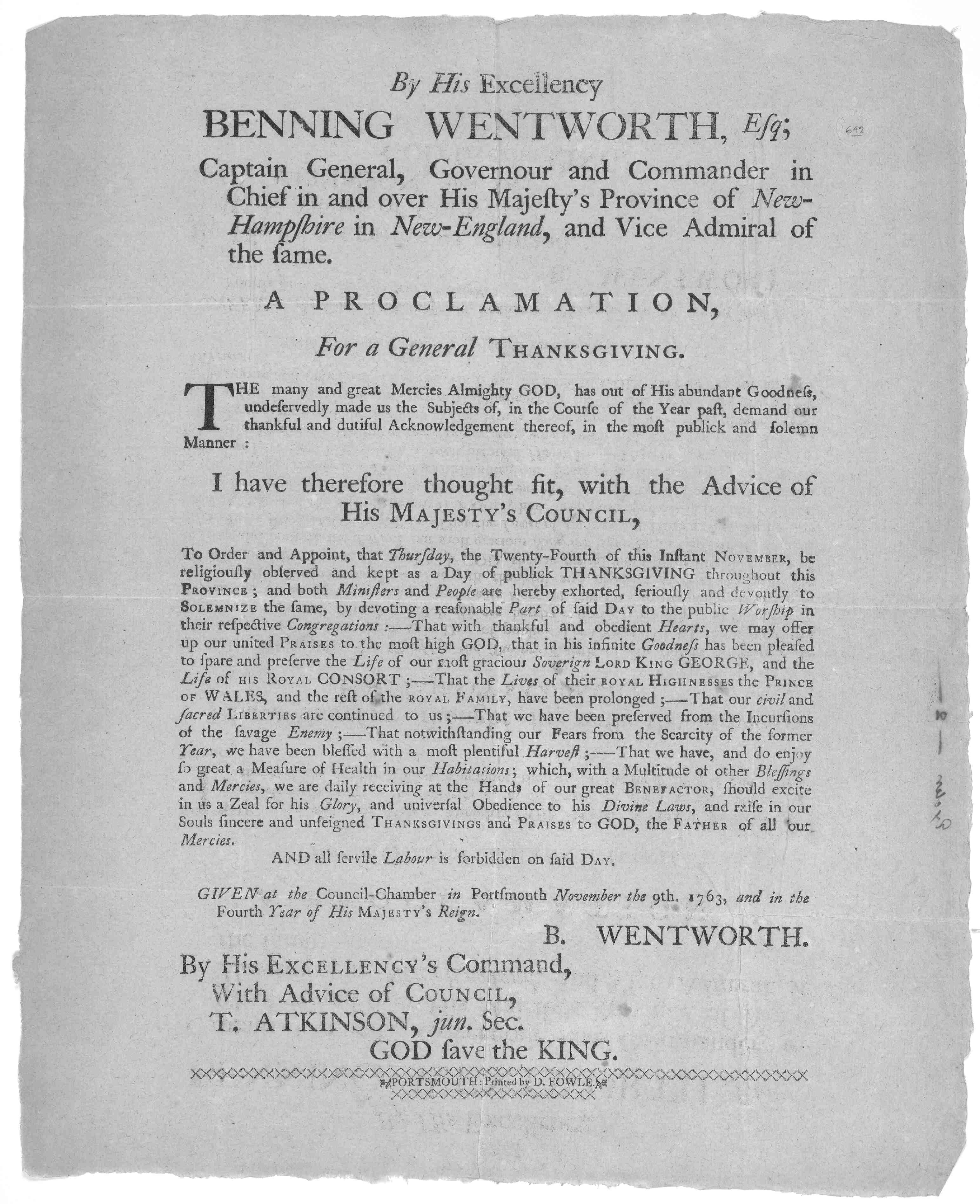
Springfield is a New England town, town in Windsor County, Vermont, Windsor County, Vermont, United States. As of the 2020 United States Census, 2020 census, the population was 9,062. History The land currently recognized as Springfield is the traditional land of the Pennacook and Abenaki people. One of the New Hampshire grants, the township was chartered on August 20, 1761, by Governor Benning Wentworth and awarded to Gideon Lyman and 61 others. Although Springfield's alluvial flats made it among the best agriculture, agricultural towns in the state, the Black River (Connecticut River), Black River waterfall, falls, which drop in , helped it develop into a mill town. Springfield was located in the center of the Precision Valley region, home of the Vermont machine tool industry. In 1888, the Jones and Lamson Machine Tool Company (J&L) moved to Springfield from Windsor, Vermont, Windsor, Vermont under the successful leadership of James Hartness. Gaining international renow ... [...More Info...] [...Related Items...] OR: [Wikipedia] [Google] [Baidu] [Amazon] |
New England Town
The town is the basic unit of Local government in the United States, local government and local division of state authority in the six New England states. Most other U.S. states lack a direct counterpart to the New England town. New England towns overlie the entire area of a state, similar to civil townships in other states where they exist, but they are fully functioning Incorporation (municipal government), municipal corporations, possessing powers similar to city, cities and county, counties in other states. Local government in New Jersey, New Jersey's system of equally powerful townships, boroughs, towns, and cities is the system which is most similar to that of New England. New England towns are often governed by a town meeting, an assembly of eligible town residents. The great majority of municipal corporations in New England are based on the town model; there, statutory forms based on the concept of a Place (United States Census Bureau), compact populated place are uncommon ... [...More Info...] [...Related Items...] OR: [Wikipedia] [Google] [Baidu] [Amazon] |
Geographic Names Information System
The Geographic Names Information System (GNIS) is a database of name and location information about more than two million physical and cultural features, encompassing the United States and its territories; the Compact of Free Association, associated states of the Marshall Islands, Federated States of Micronesia, and Palau; and Antarctica. It is a type of gazetteer. It was developed by the United States Geological Survey (USGS) in cooperation with the United States Board on Geographic Names (BGN) to promote the standardization of feature names. Data were collected in two phases. Although a third phase was considered, which would have handled name changes where local usages differed from maps, it was never begun. The database is part of a system that includes topographic map names and bibliographic references. The names of books and historic maps that confirm the feature or place name are cited. Variant names, alternatives to official federal names for a feature, are also recor ... [...More Info...] [...Related Items...] OR: [Wikipedia] [Google] [Baidu] [Amazon] |
Waterfall
A waterfall is any point in a river or stream where water flows over a vertical drop or a series of steep drops. Waterfalls also occur where meltwater drops over the edge of a tabular iceberg or ice shelf. Waterfalls can be formed in several ways, but the most common method of formation is that a river courses over a top layer of resistant bedrock before falling onto softer rock, which erodes faster, leading to an increasingly high fall. Waterfalls have been studied for their impact on species living in and around them. Humans have had a distinct relationship with waterfalls since prehistory, travelling to see them, exploring and naming them. They can present formidable barriers to navigation along rivers. Waterfalls are religious sites in many cultures. Since the 18th century, they have received increased attention as tourist destinations, sources of hydropower, andparticularly since the mid-20th centuryas subjects of research. Definition and terminology A waterfal ... [...More Info...] [...Related Items...] OR: [Wikipedia] [Google] [Baidu] [Amazon] |
Black River (Connecticut River)
The Black River is a U.S. Geological Survey. National Hydrography Dataset high-resolution flowline dataThe National Map, accessed April 1, 2011 river in the U.S. state of Vermont, and a tributary of the Connecticut River. The river's watershed consists of approximately in southeastern Vermont, almost all of which lies in Windsor County. Course The Black River begins in a small body of water called Black Pond, in Plymouth, Vermont. Winding its way toward the town of Ludlow, its narrow flow picks up a variety of small brooks and streams and is cooled by overhanging branches. Passing through Amherst Lake, Echo Lake, Lake Rescue, and Lake Pauline, the Black River picks up more tributaries and winds through the town of Ludlow, the home of Okemo Mountain Ski Resort. Tumbling through impressive Cavendish Gorge, the river widens as it passes under the Downers Covered Bridge and enters Perkinsville. The North Branch of the Black River, its headwaters in Reading Readin ... [...More Info...] [...Related Items...] OR: [Wikipedia] [Google] [Baidu] [Amazon] |
Agriculture
Agriculture encompasses crop and livestock production, aquaculture, and forestry for food and non-food products. Agriculture was a key factor in the rise of sedentary human civilization, whereby farming of domesticated species created food surpluses that enabled people to live in the cities. While humans started gathering grains at least 105,000 years ago, nascent farmers only began planting them around 11,500 years ago. Sheep, goats, pigs, and cattle were domesticated around 10,000 years ago. Plants were independently cultivated in at least 11 regions of the world. In the 20th century, industrial agriculture based on large-scale monocultures came to dominate agricultural output. , small farms produce about one-third of the world's food, but large farms are prevalent. The largest 1% of farms in the world are greater than and operate more than 70% of the world's farmland. Nearly 40% of agricultural land is found on farms larger than . However, five of every six farm ... [...More Info...] [...Related Items...] OR: [Wikipedia] [Google] [Baidu] [Amazon] |
Alluvial
Alluvium (, ) is loose clay, silt, sand, or gravel that has been deposited by running water in a stream bed, on a floodplain, in an alluvial fan or beach, or in similar settings. Alluvium is also sometimes called alluvial deposit. Alluvium is typically geologically young and is not consolidated into solid rock. Sediments deposited underwater, in seas, estuaries, lakes, or ponds, are not described as alluvium. Floodplain alluvium can be highly fertile, and supported some of the earliest human civilizations. Definitions The present consensus is that "alluvium" refers to loose sediments of all types deposited by running water in floodplains or in alluvial fans or related landforms. However, the meaning of the term has varied considerably since it was first defined in the French dictionary of Antoine Furetière, posthumously published in 1690. Drawing upon concepts from Roman law, Furetière defined '' alluvion'' (the French term for alluvium) as new land formed by deposition ... [...More Info...] [...Related Items...] OR: [Wikipedia] [Google] [Baidu] [Amazon] |
Benning Wentworth
Benning Wentworth (July 24, 1696 – October 14, 1770) was an American merchant, landowner and colonial administrator who served as the List of colonial governors of New Hampshire, governor of New Hampshire from 1741 to 1766. He is best known for issuing New Hampshire Grants, several land grants in territories claimed by the Province of New Hampshire west of the Connecticut River while serving as governor, which led to disputes with the neighboring Province of New York and the eventual establishment of Vermont. Born in Portsmouth, New Hampshire into a prominent local family, Wentworth was groomed by his father John Wentworth (lieutenant governor, born 1671), John while growing up to assume control over the family businesses. However, Wentworth's misbehavior while studying at Harvard College led him to be sent by his father to Boston instead in 1715. There, Wentworth was apprenticed to his uncle before working as a merchant. In 1730, he returned to Portsmouth to assume control o ... [...More Info...] [...Related Items...] OR: [Wikipedia] [Google] [Baidu] [Amazon] |
New Hampshire Grants
The New Hampshire Grants or Benning Wentworth Grants were land grants made between 1749 and 1764 by the colonial governor of the Province of New Hampshire, Benning Wentworth. The land grants, totaling about 135 (including 131 towns), were made on land claimed by New Hampshire west of the Connecticut River, territory that was also claimed by the Province of New York. The resulting dispute led to the eventual establishment of the Vermont Republic, which later became the U.S. state of Vermont. Background The territory of what is now Vermont was first permanently settled by European settlers when William Dummer, acting governor of the Province of Massachusetts Bay, ordered the construction of a fort roughly where Brattleboro is located. Massachusetts laid claim to the territory west of the Merrimack River at the time, and it had settlers on the Connecticut River who were prepared to move further north. The border between Massachusetts and the neighboring Province of New Hamp ... [...More Info...] [...Related Items...] OR: [Wikipedia] [Google] [Baidu] [Amazon] |
Stellafane Observatory Pink Clubhouse 2021
The Stellafane Observatory is an astronomical observatory in Springfield, Vermont, founded in 1920 by Russell W. Porter. The Pink Clubhouse was built in 1923 at the site by the Springfield Telescope Makers. The name ''Stellafane'', suggested by Porter at the club's December 1923 meeting, is derived from the Latin words ''stella'' and ''fanum'' meaning "Shrine to the Stars", and originally referred specifically to the clubhouse, but has since come to refer to all of the club's land and buildings on the summit of Breezy Hill, west of downtown Springfield. The Stellafane Convention, a gathering of amateur telescope makers and amateur astronomers is the longest running astronomical convention in the United States, having been held nearly every year at the location since 1926. The clubhouse and observatory became listed on the National Register of Historic Places in 1977, and became a National Historic Landmark in 1989, in recognition of the club's pioneering role in the popularizatio ... [...More Info...] [...Related Items...] OR: [Wikipedia] [Google] [Baidu] [Amazon] |
Springfield, Vermont (1915)
Springfield is a town in Windsor County, Vermont, United States. As of the 2020 census, the population was 9,062. History The land currently recognized as Springfield is the traditional land of the Pennacook and Abenaki people. One of the New Hampshire grants, the township was chartered on August 20, 1761, by Governor Benning Wentworth and awarded to Gideon Lyman and 61 others. Although Springfield's alluvial flats made it among the best agricultural towns in the state, the Black River falls, which drop in , helped it develop into a mill town. Springfield was located in the center of the Precision Valley region, home of the Vermont machine tool industry. In 1888, the Jones and Lamson Machine Tool Company (J&L) moved to Springfield from Windsor, Vermont under the successful leadership of James Hartness. Gaining international renown for precision and innovation, J&L ushered in a new era of precision manufacturing in the area. Edwin R. Fellows co-founded the Fellows Ge ... [...More Info...] [...Related Items...] OR: [Wikipedia] [Google] [Baidu] [Amazon] |


