|
Spalding County, Georgia
Spalding County is a County (United States), county in the West Central Georgia, West Central region of the U.S. state of Georgia (U.S. state), Georgia. As of the 2020 United States census, 2020 census, the population was 67,306. The county seat is Griffin, Georgia, Griffin.United States Census Bureau, 2020 Census Report, Spalding County, Georgia The county was created December 20, 1851, and named for former United States House of Representatives, United States representative and United States Senate, senator Thomas Spalding. Spalding County is included in the Atlanta metropolitan area, Atlanta-Sandy Springs-Roswell MSA. Geography According to the U.S. Census Bureau, the county has a total area of , of which is land and (1.6%) is water. The county is located in the Piedmont (United States), Piedmont region of the state. The western portion of Spalding County, west of a line from Sunny Side, Georgia, Sunny Side through Griffin, Georgia, Griffin to Orchard Hill, Georgia, Orc ... [...More Info...] [...Related Items...] OR: [Wikipedia] [Google] [Baidu] |
Ocmulgee River
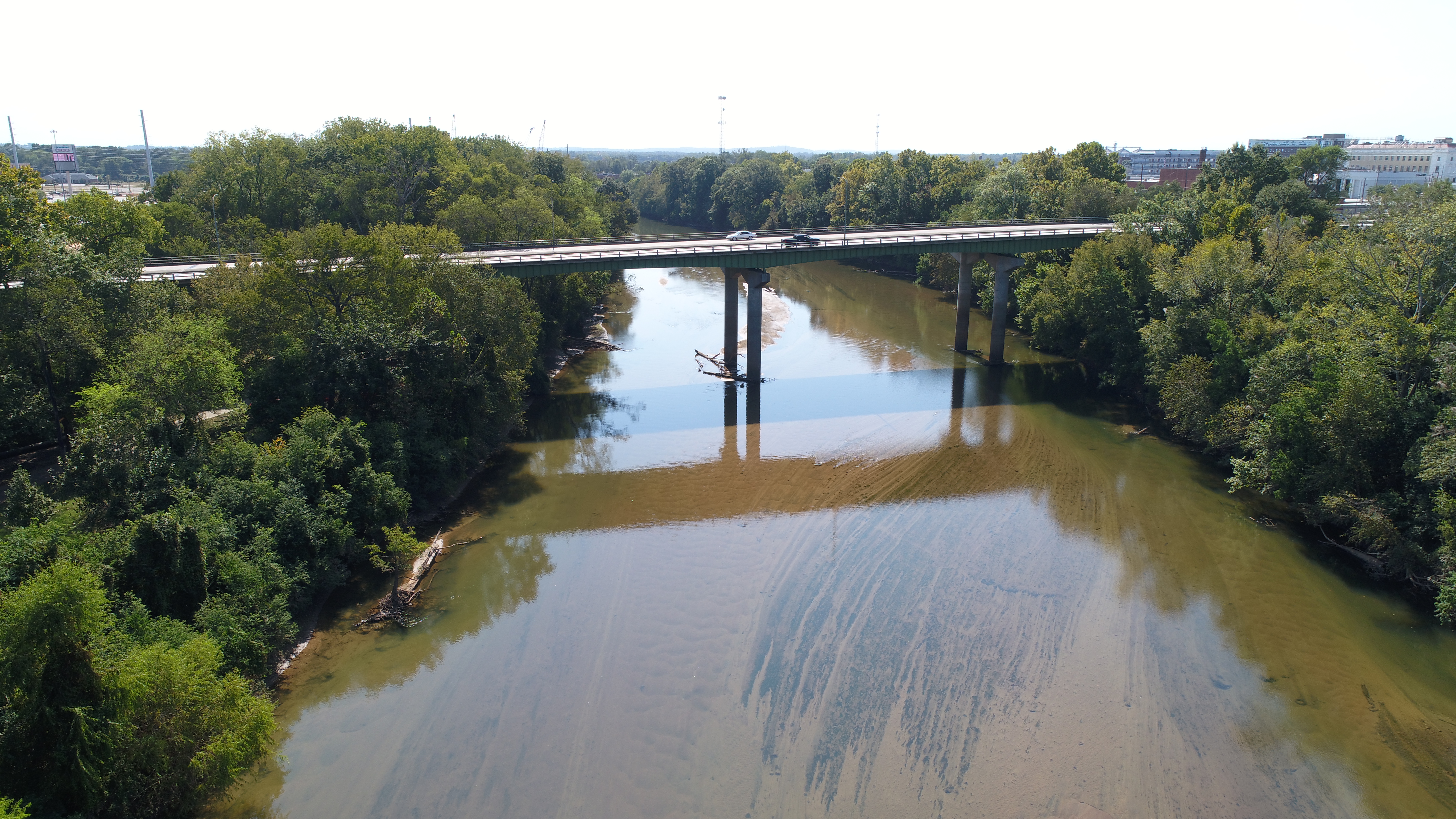
The Ocmulgee River () is a western tributary of the Altamaha River, approximately 255 mi (410 km) long, in the U.S. state of Georgia (U.S. state), Georgia. It is the westernmost major tributary of the Altamaha.Ocmulgee River ''New Georgia Encyclopedia'' (August 9, 2004). It was formerly known by its Hitchiti name of Ocheese Creek, from which the Muscogee, Creek (Muscogee) people derived their name. The Ocmulgee River and its tributaries provide drainage for some 6,180 square miles in parts of List of counties in Georgia, 33 Georgia counties, a large section of the Piedmont (United States), Piedmont and coastal plain of central Georgia. The Ocmulgee River Drainage basin, basin has three river subbasins designated by the United States Geological Survey, U.S. Geological S ... [...More Info...] [...Related Items...] OR: [Wikipedia] [Google] [Baidu] |
Georgia 92
State Route 92 (SR 92) is a state highway in the U.S. state of Georgia. Its southern terminus is an intersection with US 19 Bus./ US 41 Bus./ SR 16 in Griffin. Its northern terminus is an intersection with SR 9/ SR 120/ SR 140 in Roswell. The highway connects Griffin to Roswell, via Fayetteville, Fairburn, Douglasville, Hiram, Acworth, and Woodstock. Primarily signed from south to north, SR 92 is a rural highway that travels through three county seats. It can be seen as a western bypass of the city of Atlanta. Route description The highway begins at the intersection between West McIntosh Road and North Expressway, the latter carrying US 19/US 41/SR 3, on the north side of Griffin. SR 92 runs westward away from the intersection in the middle of a commercial area of the city. The highway is a divided as it passes through residential subdivisions to exit town. Turning northwesterly on Fayetteville Ro ... [...More Info...] [...Related Items...] OR: [Wikipedia] [Google] [Baidu] |
Georgia State Route 16
State Route 16 (SR 16) is a state highway that travels west-to-east through portions of Haralson, Carroll, Coweta, Spalding, Butts, Jasper, Putnam, Hancock, and Warren counties in the western and central parts of the U.S. state of Georgia. The highway connects the southeastern portion of Carroll County, northwest of Mount Zion to Warrenton, via Carrollton, Newnan, Griffin, Monticello, Eatonton, and Sparta. SR 16 formerly traveled on the current path of US 278 Byp./ SR 12 Byp. in Warrenton, SR 80 and SR 17 Conn., and the entire length of SR 296 west of Wrens, in Glascock and Jefferson counties. Route description SR 16 starts just south of Interstate 20 (I-20) in southwestern Haralson County, and travels southeast into Carroll County and Carrollton, where it begins a concurrency with US 27 Alt./ SR 1. SR 16 continues through Whitesburg and crosses into Coweta County and through Newna ... [...More Info...] [...Related Items...] OR: [Wikipedia] [Google] [Baidu] |
Georgia State Route 7
State Route 7 (SR 7) is a State highway (US), state highway that travels in a southeast-to-northwest orientation through portions of Lowndes County, Georgia, Lowndes, Cook County, Georgia, Cook, Tift County, Georgia, Tift, Turner County, Georgia, Turner, Crisp County, Georgia, Crisp, Dooly County, Georgia, Dooly, Houston County, Georgia, Houston, Peach County, Georgia, Peach, Crawford County, Georgia, Crawford, Monroe County, Georgia, Monroe, Lamar County, Georgia, Lamar, Pike County, Georgia, Pike, and Spalding County, Georgia, Spalding counties in the southern and Central Georgia, central parts of the U.S. state of Georgia (U.S. state), Georgia. The highway connects the Florida state line southeast of Lake Park, Georgia, Lake Park to the Griffin, Georgia, Griffin area, via Valdosta, Georgia metropolitan area, Valdosta, Tifton, Georgia, Tifton, Cordele, Georgia, Cordele, Perry, Georgia, Perry, and Barnesville, Georgia, Barnesville. The highway is concurrency (road), co ... [...More Info...] [...Related Items...] OR: [Wikipedia] [Google] [Baidu] |
Georgia 7
State Route 7 (SR 7) is a state highway that travels in a southeast-to-northwest orientation through portions of Lowndes, Cook, Tift, Turner, Crisp, Dooly, Houston, Peach, Crawford, Monroe, Lamar, Pike, and Spalding counties in the southern and central parts of the U.S. state of Georgia. The highway connects the Florida state line southeast of Lake Park to the Griffin area, via Valdosta, Tifton, Cordele, Perry, and Barnesville. The highway is concurrent with either US 41 or US 341 for its entire length, and closely parallels I-75 for much of its length. SR 7 was established at least as early as 1919 along nearly the same path it travels today. US 41/SR 7 was designated on a concurrency with I-75 northwest of Valdosta to Hahira in 1982. US 41/SR 7 were re-routed onto an eastern bypass of Valdosta in 2006. Route description Echols and Lowndes counties SR 7 begins at the Florida state line, southeast of Lake Pa ... [...More Info...] [...Related Items...] OR: [Wikipedia] [Google] [Baidu] |
Georgia State Route 3
State Route 3 (SR 3) is a state highway that travels south-to-north through portions of the western part of the U.S. state of Georgia, roughly paralleling Interstate 75 (I-75). The highway travels from its southern terminus at the Florida state line, where SR 3 and SR 300 both reach their southern terminus, concurrent with US 19. Here, US 19 travels concurrent with State Road 57, south-southeast of Thomasville. SR 3 travels through portions of Thomas, Mitchell, Dougherty, Lee, Sumter, Schley, Taylor, Upson, Pike, Spalding, Henry, Clayton, Fulton, Cobb, Bartow, Gordon, Whitfield, and Catoosa counties to its northern terminus at the Tennessee state line, in East Ridge, where US 41/ US 76 continue, concurrent with State Route 8. It travels through Thomasville, Albany, Griffin, Atlanta, Calhoun, and Dalton. At long, it is considered the third-longest signed state highway in the U.S. state of Ge ... [...More Info...] [...Related Items...] OR: [Wikipedia] [Google] [Baidu] |
US 41
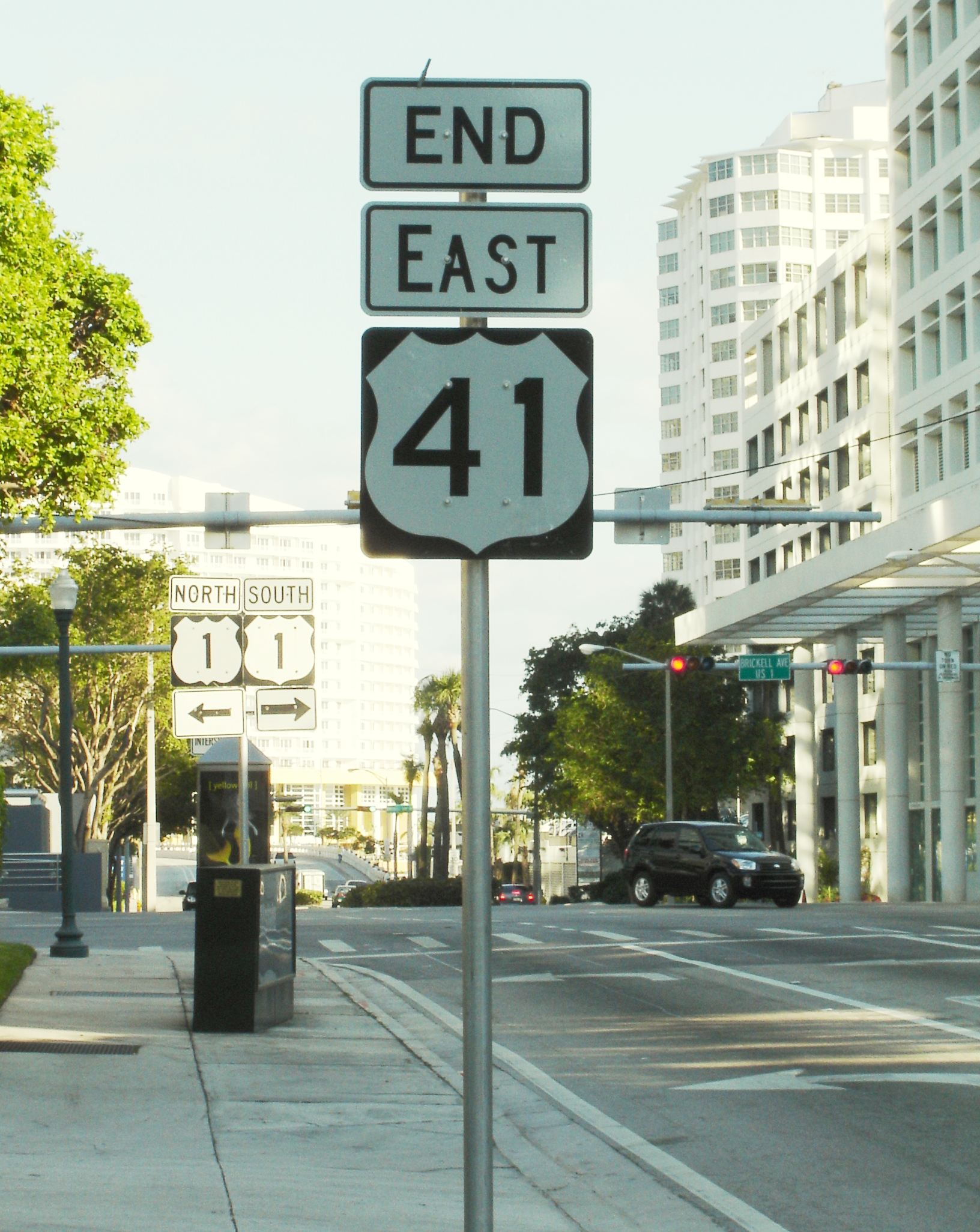
U.S. Route 41, also U.S. Highway 41 (US 41), is a major north–south United States Numbered Highway System, United States Numbered Highway that runs from Miami, Florida, to the Upper Peninsula of Michigan. Until 1949, the part in southern Florida, from Naples, Florida, Naples to Miami, was US 94. The highway's southern terminus is in the Brickell neighborhood of Downtown Miami at an intersection with Brickell Avenue (U.S. Route 1 in Florida, US 1), and its northern terminus is east of Copper Harbor, Michigan, at a modest cul-de-sac near Fort Wilkins Historic State Park at the tip of the Keweenaw Peninsula. US 41 is closely paralleled by Interstate 75 (I-75) from Naples, Florida, all the way through Georgia (U.S. state), Georgia to Chattanooga, Tennessee. Route description , - , U.S. Route 41 in Florida, FL , , - , U.S. Route 41 in Georgia, GA , , - , U.S. Route 41 in Tennessee, TN , , - , U.S. Route 41 in Kentucky, KY , , - , U.S. Route 41 in ... [...More Info...] [...Related Items...] OR: [Wikipedia] [Google] [Baidu] |
Business Plate
Business is the practice of making one's living or making money by producing or buying and selling products (such as goods and services). It is also "any activity or enterprise entered into for profit." A business entity is not necessarily separate from the owner and the creditors can hold the owner liable for debts the business has acquired except for limited liability company. The taxation system for businesses is different from that of the corporates. A business structure does not allow for corporate tax rates. The proprietor is personally taxed on all income from the business. A distinction is made in law and public offices between the term business and a company (such as a corporation or cooperative). Colloquially, the terms are used interchangeably. Corporations are distinct from sole proprietors and partnerships. Corporations are separate and unique legal entities from their shareholders; as such they provide limited liability for their owners and members. Corpor ... [...More Info...] [...Related Items...] OR: [Wikipedia] [Google] [Baidu] |
US 19
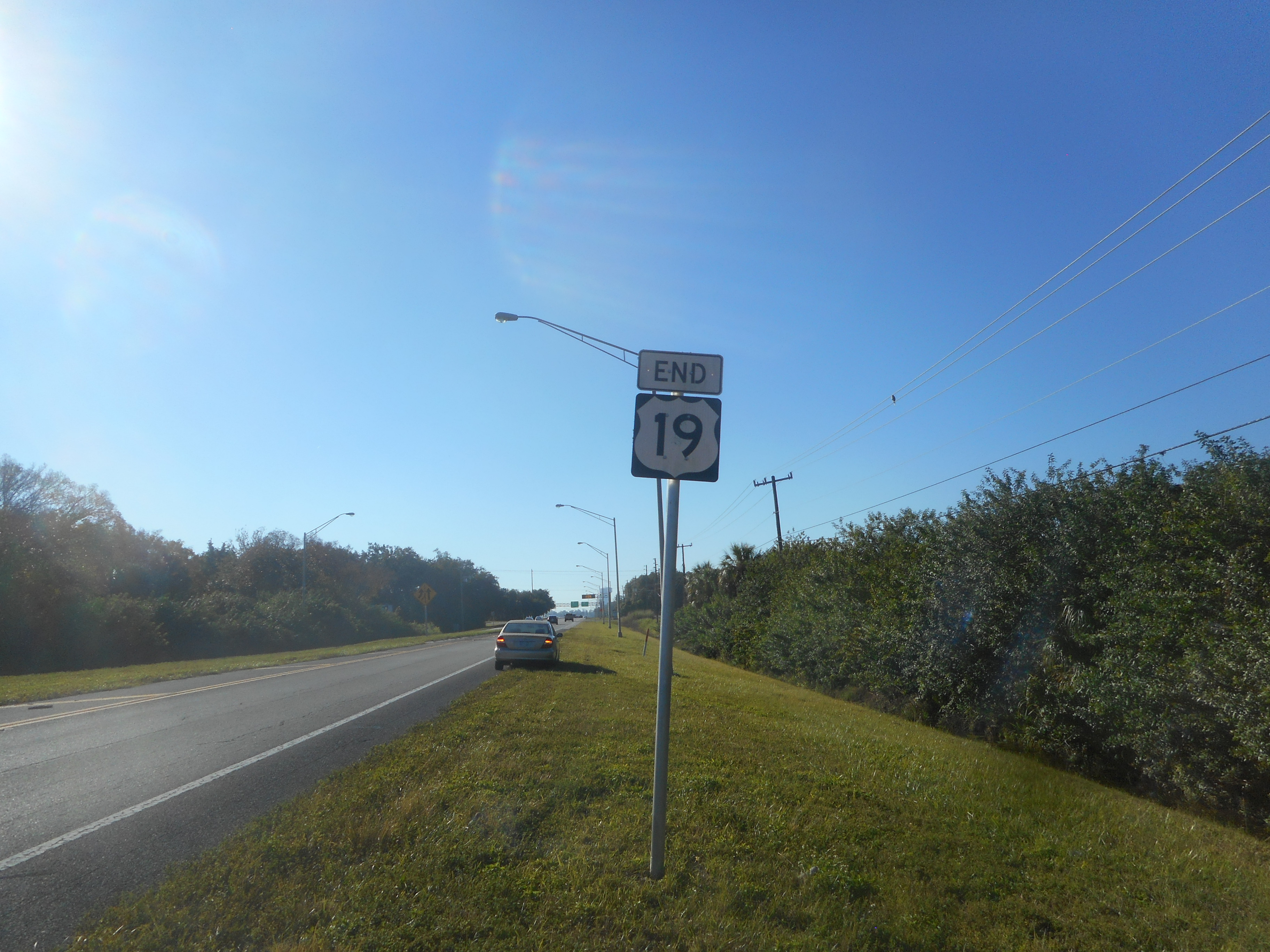
U.S. Route 19 or U.S. Highway 19 (US 19) is a north–south United States Numbered Highway in the Eastern United States. Despite encroaching Interstate Highways, the route has remained a long-haul road, connecting the Gulf of Mexico with Lake Erie. The highway's southern terminus is at Memphis, Florida, which is just south of St. Petersburg, Florida, St. Petersburg at an intersection with U.S. Route 41, US 41. Its northern terminus is in Erie, Pennsylvania, at an intersection with U.S. Route 20, US 20 about from the shores of Lake Erie. The length of the highway is , including both US 19E/US 19W paths through North Carolina and Tennessee. Route description , - , U.S. Route 19 in Florida, FL , , - , U.S. Route 19 in Georgia, GA , , - , U.S. Route 19 in North Carolina, NC , , - , U.S. Route 19E, 19E , , - , U.S. Route 19W, 19W , , - , U.S. Route 19 in Tennessee, TN , , - , U.S. Route 19 in Virginia, VA , , - , U.S. Route 19 in West Vir ... [...More Info...] [...Related Items...] OR: [Wikipedia] [Google] [Baidu] |


