|
Solar Eclipse Of January 26, 2028
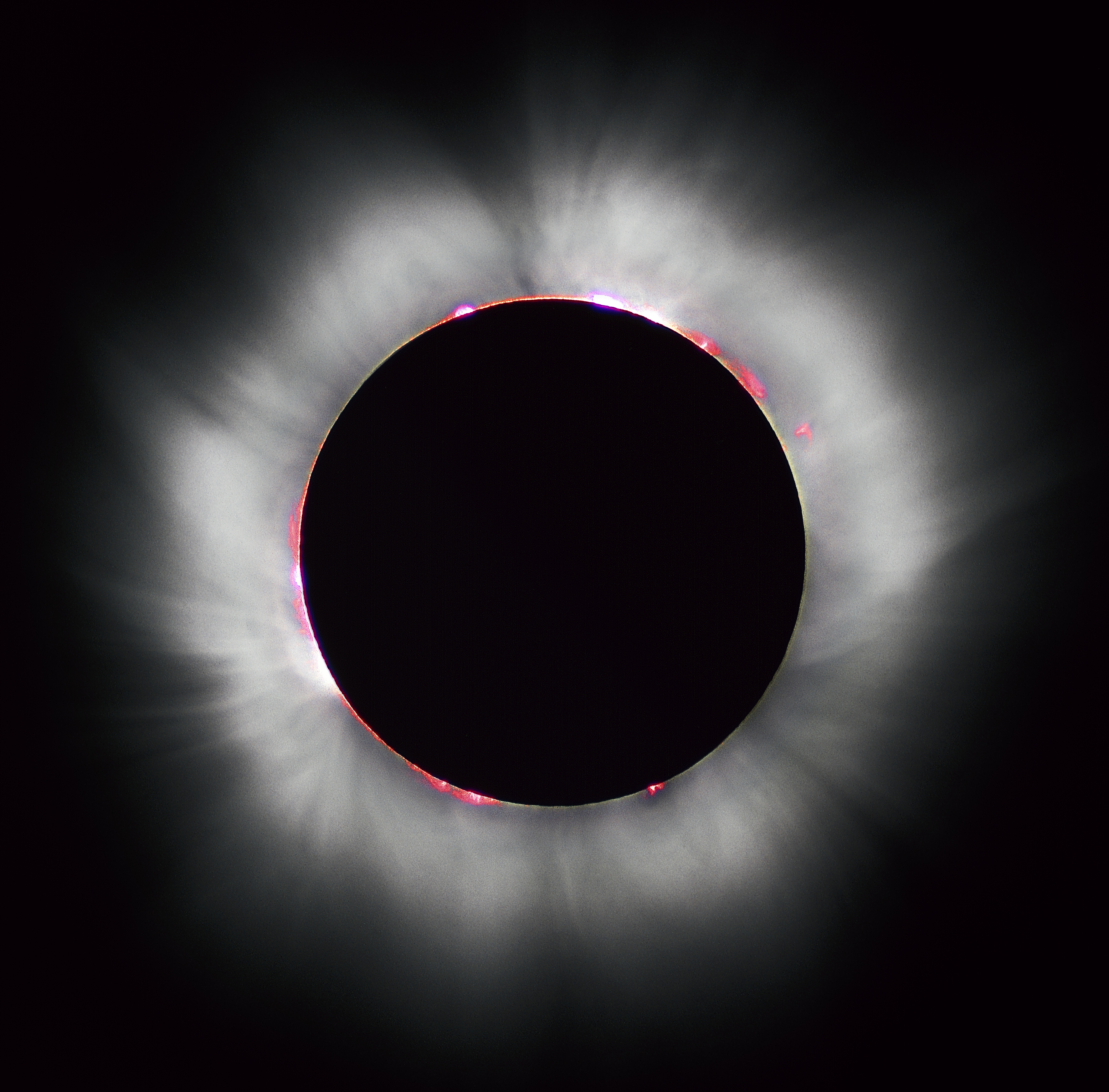
An annular solar eclipse will occur at the Moon's ascending node of orbit on Wednesday, January 26, 2028, with a magnitude of 0.9208. A solar eclipse occurs when the Moon passes between Earth and the Sun, thereby totally or partly obscuring the image of the Sun for a viewer on Earth. An annular solar eclipse occurs when the Moon's apparent diameter is smaller than the Sun's, blocking most of the Sun's light and causing the Sun to look like an annulus (ring). An annular eclipse appears as a partial eclipse over a region of the Earth thousands of kilometres wide. Occurring about 2 days before apogee (on January 28, 2028, at 15:30 UTC), the Moon's apparent diameter will be smaller. The path of annularity will pass through Ecuador, Peru, northern Brazil, and French Guiana. It will then travel across the Atlantic Ocean and end in southern Portugal (including the whole Madeira Islands), northern Morocco, and southern Spain. A partial eclipse will be visible over much of central and nor ... [...More Info...] [...Related Items...] OR: [Wikipedia] [Google] [Baidu] |
Solar Eclipse
A solar eclipse occurs when the Moon passes between Earth and the Sun, thereby obscuring the view of the Sun from a small part of Earth, totally or partially. Such an alignment occurs approximately every six months, during the eclipse season in its new moon phase, when the Moon's orbital plane is closest to Ecliptic, the plane of Earth's orbit. In a total eclipse, the disk of the Sun is fully obscured by the Moon. In #Types, partial and annular eclipses, only part of the Sun is obscured. Unlike a lunar eclipse, which may be viewed from anywhere on the night side of Earth, a solar eclipse can only be viewed from a relatively small area of the world. As such, although total solar eclipses occur somewhere on Earth every 18 months on average, they recur at any given place only once every 360 to 410 years. If the Moon were in a perfectly circular orbit and in the same orbital plane as Earth, there would be total solar eclipses once a month, at every new moon. Instead, because the Mo ... [...More Info...] [...Related Items...] OR: [Wikipedia] [Google] [Baidu] |
South America
South America is a continent entirely in the Western Hemisphere and mostly in the Southern Hemisphere, with a considerably smaller portion in the Northern Hemisphere. It can also be described as the southern Subregion#Americas, subregion of the Americas. South America is bordered on the west by the Pacific Ocean, on the north and east by the Atlantic Ocean, and to the south by the Drake Passage; North America and the Caribbean Sea lie to the northwest. The continent includes twelve sovereign states: Argentina, Bolivia, Brazil, Chile, Colombia, Ecuador, Guyana, Paraguay, Peru, Suriname, Uruguay, and Venezuela; two dependent territory, dependent territories: the Falkland Islands and South Georgia and the South Sandwich Islands; and one administrative division, internal territory: French Guiana. The Dutch Caribbean ABC islands (Leeward Antilles), ABC islands (Aruba, Bonaire, and Curaçao) and Trinidad and Tobago are geologically located on the South-American continental shel ... [...More Info...] [...Related Items...] OR: [Wikipedia] [Google] [Baidu] |
Loja, Ecuador
Loja (), formerly Loxa and fully City of the Immaculate Conception of Loja (), is the capital of Ecuador's Loja Province. It is located in the Cuxibamba valley in the south of the country, sharing borders with the provinces of Zamora-Chinchipe and other cantons of the province of Loja. Loja holds a rich tradition in the arts, and for this reason is known as the Music and Cultural Capital of Ecuador. The city is home to two major universities. The city has a population of about 203,000, and is situated 2060 m (6758 ft) above sea level. It has a mild Andean climate, ranging between 16 and 30 °C. The Pan-American Highway runs past Loja. History The city of Loja was colonized by Field Marshal Alonso de Mercadillo in 1548, and it is named for his hometown of Loja in Spain. Originally located near La Toma in the Catamayo canyon since 1546, the city was relocated to its present location (about 35 km east) after a devastating earthquake and problems with Malari ... [...More Info...] [...Related Items...] OR: [Wikipedia] [Google] [Baidu] |
El Oro Province
El Oro (; ''oro'' = gold) is the southernmost of Ecuador's coastal provinces. It was named for its historically important gold production. Today it is one of the world's major exporters of bananas. The capital is Machala. History The area was settled by the Inca, who inhabited the area at the time Spanish settlement began in 1549. The Spanish found and looted gold there and mined it, carrying the gold to Spain. The province was named for its historically important gold production. The gold was mined by Indigenous slaves captive by the Spanish mainly in the late 16th and 17th centuries in the village of Zaruma in the Zaruma Canton. In the 18th century, the earthquake of January 1749 destroyed the mining area. A local rebellion stopped the mining until the Spanish agreed to allow the native people to benefit from the mining. Spain imported gold from the area until the area gained its independence from Spain in 1820. Philip II of Spain granted the village the title of "Villa de ... [...More Info...] [...Related Items...] OR: [Wikipedia] [Google] [Baidu] |
Machala
Machala () is a city in south-west Ecuador. It is the capital of the El Oro Province, and is located near the Gulf of Guayaquil on fertility (soil), fertile lowlands. Machala has a population of 288,072 (2022 census); it is the sixth-biggest city in the country, and the second-most important port. It has been referred to as the ''Banana Capital of the World''. Economy Machala is a commercial center for the surrounding agriculture industries. There is a large trade in bananas, coffee and Cocoa bean, cocoa. The banana industry is especially oriented for exportation, and plays a huge role in the city's economy. Bananas are shipped out from nearby Puerto Bolívar mainly to North America. Machala's geographical position near Guayaquil also makes it an important transportation center. Many travelers heading south to Peru or north to Guayaquil funnel through the city. It is not known as a tourist destination among Ecuadorians or international tourists, though its proximity to the Pacific ... [...More Info...] [...Related Items...] OR: [Wikipedia] [Google] [Baidu] |
Piura
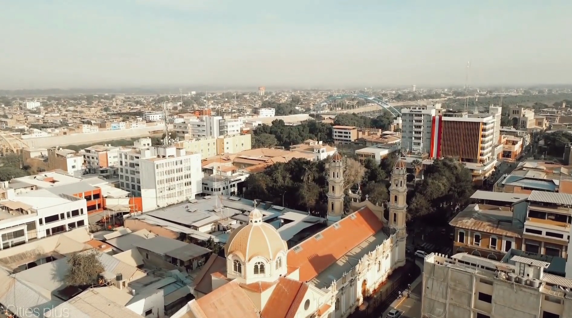
Piura is a city in northwestern Peru, located north of the Sechura Desert along the Piura River. It is the capital of the Piura Region and the Piura Province. Its population was 484,475 as of 2017 and it is the 7th most populous city in Peru. The city is located in the central eastern part of the Piura Region, 981 kilometers from the country's capital, Lima and is near to the border with Ecuador. It was here that Spanish Conqueror Francisco Pizarro founded the third Spanish city in South America and first in Peru, under the name of ''San Miguel de Piura'', in JulyHemming, J., 1970, The Conquest of the Incas, New York: Harcourt Brace Jovanovich, Inc., or August of 1532. Piura declared its independence from Spain on 4 January 1821, a few months before Peru gained its independence on 28 July 1821. It is the commercial and administrative center of the Department of Piura. Symbols Coat of arms The coat of arms of Piura was created by the Spanish Crown on December 7, 1537, thr ... [...More Info...] [...Related Items...] OR: [Wikipedia] [Google] [Baidu] |
Puerto Ayora
Puerto Ayora is a town in central Galápagos Province, Galápagos, Ecuador. Located on the southern shore of Santa Cruz Island (Galápagos), Santa Cruz Island, it is the Canton seat, seat of Santa Cruz Canton. The town is named in honor of Isidro Ayora, an Ecuadorian president. The town is sometimes mistakenly referred to as Santa Cruz. Puerto Ayora is the most populous town in the Galápagos Islands, with a population of 12,696. Geography Climate Puerto Ayora has a protected location, along the shores of Academy Bay, where a refreshing breeze often provides pleasant weather. Temperatures vary between . The hot season usually runs from December to May. Infrastructure Puerto Ayora has the best developed infrastructure in the archipelago. The larger of the two Galápagos banks, Banco del Pacifico, is located in Puerto Ayora. The walkable downtown area of Puerto Ayora is a small strip of hotels, restaurants, tour companies, gift shops, clothing stores, marine stores, tourist shops ... [...More Info...] [...Related Items...] OR: [Wikipedia] [Google] [Baidu] |
SE2028Jan26A
SE, Se, or Sé may refer to: Initialisms * Standard Edition (e.g. Java Platform, Standard Edition) * Special Edition * Second Edition (e.g. Windows 98 Second Edition) Arts and entertainment * ''Sé'' (album), by Lúnasa, 2006 * Se (instrument), a traditional Chinese musical instrument Businesses and organizations * ''Societas Europaea'', a form of legal entity registered under European Union law * Sea Ltd (NYSE: SE), tech conglomerate headquartered in Singapore * Slovenské elektrárne, electric utility company in Slovakia * XL Airways France, IATA airline designator SE * Southeastern (train operating company), or SE Trains Limited, in England Places * Sè, Atlantique, Benin * Sè, Mono, Benin * Subprefecture of Sé, São Paulo, Brazil **Sé (district of São Paulo) **Sé (São Paulo Metro), a station *Sé, Hungary *Sé, Macau *Sé (Angra do Heroísmo), Terceira, Azores, Portugal *Sé (Braga), Portugal *Sé (Bragança), Faro, Portugal *Sé (Funchal), Madeira, Portugal *S ... [...More Info...] [...Related Items...] OR: [Wikipedia] [Google] [Baidu] |
West Africa
West Africa, also known as Western Africa, is the westernmost region of Africa. The United Nations geoscheme for Africa#Western Africa, United Nations defines Western Africa as the 16 countries of Benin, Burkina Faso, Cape Verde, The Gambia, Ghana, Guinea, Guinea-Bissau, Ivory Coast, Liberia, Mali, Mauritania, Niger, Nigeria, Senegal, Sierra Leone, and Togo, as well as Saint Helena, Ascension and Tristan da Cunha (United Kingdom Overseas Territories, United Kingdom Overseas Territory).Paul R. Masson, Catherine Anne Pattillo, "Monetary union in West Africa (ECOWAS): is it desirable and how could it be achieved?" (Introduction). International Monetary Fund, 2001. The population of West Africa is estimated at around million people as of , and at 381,981,000 as of 2017, of which 189,672,000 were female and 192,309,000 male.United Nations Department of Economic and Social Affairs, Population Division (2017). World Population Prospects: The 2017 Revision, custom data acquired via webs ... [...More Info...] [...Related Items...] OR: [Wikipedia] [Google] [Baidu] |
Western Europe
Western Europe is the western region of Europe. The region's extent varies depending on context. The concept of "the West" appeared in Europe in juxtaposition to "the East" and originally applied to the Western half of the ancient Mediterranean world, the Latin West of the Roman Empire, and "Western Christendom". Beginning with the Renaissance and the Age of Discovery, roughly from the 15th century, the concept of ''Europe'' as "the Western world, West" slowly became distinguished from and eventually replaced the dominant use of "Christendom" as the preferred endonym within the area. By the Age of Enlightenment and the Industrial Revolution, the concepts of "Eastern Europe" and "Western Europe" were more regularly used. The distinctiveness of Western Europe became most apparent during the Cold War, when Europe was divided for 40 years by the Iron Curtain into the Western Bloc and Eastern Bloc, each characterised by distinct political and economical systems. Historical divisions ... [...More Info...] [...Related Items...] OR: [Wikipedia] [Google] [Baidu] |


