|
Skagerrak
The Skagerrak (; , , ) is a strait running between the North Jutlandic Island of Denmark, the east coast of Norway and the west coast of Sweden, connecting the North Sea and the Kattegat sea. The Skagerrak contains some of the busiest shipping routes in the world, with vessels from every corner of the globe. It also supports an intensive fishing industry. The ecosystem is strained and negatively affected by direct human activities. Oslo and Gothenburg are the only large cities in the Skagerrak region. The strait is likely named after Skagen, a town near the northern cape of Denmark, with 'Rak' meaning 'straight waterway'. The Skagerrak is 240 km long and 80–140 km wide, deepening towards the Norwegian coast. It has an average salinity comparable to other coastal waters, housing a variety of habitats. Historically, the Skagerrak was the only access to the Baltic Sea until the construction of the Eider Canal in 1784. During both World Wars, the strait held strategic importance ... [...More Info...] [...Related Items...] OR: [Wikipedia] [Google] [Baidu] |
Kattegat
The Kattegat (; ; ) is a sea area bounded by the peninsula of Jutland in the west, the Danish straits islands of Denmark and the Baltic Sea to the south and the Swedish provinces of Bohuslän, Västergötland, Halland and Scania in Sweden in the east. The Baltic Sea drains into the Kattegat through the Danish straits. The sea area is a continuation of the Skagerrak and may be seen as a bay of the North Sea and North Atlantic Ocean, though this is not the case in traditional Scandinavian usage. The Kattegat is a rather shallow sea and can be dangerous to navigate due to many sandy, stony reefs and the tricky shifting currents. In modern times, artificial seabed channels have been dug, many reefs have been dredged either by sand pumping or boulder clearance, and a well-developed light signaling network has been installed to protect the heavy international traffic on this small sea. There are several large cities and major ports on the Kattegat, including, in descendin ... [...More Info...] [...Related Items...] OR: [Wikipedia] [Google] [Baidu] |
Kristiansand
Kristiansand is a city and Municipalities of Norway, municipality in Agder county, Norway. The city is the fifth-largest and the municipality is the sixth-largest in Norway, with a population of around 116,000 as of January 2020, following the incorporation of the municipalities of Søgne and Songdalen into the greater Kristiansand municipality. In addition to the city itself, Statistics Norway count four other densely populated areas in the municipality: Skålevik in Flekkerøy with a population of 3,526 in the Vågsbygd borough, Strai with a population of 1,636 in the Grim borough, Justvik with a population of 1,803 in the Lund borough, and Tveit with a population of 1,396 () in the Oddernes borough. Kristiansand is divided into five boroughs; -Grim, Vest-Agder, Grim, which is located northwest in Kristiansand with a population of 15,000; Kvadraturen (Kristiansand), Kvadraturen, which is the centre and downtown Kristiansand with a population of 5,200; Lund, Kristiansand, Lund ... [...More Info...] [...Related Items...] OR: [Wikipedia] [Google] [Baidu] |
Norwegian Trench
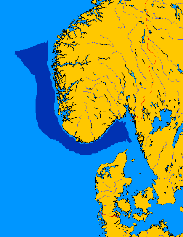
The Norwegian trench or Norwegian channel (; ; ) is an elongated depression in the sea floor off the southern coast of Norway. It reaches from the Stad peninsula in Sogn og Fjordane in the northwest to the Oslofjord in the southeast. The trench is between wide and up to deep. Off the Rogaland coast it is deep, and its deepest point is off Arendal where it reaches deep – an abyss compared to the average depth of the North Sea, which is about . Geology It was formed during the last 1.1 million years by the effects of erosion associated with repeated ice stream activity. The trench is not a subduction-related oceanic trench, where one tectonic plate is being forced under another. The Norwegian Trench was created by fluvial erosion processes during the later Tertiary age. Pleistocene glaciers and ice sheets further deepened the trench. During the main glaciations, the Skagerrak Trough was the meeting point for ice from southeastern Norway, southern Sweden and parts o ... [...More Info...] [...Related Items...] OR: [Wikipedia] [Google] [Baidu] |
North Sea
The North Sea lies between Great Britain, Denmark, Norway, Germany, the Netherlands, Belgium, and France. A sea on the European continental shelf, it connects to the Atlantic Ocean through the English Channel in the south and the Norwegian Sea in the north. It is more than long and wide, covering . It hosts key north European shipping lanes and is a major fishery. The coast is a popular destination for recreation and tourism in bordering countries, and a rich source of energy resources, including wind energy, wind and wave power. The North Sea has featured prominently in geopolitical and military affairs, particularly in Northern Europe, from the Middle Ages to the modern era. It was also important globally through the power northern Europeans projected worldwide during much of the Middle Ages and into the modern era. The North Sea was the centre of the Viking Age, Vikings' rise. The Hanseatic League, the Dutch Golden Age, Dutch Republic, and Kingdom of Great Britain, Brita ... [...More Info...] [...Related Items...] OR: [Wikipedia] [Google] [Baidu] |
Baltic Sea
The Baltic Sea is an arm of the Atlantic Ocean that is enclosed by the countries of Denmark, Estonia, Finland, Germany, Latvia, Lithuania, Poland, Russia, Sweden, and the North European Plain, North and Central European Plain regions. It is the world's largest brackish water basin. The sea stretches from 53°N to 66°N latitude and from 10°E to 30°E longitude. It is a Continental shelf#Shelf seas, shelf sea and marginal sea of the Atlantic with limited water exchange between the two, making it an inland sea. The Baltic Sea drains through the Danish straits into the Kattegat by way of the Øresund, Great Belt and Little Belt. It includes the Gulf of Bothnia (divided into the Bothnian Bay and the Bothnian Sea), the Gulf of Finland, the Gulf of Riga and the Bay of Gdańsk. The "Baltic Proper" is bordered on its northern edge, at latitude 60°N, by Åland and the Gulf of Bothnia, on its northeastern edge by the Gulf of Finland, on its eastern edge by the Gulf of Riga, and in the ... [...More Info...] [...Related Items...] OR: [Wikipedia] [Google] [Baidu] |
Hirtshals
Hirtshals is a town and seaport on the coast of Skagerrak on the island of Vendsyssel-Thy at the top of the Jutland peninsula in northern Denmark, Europe. It is located in Hjørring municipality in Region Nordjylland. The town of Hirtshals has a population of 5,347 (1 January 2025).BY3: Population 1. January by urban areas, area and population density The Mobile Statbank from Located on the , it is especially known for its |
Gothenburg
Gothenburg ( ; ) is the List of urban areas in Sweden by population, second-largest city in Sweden, after the capital Stockholm, and the fifth-largest in the Nordic countries. Situated by the Kattegat on the west coast of Sweden, it is the gubernatorial seat of Västra Götaland County, with a population of approximately 600,000 in the city proper and about 1.1 million inhabitants in Metropolitan Gothenburg, the metropolitan area. Gustavus Adolphus, King Gustavus Adolphus founded Gothenburg by royal charter in 1621 as a heavily fortified, primarily Dutch, trading colony. In addition to the generous privileges given to his Dutch allies during the ongoing Thirty Years' War, e.g. tax relaxation, he also attracted significant numbers of his German and Scottish allies to populate his only town on the western coast; this trading status was furthered by the founding of the Swedish East India Company. At a key strategic location at the mouth of the , where Scandinavia's largest dr ... [...More Info...] [...Related Items...] OR: [Wikipedia] [Google] [Baidu] |
Kosterhavet National Park
Kosterhavet National Park (, literally ''The Koster Sea National Park'') is the first national marine park in Sweden, inaugurated in September 2009. It is part of the Skagerrak sea and is located in Strömstad and Tanum municipalities in Bohuslän, Västra Götaland County, Sweden. It consists of the sea and shores around the Koster Islands, excluding everything else on the islands. In the north, it borders the Norwegian marine park of Ytre Hvaler. Kosterhavet National Park is home to Sweden's largest seal colony. Nature The environment in the park is unique to Swedish waters. Over 6,000 marine species have been identified, about 200 of them can not to be found elsewhere in Sweden. The Kosterfjord () is deep with relatively low temperature – – and high salinity (about 35%). Brachiopod, sponge and coral larvae are brought in by currents from the Atlantic. Rare seabirds, such as Arctic terns and skuas, along with a large population of harbor seals have their habitat he ... [...More Info...] [...Related Items...] OR: [Wikipedia] [Google] [Baidu] |
Skagen
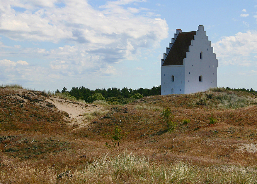
Skagen () is the northernmost town in Denmark, on the east coast of the Skagen Odde peninsula in the far north of Jutland, part of Frederikshavn Municipality in North Denmark Region, Nordjylland, north of Frederikshavn and northeast of Aalborg. The Port of Skagen is Denmark's main fishing port and it also has a thriving tourist industry, attracting 2 million people annually. The name was applied originally to the peninsula but it now also refers to the town. The settlement began during the Middle Ages as a fishing village, renowned for its herring industry. Thanks to its seascapes, fishermen and evening light, towards the end of the 19th century it became popular with a group of impressionism, impressionist artists now known as the Skagen Painters. In 1879, the Skagen Fishermen's Association was established with the purpose of facilitating the local fishing industry through the Skagensbanen railway, which opened as a narrow-gauged railway in 1890. The modern port of Skag ... [...More Info...] [...Related Items...] OR: [Wikipedia] [Google] [Baidu] |
Hanstholm
Hanstholm is a small town and a former island, now elevated area in Thisted municipality of Region Nordjylland, located in northern Denmark. The population of the town is 2,085 (1 January 2024).BY3: Population 1. January by urban and rural areas, area and population density The Mobile Statbank from Etymology The former island Hanstholm (short form of the original name Hansted Holm) has many placenames, including Hansted, Nørby, Gårddal, Ræhr, Hamborg, Bjerre, Febbersted, Krog, Nytorp and Vigsø. In the beginning of the[...More Info...] [...Related Items...] OR: [Wikipedia] [Google] [Baidu] |
North Jutlandic Island
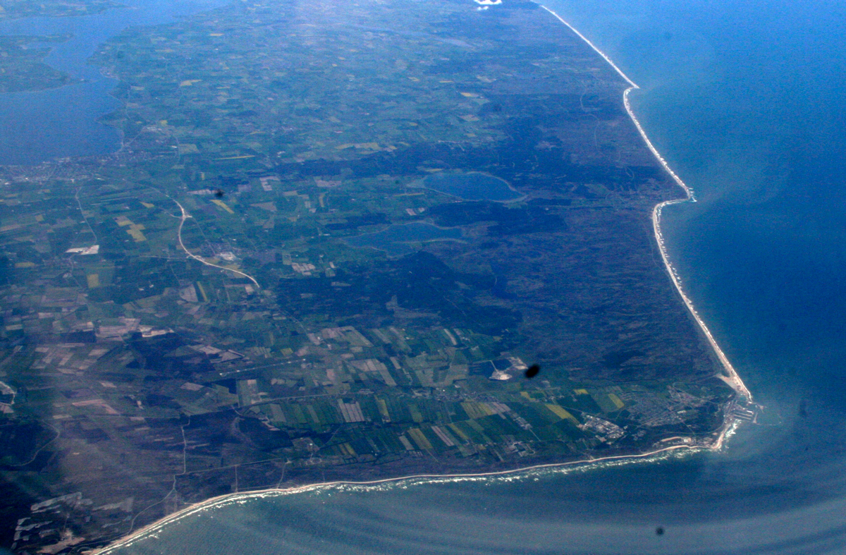
The North Jutlandic Island (), Vendsyssel-Thy, or Jutland north of the Limfjord (''Jylland nord for Limfjorden'') is the northernmost part of continental Denmark and of Jutland. It is more common to refer to the three traditional districts of Vendsyssel, Hanherred, and Thy. The area has been intermittently a tied island and, during modern times, was not surrounded by water until a storm in February 1825, which severed the region from the remainder of Jutland and created a water connection between the North Sea and the western end of the Limfjord. Vendsyssel-Thy retains its traditional status as a part of Jutland even though it is now an island. By area, it is the second-largest island of Denmark after Zealand (excluding Greenland), with a population of 294,424 on 1 January 2020. 309,834 people lived on the island in 1981. Danes rarely refer to the area as a whole, but more often to the three constituent districts or to North Jutland (which also includes an area south of t ... [...More Info...] [...Related Items...] OR: [Wikipedia] [Google] [Baidu] |
Norway
Norway, officially the Kingdom of Norway, is a Nordic countries, Nordic country located on the Scandinavian Peninsula in Northern Europe. The remote Arctic island of Jan Mayen and the archipelago of Svalbard also form part of the Kingdom of Norway. Bouvet Island, located in the Subantarctic, is a Dependencies of Norway, dependency, and not a part of the Kingdom; Norway also Territorial claims in Antarctica, claims the Antarctic territories of Peter I Island and Queen Maud Land. Norway has a population of 5.6 million. Its capital and largest city is Oslo. The country has a total area of . The country shares a long eastern border with Sweden, and is bordered by Finland and Russia to the northeast. Norway has an extensive coastline facing the Skagerrak strait, the North Atlantic Ocean, and the Barents Sea. The unified kingdom of Norway was established in 872 as a merger of Petty kingdoms of Norway, petty kingdoms and has existed continuously for years. From 1537 to 1814, Norway ... [...More Info...] [...Related Items...] OR: [Wikipedia] [Google] [Baidu] |


