|
Sió
The Sió or Sió-csatorna (''Sió-Channel'') is a fully regulated river in midwest Hungary. It is the outlet, at the eastern end, of Lake Balaton, flowing out of the lake in Siófok. The long Sió flows into the river Danube near the city of Szekszárd. The Sió flows through the Hungarian counties Somogy, Fejér and Tolna, its main tributaries are Kapos from the right and Sárvíz from the left. The drainage basin of the Sió (including Balaton) covers more than a third of the Transdanubia region. The Sió's basin size is and its average discharge at the mouth A mouth also referred to as the oral is the body orifice through which many animals ingest food and animal communication#Auditory, vocalize. The body cavity immediately behind the mouth opening, known as the oral cavity (or in Latin), is also t ... is . References Rivers of Hungary {{Hungary-river-stub ... [...More Info...] [...Related Items...] OR: [Wikipedia] [Google] [Baidu] |
Siófok
Siófok (; ; ) is a town in Somogy County, Hungary on the southern bank of Lake Balaton. It is the Somogy County#Municipalities, second largest municipality in Somogy County and the seat of Siófok District. It covers an area of about between Lake Balaton, the ''Mezőföld'' and the ''Outer Somogy-Hills''. Lying at the firth of the Sió, Sió Channel, it serves as the most important logistic station for goods between Lake Balaton and the River Danube. The town is Hungary's second most popular holiday destination (after Budapest) due to its coast, over 1,000 hotels, and plenty of bars, restaurants and nightclubs. Siófok is one of the richest municipalities of Hungary due to tourism. Hungarians often call the town "the capital of Lake Balaton", as it is the largest town on its shores and acts as the financial, cultural, media, commercial and tourist hub of the northern part of Somogy County and the southern shore of Lake Balaton. Etymology ''Fuk'' was first mentioned as a village ... [...More Info...] [...Related Items...] OR: [Wikipedia] [Google] [Baidu] |
Somogy County
Somogy (, ; ; , ) is an administrative county (Counties of Hungary, comitatus or ''vármegye'') in present Hungary, and also in the former Kingdom of Hungary. Somogy County lies in south-western Hungary, on the border with Croatia's Koprivnica-Križevci County, Koprivnica-Križevci and Virovitica-Podravina County, Virovitica-Podravina counties. It stretches between the river Dráva and the southern shore of Lake Balaton. It shares borders with the Hungarian counties of Zala County, Zala, Veszprém (county), Veszprém, Fejér, Tolna (county), Tolna, and Baranya (county), Baranya. Somogy is the most sparsely populated county in Hungary. The county capital is Kaposvár. Its area is 6,036 km2. History Somogy was also the name of a historic administrative county (Comitatus (Kingdom of Hungary), comitatus) of the Kingdom of Hungary. Its territory, which was slightly larger than that of present Somogy County, is now in south-western Hungary. The capital of that county was also ... [...More Info...] [...Related Items...] OR: [Wikipedia] [Google] [Baidu] |
Lake Balaton
Lake Balaton () is a freshwater rift lake in the Transdanubian region of Hungary. It is the List of largest lakes of Europe, largest lake in Central Europe, and one of the region's foremost tourist destinations. The Zala River provides the largest inflow of water to the lake, and the canalized Sió is the only outflow. The mountainous region of the northern shore is known both for its transdanubia#History, historic character and as a major Hungarian wine, wine region, while the flat southern shore is known for its resort towns. Balatonfüred and Hévíz developed early as resorts for the wealthy, but it was not until the late 19th century when landowners, ruined by ''Phylloxera'' attacking their grape vines, began building summer homes to rent out to the burgeoning middle class. Name In distinction to all other Hungarian language, Hungarian endonyms for lakes, which universally bear the suffix ''-tó'' 'lake', Lake Balaton is referred to in Hungarian with a definite article; that ... [...More Info...] [...Related Items...] OR: [Wikipedia] [Google] [Baidu] |
Sárvíz (Sió)
The Sárvíz is a river in Hungary. It is long and flows as a left bank tributary into the Sió in the village of Sióagárd, which lies in Tolna County Tolna (, ; ) is an administrative county (Comitatus (Kingdom of Hungary), comitatus or vármegye) in present-day Hungary as it was in the former Kingdom of Hungary. It lies in central Hungary, on the west bank of the river Danube. It shares borde .... References External links Geography of Fejér County Geography of Tolna County Rivers of Hungary {{Hungary-river-stub ... [...More Info...] [...Related Items...] OR: [Wikipedia] [Google] [Baidu] |
Tolna County
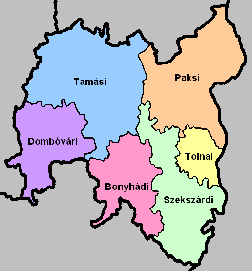
Tolna (, ; ) is an administrative county (Comitatus (Kingdom of Hungary), comitatus or vármegye) in present-day Hungary as it was in the former Kingdom of Hungary. It lies in central Hungary, on the west bank of the river Danube. It shares borders with the Hungarian counties of Somogy County, Somogy, Fejér, Bács-Kiskun, and Baranya (county), Baranya. The capital of Tolna county is Szekszárd. Its area is 3,703 km2. History Tolna (in Latin: ''comitatus Tolnensis'') was also the name of a historic administrative county (Comitatus (Kingdom of Hungary), comitatus) of the Kingdom of Hungary. Its territory, which was about the same as that of the present Tolna county, is now in central Hungary. The capital of the county was Szekszárd. Demographics In 2015, Tolna had a population of 225,936 and the population density was . Ethnicity Besides the Hungarian majority, the main minorities are the Germans (approx. 10,000) and Roma (8,500). Total population (2011 census): 230,3 ... [...More Info...] [...Related Items...] OR: [Wikipedia] [Google] [Baidu] |
Szekszárd
Szekszárd (, formerly also ''Szegzárd''; ; or ; ) is a small city in southern Hungary and the capital of Tolna County. By population, Szekszárd is the smallest county capital in Hungary; by area, it is the second-smallest (after Tatabánya). Location Szekszárd lies at the meeting point of the Transdanubian Mountains, Transdanubian Hills and the Alföld, Great Hungarian Plain, at the mouth of Sió into the flood plain of Danube. Etymology The Etymological Dictionary of Geographical Names, somewhat differently from the above, derives the name of the locality from the old Hungarian colour name szegszár (sötétsárga, brownish yellow), which could have become a personal name with the diminutive -d and thus could have been a predecessor of the town name. History Szekszárd was first mentioned in 1015. The Benedictine monastery of the town was founded by King Béla I of Hungary, Béla I in 1061. During the reign of Matthias Corvinus of Hungary, King Matthias, Szekszárd w ... [...More Info...] [...Related Items...] OR: [Wikipedia] [Google] [Baidu] |
Tolna (county)
Tolna (, ; ) is an administrative county (Comitatus (Kingdom of Hungary), comitatus or vármegye) in present-day Hungary as it was in the former Kingdom of Hungary. It lies in central Hungary, on the west bank of the river Danube. It shares borders with the Hungarian counties of Somogy County, Somogy, Fejér, Bács-Kiskun, and Baranya (county), Baranya. The capital of Tolna county is Szekszárd. Its area is 3,703 km2. History Tolna (in Latin: ''comitatus Tolnensis'') was also the name of a historic administrative county (Comitatus (Kingdom of Hungary), comitatus) of the Kingdom of Hungary. Its territory, which was about the same as that of the present Tolna county, is now in central Hungary. The capital of the county was Szekszárd. Demographics In 2015, Tolna had a population of 225,936 and the population density was . Ethnicity Besides the Hungarian majority, the main minorities are the Germans (approx. 10,000) and Roma (8,500). Total population (2011 census): 230,3 ... [...More Info...] [...Related Items...] OR: [Wikipedia] [Google] [Baidu] |
Danube
The Danube ( ; see also #Names and etymology, other names) is the List of rivers of Europe#Longest rivers, second-longest river in Europe, after the Volga in Russia. It flows through Central and Southeastern Europe, from the Black Forest south into the Black Sea. A large and historically important river, it was once a frontier of the Roman Empire. In the 21st century, it connects ten European countries, running through their territories or marking a border. Originating in Germany, the Danube flows southeast for , passing through or bordering Austria, Slovakia, Hungary, Croatia, Serbia, Romania, Bulgaria, Moldova, and Ukraine. Among the many List of cities and towns on the river Danube, cities on the river are four national capitals: Vienna, Bratislava, Budapest, and Belgrade. Its drainage basin amounts to and extends into nine more countries. The Danube's longest headstream, the Breg (river), Breg, rises in Furtwangen im Schwarzwald, while the river carries its name from its ... [...More Info...] [...Related Items...] OR: [Wikipedia] [Google] [Baidu] |
Bogyiszló
Bogyiszló is a village in Tolna County in Hungary. The village is famous for its hot, white-skinned peppers. Geography Bogyiszló is located from 11 km east from Szekszárd, in the southern part of Mezőföld, near the Danube river and Sió channel mouth. Approach: from road number 6 from west-direction, or from road number 51 from east-direction, on M9 highway, across the Danube on bridge named after Ladislaus I of Hungary. History Based on archaeological finds, Bogyiszló has already been populated area in the ages of Avars (Carpathians), Avars. Twin towns – sister cities * Schlitz, Hesse, Schlitz, Germany Economy Bogyiszló is an agricultural village. It is known for the Bogyiszló white-skinned Hungarian wax pepper, pepper. With the eradication of the forest that once covered the floodplain, the area was found to be ideal for growing both sweet, and hot varieties of pepper, as well as the red peppers used in making paprika. The area is also noted for its forestry, ... [...More Info...] [...Related Items...] OR: [Wikipedia] [Google] [Baidu] |
Transdanubia
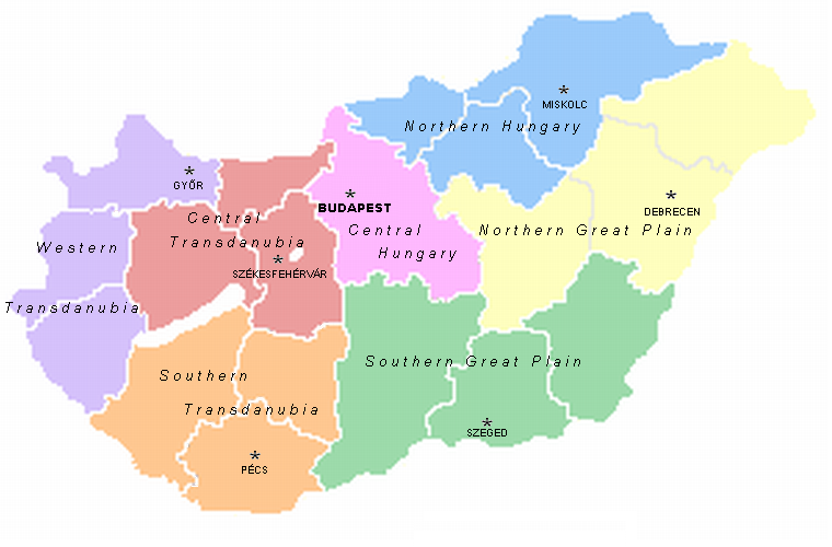
Transdanubia ( ; , or ', ) is a traditional region of Hungary. It is also referred to as Hungarian Pannonia, or Pannonian Hungary. Administrative divisions Traditional interpretation The borders of Transdanubia are the Danube River (north and east), the Drava and Mur River, Mura rivers (south), and the foothills of the Alps roughly along the border between Hungary and Austria (west). Transdanubia comprises the counties of Győr-Moson-Sopron, Komárom-Esztergom, Fejér, Veszprém (county), Veszprém, Vas, Zala County, Zala, Somogy County (former), Somogy, Tolna (county), Tolna, Baranya (county), Baranya and the part of Pest (county), Pest that lies west of the Danube. (In the early Middle Ages the latter was known as Pilis county.) This article deals with Transdanubia in this geographical meaning. Territorial changes While the northern, eastern and southern borders of the region are clearly marked by the Danube and Drava rivers, the western border was always identical with ... [...More Info...] [...Related Items...] OR: [Wikipedia] [Google] [Baidu] |
Drainage Basin
A drainage basin is an area of land in which all flowing surface water converges to a single point, such as a river mouth, or flows into another body of water, such as a lake or ocean. A basin is separated from adjacent basins by a perimeter, the drainage divide, made up of a succession of elevated features, such as ridges and hills. A basin may consist of smaller basins that merge at river confluences, forming a hierarchical pattern. Other terms for a drainage basin are catchment area, catchment basin, drainage area, river basin, water basin, and impluvium. In North America, they are commonly called a watershed, though in other English-speaking places, " watershed" is used only in its original sense, that of the drainage divide line. A drainage basin's boundaries are determined by watershed delineation, a common task in environmental engineering and science. In a closed drainage basin, or endorheic basin, rather than flowing to the ocean, water converges toward the ... [...More Info...] [...Related Items...] OR: [Wikipedia] [Google] [Baidu] |


