|
Sirinhaém
Sirinhaém is a municipality in Pernambuco with 46,361 inhabitants. The town was founded in 1614 making it among the oldest in the state. The Mayor is Camila Machado Leocadio Lins Dos Santos (PP, 2021 – 2024). Access BR-101, PE-060, PE-064 (via Cabo de Santo Agostinho) Geography * State - Pernambuco * Region - RMR (Recife) * Boundaries - Ipojuca and Escada (N); Rio Formoso and Tamandaré (S); Ribeirão (W); Atlantic Ocean (E) * Area - 378.8 km2 * Elevation - 49 m * Vegetation - Forest Subperenifólia and Coconut trees * Climate - Hot tropical and humid * Mean and high annual temperatures - 20.1 °C; 29.5 °C * Distance to Recife - 65 km Beaches *Gamela beach Beach of clear water, reefs and extensive areas of coconut trees. It has some bars and ''Palhoças'' (tents) offering typical food of the region (based in fish and seafood). *Guadalupe beach Still almost virgin in its 3 kilometers long. Its part of the ''Gold Coast Project' ... [...More Info...] [...Related Items...] OR: [Wikipedia] [Google] [Baidu] |
Santo Aleixo Island
Santo Aleixo Island is a Brazil, Brazilian island located on the southern coast of Pernambuco, Northeast Region, Brazil, northeastern region of Brazil. It has two beaches, with Garden pond, natural pools: Praia dos Pernambucanos, with bar services and most visited by tourists, and Praia da Holanda, which has a quieter atmosphere and can be reached on a short walk. There is also Enseada Espanha and França, which is geographically linked to the second beach. Administratively, the island is part of Sirinhaém, although it's privately owned. It is located between Porto de Galinhas and Praia dos Carneiros. History In 1527, the Spanish navigator Rodrigo Acuña, on his way back to Spain, was shipwrecked off the coast of Pernambuco and landed with some companions on the island, where he recovered after finding food and providing himself with essential utensils. Historiography gives the following account of this misfortune: It was also on the Santo Aleixo island that the first Frenc ... [...More Info...] [...Related Items...] OR: [Wikipedia] [Google] [Baidu] |
Ribeirão, Pernambuco
Ribeirão is a city located in the state of Pernambuco, Brazil. Located at 87 km away from Recife, capital of the state of Pernambuco. Has an estimated (Brazilian Institute of Geography and Statistics, IBGE 2020) population of 47,616 inhabitants. Geography * State - Pernambuco * Region - Zona da Mata (coastal), Zona da mata Pernambucana * Boundaries - Amaraji, Escada, Pernambuco, Escada and Primavera, Pernambuco, Primavera (N); Gameleira (S); Sirinhaém (E); Joaquim Nabuco, Pernambuco, Joaquim Nabuco, Água Preta and Cortês (W) * Area - 287.98 km2 * Elevation - 97 m * Hydrography - Sirinhaém River * Vegetation - Subperenifólia forest * Climate - Hot tropical and humid * Annual average temperature - 25.1 c * Distance to Recife - 87 km Economy The main economic activities in Ribeirão are based in the metallurgy industry, commerce and agribusiness, especially sugarcane, bananas, manioc; and livestock such as cattle, american bison, buffalos, goats and ... [...More Info...] [...Related Items...] OR: [Wikipedia] [Google] [Baidu] |
Escada, Pernambuco
Escada is a city in northeastern Brazil, in the State of Pernambuco, with 59 836 inhabitants according with IBGE 2022. It is the most populous municipality in its microregion and one of the main ones in the Microregion of the Southern Forest of Pernambuco. It is located at a distance of 60 km from the capital of Pernambuco, Recife. Known as "Princesa dos Canaviais", a nickname that refers to the large plantations and sugar cane mills installed in the region. Geography * State - Pernambuco * Region - Zona da mata Pernambucana * Boundaries - Cabo de Santo Agostinho and Vitória de Santo Antão (N); Sirinhaém and Ribeirão (S); Primavera (W); Ipojuca (E) * Area - 347.2 km2 * Elevation - 109 m * Hydrography - Ipojuca and Sirinhaém rivers * Vegetation - Subperenifólia forest * Climate - Hot tropical and humid * Annual average temperature - 25 c * Distance to Recife - 59 km Economy The main economic activities in Escada are based in general commerce and primary ... [...More Info...] [...Related Items...] OR: [Wikipedia] [Google] [Baidu] |
Tamandaré
Tamandarë (Brazilian Portuguese: ''Tamandaré''; Old Tupi: ''Tamandûaré'', lit. "different") is a coastal municipality about south of Recife, the capital city of the Brazilian state of Pernambuco. Geography * State - Pernambuco * Region - Zona da mata Pernambucana * Boundaries - Rio Formoso and Sirinhaém (N); Barreiros (S); Água Preta (W); Atlantic Ocean (E) * Area - * Elevation - 8 m * Vegetation - Coconut trees and Atlantic forest * Clima - Hot tropical and humid * Annual average temperature - 25.3 c * Distance to Recife - 103 km The municipality contains part of the strictly protected Saltinho Biological Reserve, a conservation unit created in 1983. Beaches *Tamandaré beach Urbanized, has two kilometers long of sand and a number of tourist facilities. Has small waves and fine sand. Easy to reach from Recife and Caruaru. *Boca da Barra beach At low tide is formed natural pools. Suitable for swimming, has a dense mangrove vegetation in the estuary ... [...More Info...] [...Related Items...] OR: [Wikipedia] [Google] [Baidu] |
Rio Formoso
Rio Formoso ( English: ''River Handsome''), is a municipality in Pernambuco with 23,628 inhabitants. Geography * State - Pernambuco * Region - Zona da mata Pernambucana * Boundaries - Sirinhaém (N); Tamandaré (S); Gameleira (W); Tamandaré and Atlantic Ocean (E) * Area - 239.8 km2 * Elevation - 5 m * Vegetation - Forest Subperenifólia * Climate - Hot tropical and humid * Annual average temperature - 25.2 c * Distance to Recife - 91 km The municipality contains part of the strictly protected Saltinho Biological Reserve, a conservation unit created in 1983. Beaches *Pedra beach and Reduto beach There are the only two beaches in ''Rio Formoso''. The major attraction is the estuary of the Formoso River. Has an extensive area of coconut trees, sand banks and natural reefs. Economy The main economic activities in Rio Formoso are based in food and beverage industry and agribusiness. Especially, coconuts, sugarcane, and creations of cattle. Economic In ... [...More Info...] [...Related Items...] OR: [Wikipedia] [Google] [Baidu] |
Ipojuca
Ipojuca is a municipality in Pernambuco in eastern Brazil. As of 2024 the population according to IBGE was 105.638 and the per capita income (2007) was R$76.418 (more than $23,000 US dollars) making it one of the country's highest. The settlement dates to 1560, but the official founding date is 1861 and the community was incorporated as a town in 1864. It is famous for its beaches such as Porto de Galinhas (considered one of the best beaches in Brazil), Muro Alto, Maracaipe. History The colonization of Ipojuca began in 1560, after the expulsion of the Caeté Indians and other tribes from the southern coast of Pernambuco. From there, the settlers could migrate to the fertile land of Ipojuca rich in massapê. The land is very suitable for the cultivation of sugar cane, which caused rapid agricultural expansion in the region. Among the pioneers were the Lacerda, Cavalcanti, and Rolim Moura families. When the Dutch invaded Pernambuco, several mills had already been established in ... [...More Info...] [...Related Items...] OR: [Wikipedia] [Google] [Baidu] |
Coast
A coast (coastline, shoreline, seashore) is the land next to the sea or the line that forms the boundary between the land and the ocean or a lake. Coasts are influenced by the topography of the surrounding landscape and by aquatic erosion, such as that caused by wind wave, waves. The geology, geological composition of rock (geology), rock and soil dictates the type of shore that is created. Earth has about of coastline. Coasts are important zones in natural ecosystems, often home to a wide range of biodiversity. On land, they harbor ecosystems, such as freshwater marsh, freshwater or estuary, estuarine wetlands, that are important for birds and other terrestrial animals. In wave-protected areas, coasts harbor salt marshes, mangroves, and seagrass meadow, seagrasses, all of which can provide nursery habitat for finfish, shellfish, and other aquatic animals. Rocky shores are usually found along exposed coasts and provide habitat for a wide range of sessility (motility), sessile ... [...More Info...] [...Related Items...] OR: [Wikipedia] [Google] [Baidu] |
Coconut Tree
The coconut tree (''Cocos nucifera'') is a member of the palm tree family (biology), family (Arecaceae) and the only living species of the genus ''Cocos''. The term "coconut" (or the archaic "cocoanut") can refer to the whole coconut palm, the seed, or the fruit, which botanically is a drupe, not a Nut (fruit), nut. Originally native to Central Indo-Pacific, they are now ubiquitous in coastal tropical regions and are a cultural icon of the tropics. The coconut tree provides food, fuel, cosmetics, folk medicine and building materials, among many other uses. The inner flesh of the mature seed, as well as the coconut milk extracted from it, forms a regular part of the diets of many people in the tropics and subtropics. Coconuts are distinct from other fruits because their endosperm contains a large quantity of an almost clear liquid, called "coconut water" or "coconut juice". Mature, ripe coconuts can be used as edible seeds, or processed for Coconut oil, oil and Coconut milk, ... [...More Info...] [...Related Items...] OR: [Wikipedia] [Google] [Baidu] |
Reef
A reef is a ridge or shoal of rock, coral, or similar relatively stable material lying beneath the surface of a natural body of water. Many reefs result from natural, abiotic component, abiotic (non-living) processes such as deposition (geology), deposition of sand or wave erosion planning down rock outcrops. However, reefs such as the coral reefs of tropical waters are formed by biotic component, biotic (living) processes, dominated by corals and coralline algae. Artificial reefs, such as shipwrecks and other man-made underwater structures, may occur intentionally or as the result of an accident. These are sometimes designed to increase the physical complexity of featureless sand bottoms to attract a more diverse range of organisms. They provide shelter to various aquatic animals which help prevent extinction. Another reason reefs are put in place is for aquaculture, and fish farmers who are looking to improve their businesses sometimes invest in them. Reefs are often quite n ... [...More Info...] [...Related Items...] OR: [Wikipedia] [Google] [Baidu] |
Manguezal Da Barra Do Sirinhaém
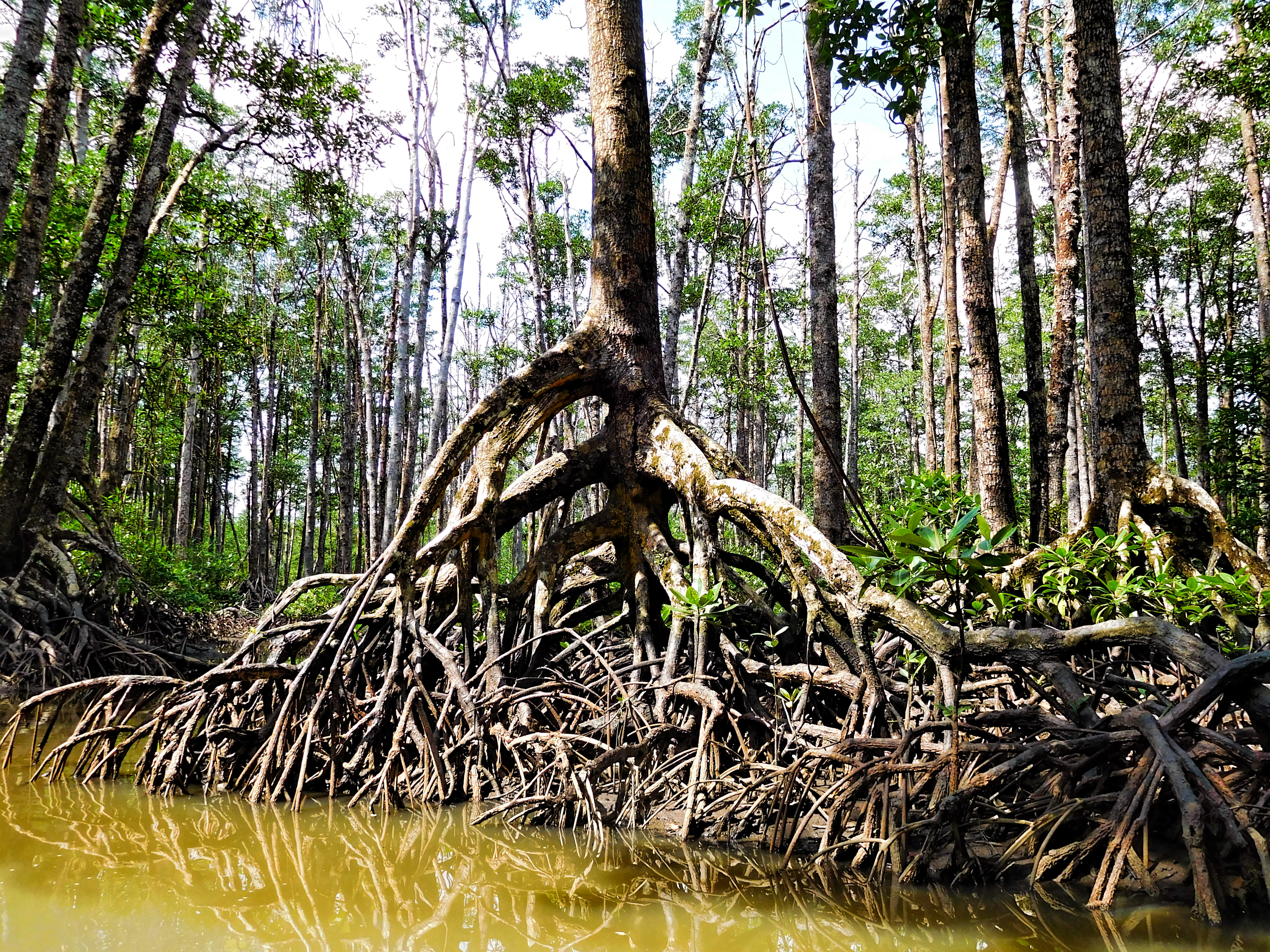
A mangrove is a shrub or tree that grows mainly in coastal saline or brackish water. Mangroves grow in an equatorial climate, typically along coastlines and tidal rivers. They have particular adaptations to take in extra oxygen and remove salt, allowing them to tolerate conditions that kill most plants. The term is also used for tropical coastal vegetation consisting of such species. Mangroves are taxonomically diverse due to convergent evolution in several plant families. They occur worldwide in the tropics and subtropics and even some temperate coastal areas, mainly between latitudes 30° N and 30° S, with the greatest mangrove area within 5° of the equator. Mangrove plant families first appeared during the Late Cretaceous to Paleocene epochs and became widely distributed in part due to the movement of tectonic plates. The oldest known fossils of mangrove palm date to 75 million years ago. Mangroves are salt-tolerant (halophytic) and are adapted to live in hars ... [...More Info...] [...Related Items...] OR: [Wikipedia] [Google] [Baidu] |


