|
Siege Of Mankera (1821–1822)
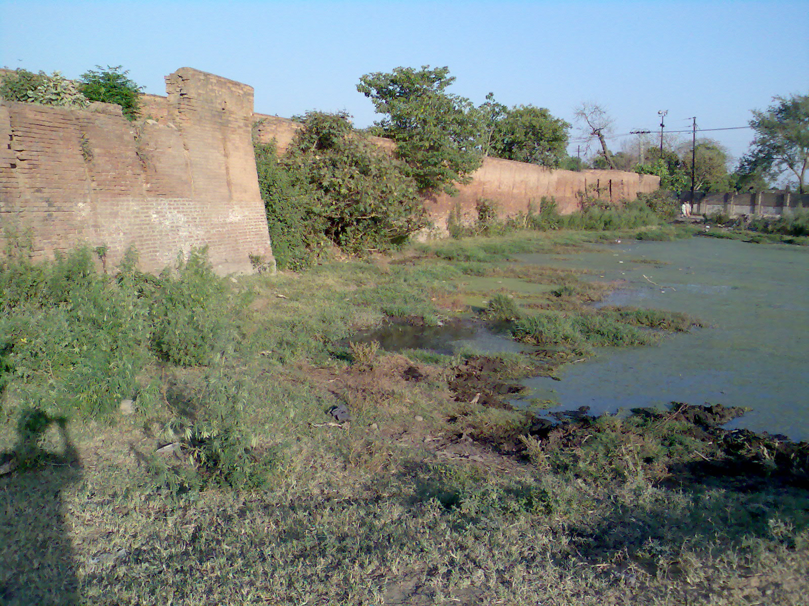
The siege of Mankera, also known as the fall of Mankera, was a conflict from 7 December 1821 to 1 January 1822 between the Sikh forces led by Maharaja Ranjit Singh and the Mankera forces led by Nawab Hafiz Ahmad Khan. Background The Sindh Sagar Doab was fully under the rule of the Kingdom of Mankera and Mitha Tiwana. The chief of Mankera Nawab Hafiz Ahmad Khan had the most control over the region. Mohammad Khan, the previous chief of Mankera, had built 12 forts outside the Mankera fort to make direct invasion of the main fort impossible. The fort used to be a part of the Bhangi Misl until they lost it and an independent state was formed. Instead of paying taxes to the Sikh Empire, the Nawab paid tribute to the Durrani Empire in Kabul. Furthermore, Mankera held the 3 important towns of Leiah, Bhakkar and Dera Ismail Khan, and the caravan route from Iran and Baluchistan also went through the territory of the Nawab. This made Mankera an important asset for the Sikh Empire to have. ... [...More Info...] [...Related Items...] OR: [Wikipedia] [Google] [Baidu] |
Mankera
Mankera ( Saraiki and ) is the principal town of Mankera Tehsil, an administrative subdivision of Bhakkar District, in the Punjab province of Pakistan. It is situated about west of the city of . Bhakkar is located in the west of Punjab. The mighty flows on the western side of the district and the J ... [...More Info...] [...Related Items...] OR: [Wikipedia] [Google] [Baidu] |
Kabul
Kabul is the capital and largest city of Afghanistan. Located in the eastern half of the country, it is also a municipality, forming part of the Kabul Province. The city is divided for administration into #Districts, 22 municipal districts. A 2025 estimate puts the city's population at 7.175 million. In contemporary times, Kabul has served as Afghanistan's political, cultural and economical center. Rapid urbanisation has made it the country's primate city and one of the largest cities in the world. The modern-day city of Kabul is located high in a narrow valley in the Hindu Kush mountain range, and is bounded by the Kabul River. At an elevation of , it is one of the List of capital cities by elevation, highest capital cities in the world. The center of the city contains its old neighborhoods, including the areas of Khashti Bridge, Khabgah, Kahforoshi, Saraji, Chandavel, Shorbazar, Deh-Afghanan and Ghaderdiwane. Kabul is said to be over 3,500 years old, and was mentioned at the ... [...More Info...] [...Related Items...] OR: [Wikipedia] [Google] [Baidu] |
Derajat
Derajat (Urdu: , the plural of the word 'dera' ) is a historical and cultural region in central Pakistan, bounded by the Indus River to the east and the Sulaiman Mountains to the west. It is located in the area where the provinces of Punjab, Pakistan, Punjab, Khyber Pakhtunkhwa, and Balochistan, Pakistan, Balochistan meet. Derajat includes the present-day administrative districts of Dera Ismail Khan District, Dera Ismail Khan, Dera Ghazi Khan District, Dera Ghazi Khan, Rajanpur District, Rajanpur, Taunsa District, Taunsa and Tank District, Tank in the Khyber Pakhtunkhwa and Punjab provinces. The "Baloch Derajat" (consisting of Dera Bugti, Dera Allah Yar and Dera Murad Jamali) is adjacent to Derajat towards the southwest in Balochistan. The people of Derajat are called Derawal, and the varieties of Saraiki language, Saraiki they speak are collectively called Derawali dialect, also known locally as ''Hindki''. Pashto and Balochi language, Balochi languages are spoken in the northern ... [...More Info...] [...Related Items...] OR: [Wikipedia] [Google] [Baidu] |
Indus
The Indus ( ) is a transboundary river of Asia and a trans- Himalayan river of South and Central Asia. The river rises in mountain springs northeast of Mount Kailash in the Western Tibet region of China, flows northwest through the disputed Kashmir region, first through the Indian-administered Ladakh, and then the Pakistani administered Gilgit Baltistan, Quote: "Kashmir, region of the northwestern Indian subcontinent. It is bounded by the Uygur Autonomous Region of Xinjiang to the northeast and the Tibet Autonomous Region to the east (both parts of China), by the Indian states of Himachal Pradesh and Punjab to the south, by Pakistan to the west, and by Afghanistan to the northwest. The northern and western portions are administered by Pakistan and comprise three areas: Azad Kashmir, Gilgit, and Baltistan, ... The southern and southeastern portions constitute the Indian state of Jammu and Kashmir. The Indian- and Pakistani-administered portions are divided by a "line of ... [...More Info...] [...Related Items...] OR: [Wikipedia] [Google] [Baidu] |
Jhelum
Jhelum (; , ) is a city, located along the western bank of the Jhelum River, in Punjab, Pakistan. It is the 21st largest city in Punjab and 31st largest in Pakistan, by population. Located in northern Punjab, it serves as the capital of the eponymous district; and is often referred to as the 'City of Soldiers' or 'Land of Martyrs and Warriors', due to the inclusion of many soldiers from the city in the British Indian Army and, later, the Pakistan Armed Forces; owing to the categorisation of the Punjabi tribes as a ' martial race'. Jhelum is a few miles upstream from the site of the ancient Battle of the Hydaspes, between the armies of Alexander III of Macedon and Porus. The site of the modern city of Jhelum could have, possibly, been the capital of Porus' Kingdom, Paurava. A city called Bucephala was founded nearby to commemorate the death of Alexander's horse, Bucephalus. Other notable sites nearby include the 16th-century Rohtas Fort, the Tilla Jogian complex o ... [...More Info...] [...Related Items...] OR: [Wikipedia] [Google] [Baidu] |
Jagir
A jagir (), ( Hindustani: जागीर/جاگیر, ''Jāgīr''), ( Marathi: जहागीर, ''Jahāgīrá'') also spelled as jageer, was a type of feudal land grant in the Indian subcontinent at the foundation of its Jagirdar ( Zamindar) system. It developed during the Islamic era of the Indian subcontinent, starting in the early 13th century, wherein the powers to govern and collect tax from an estate was granted to an appointee of the state. 13th-century origin and successors This feudal system of land ownership is referred to as the ''jagirdar'' system. The system was introduced by the Sultans of Delhi from the 13th century onwards, was later adopted by the Mughal Empire, the Maratha Empire and continued under the British East India Company. Some Hindu jagirdars were converted into Muslim vassal states under Mughal imperial sway, such as the nawabs of Kurnool. Most princely states of India during the colonial British Raj era were jagirdars such as Mohrampur Jagi ... [...More Info...] [...Related Items...] OR: [Wikipedia] [Google] [Baidu] |
Layyah
Layyah ( Saraiki and ), previously spelled as Leiah, is a city in Layyah District of Punjab province of Pakistan.Tehsils & Unions in the District of Layyah . National Reconstruction Bureau, Government of Pakistan The city is the headquarter of and Layyah Tehsil. It is the 75th most populous city of Pakistan. The main languages spoken in the city include [...More Info...] [...Related Items...] OR: [Wikipedia] [Google] [Baidu] |
Sikh Khalsa Army
The Sikh Khalsa Army (), also known as Khalsaji or simply Sikh Army, was the military force of the Sikh Empire. With its roots in the Khalsa founded by Guru Gobind Singh, the army was later modernised on Franco-British principles by Maharaja Ranjit Singh.''The Sikh Army 1799–1849'' By Ian Heath, Michael Perry It was divided in three wings: the Fauj-i-Khas (elites), Fauj-i-Ain (regular force) and Fauj-i-Be Qawaid (irregulars). Due to the lifelong efforts of the Maharaja and his European officers, it gradually became a prominent fighting force of Asia.''History of the Punjab'' by Prof Manjeet Singh Sodhi ) Ranjit Singh changed and improved the training and organisation of his army. He reorganized responsibility and set performance standards in logistical efficiency in troop deployment, manoeuvre, and marksmanship. He reformed the staffing to emphasize steady fire over cavalry and guerrilla warfare, improved the equipment and methods of war. The military system of Ranjit Singh com ... [...More Info...] [...Related Items...] OR: [Wikipedia] [Google] [Baidu] |
Battle Of Mangal
The Battle of Mangal was fought between the Sikh forces led by Hari Singh Nalwa and the Jadoon, Tanaoli and Swati tribes led by Mahomed Khan, Bostan Khan and Najeebullah Swati. Background and Battle Maharaja Ranjit Singh deployed Hari Singh Nalwa. He marched by Muzaffarabad and Pakhli with 7,000 foot soldiers under his command. When he reached Mangal, around 25,000 Pashtun and Hazara troops and their leader, Mohammad Khan Tarain, who opposed the Sikh's passage, attacked the Sikhs. Despite being outnumbered, the Sikhs defeated their opponents with a loss of 2,000 men. Aftermath The Jaduns to save their town paid down a fine of 5 and a half rupees per house to the Sikhs. Hari Singh Nalwa then built a fort at Nawanshahr. The Maharaja, partly pleased with the treasures and partly to reward his lieutenant for the victory, made Hari Singh Nalwa the governor of the entirety of Hazara. See also * Nihang The Nihang (also spelt as Nihung lit. "Crocodiles") or Akali (lit. "Immortal ... [...More Info...] [...Related Items...] OR: [Wikipedia] [Google] [Baidu] |
Dusshera
Vijayadashami (), more commonly known as Dassahra in Hindi, and also known as Dashāhra or Dashain in Bhojpuri, Maithili and Nepali, is a major Hindu festival celebrated every year at the end of Durga Puja and Navarahtri. It is observed on the tenth day of the month of Ashvin, the seventh in the Hindu lunisolar calendar. The festival typically falls in the Gregorian calendar months of September and October, more specifically between 27 September and 26 October. It is celebrated on the tenth day of the waxing moon (Shukla Paksha) of the Ashvayuja month. Vijayadashami is observed for different reasons and celebrated differently in various parts of India and Nepal. In the southern, eastern, northeastern, and some northern states of India, Vijayadashami marks the end of Durga Puja, commemorating goddess Durga's victory against Mahishasura to restore and protect ''dharma''. In the northern, central, and western states, it marks the end of Ramlila and commemorates the deity Rama' ... [...More Info...] [...Related Items...] OR: [Wikipedia] [Google] [Baidu] |
Baluchistan
Balochistan ( ; , ), also spelled as Baluchistan or Baluchestan, is a historical region in West and South Asia, located in the Iranian plateau's far southeast and bordering the Indian Plate and the Arabian Sea coastline. This arid region of desert and mountains is primarily populated by ethnic Baloch people. The Balochistan region is split among three countries: Iran, Afghanistan and Pakistan. Administratively it comprises the Pakistani province of Balochistan, the Iranian province of Sistan and Baluchestan, and the southern areas of Afghanistan, which include Nimruz, Helmand and Kandahar provinces. It borders the Pashtunistan region to the north, Sindh and Punjab to the east, and Persian regions to the west. Its southern coastline, including the Makran Coast, is washed by the Arabian Sea, in particular by its western part, the Gulf of Oman. Etymology The name "Balochistan" is generally believed to derive from the name of the Baloch people. Since the Baloch people are ... [...More Info...] [...Related Items...] OR: [Wikipedia] [Google] [Baidu] |
Iran
Iran, officially the Islamic Republic of Iran (IRI) and also known as Persia, is a country in West Asia. It borders Iraq to the west, Turkey, Azerbaijan, and Armenia to the northwest, the Caspian Sea to the north, Turkmenistan to the northeast, Afghanistan to the east, Pakistan to the southeast, and the Gulf of Oman and the Persian Gulf to the south. With a Ethnicities in Iran, multi-ethnic population of over 92 million in an area of , Iran ranks 17th globally in both List of countries and dependencies by area, geographic size and List of countries and dependencies by population, population. It is the List of Asian countries by area, sixth-largest country entirely in Asia and one of the world's List of mountains in Iran, most mountainous countries. Officially an Islamic republic, Iran is divided into Regions of Iran, five regions with Provinces of Iran, 31 provinces. Tehran is the nation's Capital city, capital, List of cities in Iran by province, largest city and financial ... [...More Info...] [...Related Items...] OR: [Wikipedia] [Google] [Baidu] |


