|
Sheridan, Minneapolis
Sheridan is a neighborhood in the Northeast community of Minneapolis. Location and characteristics Sheridan's boundaries are 17th and 18th Avenues NE to the north, Washington Street to the east, Broadway Street NE to the south, and the Mississippi River to the west. It is located in Ward 3, currently represented by council member Michael Rainville. Sheridan is also considered part of the Northeast Minneapolis Arts District. Sheridan has a community garden with rentable plots and a mega-plot that's used to grow organic food for the community. History Sheridan is named for Civil War general Philip Sheridan. Portions of the Sheridan neighborhood were actually part of the former city of St. Anthony, Minnesota which was annexed by Minneapolis in 1872. Many of the area's initial settlers were immigrants from Eastern and Northern Europe who worked in nearby industries including grain mills, lumber mills, breweries and railroads. The neighborhood's housing was largely built betwe ... [...More Info...] [...Related Items...] OR: [Wikipedia] [Google] [Baidu] |
Neighborhoods Of Minneapolis
Minneapolis is officially defined by its city council as divided into 83 neighborhoods. The neighborhoods are historically grouped into 11 communities. Informally, there are city areas with colloquial labels. Residents may also group themselves by their city street suffixes: North, Northeast, South, and Southeast. General areas The local community defines several general areas based on the directional suffixes added to streets in the city. These city areas do not necessarily correlate with official community or neighborhood definitions. Downtown Minneapolis refers to the street grid area aligned on a diagonal with the Mississippi River bend, as opposed to the true north-south grid orientation. The area north of downtown on the west bank of the Mississippi River is considered North Minneapolis. The part of Minneapolis on the east bank of the Mississippi River is divided by East Hennepin Avenue into Northeast and Southeast, approximately aligned with the communities of Northeas ... [...More Info...] [...Related Items...] OR: [Wikipedia] [Google] [Baidu] |
Government Of Minneapolis
Minneapolis, the largest city in Minnesota, United States, and the county seat of Hennepin County, operates under a Mayor–council government system. This article provides an overview of the structure and functions of Minneapolis's city government. Charter and ordinances Minnesota was the fourth state in the U.S. to permit "home rule" in 1896. A home rule charter serves as a constitution for a local government. It allows a community to establish and maintain a municipal corporation to provide for the common health, safety, and welfare. Several early attempts to establish a home rule charter in Minneapolis failed. In 1920, the matter was resolved by the Minnesota State Legislature when it codified the general statutes applicable to first class cities as well as all special laws specific to the City of Minneapolis at that time into the City’s first home rule charter. That charter remained in effect—through multiple amendments—until 2013, when a complete revision, including t ... [...More Info...] [...Related Items...] OR: [Wikipedia] [Google] [Baidu] |
Hawthorne, Minneapolis
Hawthorne is a neighborhood in the Near North community in Minneapolis. Its boundaries are Lowry Avenue North to the north, the Mississippi River to the east, West Broadway to the south, and Emerson Avenue North to the west. It is located in Ward 5, represented by city council member Jeremiah Ellison. The neighborhood is named in honor of 19th Century American author Nathaniel Hawthorne Nathaniel Hawthorne (né Hathorne; July 4, 1804 – May 19, 1864) was an American novelist and short story writer. His works often focus on history, morality, and religion. He was born in 1804 in Salem, Massachusetts, from a family long associat .... Demographics Based on Census 2000 figures, the neighborhood's ethnic makeup changed significantly between 1980 and 2000. All ethnic groups except whites and American Indians increased in number. The white population dropped from 85 percent of the population in 1980 to 19 percent in 2000. During that same time period, the black population incr ... [...More Info...] [...Related Items...] OR: [Wikipedia] [Google] [Baidu] |
Logan Park, Minneapolis
Logan Park is a neighborhood in the Northeast community in Minneapolis. It is one of ten neighborhoods in Ward 1 of Minneapolis, currently represented by Council President Elliott Payne. Location and characteristics Logan Park's boundaries are 19th Avenue NE to the north, Central Avenue to the east, Broadway Street NE to the south, and Washington Street NE to the west. It is named after Logan Park (located within its borders) which is, in turn, named after Civil War general and US Senator John A. Logan. The neighborhood was originally settled in the late 19th century and built around Logan Park itself. Homes near the park tend to be larger and Victorian in style. The remainder of the neighborhood is smaller residential housing and industrial space with much of the industry clustered around the railroad tracks running parallel to Central Avenue. Many of the neighborhood's industrial buildings (such as the Northrup-King headquarters) have since been re-purposed as artist ... [...More Info...] [...Related Items...] OR: [Wikipedia] [Google] [Baidu] |
Holland, Minneapolis
Holland is a neighborhood in the Northeast community in Minneapolis. It is one of ten neighborhoods in Ward 1 of Minneapolis, currently represented by Council President Elliott Payne. Location and characteristics Holland's boundaries are 27th Avenue NE to the north, Central Avenue to the east, 19th and 17th Avenues NE to the south, and University Avenue NE to the west. It is named after Josiah G. Holland, an American educator, novelist and poet. Much of the neighborhood is smaller residential housing dating from before 1920. During the early 20th century it was a common destination for immigrants from Eastern Europe, some of whom worked at the Shoreham Yards railroad complex north of the neighborhood. Today it is considered part of the Northeast Minneapolis Arts District as it has gradually transformed to include more small businesses, restaurants, art galleries and workspaces. Landmarks The neighborhood is home to Edison High School, the nearby Jackson Square Park and ... [...More Info...] [...Related Items...] OR: [Wikipedia] [Google] [Baidu] |
Bottineau, Minneapolis
Bottineau is a neighborhood in the Northeast community of Minneapolis. It is one of ten neighborhoods in Ward 1 of Minneapolis, currently represented by Council President Elliott Payne. Location and characteristics Bottineau's boundaries are Lowry Avenue NE to the north, University Avenue NE to the east, 16th and 17th Avenues NE to the south, and the Mississippi River to the west. The neighborhood is named for its founder, Minnesota frontiersman Pierre Bottineau, who purchased land in the area in 1845. The neighborhood's location along the Mississippi River made it an ideal site for industry including grain mills, lumber mills and breweries. During the late 1800s and early 1900s the neighborhood became more residential (aided by an expansion of the city's streetcar system up 2nd Street NE). Bottineau suffered somewhat during the white flight of the 1950s and 1960s as many of the neighborhood's small businesses closed and single family homes were converted into multiple unit ... [...More Info...] [...Related Items...] OR: [Wikipedia] [Google] [Baidu] |
Bike Path
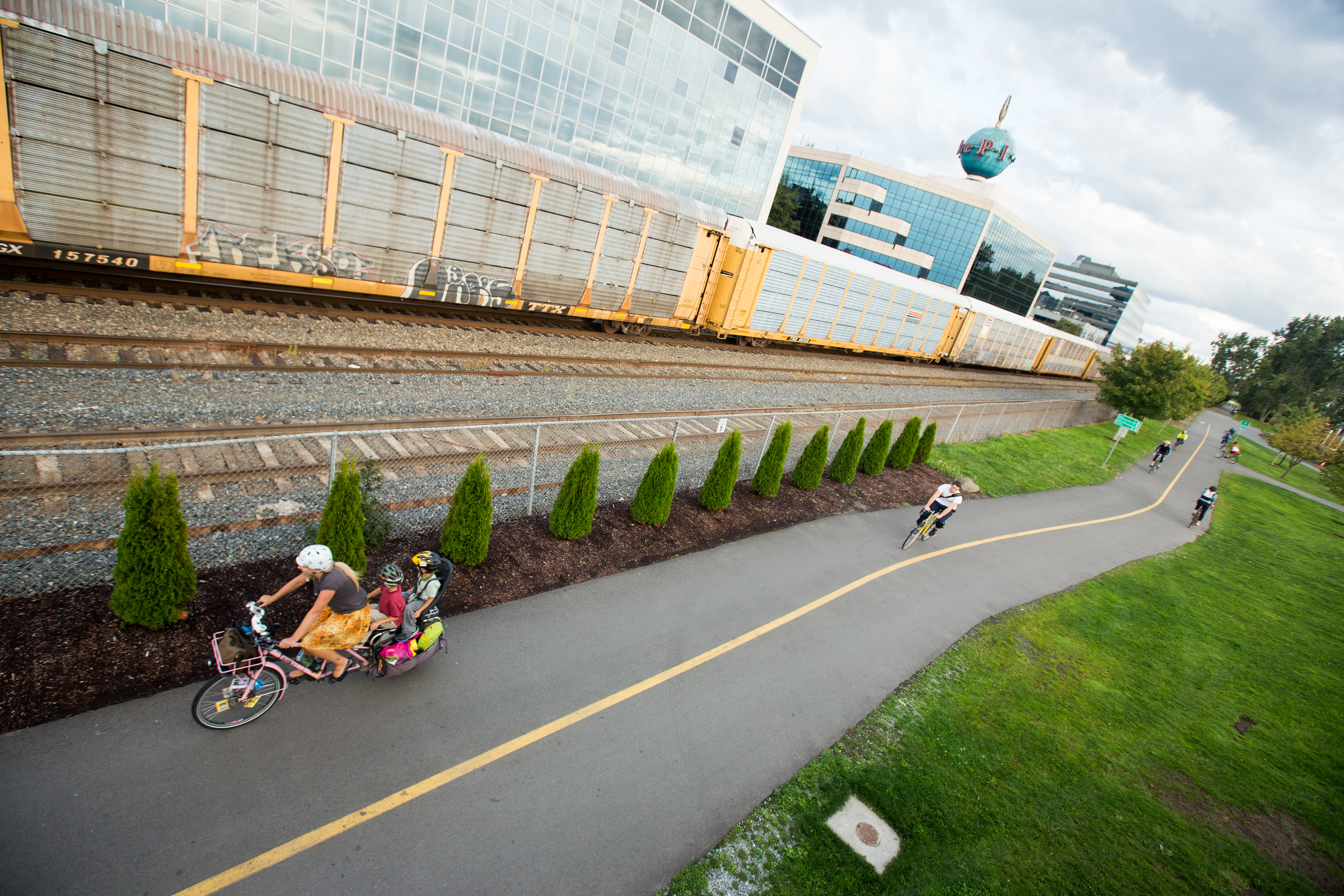
A bike path or a cycle path is a bikeway separated from motorized traffic and dedicated to cycling or shared with pedestrians or other non-motorized users. In the US a bike path sometimes encompasses '' shared use paths'', "multi-use path", or "Class III bikeway" is a paved path that has been designated for use by cyclists outside the right of way of a public road. It may or may not have a center divider or stripe to prevent head-on collisions. In the UK, a ''shared-use footway'' or ''multi-use path'' is for use by both cyclists and pedestrians. Bike paths with independent rights-of-way Bike paths that follow independent rights-of-way are often used to promote recreational cycling. In Northern European countries, cycling tourism represents a significant proportion of overall tourist activity. Extensive interurban bike path networks can be found in countries such as Denmark or the Netherlands, which has had a national system of cycle routes since 1993. These networks may use rou ... [...More Info...] [...Related Items...] OR: [Wikipedia] [Google] [Baidu] |
Bicycle Boulevard
A bicycle boulevard, sometimes referred to as a neighborhood greenway, neighborway, neighborhood bikeway or neighborhood byway is a type of bikeway composed of a low-speed street which has been "optimized" for bicycle traffic. Bicycle boulevards discourage cut-through motor-vehicle traffic but may allow local motor-vehicle traffic at low speeds. They are designed to give priority to bicyclists as through-going traffic. They are intended as a low-cost, politically popular way to create a connected network of streets with good bicyclist comfort and/or safety. Bicycle boulevards attempt to achieve several goals: * discouragement of non-local motor vehicle traffic; * low speed limits; * low motor-vehicle traffic volumes; * free-flow travel for bikes by assigning the right-of-way to the bicycle boulevard at intersections wherever possible; * traffic control to help bicycles cross major arterial roads; * a distinctive look and/or ambiance such that cyclists become aware of the exi ... [...More Info...] [...Related Items...] OR: [Wikipedia] [Google] [Baidu] |
Metro Transit (Minnesota)
Metro Transit is the primary public transportation operator in the Minneapolis–Saint Paul area of the U.S. state of Minnesota and the largest operator in the state. In , the system had a ridership of , or about per weekday as of . The system is a division of the Metropolitan Council (Minnesota), Metropolitan Council, the region's metropolitan planning organization (MPO), carrying 90% to 95% of the transit riders in the region on a combined network of regular-route buses, light rail and commuter rail. The remainder of Twin Cities transit ridership is generally split among suburban "opt-out" carriers operating out of cities that have chosen not to participate in the Metro Transit network. The biggest opt-out providers are Minnesota Valley Transit Authority (MVTA), Maple Grove Transit and Southwest Transit (SW Transit). The University of Minnesota also operates a University of Minnesota Campus Shuttle, campus shuttle system that coordinates routes with Metro Transit services. It ... [...More Info...] [...Related Items...] OR: [Wikipedia] [Google] [Baidu] |
Hennepin County Library
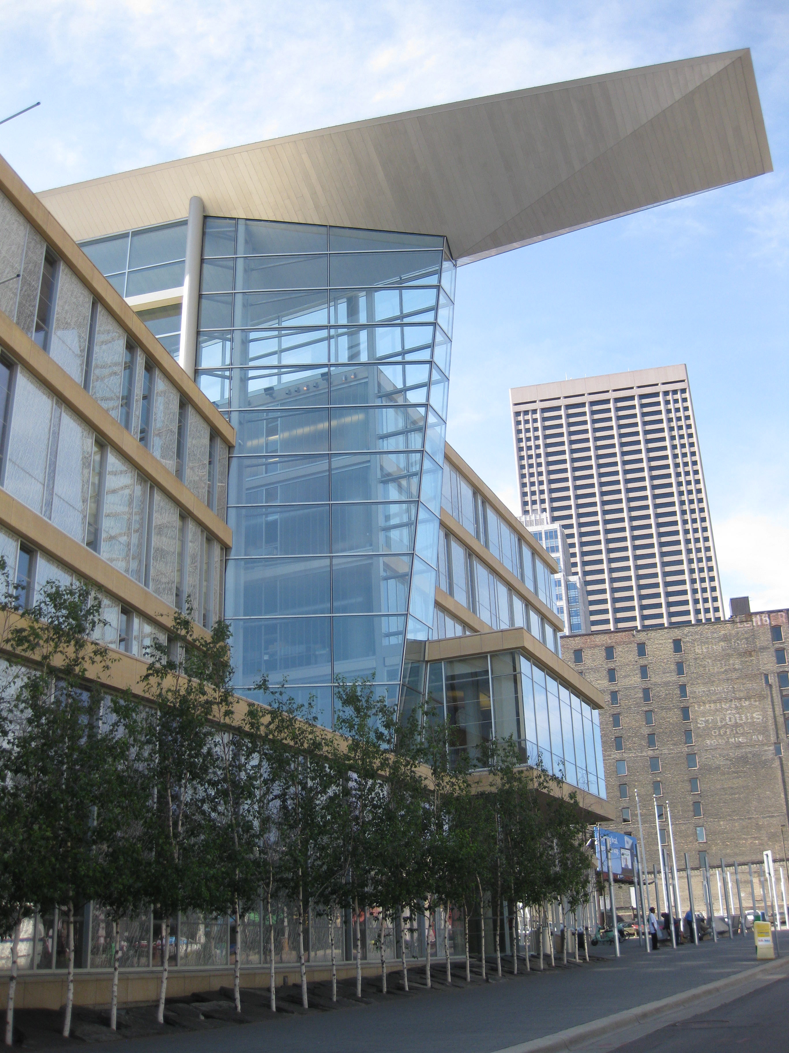
Hennepin County Library is a public library system serving Hennepin County, Minnesota, US. The current iteration of Hennepin County Library was formed by the merger of urban Minneapolis Public Library and suburban Hennepin County Library on January 1, 2008. The system has 41 library locations, deposit collections at nursing homes and correctional facilities, mail service to the homebound, and extensive outreach services. With more than 4 million items in its collection, the Hennepin County Library system is one of the largest public libraries in the United States. The library is a department of Hennepin County Government. The library headquarters are in the Ridgedale Library in suburban Minnetonka. The library system has an eleven-member advisory Library Board appointed by the Hennepin County Board of Commissioners. It is a member of the Metropolitan Library Service Agency, a consortium of eight Twin Cities library systems. History Minneapolis Public Library was founded ... [...More Info...] [...Related Items...] OR: [Wikipedia] [Google] [Baidu] |
Grain Belt (beer)
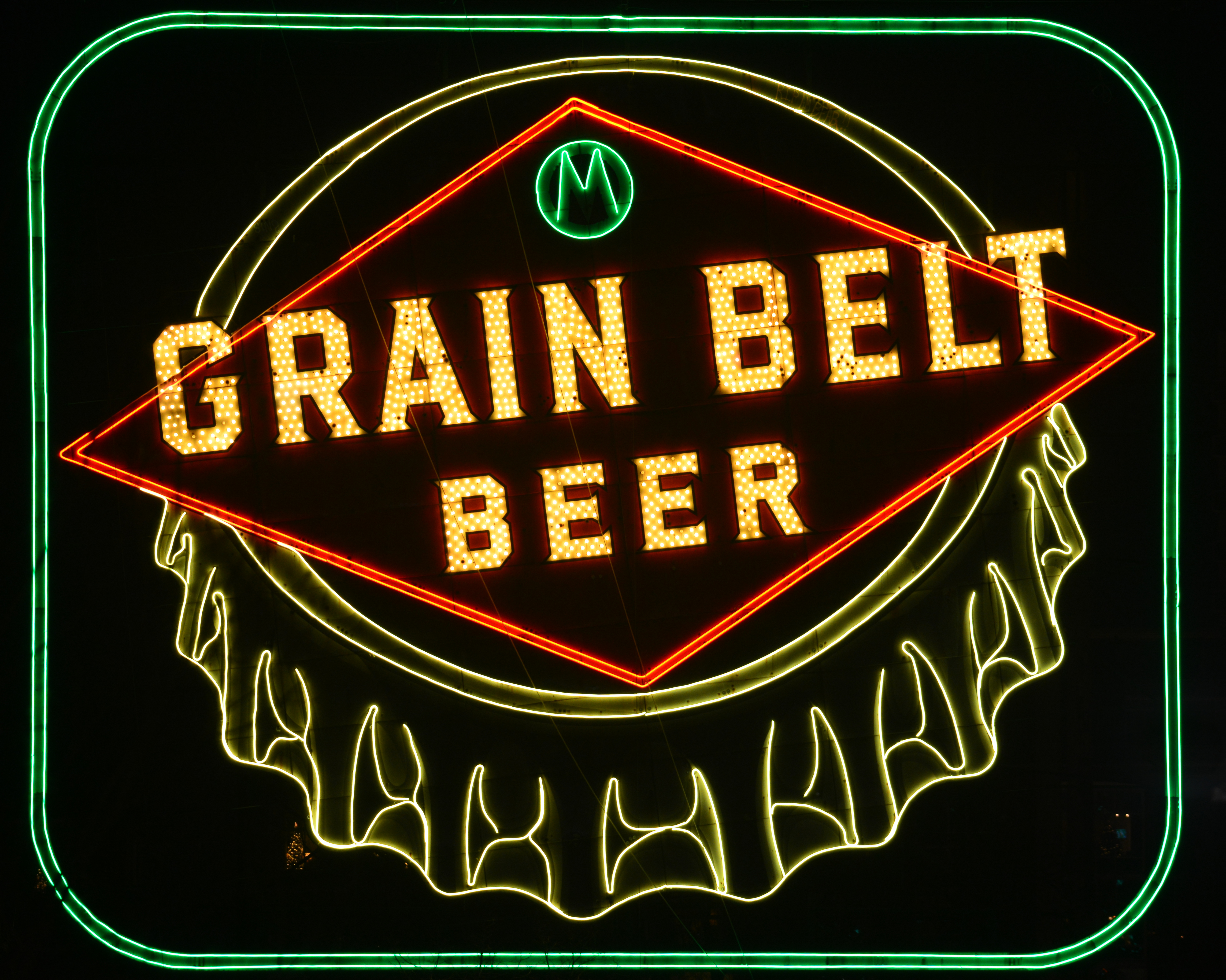
Grain Belt is a brand of beer brewed in the United States, American state of Minnesota, by the August Schell Brewing Company. The beer has been produced in a number of varieties. Grain Belt Golden was the original style introduced in 1893. The current offerings are: Grain Belt Premium, first introduced in 1947; Grain Belt Premium Light; Grain Belt Nordeast, introduced on April 7, 2010; and the newest offering, Grain Belt Lock & Dam, introduced in 2016. It was originally produced by the Minneapolis Brewing Company which formed with the merger of four smaller brewers in 1891. Soon after introduction, Grain Belt became the company's flagship product. It was brewed at the original Grain Belt brewery in Minneapolis, Minnesota until 1976. A series of other owners followed, and Schell took over the product line in 2002. History Name and logo The name refers to the "Grain Belt" of the United States, American Midwest where much of the world's supply of barley, corn, soybeans and other ... [...More Info...] [...Related Items...] OR: [Wikipedia] [Google] [Baidu] |
Philip Sheridan
Philip Henry Sheridan (March 6, 1831 – August 5, 1888) was a career United States Army officer and a Union general in the American Civil War. His career was noted for his rapid rise to major general and his close association with General-in-chief Ulysses S. Grant, who transferred Sheridan from command of an infantry division in the Western Theater to lead the Cavalry Corps of the Army of the Potomac in the East. In 1864, he defeated Confederate forces under General Jubal Early in the Shenandoah Valley and his destruction of the economic infrastructure of the Valley, called "The Burning" by residents, was one of the first uses of scorched-earth tactics in the war. In 1865, his cavalry pursued Gen. Robert E. Lee and was instrumental in forcing his surrender at Appomattox Courthouse. In his later years, Sheridan fought in the Indian Wars against Native American tribes of the Great Plains. He was instrumental in the development and protection of Yellowstone National Park, bo ... [...More Info...] [...Related Items...] OR: [Wikipedia] [Google] [Baidu] |


