|
Shelderton
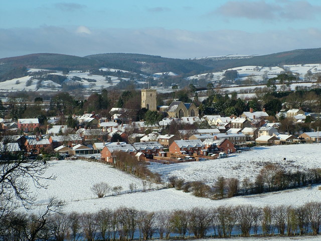
Shelderton is a hamlet in south Shropshire, England. It is located just southeast of the village of Clungunford and is part of that village's civil parish.Ordnance Survey mapping It was a medieval township and belonged to Munslow hundred. The border with Herefordshire is nearby to the south. The small hamlet of Little Common is near to Shelderton, on the B4367 road, and is connected with Shelderton by a footpath (). Also on the B4367, near to where the Leintwardine lane from Shelderton meets the B4367, is a Grade II Listed house called The Lynches (). The nearest market towns are Craven Arms and Ludlow. A Roman road runs through Shelderton, on its way between the Roman fort and settlement at Leintwardine and the city at Wroxeter. There is a Royal Mail post box A post box (British English; also written postbox; also known as pillar box), also known as a collection box, mailbox, letter box or drop box (American English) is a physical box into which members of the public c ... [...More Info...] [...Related Items...] OR: [Wikipedia] [Google] [Baidu] |
Clungunford
Clungunford is a village and civil parish in south Shropshire, England, located near the border with Herefordshire. Village The village features St. Cuthbert's parish church. The River Clun flows just to the west of the village and can be crossed here by Clungunford Bridge. There are no pubs or shops in present times. The parish council runs the website www.clungunford.com which provides information on up and coming events. The village hall ("Clungunford Village Hall"), is managed by a charity and has undergone a full refurbishment in 2019 and has a well stocked bar that is run by a Community Interest Company and is open every Friday night and on other occasions when events are arranged. There is a coffee morning in the hall on the 2nd and 4th Thursdays of the month and a Table Tennis club on Tuesdays. A mobile Post office visits on Thursday for an hour from 11.45 in the car park outsode the Village Hall. The church (St Cuthbert's) is located on the western edge of the set ... [...More Info...] [...Related Items...] OR: [Wikipedia] [Google] [Baidu] |
Munslow (hundred)
Munslow is a hundred of Shropshire, England. It was formed with the amalgamation of the Anglo-Saxon hundreds of Patton and Culvestan during the reign of Henry I (1100 to 1135). Hundreds in England had various judicial, fiscal and other local government functions, their importance gradually declining from the end of manorialism to the latter part of the 19th century. The hundred is named after the village of Munslow, where the hundred's judicial and administrative functions were mostly carried out. The 'hundred house' for Munslow hundred was originally located in neighbouring Aston Munslow, but from the Tudor period was located in Munslow itself. Geography The hundred was divided into "upper" and "lower" divisions (the "lower" division being considerably larger). The hundred reached from All Stretton to the north, down the valleys of the rivers Onny, Corve and Teme, to the Herefordshire border south and west of Ludlow. [...More Info...] [...Related Items...] OR: [Wikipedia] [Google] [Baidu] |
Onibury
Onibury is a village and Civil parishes in England, civil parish on the River Onny in southern Shropshire, about northwest of the market town of Ludlow. The parish includes the hamlets of Walton and Wootton and was extended in 1967 to include parts from Clungunford and Stokesay. It borders the parishes of Clungunford, Stokesay (now part of Craven Arms parish), Bromfield, Shropshire, Bromfield, Culmington and Stanton Lacy. The English country house, country houses of Ferney Hall and Stokesay Court are in the parish. History Toponym The Toponymy, toponym "Onibury" is derived from the Old English for "fortified place on the River Onny". "Onny" means "river on whose banks ash trees grew", from the Welsh language, Welsh "on" meaning ashes. Domesday Book Onibury is recorded in the Domesday Book of 1086 as ''Aneberie''. It had 15 households, making it a fairly medium-sized settlement for the time, and a priest. The Manorialism, manor formed part of the Saxon hundred (county division), ... [...More Info...] [...Related Items...] OR: [Wikipedia] [Google] [Baidu] |
Listed Building
In the United Kingdom, a listed building or listed structure is one that has been placed on one of the four statutory lists maintained by Historic England in England, Historic Environment Scotland in Scotland, in Wales, and the Northern Ireland Environment Agency in Northern Ireland. The term has also been used in the Republic of Ireland, where buildings are protected under the Planning and Development Act 2000. The statutory term in Ireland is "protected structure". A listed building may not be demolished, extended, or altered without special permission from the local planning authority, which typically consults the relevant central government agency, particularly for significant alterations to the more notable listed buildings. In England and Wales, a national amenity society must be notified of any work to a listed building which involves any element of demolition. Exemption from secular listed building control is provided for some buildings in current use for worsh ... [...More Info...] [...Related Items...] OR: [Wikipedia] [Google] [Baidu] |
Royal Mail
, kw, Postya Riel, ga, An Post Ríoga , logo = Royal Mail.svg , logo_size = 250px , type = Public limited company , traded_as = , foundation = , founder = Henry VIII , location = London, England, UK , key_people = * Keith Williams (Non-executive Chairman) * Simon Thompson (CEO) , area_served = United Kingdom , industry = Postal services, courier , products = , services = Letter post, parcel service, EMS, delivery, freight forwarding, third-party logistics , revenue = £12.638 billion(2021) , operating_income = £611 million (2021) , net_income = £620 million (2021) , num_employees = 158,592 (2021) , parent = , divisions = * Royal Mail * Parcelforce Worldwide , subsid = * General Logistics Systems * eCourier * StoreFeeder * Intersoft Systems & Programming , homepage = , dissolved = , footnotes = International Distributions Services plc (formerly Royal Mail plc), trading as Royal Mail, is a British multinational post ... [...More Info...] [...Related Items...] OR: [Wikipedia] [Google] [Baidu] |
Wroxeter
Wroxeter is a village in Shropshire, England, which forms part of the civil parish of Wroxeter and Uppington, beside the River Severn, south-east of Shrewsbury. ''Viroconium Cornoviorum'', the fourth largest city in Roman Britain, was sited here, and is gradually being excavated. History Roman Wroxeter, near the end of the Watling Street Roman road that ran across Romanised Celtic Britain from '' Dubris'' (Dover), was a key frontier position lying on the bank of the Severn river whose valley penetrated deep into what later became Wales following brytons fall to the Anglo Saxons, and also on a route to the south leading to the Wye valley. Archaeology has shown that the site of the later city first was established about AD 55 as a frontier post for a Thracian legionary cohort located at a fort near the Severn river crossing. A few years later a legionary fortress (''castrum'') was built within the site of the later city for the Legio XIV Gemina during their invasion o ... [...More Info...] [...Related Items...] OR: [Wikipedia] [Google] [Baidu] |
Leintwardine
Leintwardine ( ) is a small to mid-size village and civil parish in north Herefordshire, England, close to the border with Shropshire. History Roman A popular misconception is that the Romans called the village ''Branogenium''. Branogenium in fact refers to a Roman fort roughly south of the village. The Roman name for Leintwardine was actually ''Bravonium''. The High Street in Leintwardine is on the same line as the Roman road known (to the English) as Watling Street. (The modern-day street in the village named Watling Street runs to the east of the original Watling Street, roughly on the alignment of the eastern edge of the Roman settlement.) The name Bravonium, as it appears in the Antonine Itinerary (Iter XII), is derived from the Romano-British word for quern. This suggests that there was either a hill or rock formation here that looked like a quern, or that there were quern quarries nearby. In the Upper Silurian series, the Leintwardine beds outcrop in the area and these ... [...More Info...] [...Related Items...] OR: [Wikipedia] [Google] [Baidu] |
Roman Road
Roman roads ( la, viae Romanae ; singular: ; meaning "Roman way") were physical infrastructure vital to the maintenance and development of the Roman state, and were built from about 300 BC through the expansion and consolidation of the Roman Republic and the Roman Empire. They provided efficient means for the overland movement of armies, officials, civilians, inland carriage of official communications, and trade goods. Roman roads were of several kinds, ranging from small local roads to broad, long-distance highways built to connect cities, major towns and military bases. These major roads were often stone-paved and metaled, cambered for drainage, and were flanked by footpaths, bridleways and drainage ditches. They were laid along accurately surveyed courses, and some were cut through hills, or conducted over rivers and ravines on bridgework. Sections could be supported over marshy ground on rafted or piled foundations.Corbishley, Mike: "The Roman World", page 50. Warwick Pr ... [...More Info...] [...Related Items...] OR: [Wikipedia] [Google] [Baidu] |
Ludlow
Ludlow () is a market town in Shropshire, England. The town is significant in the history of the Welsh Marches and in relation to Wales. It is located south of Shrewsbury and north of Hereford, on the A49 road (Great Britain), A49 road which bypasses the town. The town is near the confluence of the rivers River Corve, Corve and River Teme, Teme. The oldest part is the medieval Defensive wall, walled town, founded in the late 11th century after the Norman Conquest, Norman conquest of England. It is centred on a small hill which lies on the eastern bank of a bend of the River Teme. Situated on this hill are Ludlow Castle and the parish church, St Laurence's Church, Ludlow, St Laurence's, the largest in the county. From there the streets slope downward to the rivers River Corve, Corve and River Teme, Teme, to the north and south respectively. The town is in a sheltered spot beneath Mortimer Forest and the Clee Hills, which are clearly visible from the town. Ludlow has nearly 500 ... [...More Info...] [...Related Items...] OR: [Wikipedia] [Google] [Baidu] |
Craven Arms
Craven Arms is a market town and civil parish in Shropshire, England, on the A49 road and the Welsh Marches railway line, which link it north and south to the larger towns of Shrewsbury and Ludlow respectively. The Heart of Wales railway line joins the Welsh Marches line at Craven Arms and the town is served by Craven Arms railway station. The town is enclosed to the north by the Shropshire Hills Area of Outstanding Natural Beauty, and to the south is the fortified manor house of Stokesay Castle. Craven Arms is a market town for the surrounding rural area, with a number of shops, banks, estate agents, a supermarket, an abattoir and many commercial/light industrial businesses. It is also a visitor destination, being home or nearby to a number of attractions, and being central for visitors to the area of outstanding natural beauty. It describes itself as the "Gateway to the Marches". History Craven Arms is a relatively new town (for Shropshire), being only a small village calle ... [...More Info...] [...Related Items...] OR: [Wikipedia] [Google] [Baidu] |
Market Town
A market town is a Human settlement, settlement most common in Europe that obtained by custom or royal charter, in the Middle Ages, a market right, which allowed it to host a regular marketplace, market; this distinguished it from a village or city. In Britain, small rural towns with a hinterland of villages are still commonly called market towns, as sometimes reflected in their names (e.g. Downham Market, Market Rasen, or Market Drayton). Modern markets are often in special halls, but this is a recent development, and the rise of permanent retail establishments has reduced the need for periodic markets. Historically the markets were open-air, held in what is usually called (regardless of its actual shape) the market square (or "Market Place" etc), and centred on a market cross (mercat cross in Scotland). They were and are typically open one or two days a week. History The primary purpose of a market town is the provision of goods and services to the surrounding locality. Al ... [...More Info...] [...Related Items...] OR: [Wikipedia] [Google] [Baidu] |
Hundred (county Division)
A hundred is an administrative division that is geographically part of a larger region. It was formerly used in England, Wales, some parts of the United States, Denmark, Southern Schleswig, Sweden, Finland, Norway, the Bishopric of Ösel–Wiek, Curonia, the Ukrainian state of the Cossack Hetmanate and in Cumberland County in the British Colony of New South Wales. It is still used in other places, including in Australia (in South Australia and the Northern Territory). Other terms for the hundred in English and other languages include '' wapentake'', ''herred'' (Danish and Bokmål Norwegian), ''herad'' ( Nynorsk Norwegian), ''hérað'' (Icelandic), ''härad'' or ''hundare'' (Swedish), ''Harde'' (German), ''hiird'' ( North Frisian), '' satakunta'' or ''kihlakunta'' (Finnish), ''kihelkond'' (Estonian), ''kiligunda'' (Livonian), ''cantref'' (Welsh) and '' sotnia'' (Slavic). In Ireland, a similar subdivision of counties is referred to as a barony, and a hundred is a subdivision ... [...More Info...] [...Related Items...] OR: [Wikipedia] [Google] [Baidu] |


.jpg)

.jpg)