|
Sheikh Badr
Al-Shaykh Badr (, also transliterated ''Sheikh Bader'') is a city in western Syria, administratively part of the Tartus Governorate. Al-Shaykh Badr has an altitude of . According to the Syria Central Bureau of Statistics (CBS), al-Shaykh Badr, which is the center of its '' nahiya'' (subdistrict), had a population of 9,486 in the 2004 census. The town is predominantly populated by Alawites. As of 2008, its subdistrict had a population of 47,982. The town is named after the shrine of a holy man, Shaykh Badr, located within it. History Ottoman period The modern city of al-Shaykh Badr includes the village of Murayqib, which was recorded as a village throughout the Ottoman period (1517–1918). Tax records from 1519 and 1524 each recorded that the village paid 186 '' dirhems'' or piasters, rising to 396 ''dirhems'' in 1547 and 1,600 ''dirhems'' in 1645. During the ten-year period when Muhammad Ali's Egypt controlled Syria, the governor Ibrahim Pasha dispatched 500 Druze warriors t ... [...More Info...] [...Related Items...] OR: [Wikipedia] [Google] [Baidu] |
Syria
Syria, officially the Syrian Arab Republic, is a country in West Asia located in the Eastern Mediterranean and the Levant. It borders the Mediterranean Sea to the west, Turkey to Syria–Turkey border, the north, Iraq to Iraq–Syria border, the east and southeast, Jordan to Jordan–Syria border, the south, and Israel and Lebanon to Lebanon–Syria border, the southwest. It is a republic under Syrian transitional government, a transitional government and comprises Governorates of Syria, 14 governorates. Damascus is the capital and largest city. With a population of 25 million across an area of , it is the List of countries and dependencies by population, 57th-most populous and List of countries and dependencies by area, 87th-largest country. The name "Syria" historically referred to a Syria (region), wider region. The modern state encompasses the sites of several ancient kingdoms and empires, including the Eblan civilization. Damascus was the seat of the Umayyad Caliphate and ... [...More Info...] [...Related Items...] OR: [Wikipedia] [Google] [Baidu] |
Ibrahim Pasha Of Egypt
Ibrahim Pasha ( ''Ibrāhīm Bāshā''; 1789 – 10 November 1848) was an Egyptian general and politician; he was the commander of both the Egyptian and Ottoman armies and the eldest son of Muhammad Ali, the Ottoman Wāli and unrecognized Khedive of Egypt and Sudan. He was the second ruler of Egypt from the Muhammad Ali Dynasty and ruled from 20 July 1848 to 10 November 1848. Ibrahim served as a general in the Egyptian army that his father established during his reign, taking his first command of Egyptian forces when he was merely a teenager. In the final year of his life, he was appointed Regent for his still-living father and became the effective ruler of Egypt and Sudan, owing to the latter's ill health. His rule also extended over the other dominions that his father had brought under Egyptian rule, namely Syria, Hejaz, Morea, Thasos, and Crete. Ibrahim pre-deceased his father, dying 10 November 1848, only four months after rising to power. He was succeeded as Regent by his n ... [...More Info...] [...Related Items...] OR: [Wikipedia] [Google] [Baidu] |
Comprehensive Planning
Comprehensive planning is an ordered process that determines community goals and aspirations in terms of community development. The end product is called a comprehensive plan, also known as a general plan, or master plan. This resulting document expresses and regulates public policies on transportation, utilities, land use, recreation, and housing. Comprehensive plans typically encompass large geographical areas, a broad range of topics, and cover a long-term time horizon. The term comprehensive plan is most often used by urban planners in the United States. Each city and county adopts and updates their plan to guide the growth and land development of their community, for both the current period and the long term. This "serious document" is then the foundation for establishing goals, purposes, zoning and activities allowed on each land parcel to provide compatibility and continuity to the entire region as well as each individual neighborhood. It has been one of the most importa ... [...More Info...] [...Related Items...] OR: [Wikipedia] [Google] [Baidu] |
Mausoleum
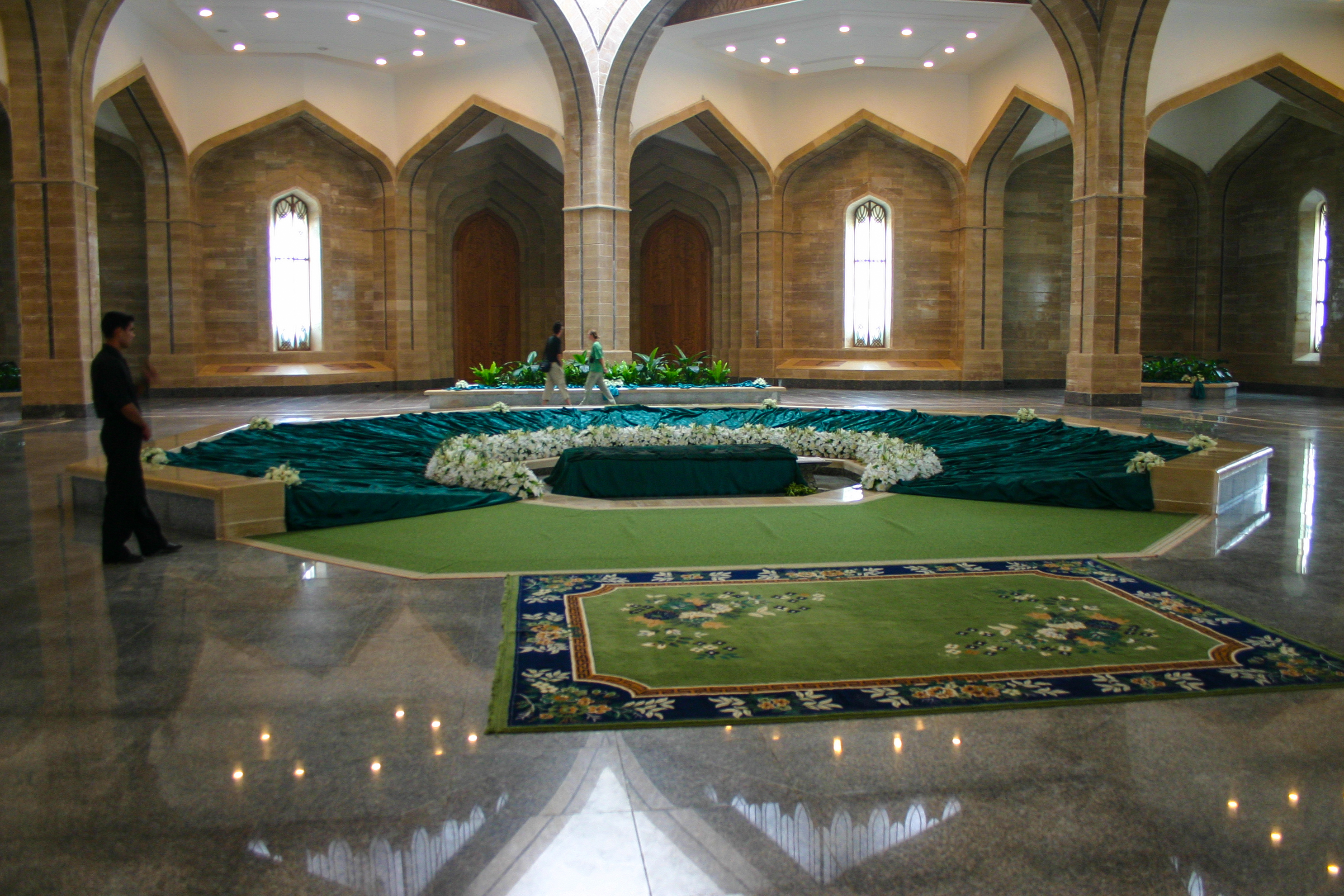
A mausoleum is an external free-standing building constructed as a monument enclosing the burial chamber of a deceased person or people. A mausoleum without the person's remains is called a cenotaph. A mausoleum may be considered a type of tomb, or the tomb may be considered to be within the mausoleum. Overview The word ''mausoleum'' (from the ) derives from the Mausoleum at Halicarnassus (near modern-day Bodrum in Turkey), the grave of King Mausolus, the Persian satrap of Caria, whose large tomb was one of the Seven Wonders of the Ancient World. Mausolea were historically, and still may be, large and impressive constructions for a deceased leader or other person of importance. However, smaller mausolea soon became popular with the gentry and nobility in many countries. In the Roman Empire, these were often in necropoles or along roadsides: the via Appia Antica retains the ruins of many private mausolea for kilometres outside Rome. When Christianity became domin ... [...More Info...] [...Related Items...] OR: [Wikipedia] [Google] [Baidu] |
Syrian Army
The Syrian Army is the land force branch of the Syrian Armed Forces. Up until the fall of the Assad regime, the Syrian Arab Army existed as a land force branch of the Syrian Arab Armed Forces, which dominanted the military service of the four uniformed services, controlling the most senior posts in the armed forces, and had the greatest manpower, approximately 80 percent of the combined services.. The Syrian Army originated in local military forces formed by the French after World War I, after France obtained a mandate over the region. It officially came into being in 1945, before Syria obtained full independence the following year and 2 years after official independance. After 1946, it played a major role in Syria's governance, mounting six military coups: two in 1949, including the March 1949 Syrian coup d'état and the August 1949 coup by Colonel Sami al-Hinnawi, and one each in 1951, 1954, 1963, 1966, and 1970. It fought four wars with Israel (1948, the Six-Day War in ... [...More Info...] [...Related Items...] OR: [Wikipedia] [Google] [Baidu] |
Qardaha
Qardaha ( / ALA-LC: ''Qardāḥah'') is a town in northwestern Syria, in the mountains overlooking the coastal town of Latakia. Nearby localities include Kilmakho to the west, Bustan al-Basha to the southwest, Harf al-Musaytirah to the southeast and Muzayraa to the north. According to the Syrian Central Bureau of Statistics, Qardaha had a population of 8,671 in 2004.General Census of Population and Housing 2004 Syrian Central Bureau of Statistics (CBS). Latakia Governorate. It has a predominantly |
Duraykish
Duraykish (, also transliterated ''Dreikiche'' or ''Dreykish'') is a city in western Syria, in the Tartus Governorate, at a distance of about east of Tartus. The name 'Dreikiche' derives from Latin and means "three caves". The town is famous for its mineral water springs located to the south of the city. The mineral water of the town is bottled and sold under the label 'Dreikiche'. Its inhabitants are mostly Alawites. Geography The city sits on a hillside, near the opening of two valleys, with the older part of town divided into two parts by an elevation of about . The average elevation of old Duraykish is between and above sea level. The commercial center of old Duraykish is on the east side of the city. The newer, lower part of town, al-Maqla'a, is situated about below the city center. History Duraykish was the largest Alawite community in the Syrian Coastal Mountain Range from the mid-19th century until the 1960s. As a village of roughly 1,000 inhabitants, Duraykish was ch ... [...More Info...] [...Related Items...] OR: [Wikipedia] [Google] [Baidu] |
Al-Shaykh Badr District
Al-Shaykh Badr District () is a district of the Tartus Governorate in northwestern Syria. Administrative centre is the town of al-Shaykh Badr Al-Shaykh Badr (, also transliterated ''Sheikh Bader'') is a city in western Syria, administratively part of the Tartus Governorate. Al-Shaykh Badr has an altitude of . According to the Syria Central Bureau of Statistics (CBS), al-Shaykh Badr, w .... At the 2004 census, the district had a population of 52,981. Sub-districts The district of al-Shaykh Badr is divided into three sub-districts or nawāḥī (population as of 2004): * Al-Shaykh Badr Subdistrict (ناحية الشيخ بدر): population 25,324. * Brummanet al-Mashayekh Subdistrict (ناحية برمانة المشايخ): population 13,562 * Al-Qamsiyah Subdistrict (ناحية القمصية): population 14,095. References {{TartusSY-geo-stub ... [...More Info...] [...Related Items...] OR: [Wikipedia] [Google] [Baidu] |
Districts Of Syria
The 14 governorates of Syria, or ''muhafazat'' (sing. ''muhafazah''), are divided into 65 districts, or ''manatiq'' (sing. ''mintaqah''), including the city of Damascus. The districts are further divided into 281 subdistricts, or ''nawahi'' (sing. ''nahiya''). Each district bears the same name as its district capital. Districts and subdistricts are administered by officials appointed by the governor, subject to the approval of the minister of the interior. These officials work with elected district councils to attend to assorted local needs, and serve as intermediaries between central government authority and traditional local leaders, such as village chiefs, clan leaders, and councils of elders. List of districts The 65 districts are listed below by governorate (with capital districts in bold text). The city of Damascus functions as a governorate, a district and a subdistrict. Parts of Quneitra Governorate have been under Israeli-occupied territories, Israeli occupation since 19 ... [...More Info...] [...Related Items...] OR: [Wikipedia] [Google] [Baidu] |
Bashraghi
Bashraghi () is a village in northwestern Syria, administratively part of the Jableh District of the Latakia Governorate. According to the Syria Central Bureau of Statistics, Bashraghi had a population of 657 in the 2004 census.General Census of Population and Housing 2004 Syria Central Bureau of Statistics (CBS). Latakia Governorate. Its inhabitants are Alawites
Alawites () are an Arab ethnoreligious group who live primarily in the Levant regio ...
[...More Info...] [...Related Items...] OR: [Wikipedia] [Google] [Baidu] |
French Mandate Of Syria
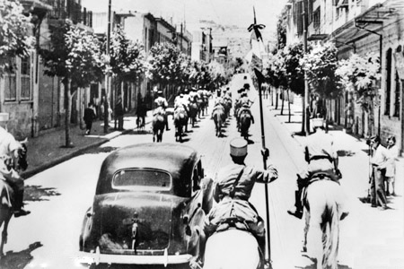
The Mandate for Syria and the Lebanon (; , also referred to as the Levant States; 1923−1946) was a League of Nations mandate founded in the aftermath of the First World War and the partitioning of the Ottoman Empire, concerning the territories of Syria (region), Syria and Lebanon. The mandate system was supposed to differ from colonialism, with the governing country intended to act as a trustee until the inhabitants were considered eligible for self-government. At that point, the mandate would terminate and a sovereign state would be born. During the two years that followed the end of the war in 1918—and in accordance with the Sykes–Picot Agreement signed by the United Kingdom and France during the war—the British held control of most of Ottoman Iraq (now Iraq) and the southern part of Ottoman Syria (now Israel, Palestine (region), Palestine and Transjordan (region), Transjordan), while the French controlled the rest of Ottoman Syria (including History of Lebanon under Ott ... [...More Info...] [...Related Items...] OR: [Wikipedia] [Google] [Baidu] |


