|
Schwarzhorn (other)
Schwarzhorn may refer to mountains/peaks in: Austria * Tilisuna-Schwarzhorn (2460 m), in the Rätikon range, in Vorarlberg Italy * Schwarzhorn/Corno Nero (Monte Rosa) (4321 m), part of the Monte Rosa massif, on southern side of the Pennine Alps, in Italy just next to Swiss border (Ludwigshöhe) * Schwarzhorn (South Tyrol)/Corno Nero (2439 m) in South Tyrol Switzerland *Schwarzhorn (Bernese Alps) (2928 m), in the Bernese Alps between Brienz and Grindelwald (BE) * Schwarzhorn (Binntal)/Punta Marani (3108 m), on the border to Italy in canton of Valais (VS), between the Binntal (Valais) and the Valle Dèvero (Piedmont) * Schwarzhorn (Flüela) (3146 m), near Flüela Pass, Albula Alps (GR) * Piz Gren/Schwarzhorn (2890 m), part of the Lepontine Alps, above Obersaxen, Vorderrhein (GR) * Schwarzhorn (Mattertal) (3201 m), near St. Niklaus (VS), west of Embd * Parpaner Schwarzhorn (2683 m), in the Grisons (GR), between Arosa and Lenzerheide * Schwarzhorn (Rätikon) (2574 m), part of the Räti ... [...More Info...] [...Related Items...] OR: [Wikipedia] [Google] [Baidu] |
Tilisuna-Schwarzhorn
Tilisuna-Schwarzhorn (also called Schwarzhara) is a mountain in the Sulzfluh sub-range of the Rätikon mountain range in the Austrian state Vorarlberg. It has elevation , with a long ridge from north to south and wide scarps east and west. Besides the main summit, there is a second summit called Kleines Schwarzhorn. Both summits are separated by the col Fürkele. The alpine club hut Tilisunahütte (2208 m) is located near the Tilisuna-Schwarzhorn. The first ascensionists of Tilisuna-Schwarzhorn were land surveyors in 1853. Nowadays there are two common routes to the summit: * Easiest route: From south starting at Tilisunahütte via the saddle Schwarze Scharte in 45 to 75 minutes; some parts UIAA grade In rock climbing, mountaineering, and other climbing disciplines, climbers give a grade to a climbing route or boulder problem, intended to describe concisely the difficulty and danger of climbing it. Different types of climbing (such as spor ... II, mostly grade I. Thi ... [...More Info...] [...Related Items...] OR: [Wikipedia] [Google] [Baidu] |
Parpaner Schwarzhorn
The Parpaner Schwarzhorn is a mountain of the Plessur Alps, overlooking Parpan Parpan was a municipality in the district Plessur of the canton of Graubünden in Switzerland. On 1 January 2010 the municipalities of Malix and Parpan merged into Churwalden. History Parpan is first mentioned in 1208 as ''Partipan''. Former ... in the canton of Graubünden. It lies north of the Parpaner Weisshorn. References External linksParpaner Schwarzhorn on Hikr Mountains of the Alps Mountains of Switzerland Mountains of Graubünden {{Graubünden-geo-stub ... [...More Info...] [...Related Items...] OR: [Wikipedia] [Google] [Baidu] |
Illhorn
The Illhorn is a mountain of the Swiss Pennine Alps, overlooking Chandolin in the canton of Valais. With a height of 2,717 metres above sea level, it is the highest point of the Illgraben valley. Illgraben debris flows The Illgraben catchment extends from the summit of the Illhorn to the Rhone at an elevation of 610m, and experiences debris flows and mud slide A mudflow or mud flow is a form of mass wasting involving fast-moving flow of debris that has become liquified by the addition of water. Such flows can move at speeds ranging from 3 meters/minute to 5 meters/second. Mudflows contain a significa ...s several times annually. The largest recorded debris flow in the valley occurred in June 1961, and had a volume of several hundred thousand cubic metres. A warning system gives alert signals 5–15 minutes before the arrival of debris flows at channel crossings. The area is a popular hiking spot and these geomorphological processes are visible most years. References ... [...More Info...] [...Related Items...] OR: [Wikipedia] [Google] [Baidu] |
Schwarzhorn (Pennine Alps)
Schwarzhorn may refer to mountains/peaks in: Austria *Tilisuna-Schwarzhorn (2460 m), in the Rätikon range, in Vorarlberg Italy * Schwarzhorn/Corno Nero (Monte Rosa) (4321 m), part of the Monte Rosa massif, on southern side of the Pennine Alps, in Italy just next to Swiss border (Ludwigshöhe) * Schwarzhorn (South Tyrol)/Corno Nero (2439 m) in South Tyrol Switzerland *Schwarzhorn (Bernese Alps) (2928 m), in the Bernese Alps between Brienz and Grindelwald (BE) * Schwarzhorn (Binntal)/Punta Marani (3108 m), on the border to Italy in canton of Valais (VS), between the Binntal (Valais) and the Valle Dèvero (Piedmont) * Schwarzhorn (Flüela) (3146 m), near Flüela Pass, Albula Alps (GR) * Piz Gren/Schwarzhorn (2890 m), part of the Lepontine Alps, above Obersaxen, Vorderrhein (GR) * Schwarzhorn (Mattertal) (3201 m), near St. Niklaus (VS), west of Embd *Parpaner Schwarzhorn (2683 m), in the Grisons (GR), between Arosa and Lenzerheide * Schwarzhorn (Rätikon) (2574 m), part of the Rätiko ... [...More Info...] [...Related Items...] OR: [Wikipedia] [Google] [Baidu] |
Schwarzhorn (Wildstrubel Massif)
The Schwarzhorn is a mountain of the Bernese Alps, located west of Leukerbad in the canton of Valais. It lies approximately halfway between the Wildstrubel and the Gemmi Pass Gemmi Pass is a high mountain pass across the Bernese Alps connecting Leukerbad (on the south) in the canton of Valais with Kandersteg (on the north) in the canton of Bern. The pass itself lies within the canton of Valais, at a height of abov .... Politically, the Schwarzhorn belongs to the municipalities of Leukerbad, Inden and Mollens. References External links Schwarzhorn on Hikr Bernese Alps Mountains of the Alps Alpine three-thousanders Mountains of Valais Mountains of Switzerland {{Valais-geo-stub ... [...More Info...] [...Related Items...] OR: [Wikipedia] [Google] [Baidu] |
Schwarzhorn (Vals)
The Schwarzhorn is a mountain of the Swiss Lepontine Alps, located west of Vals in the canton of Graubünden. It lies on the range between the Lumnezia and the Valser Tal, south of the Faltschonhorn The Faltschonhorn is a mountain of the Swiss Lepontine Alps, located west of Vals in the canton of Graubünden. It lies on the range between the Val Lumnezia and the Valser Tal, south of Piz Aul Piz Aul is a mountain of the Lepontine Alps, .... References External links Schwarzhorn on Hikr Mountains of the Alps Mountains of Graubünden Lepontine Alps Mountains of Switzerland {{Graubünden-geo-stub ... [...More Info...] [...Related Items...] OR: [Wikipedia] [Google] [Baidu] |
Hinter Grauspitz
The Hinter Grauspitz (also known as ''Schwarzhorn'') is a mountain on the border of Switzerland and Liechtenstein in the Rätikon range of the Eastern Alps Eastern Alps is the name given to the eastern half of the Alps, usually defined as the area east of a line from Lake Constance and the Alpine Rhine valley up to the Splügen Pass at the Alpine divide and down the Liro River to Lake Como in t .... With a height of above sea level, it is the second highest summit in Liechtenstein. References * * * External linksHinter Grauspitz on Hikr Mountains of Liechtenstein Mountains of Switzerland Liechtenstein–Switzerland border International mountains of Europe Mountains of Graubünden Mountains of the Alps Two-thousanders of Switzerland {{Graubünden-mountain-stub ... [...More Info...] [...Related Items...] OR: [Wikipedia] [Google] [Baidu] |
Schwarzhorn (Rätikon)
The Schwarzhorn is a mountain on the border of Switzerland and Liechtenstein in the Rätikon range of the Eastern Alps Eastern Alps is the name given to the eastern half of the Alps, usually defined as the area east of a line from Lake Constance and the Alpine Rhine valley up to the Splügen Pass at the Alpine divide and down the Liro River to Lake Como in t .... With a height of or above sea level, it is the second highest summit in Liechtenstein. Sometimes the mountain is listed as ''Hinter-Grauspitz'', but according to reference book "Die Orts- und Flurnamen des Fürstentums Liechtenstein", these are two different mountain peaks. References Maps * * * External links The Tallest Mountains In LiechtensteinSchwarzhorn on Peakbagger Mountains of Liechtenstein Mountains of Switzerland Liechtenstein–Switzerland border International mountains of Europe Mountains of Graubünden Mountains of the Alps Two-thousanders of Switzerland {{Graubünden-mount ... [...More Info...] [...Related Items...] OR: [Wikipedia] [Google] [Baidu] |
Schwarzhorn (Mattertal)
The Schwarzhorn is a mountain of the Swiss Pennine Alps, overlooking the Augstbord Pass in the canton of Valais. It lies on the range between the Turtmanntal and the Mattertal The Matter Valley (German: Mattertal, or sometimes ''Nikolaital'') is located in southwestern Switzerland, south of the Rhone valley in the canton of Valais. The village of Zermatt is the most important settlement of the valley, which is surrou .... References External links Schwarzhorn on Hikr Mountains of the Alps Alpine three-thousanders Mountains of Switzerland Mountains of Valais {{valais-mountain-stub ... [...More Info...] [...Related Items...] OR: [Wikipedia] [Google] [Baidu] |
Rätikon
The Rätikon is a mountain range of the Central Eastern Alps, located at the border between Vorarlberg, Liechtenstein and Graubünden. It is the geological border between the Eastern and Western Alps and stretches from the Montafon as far as the Rhine. In the south, the Prättigau is its limit, and in the north, it is the Walgau. In the east, it borders the Silvretta groups. The Rätikon mountain range derives its name from Raetia, a province of the Roman Empire, named after the Rhaetian ('' Raeti'' or ''Rhaeti'') people. Topography and geology The classification of the Rätikon to the central Eastern Alps is based solely on geographic-geological traditions. Large parts of the Rätikon consist of sedimentary rocks (limestone). From a geological point of view, the north-west Rätikon is assigned to the Northern Limestone Alps, while the South-West Rätikon belongs to the Bündner Schist/Bündner slate of the Western Alps. Peaks Its chief peaks are: * Schesaplana ... [...More Info...] [...Related Items...] OR: [Wikipedia] [Google] [Baidu] |
Piz Gren
Piz Gren (german: Schwarzhorn) is a mountain of the Swiss Lepontine Alps, located between Tenigerbad and Lumbrein in the canton of Graubünden. Its summit () lies near the tripoint between Val Sumvitg, Val Gronda, and Val Miedra Val may refer to: Val-a Film * ''Val'' (film), an American documentary about Val Kilmer, directed by Leo Scott and Ting Poo Military equipment * Aichi D3A, a Japanese World War II dive bomber codenamed "Val" by the Allies * AS Val, a So .... References External links Piz Gren on Hikr Mountains of Switzerland Mountains of Graubünden Mountains of the Alps Lepontine Alps Two-thousanders of Switzerland Lumnezia Sumvitg {{graubünden-mountain-stub ... [...More Info...] [...Related Items...] OR: [Wikipedia] [Google] [Baidu] |
Schwarzhorn (Flüela)
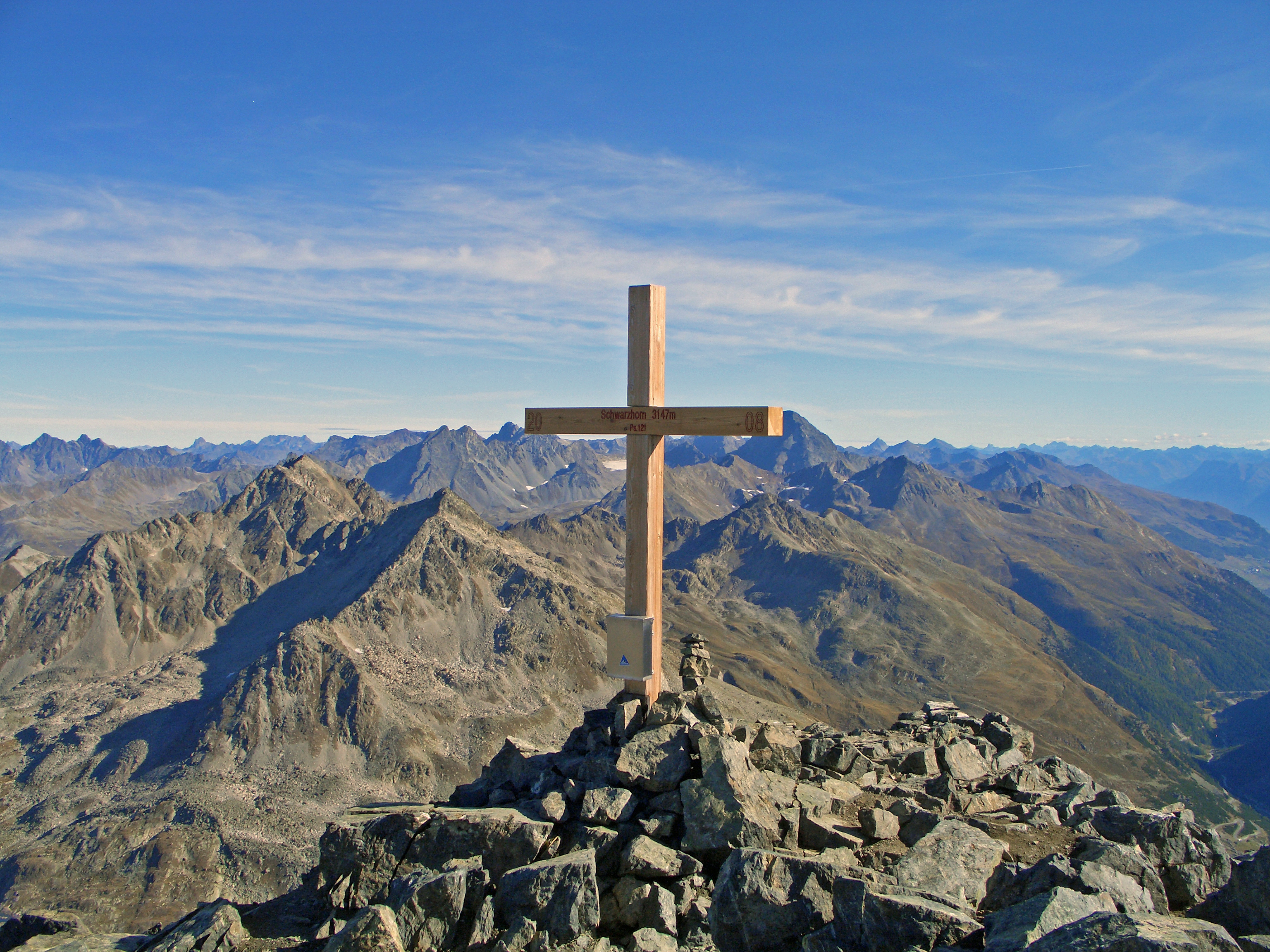
The Flüela Schwarzhorn is a mountain of the Albula Alps, overlooking the Flüela Pass The Flüela Pass (german: Flüelapass, rm, Pass dal Flüela, elevation ) is a high mountain pass of the Swiss Alps in Graubünden. Traditionally considered the boundary between the Albula and Silvretta Alps, the pass crosses the watershed / dra ..., in the canton of Graubünden. With a height of 3,146 metres above sea level, it is the highest point of the Albula Alps north of the Fuorcla da Grialetsch (2,537 m). From the Flüela Pass a trail leads to the summit. References External linksFlüela Schwarzhorn on Hikr Mountains of the Alps Alpine three-thousanders Mountains of Switzerland Mountains of Graubünden Davos Zernez {{graubünden-mountain-stub ... [...More Info...] [...Related Items...] OR: [Wikipedia] [Google] [Baidu] |

