|
Savamala
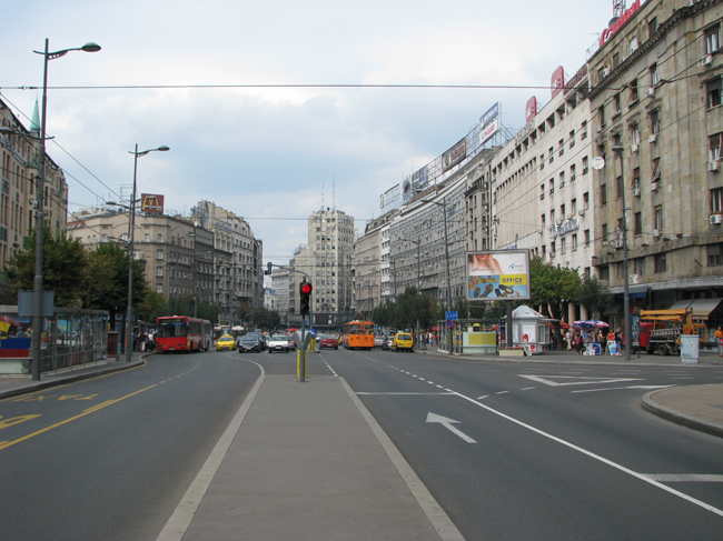
Savamala ( sr-Cyrl, Савамала) is an urban neighborhood of Belgrade, the capital of Serbia. It is located in Belgrade's municipalities of Savski Venac and Stari Grad. Location Savamala is located south of the Kalemegdan fortress and the neighborhood of Kosančićev Venac, and stretches along the right bank of the Sava river. Its northern section belongs to the municipality of Stari Grad, while central and southern sections belong to the municipality of Savski Venac. The central street in the neighborhood is ''Karađorđeva''. Originally, the entire western section ('' Terazije slopes'') of today's city center was called Savamala, roughly bounded by the modern streets and squares of Terazije, '' King Milan's'', Slavija, '' Nemanjina'' and '' Prince Miloš's''. The entire area was known as Zapadni Vračar, but that name completely disappeared from usage, while as Savamala today is considered only a section along the ''Karađorđeva'' street. Today, the zone of "preve ... [...More Info...] [...Related Items...] OR: [Wikipedia] [Google] [Baidu] [Amazon] |
Kosančićev Venac
Kosančićev Venac ( sr-Cyrl, Косанчићев Венац) is an urban neighborhood of Belgrade, the capital of Serbia. It is located in Belgrade's municipality of Stari Grad. It has been described as the most valuable and most representative veduta of Belgrade. In 1971, it was declared a spatial cultural-historical unit and placed under legal protection. Location Kosančićev Venac is located along the elbow-shaped street of the same name, west of downtown Belgrade ( Terazije). It developed on the western edge of the ending section of the ridge of Šumadija geological bar which extends from Terazijska Terasa "via" Obilićev Venac to Kalemegdan, which is a continuation of Kosančićev Venac and overlooks the ''Sava'' port on the Sava river, the northernmost section of the neighborhood of Savamala. On southeast it borders the neighborhood of Zeleni Venac. History Antiquity The Celtic and Roman Castrum occupied part of today's Belgrade Fortress. Civilian zone spre ... [...More Info...] [...Related Items...] OR: [Wikipedia] [Google] [Baidu] [Amazon] |
Terazijska Terasa
Terazije ( sr-Cyrl, Теразијe) is the central town square and the surrounding neighborhood of Belgrade, Serbia. It is located in the municipality of Stari Grad. Today, Terazije has primarily function of the main transit square, surrounded by the important public buildings, cultural institutions, hotels, public monuments and parks. Though not classically shaped square, Terazije was historically important as the gathering spot and the former business and commercial center of Belgrade. With the Knez Mihailova Street, which extends to the northeast connecting directly Terazije and Belgrade Fortress, the square is one of the oldest and most recognizable ambience units of Belgrade. Due to its historical and cultural importance, Terazije was declared a protected spatial cultural-historical unit in January 2020. Location Despite the fact that many Belgraders consider the Republic Square or Kalemegdan to be the city's centerpiece areas, Terazije is Belgrade's designated cente ... [...More Info...] [...Related Items...] OR: [Wikipedia] [Google] [Baidu] [Amazon] |
Terazije
Terazije ( sr-Cyrl, Теразијe) is the central town square and the surrounding neighborhood of Belgrade, Serbia. It is located in the municipality of Stari Grad, Belgrade, Stari Grad. Today, Terazije has primarily function of the main transit square, surrounded by the important public buildings, cultural institutions, hotels, public monuments and parks. Though not classically shaped square, Terazije was historically important as the gathering spot and the former business and commercial center of Belgrade. With the Knez Mihailova Street, which extends to the northeast connecting directly Terazije and Belgrade Fortress, the square is one of the oldest and most recognizable ambience units of Belgrade. Due to its historical and cultural importance, Terazije was declared a protected spatial cultural-historical unit in January 2020. Location Despite the fact that many Belgraders consider the Republic Square (Belgrade), Republic Square or Kalemegdan to be the city's centerpiece ... [...More Info...] [...Related Items...] OR: [Wikipedia] [Google] [Baidu] [Amazon] |
Zeleni Venac
Zeleni Venac ( sr-Cyrl, Зелени венац) or colloquially Zelenjak ( sr-Cyrl, Зелењак) is an List of Belgrade neighborhoods, urban neighborhood of Belgrade, the capital of Serbia. It is located in the Belgrade's municipalities of Savski Venac (major part) and Stari Grad, Belgrade, Stari Grad. Location Zeleni Venac is located in downtown Belgrade, just few minutes away to the east of Terazije, the designated center of the city, down the Prizrenska or Sremska streets. It borders the neighborhood of Savamala to the south, while the northern border is Brankova Street which separates it from the neighborhoods of Kosančićev Venac and Varoš Kapija in the municipality of Stari Grad. The car tunnel (''Terazije#Terazije Tunnel, Terazije Tunnel'') under Terazije connects it to Republic Square (Belgrade), Republic Square while underground pedestrian passage connects it to Terazije and Prince Michael Street via Prizrenska and Sremska streets, respectively. Park Luka Ćelovi� ... [...More Info...] [...Related Items...] OR: [Wikipedia] [Google] [Baidu] [Amazon] |
Subdivisions Of Belgrade
Serbia's capital city of Belgrade is divided into 17 municipality, municipalities. Most of the Municipalities of Serbia, municipalities are situated on the southern side of the Danube and Sava rivers, in the Šumadija region. Three municipalities (Zemun, Novi Beograd, and Surčin) are on the northern bank of the Sava, in the Syrmia region, and the municipality of Palilula (Belgrade), Palilula, spanning the Danube, is in both the Šumadija and Banat regions. Municipalities Governmental structure A municipality is a part of the territory of the City of Belgrade, in which certain operations of local self-government laid down by the City Charter are run. Pursuant to the Constitution, legislation, present Charter and bylaws of the municipality, the citizens participate in conducting operations of the municipality through the councilors elected to the municipal assembly, civil initiative, local citizens’ meeting and referendum. The bodies of the municipality are: *Municipa ... [...More Info...] [...Related Items...] OR: [Wikipedia] [Google] [Baidu] [Amazon] |
Kalemegdan
The Kalemegdan Park (), or simply Kalemegdan ( sr-Cyrl, Калемегдан) is the largest park and the most important historical monument in Belgrade. It is located on a cliff, at the junction of the River Sava and the Danube. Kalemegdan Park, split in two as the Kalemegdan Park#Great Kalemegdan Park, Great and Kalemegdan Park#Little Kalemegdan Park, Little Parks, was developed in the area that once was the town field within the Belgrade Fortress. Today residents often erroneously refer to the entire fortress as the Kalemegdan Fortress or just Kalemegdan, even though the park occupies the smaller part, especially of the historical fortress, and it is some two millennia younger. The fortress, including the Kalemegdan, represents a cultural monument of exceptional importance (from 1979), the area where various sport, cultural and arts events take place, for all generations of Belgraders and numerous visitors of the city. History Pre-park history The name is formed from t ... [...More Info...] [...Related Items...] OR: [Wikipedia] [Google] [Baidu] [Amazon] |
Belgrade
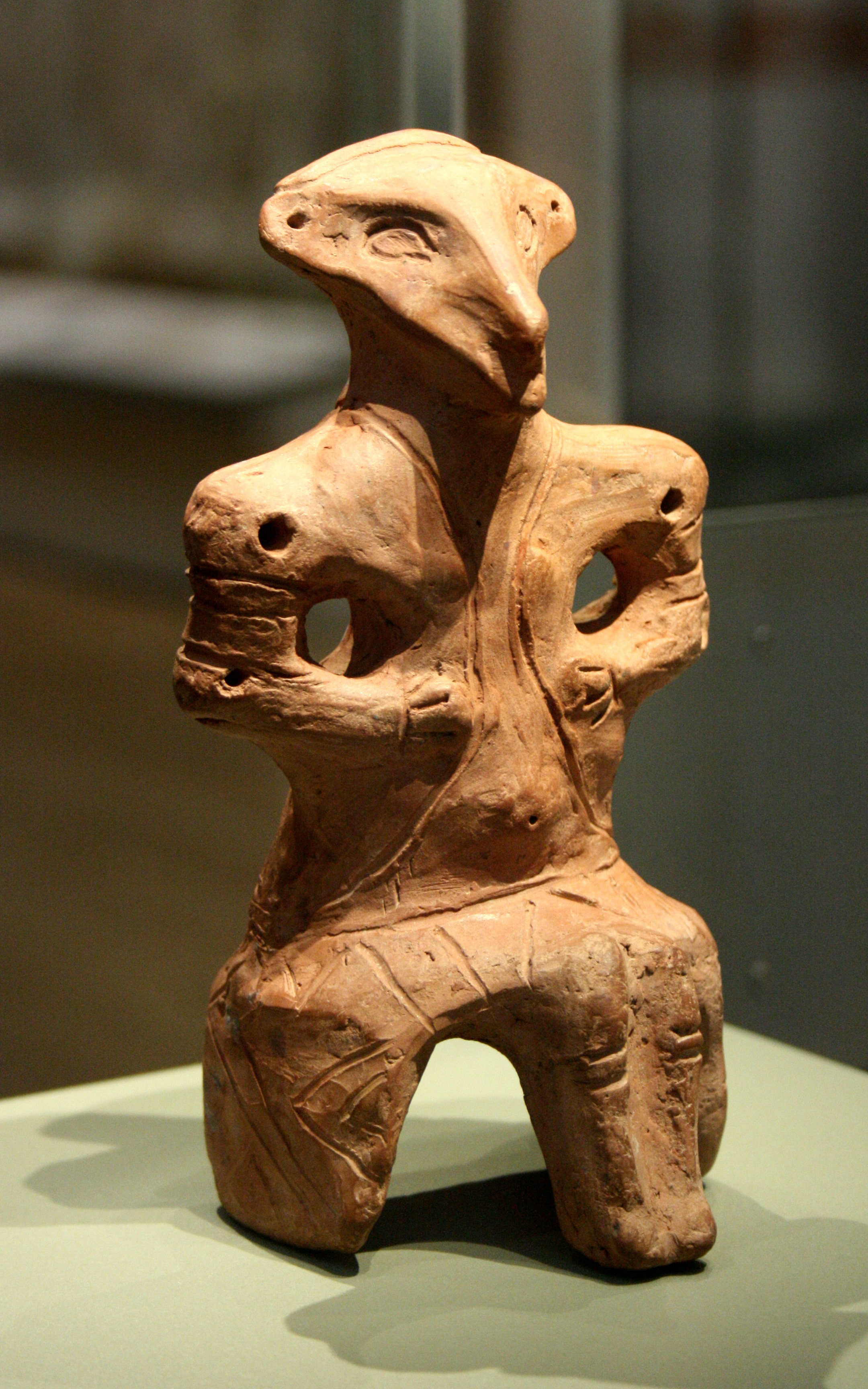
Belgrade is the Capital city, capital and List of cities in Serbia, largest city of Serbia. It is located at the confluence of the Sava and Danube rivers and at the crossroads of the Pannonian Basin, Pannonian Plain and the Balkan Peninsula. The population of the Belgrade metropolitan area is 1,685,563 according to the 2022 census. It is one of the Balkans#Urbanization, major cities of Southeast Europe and the List of cities and towns on the river Danube, third-most populous city on the river Danube. Belgrade is one of the List of oldest continuously inhabited cities, oldest continuously inhabited cities in Europe and the world. One of the most important prehistoric cultures of Europe, the Vinča culture, evolved within the Belgrade area in the 6th millennium BC. In antiquity, Thracians, Thraco-Dacians inhabited the region and, after 279 BC, Celts settled the city, naming it ''Singidunum, Singidūn''. It was Roman Serbia, conquered by the Romans under the reign of Augustus and ... [...More Info...] [...Related Items...] OR: [Wikipedia] [Google] [Baidu] [Amazon] |
Savski Venac
Savski Venac ( sr-cyr, Савски Венац, ) is a municipality of the city of Belgrade. According to the 2022 census results, the municipality has a population of 36,699 inhabitants. It is one of the three municipalities which constitute the very center of Belgrade, together with Stari Grad and Vračar. Savski Venac is located on the right bank of the Sava river. It stretches in the north-south direction for (from downtown Belgrade, just from Terazije, to Banjica) and east-west direction for (from Senjak and the Sava bank to Autokomanda). It borders the municipalities of Stari Grad to the north, Vračar to the north-east, Voždovac to the east, Rakovica to the south and Čukarica to the west. History and name While Savski Venac and Stari Grad are often styled ''the oldest municipalities'' of Belgrade due to their inclusion of the oldest sections of urban Belgrade outside the walls of the Kalemegdan fortress, they are actually the most recently created municipaliti ... [...More Info...] [...Related Items...] OR: [Wikipedia] [Google] [Baidu] [Amazon] |
Slavija (Beograd)
Slavija Square ( sr-cyr, Трг Славија, Trg Slavija) is a major commercial junction between the intersections of Kralja Milana, Beogradska, Makenzijeva, Svetosavska, Bulevar oslobođenja, Deligradska and Nemanjina streets in Belgrade. The square was previously named Dimitrije Tucović Square after the prominent Serbian socialist. Location Slavija is located less than south of Terazije (downtown Belgrade), at an altitude of . The square itself belongs entirely to the municipality of Vračar, though the municipality of Savski Venac begins immediately to the west. The Slavija neighborhood which surrounds the square borders the neighborhoods of Cvetni Trg in the north, Grantovac and Krunski Venac in the north and north-east, and Englezovac and Savinac in the south-east, all in Vračar. The Manjež park is to the north, while West Vračar is to the west, both in Savski Venac. History 19th century Until the 1880s, the area around Slavija was a large pool on the eastern o ... [...More Info...] [...Related Items...] OR: [Wikipedia] [Google] [Baidu] [Amazon] |
Branko's Bridge
Branko's Bridge () is the second-largest bridge (after Gazela) of Belgrade, Serbia, connecting the city center with New Belgrade across the Sava river. Built in 1956 on the foundations of the 1934 King Alexander Bridge, which was destroyed in World War II, it reconnected Belgrade and Zemun as the only motorway bridge at the time. After several official and unofficial names, the present name stuck after the Brankova Street, which extends into the bridge from the direction of the old section of Belgrade. Location On the right (eastern) bank, the bridge starts at the Sava Port, above the ''Karađorđeva'' Street, central street in the neighborhood of Savamala. The bridge is an extension of the ''Brankova'' Street, which delineates it from the neighborhood of Kosančićev Venac on the north and Zeleni Venac on the south. Through the Terazije tunnel, the ''Brankova'' connects it directly to downtown. On the left (western) bank, the bridge enters New Belgrade between the neigh ... [...More Info...] [...Related Items...] OR: [Wikipedia] [Google] [Baidu] [Amazon] |
Miloš Obrenović
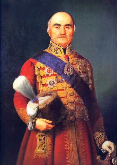
Miloš Obrenović (; ; 18 March 1780 or 1783 – 26 September 1860) born Miloš Teodorović (; ), also known as Miloš the Great () was the Prince of Serbia twice, from 1815 to 1839, and from 1858 to 1860. He was an eminent figure of the First Serbian uprising, the leader of the Second Serbian uprising, and the founder of the house of Obrenović. Under his rule, Serbia became an autonomous principality within the Ottoman Empire. Prince Miloš was an autocrat, consistently refusing to decentralize power, which gave rise to a strong internal opposition. Despite his humble background, he eventually became the most affluent man in Serbia and one of the wealthiest in the Balkans, possessing estates in Vienna, Serbia and Wallachia. During his rule, Miloš bought a certain number of estates and ships from the Ottomans and was also a prominent trader. Early life Miloš Teodorović was the son of Teodor "Teša" Mihailović (died 1802) from Dobrinja, and Višnja (died 18 June 1817). ... [...More Info...] [...Related Items...] OR: [Wikipedia] [Google] [Baidu] [Amazon] |
Zapadni Vračar
Zapadny (masculine), Zapadnaya (feminine), Zapadnoye (neuter), or Zapadnyy may refer to: *Zapadny Okrug (other) Zapadny Okrug may refer to: *Western Administrative Okrug (''Zapadny administrativny okrug''), an administrative okrug of the federal city of Moscow, Russia *Zapadny Okrug, Belgorod, a city okrug of Belgorod, Belgorod Oblast, Russia *Zapadny Okrug, ..., several okrugs and city okrugs in Russia *Zapadny District, until 1960, name of Gorodovikovsky District of the Republic of Kalmykia, Russia * Zapadny (rural locality) (''Zapadnaya'', ''Zapadnoye''), several rural localities in Russia * Zapadnaya crater, an impact crater in Ukraine * Zapadnyy (village), a small village located in Kostroma Oblast, Russia {{Disambiguation, geo ... [...More Info...] [...Related Items...] OR: [Wikipedia] [Google] [Baidu] [Amazon] |


